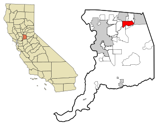
Lincoln, California

Last updated

Lincoln, California
City
City of Lincoln
Woman's Club of Lincoln (California), entrance.jpg
Downtown Lincoln, California (cropped).JPEG
Woman's Club of Lincoln (left) and downtown (right)
Flag of Lincoln, California.gif
Placer County California Incorporated and Unincorporated areas Lincoln Highlighted 0641474.svg
Location of Lincoln in Placer County, California
Usa edcp relief location map.png
Red pog.svg
Lincoln, California
Location in the United States of America
Coordinates: 38°53′14″N121°17′46″W / 38.88722°N 121.29611°W / 38.88722; -121.29611
Country United States
State California
County Placer
Incorporated August 7, 1890 [1]
Government
  Type Council–manager [2]
   Mayor Holly Andreatta [2]
   State senator Brian Dahle (R) [3]
   Assemblymember Kevin McCarty (D) [3]
   U. S. rep. Mike Thompson (D) [4]
Area
[5]
  Total23.55 sq mi (61.00 km2)
  Land23.51 sq mi (60.89 km2)
  Water0.04 sq mi (0.11 km2)  0.12%
Elevation
[6]
167 ft (51 m)
Population
 (2010) [7]
  Total42,819
  Estimate 
(2019) [8]
48,275
  Density2,053.38/sq mi (792.81/km2)
Time zone UTC-8 (Pacific)
  Summer (DST) UTC-7 (PDT)
ZIP code
95648
Area code 916, 279
FIPS code 06-41474
GNIS feature ID 277539
Website Official website OOjs UI icon edit-ltr-progressive.svg

Lincoln is a city in Placer County, California, United States, part of the Sacramento metropolitan area. Located ten miles north of Roseville in an area of rapid suburban development, it grew 282 percent between 2000 and 2010, making it the fastest-growing city over 10,000 people in the U.S. [9] Its 2019 population was estimated to be 48,275. [10]

Contents

Lincoln is part of the Sacramento-Roseville Metropolitan Statistical Area.

History

The original townsite was surveyed and laid out in 1859 by Theodore Judah along the proposed line of the California Central Railroad. The name Lincoln was conferred in honor of Charles Lincoln Wilson, one of the organizers, a fundraiser, and a management contractor of the California Central Railroad (CCRR). The CCRR was planned as a rail link between the cities of Marysville and Sacramento via a connection to the Sacramento Valley Railroad in Folsom. Grading from Folsom to Marysville commenced in 1858 and was completed up to Grider's Ranch (Roseville) by 1859.

November 1859 advertisement announcing the founding sale of town lots, by Charles Lincoln Wilson 1859-1121 Sacramento Daily Union Ad Lincoln town lots sale.jpg
November 1859 advertisement announcing the founding sale of town lots, by Charles Lincoln Wilson

At Auburn Ravine, where the line makes an elbow and turns northward toward Marysville, a new railway town Lincoln was located by Judah with town lots on sale from Wilson. [11] At an auction in Sacramento on November 23, 1859, over $4,000 was raised from the sales of lots in Lincoln, ranging from $20 to $400 for each lot. [12] With the grading on the first division of the road from Folsom completed eighteen miles to Lincoln, track laying began at Folsom on December 30, 1859. [13] With the help of the Chinese laborers, the company was able to complete the railroad to Lincoln on October 14, 1861. [14] [15] The completion of the railroad "changed the appearance of the locality, and breathed into the town the breath of life", birthing possibly the first platted railroad town in California. [16]

At this point, due to a lack of funds, further construction on the California Central was temporarily halted and Lincoln experienced a small-scale boom as the northern terminus of this new railroad. Within a few years, however, more investors were found and the line was extended to Wheatland, in Yuba County, bringing an end to this early stage of Lincoln's development.

When most of its population and business moved on with the railroad, the town settled into a lull until the early 1870s, when rich clay deposits of the Ione Formation were discovered nearby. This led to the establishment of Gladding, McBean & Co., the pottery for which Lincoln is now famous, ushering in a new era of prosperity and growth.

Lincoln remained a sleepy town until the mid-1990s when the suburbs of Sacramento started expanding beyond nearby Roseville. The city is now experiencing a new period of growth. As of the 2010 census, the population was 42,819, for a growth rate of 282 percent since 2000, making Lincoln the fastest-growing city in the United States over that decade. [9]

In June 2003 the first casino in the greater Sacramento Metropolitan Area, the Thunder Valley Casino Resort, opened in Lincoln.[ citation needed ]

In 2006, Lincoln was named an All-America City by the National Civic League. It was the only California city to be named an All-America City that year and only one of the cities to receive the prestigious award.[ citation needed ]

Geography

Lincoln is located at 38°53′14″N121°17′46″W / 38.88722°N 121.29611°W / 38.88722; -121.29611 (38.887121, -121.295973). [17]

According to the United States Census Bureau, the city has a total area of 20.1 square miles (52 square kilometers), of which 0.02 square miles (0.052 km2), or 0.12 percent, is water.

Climate

Lincoln has a hot-summer Mediterranean climate (Köppen Csa) that is characterized by cool, wet winters and hot, dry summers. The wet season is generally October through April. Lincoln averages nearly 250 sunny days per year. During summer, days can become hot with an average high of 94 degrees Fahrenheit (34 degrees Celsius) in July. Some days have even hit 104 °F (40 °C) and these conditions have been known to last several weeks. The cooling effect of the delta breeze from the Bay Area helps bring night temperatures down to comfortable levels. Spring and fall months are quite short transitional periods with mild temperatures. During winter months, temperatures are quite chilly with an average low of 39 °F (4 °C) in January. Some nights have reported below-freezing temperatures, though this is uncommon. Lincoln receives a little over 20.45 inches (519 millimeters) of precipitation a year. Snowfall is extremely rare in Lincoln but it does happen.

Climate data for Lincoln, California
MonthJanFebMarAprMayJunJulAugSepOctNovDecYear
Record high °F (°C)75
(24)
78
(26)
86
(30)
98
(37)
107
(42)
110
(43)
115
(46)
110
(43)
111
(44)
102
(39)
87
(31)
76
(24)
115
(46)
Mean daily maximum °F (°C)53
(12)
60
(16)
64
(18)
71
(22)
80
(27)
88
(31)
94
(34)
92
(33)
87
(31)
77
(25)
63
(17)
54
(12)
74
(23)
Daily mean °F (°C)46
(8)
51
(11)
54
(12)
60
(16)
66
(19)
73
(23)
78
(26)
76
(24)
73
(23)
65
(18)
54
(12)
47
(8)
62
(17)
Mean daily minimum °F (°C)39
(4)
42
(6)
44
(7)
48
(9)
53
(12)
58
(14)
61
(16)
61
(16)
58
(14)
52
(11)
44
(7)
39
(4)
50
(10)
Record low °F (°C)21
(−6)
23
(−5)
27
(−3)
33
(1)
36
(2)
43
(6)
48
(9)
46
(8)
41
(5)
31
(−1)
27
(−3)
16
(−9)
16
(−9)
Average precipitation inches (mm)3.98
(101)
3.46
(88)
3.07
(78)
1.58
(40)
0.58
(15)
0.12
(3.0)
0.04
(1.0)
0.06
(1.5)
0.35
(8.9)
1.08
(27)
2.80
(71)
3.33
(85)
20.45
(519.4)
Average precipitation days98953111137957
Source: http://www.myforecast.com/bin/climate.m?city=11897&zip_code=95648&metric=false

Demographics

Historical population
CensusPop.Note
1880 275
1890 961249.5%
1900 1,06110.4%
1910 1,40232.1%
1920 1,325−5.5%
1930 2,09458.0%
1940 2,044−2.4%
1950 2,41017.9%
1960 3,19732.7%
1970 3,176−0.7%
1980 4,13230.1%
1990 7,24875.4%
2000 11,20554.6%
2010 42,819282.1%
2020 49,75716.2%
U.S. Decennial Census [18]

2010

At the 2010 census Lincoln had a population of 42,819. The population density was 2,127.1 inhabitants per square mile (821.3 inhabitants per square kilometer). The racial makeup of Lincoln was 34,087 (79.6%) White, 629 (1.5%) African American, 399 (0.9%) Native American, 2,663 (6.2%) Asian, 115 (0.3%) Pacific Islander, 3,125 (7.3%) from other races, and 1,801 (4.2%) from two or more races. Hispanic or Latino of any race were 7,597 persons (17.7%). [19]

The census reported that 42,704 people (99.7% of the population) lived in households, 30 (0.1%) lived in non-institutionalized group quarters, and 85 (0.2%) were institutionalized.

There were 16,479 households, 5,190 (31.5%) had children under the age of 18 living in them, 10,365 (62.9%) were opposite-sex married couples living together, 1,202 (7.3%) had a female householder with no husband present, 586 (3.6%) had a male householder with no wife present. There were 775 (4.7%) unmarried opposite-sex partnerships, and 110 (0.7%) same-sex married couples or partnerships. 3,518 households (21.3%) were one person and 2,128 (12.9%) had someone living alone who was 65 or older. The average household size was 2.59. There were 12,153 families (73.7% of households); the average family size was 3.01.

The age distribution was 10,382 people (24.2%) under the age of 18, 2,360 people (5.5%) aged 18 to 24, 10,862 people (25.4%) aged 25 to 44, 9,166 people (21.4%) aged 45 to 64, and 10,049 people (23.5%) who were 65 or older. The median age was 40.5 years. For every 100 females, there were 92.5 males. For every 100 females aged 18 and over, there were 89.6 males.

There were 17,457 housing units at an average density of 867.2 per square mile, of the occupied units 13,115 (79.6%) were owner-occupied and 3,364 (20.4%) were rented. The homeowner vacancy rate was 2.5%; the rental vacancy rate was 4.7%. 32,473 people (75.8% of the population) lived in owner-occupied housing units and 10,231 people (23.9%) lived in rental housing units.

2000

At the 2000 census there were 11,205 people in 3,874 households, including 3,033 families, in the city. The population density was 612.6 inhabitants per square mile (236.5/km2). There were 4,146 housing units at an average density of 226.7 per square mile (87.5/km2). The racial makeup of the city was 79.64% White, 0.44% African American, 1.26% Native American, 1.08% Asian, 0.14% Pacific Islander, 13.47% from other races, and 3.97% from two or more races. Hispanic or Latino of any race were 25.98%. [20]

Of the 3,874 households, 40.5% had children under the age of 18 living with them, 59.5% were married couples living together, 13.3% had a female householder with no husband present, and 21.7% were non-families. Of all households, 17.2% were one person and 6.8% were one person aged 65 or older. The average household size was 2.86 and the average family size was 3.20.

The age distribution was 30.0% under the age of 18, 8.9% from 18 to 24, 30.3% from 25 to 44, 19.6% from 45 to 64, and 11.3% 65 or older. The median age was 32 years. For every 100 females, there were 95.9 males. For every 100 females aged 18 and over, there were 92.7 males.

The median income for a household in the city was $45,547, and the median family income was $51,166. Males had a median income of $38,460 versus $25,603 for females. The per capita income for the city was $19,447. About 10.3 percent of families and 12.4 percent of the population were below the poverty line, including 20.0 percent of those under age 18 and 4.7 percent of those aged 65 or over.

Related Research Articles

<span class="mw-page-title-main">Placer County, California</span> County in California, United States

Placer County, officially the County of Placer, is a county located in the U.S. state of California. As of the 2020 census, the population was 404,739. The county seat is Auburn.

<span class="mw-page-title-main">Placerville, California</span> City in California, United States

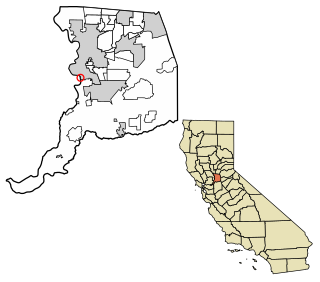
Placerville is a city in and the county seat of El Dorado County, California. The population was 10,747 as of the 2020 census, up from 10,389 as of the 2010 census. It is part of the Sacramento–Arden-Arcade–Roseville Metropolitan Statistical Area.

<span class="mw-page-title-main">Granite Bay, California</span> Census-designated place in California, United States

Granite Bay is a census-designated place (CDP) in Placer County, California, United States. It is part of the Sacramento–Arden-Arcade–Roseville Metropolitan Statistical Area. The population was 21,247 at the 2020 census, up from 20,402 at the 2010 census. The ZIP codes are 95746 and 95661. Granite Bay is a primarily residential suburb of Sacramento and is located just east of Roseville and west of Folsom Lake.

<span class="mw-page-title-main">Rocklin, California</span> City in California, United States

Rocklin is a city in Placer County, California, about 22 miles (35 km) from Sacramento, and about 6.1 miles (9.8 km) northeast of Roseville in the Sacramento metropolitan area. Besides Roseville, it shares borders with Granite Bay, Loomis and Lincoln. As of the 2010 census, Rocklin's population was 56,974. The California Department of Finance placed the 2019 population at 68,823.

<span class="mw-page-title-main">Roseville, California</span> City in California, United States

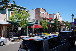
Roseville is the most populous city in Placer County, California, located within the Sacramento metropolitan area. As of 2019, the US Census Bureau estimated the city's population to be 141,500. Interstate 80 runs through Roseville and State Route 65 runs through part of the northern edge of the city.

<span class="mw-page-title-main">Citrus Heights, California</span> City in California, United States

Citrus Heights is a city in Sacramento County, California, United States. As of the 2020 U.S. Census, the city had a population of 87,583, up from 83,301 at the 2010 U.S. Census.

<span class="mw-page-title-main">Fair Oaks, California</span> Census designated place in California, United States

Fair Oaks is a census-designated place (CDP) in Sacramento County, California, United States. It is part of the Sacramento–Arden-Arcade–Roseville Metropolitan Statistical Area. The population was 32,514 at the 2020 census, up from 30,912 at the 2010 census. The Fair Oaks zip code is 95628 and its area codes are 916 and 279. It is bordered to the west by Carmichael, north by the city of Citrus Heights, to the east by Orangevale, and to the south by the American River.

<span class="mw-page-title-main">Florin, California</span> Census-designated place in California, United States

Florin is a census-designated place (CDP) in Sacramento County, California, United States. It is part of the Sacramento–Roseville–Folsom Metropolitan Statistical Area. The population was 52,388 at the 2020 census, up from 47,513 at the 2010 census and 27,653 at the 2000 census.

<span class="mw-page-title-main">Folsom, California</span> City in California, United States

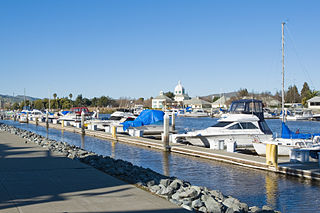
Folsom is a city in Sacramento County, California, United States. The population was 80,454 at the 2020 census.

<span class="mw-page-title-main">Gold River, California</span> Census-designated place in California, United States

Gold River is a census-designated place (CDP) in Sacramento County, California. The population was 7,812 at the 2010 census, down from 8,023 at the 2000 census. Gold River is part of the Sacramento–Arden-Arcade–Roseville Metropolitan Statistical Area. With a median family income of $141,399 according to U.S Census Bureau in 2021, Gold River is the highest-income place in Sacramento County.

<span class="mw-page-title-main">Isleton, California</span> City in California, United States

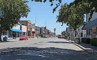
Isleton is a city in Sacramento County, California, United States. The population was 804 at the 2010 census, down from 828 at the 2000 census. It is located on Andrus Island amid the slough wetlands of the Sacramento-San Joaquin River Delta, on the eastern edge of the Rio Vista Gas Field. The city has many preserved 19th-century era storefronts along its main street, some of which show distinct Chinese influences.

<span class="mw-page-title-main">Orangevale, California</span> Census-designated place in California, United States

Orangevale is a census-designated place (CDP) in Sacramento County, California, United States. It is part of the Sacramento–Arden-Arcade–Roseville Metropolitan Statistical Area. The population was 33,960 at the 2010 census, up from 26,705 at the 2000 census. It is located approximately 25 miles (40 km) northeast of Sacramento. The community is known for its rolling hills that offer the best views of the Sierra Nevada mountain range, its foothills, and a rural environment in the middle of a growing metropolitan area. Some residential properties in the area are zoned to accommodate horses and orchards. It has a ZIP Code of 95662.

<span class="mw-page-title-main">Parkway–South Sacramento, California</span> Unincorporated community in California, United States

Parkway–South Sacramento is a former census-designated place (CDP) in Sacramento County, California, United States. It is part of the Sacramento–Arden-Arcade–Roseville Metropolitan Statistical Area. The area shares three boundaries with the City of Sacramento. The population was 36,468 at the 2000 census.

<span class="mw-page-title-main">Rosemont, California</span> Census-designated place in California, United States

Rosemont is a census-designated place (CDP) in Sacramento County, California, United States. It is part of the Sacramento–Arden-Arcade–Roseville metropolitan area. The population rose to 23,510 at the 2020 census. It was 22,681 at the 2010 census, down from 22,904 at the 2000 census.

<span class="mw-page-title-main">Lathrop, California</span> City in the United States

Lathrop is a city located 9 miles (14 km) south of Stockton in San Joaquin County, California, United States. The 2020 census reported that Lathrop's population was 28,701. The city is located in Northern California at the intersection of Interstate 5 and California State Route 120, in the San Joaquin Valley.

<span class="mw-page-title-main">Suisun City, California</span> City in California, United States

Suisun City is a city in Solano County, California, United States. The population was 29,518 at the 2020 census.

<span class="mw-page-title-main">Hopland, California</span> Unincorporated community in California, United States

Hopland is a census-designated place in Mendocino County, California, United States. It is located on the west bank of the Russian River 13 miles (21 km) south-southeast of Ukiah, in the Sanel Valley, at an elevation of 502 feet (153 m). The population was 661 at the 2020 census, down from 756 at the 2010 census.

<span class="mw-page-title-main">California Central Railroad</span> Northern California pioneer railroad (1857–1868) from Folsom to Lincoln, California

The California Central Railroad (CCRR) was incorporated on April 21, 1857, to build a railroad from Folsom to Marysville, as an extension of the Sacramento Valley Railroad which terminated at Folsom. The first division of the CCRR was 18.5 miles long; it started at Folsom, crossed the American River, and ended at the new town of Lincoln, twenty-four miles south of Marysville. The bridge over the American River was the first railroad bridge of any importance built in California, and the American the first river in California crossed by trains. In 1858, California Central was probably the first California railroad to employ Chinese laborers and first to demonstrate that "Chinese laborers can be profitably employed in grading railroads in California."

Elverta is a census-designated place in Sacramento County, California. It is part of the Sacramento metropolitan area, which includes Sacramento, Arden-Arcade, and Roseville. It is about 20 miles (32 km) from Sacramento, 2.5 miles (4.0 km) from Rio Linda, 6 miles (9.7 km) from Roseville, and 8.0 miles (12.9 km) from Antelope. The population was 5,492 as of the 2010 census.

<span class="mw-page-title-main">Freeport, California</span> Census-designated place in California, United States

Freeport, California is a census-designated place located approximately 7.5 miles (12.1 km) south of downtown Sacramento on California State Route 160. Freeport lies on the eastern banks of the Sacramento River in Sacramento County. The population was 58 at the 2020 census.

References

  1. "California Cities by Incorporation Date". California Association of Local Agency Formation Commissions. Archived from the original (Word) on February 21, 2013. Retrieved August 25, 2014.
  2. 1 2 "City Council". City of Lincoln, California. February 6, 2023. Retrieved November 26, 2023.
  3. 1 2 "Statewide Database". UC Regents. Archived from the original on February 1, 2015. Retrieved December 3, 2014.
  4. "California's 4th Congressional District - Representatives & District Map". Civic Impulse, LLC. Retrieved March 3, 2013.
  5. "2019 U.S. Gazetteer Files". United States Census Bureau. Archived from the original on January 16, 2020. Retrieved July 1, 2020.
  6. "Lincoln". Geographic Names Information System . United States Geological Survey, United States Department of the Interior . Retrieved October 19, 2014.
  7. "Lincoln (city) QuickFacts". United States Census Bureau. Archived from the original on January 8, 2015. Retrieved January 7, 2015.
  8. "Population and Housing Unit Estimates". United States Census Bureau. May 24, 2020. Archived from the original on April 21, 2019. Retrieved May 27, 2020.
  9. 1 2 "Population Distribution and Change: 2000 to 2010" (PDF). U.S. Census Bureau. March 2011. Archived (PDF) from the original on October 9, 2022. Retrieved June 13, 2011.
  10. "Population and Housing Unit Estimates". Archived from the original on April 21, 2019. Retrieved May 21, 2020.
  11. "The California Central Railroad". cdnc.ucr.edu. San Joaquin Republican, Volume IX, Number 279. November 24, 1859. Archived from the original on July 9, 2021. Retrieved June 30, 2021.
  12. "The new town of Lincoln". cdnc.ucr.edu. Daily National Gazette, Volume 2, Number 18. November 26, 1859. Archived from the original on July 9, 2021. Retrieved June 30, 2021. The new town of Lincoln, located at Auburn Ravine on Mr. S. R. Wymans Ranch, bids fair to become a town of some note. It will be the depot for the California Central Railroad and will be the nearest point to the Railroad from Nevada and Sierra counties.
  13. "LAYING THE TRACK". Sacramento Daily Union, Volume 18, Number 2734. December 31, 1859. Archived from the original on June 29, 2021. Retrieved June 30, 2021.
  14. "Board of Directors: California Central Railroad". cdnc.ucr.edu. Sacramento Daily Union, Volume 15, Number 2252. June 15, 1858. Archived from the original on June 29, 2021. Retrieved June 21, 2021. The experiment bids fair to demonstrate that Chinese laborers can be profitably employed in grading railroads in California.
  15. "Railroad Matters". cdnc.ucr.edu. Weekly Butte Record, Volume 8, Number 50. October 19, 1861. Archived from the original on July 9, 2021. Retrieved July 1, 2021. On Monday last [14 October 1861] a regular train of passenger cars commenced running on the California Central Railroad, between Folsom and Lincoln.
  16. "Lincoln. — The town of Lincoln, at Auburn Ravine, Placer county". cdnc.ucr.edu. Sacramento Daily Union, Volume 22, Number 3308. November 4, 1861. Archived from the original on July 9, 2021. Retrieved July 1, 2021. The town does not take its name from the present President of the United States, but from its founder, whose middle name is Lincoln. ... The completion of the railroad and the daily arrival of the locomotive has changed the appearance of the locality, and breathed into the town the breath of life.
  17. "US Gazetteer files: 2010, 2000, and 1990". United States Census Bureau. February 12, 2011. Archived from the original on August 24, 2019. Retrieved April 23, 2011.
  18. "Census of Population and Housing". Census.gov. Archived from the original on October 3, 2014. Retrieved June 4, 2015.
  19. "2010 Census Interactive Population Search: CA - Lincoln city". U.S. Census Bureau. Archived from the original on July 15, 2014. Retrieved July 12, 2014.
  20. "U.S. Census website". United States Census Bureau. Archived from the original on July 1, 2021. Retrieved January 31, 2008.