Rock Creek, Plumas County, California

Last updated
Rock Creek
Unincorporated community
California Locator Map with US.PNG
Red pog.svg
Rock Creek
Location in California
Usa edcp location map.svg
Red pog.svg
Rock Creek
Rock Creek (the US)
Coordinates: 39°54′10″N121°21′11″W / 39.90278°N 121.35306°W / 39.90278; -121.35306 Coordinates: 39°54′10″N121°21′11″W / 39.90278°N 121.35306°W / 39.90278; -121.35306
Country Flag of the United States.svg  United States
State Flag of California.svg  California
County Plumas County
Elevation [1] 1,863 ft (568 m)

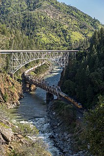
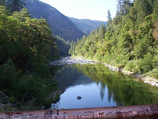
Rock Creek is an unincorporated community in Plumas County, California. [1] It lies at an elevation of 1863 feet (568 m). [1] Rock Creek is located on the Western Pacific Railroad, 2 miles (3.2 km) west-southwest of Storrie. [2]

Unincorporated area Region of land not governed by own local government

In law, an unincorporated area is a region of land that is not governed by a local municipal corporation; similarly an unincorporated community is a settlement that is not governed by its own local municipal corporation, but rather is administered as part of larger administrative divisions, such as a township, parish, borough, county, city, canton, state, province or country. Occasionally, municipalities dissolve or disincorporate, which may happen if they become fiscally insolvent, and services become the responsibility of a higher administration. Widespread unincorporated communities and areas are a distinguishing feature of the United States and Canada. In most other countries of the world, there are either no unincorporated areas at all, or these are very rare; typically remote, outlying, sparsely populated or uninhabited areas.

Plumas County, California County in California, United States

Plumas County is a county in the Sierra Nevada of California, United States. As of the 2010 census, the population was 20,007. The county seat is Quincy, and the only incorporated city is Portola. The largest community in the county is East Quincy. The county was named for the Spanish Río de las Plumas, which flows through the county.

California State of the United States of America

California is a state in the Pacific Region of the United States. With 39.6 million residents, California is the most populous U.S. state and the third-largest by area. The state capital is Sacramento. The Greater Los Angeles Area and the San Francisco Bay Area are the nation's second- and fifth-most populous urban regions, with 18.7 million and 8.8 million residents respectively. Los Angeles is California's most populous city, and the country's second-most populous, after New York City. California also has the nation's most populous county, Los Angeles County, and its largest county by area, San Bernardino County. The City and County of San Francisco is both the country's second-most densely populated major city after New York City and the fifth-most densely populated county, behind only four of the five New York City boroughs.

Related Research Articles

Feather River river in the United States of America

The Feather River is the principal tributary of the Sacramento River, in the Sacramento Valley of Northern California. The river's main stem is about 73 miles (117 km) long. Its length to its most distant headwater tributary is just over 210 miles (340 km). The main stem Feather River begins in Lake Oroville, where its four long tributary forks join together—the South Fork, Middle Fork, North Fork, and West Branch Feather Rivers. These and other tributaries drain part of the northern Sierra Nevada, and the extreme southern Cascades, as well as a small portion of the Sacramento Valley. The total drainage basin is about 6,200 square miles (16,000 km2), with approximately 3,604 square miles (9,330 km2) above Lake Oroville.

Camp Eighteen, California Unincorporated community in California, United States

Camp Eighteen is an unincorporated community in Butte County, California, about 1.25 miles (2.01 km) from the Plumas County line. It lies 7 miles (11 km) north of Clipper Mills, at an elevation of 3947 feet. The ZIP Code is 95940. The community is inside area code 530. Nearby communities are Lumpkin and Rogerville. The now-defunct Feather River Railway used to serve the area but appears to have been decommissioned. Sly Creek Reservoir is about 3.6 miles (5.8 km) southeast.

Frenchman Lake(a.k.a. Frenchmen's Reservoir and several derivations thereof) is located in Southeastern Plumas County, California and was created by the damming of Little Last Chance Creek. Named after Claude Francois Seltier, a French immigrant who settled in the area in 1858.

North Fork Feather River river in the United States of America

The North Fork Feather River is a watercourse of the northern Sierra Nevada in the U.S. state of California. It flows generally southwards from its headwaters near Lassen Peak to Lake Oroville, a reservoir formed by Oroville Dam in the foothills of the Sierra, where it runs into the Feather River. The river drains about 2,100 square miles (5,400 km2) of the western slope of the Sierras. By discharge, it is the largest tributary of the Feather.

The East Branch North Fork Feather River is a left tributary of the North Fork Feather River in the northern Sierra Nevada, Plumas County, California. Primarily within the Plumas National Forest, its course extends past Twain to near Belden.

Bucks Lake Wilderness

The Bucks Lake Wilderness is a 23,958-acre (97.0 km2) wilderness area located in the Plumas National Forest section of the Sierra Nevada, in northeastern California, United States.

Las Plumas, California Former settlement in California, United States

Las Plumas is a former settlement in Butte County, California.

Two Rivers, California Unincorporated community in California, United States

Two Rivers is an unincorporated community in Plumas County, California. It lies at an elevation of 4324 feet. Two Rivers is located near where Jamison Creek joins the Middle Fork Feather River, 4 miles (6.4 km) northwest of Blairsden.

Bontes, California Former settlement in California, United States

Bontes is a former settlement in Plumas County, California. It lay at an elevation of 4390 feet. Bontes is located near the mouth of Bonta Creek. It still appeared on maps as of 1897.

Dentens, California Former settlement in California, United States

Dentens is a former settlement in Plumas County, California, United States. It lay at an elevation of 4,344 feet (1,324 m). Dentens is located near the mouth of Denten Creek, 1 mile (1.6 km) south-southeast of Blairsden. It still appeared on maps as 1897.

Edmanton, California Former settlement in California, United States

Edmanton is a former settlement in Plumas County, California. It lay at an elevation of 4741 feet. Edmanton is located on Big Creek, 2.5 miles (4.0 km) southwest of Meadow Valley.

Hopnomkoyo is a former Maidu settlement in Plumas County, California. It was located on Lights Creek, at an elevation of 6,824 feet (2,080 m), but its precise location is unknown.

Hot Springs, Plumas County, California Unincorporated community in California, United States

Hot Springs is an unincorporated community in Plumas County, California. It lies at an elevation of 2815 feet. Hot Springs is located 2 miles (3.2 km) east of Twain.

Little Jamison, California Former settlement in California, United States

Little Jamison is a former settlement in Plumas County, California. It lay at an elevation of 5269 feet. Little Jamison is located on Little Jamison Creek, 6 miles (9.7 km) west of Clio. It still appeared on maps as of 1897.

Moccasin, Plumas County, California Unincorporated community in California, United States

Moccasin is an unincorporated community in Plumas County, California. It lies at an elevation of 3517 feet. Moccasin is located on the Western Pacific Railroad, 2.25 miles (3.6 km) southwest of Crescent Mills.

Rock Creek Camp, California Unincorporated community in California, United States

Rock Creek Camp is an unincorporated community in Plumas County, California. It lies at an elevation of 1837 feet. Rock Creek Camp is located near Rock Crest.

Rock Crest, California Unincorporated community in California, United States

Rock Crest is an unincorporated community in Plumas County, California. It lies at an elevation of 1880 feet. Rock Crest is located about 1 mile (1.6 km) north-northeast of Storrie.

Silver Creek, Plumas County, California Former settlement in California, United States

Silver Creek is a former settlement in Plumas County, California. It lay at an elevation of 3724 feet. Silver Creek is located 1.25 miles (2.0 km) north-northwest of Meadow Valley.

Squirrel Creek, California Former settlement in California, United States

Squirrel Creek is a former settlement in Plumas County, California. It lay at an elevation of 5407 feet. Squirrel Creek is located 8 miles (12.9 km) west-northwest of Clio. It still appeared on maps as of 1897.

References

  1. 1 2 3 U.S. Geological Survey Geographic Names Information System: Rock Creek, Plumas County, California
  2. Durham, David L. (1998). California's Geographic Names: A Gazetteer of Historic and Modern Names of the State. Clovis, Calif.: Word Dancer Press. p. 413. ISBN   1-884995-14-4.