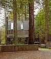
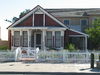
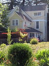
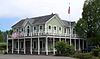
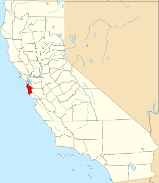
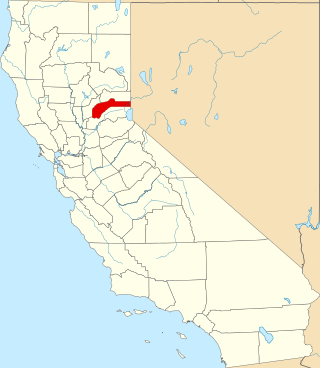
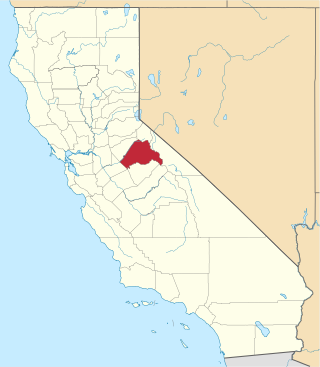
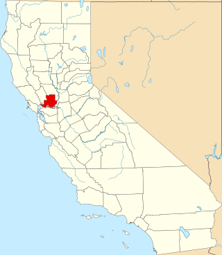
[3] Name on the Register [4] Image Date listed [5] Location City or town Description 1 Baker House Baker House December 12, 2018 (# 100003234 35292 Timber Ridge Rd. 38°41′30″N 123°25′13″W / 38.6916°N 123.4203°W / 38.6916; -123.4203 (Baker House ) Sea Ranch 2 Bodega Bay Bodega Bay December 18, 1973 (# 73000461 Address Restricted Bodega Bay 3 Buena Vista Winery Buena Vista Winery July 24, 1986 (# 86001902 18000 Old Winery Rd. 38°17′58″N 122°25′23″W / 38.299444°N 122.423056°W / 38.299444; -122.423056 (Buena Vista Winery ) Sonoma Also known as Buena Vista Vineyards-Buena Vista Vinicultural Society 4 Luther Burbank House and Garden Luther Burbank House and Garden October 15, 1966 (# 66000241 200 Santa Rosa Ave. 38°26′10″N 122°42′42″W / 38.436158°N 122.711783°W / 38.436158; -122.711783 (Luther Burbank House and Garden ) Santa Rosa 5 Nicholas Carriger Estate Nicholas Carriger Estate November 16, 2001 (# 01001234 18880 Carriger Rd. 38°17′48″N 122°30′43″W / 38.296767°N 122.511969°W / 38.296767; -122.511969 (Nicholas Carriger Estate ) Sonoma 1850 home of early American settler, farmer and gold-mining magnate Nicholas Carriger [6] 6 Cloverdale Railroad Station Upload image December 12, 1976 (# 76000536 Railroad Ave. 38°48′14″N 123°00′41″W / 38.803889°N 123.011389°W / 38.803889; -123.011389 (Cloverdale Railroad Station ) Cloverdale Destroyed by fire September 25, 1991 [7] 7 Cnopius House Cnopius House April 12, 1982 (# 82002277 726 College Ave. 38°26′44″N 122°42′45″W / 38.445556°N 122.7125°W / 38.445556; -122.7125 (Cnopius House ) Santa Rosa 8 Comstock House Comstock House January 27, 2012 (# 11001053 767 Mendocino Ave. 38°26′52″N 122°43′05″W / 38.447656°N 122.718111°W / 38.447656; -122.718111 (Comstock House ) Santa Rosa 9 Condominium 1 Condominium 1 July 29, 2005 (# 05000731 110–128 Sea Walk Dr. 38°40′45″N 123°25′40″W / 38.679167°N 123.427778°W / 38.679167; -123.427778 (Condominium 1 ) Sea Ranch 10 Cunningham-Hembree Estate Cunningham-Hembree Estate July 9, 2018 (# 100002638 9225 Foxwood Dr. 38°33′08″N 122°48′40″W / 38.5522°N 122.8111°W / 38.5522; -122.8111 (Cunningham-Hembree Estate ) Windsor 11 De Turk Round Barn De Turk Round Barn April 21, 2004 (# 04000334 819 Donahue St. 38°26′27″N 122°43′31″W / 38.440844°N 122.7252°W / 38.440844; -122.7252 (De Turk Round Barn ) Santa Rosa 12 Dry Creek-Warm Springs Valleys Archeological District Upload image December 9, 1977 (# 77000350 Address Restricted Healdsburg vicinity 13 Duncan's Landing Site Duncan's Landing Site November 12, 1971 (# 71000206 Address Restricted Jenner 14 Ellis-Martin House Ellis-Martin House October 4, 2006 (# 06000915 1197 E. Washington St. 38°14′43″N 122°37′48″W / 38.245186°N 122.630089°W / 38.245186; -122.630089 (Ellis-Martin House ) Petaluma 15 Flamingo Hotel Upload image September 20, 2021 (# 100006937 2777 4th St. 38°27′04″N 122°41′18″W / 38.4512°N 122.6883°W / 38.4512; -122.6883 (Flamingo Hotel ) Santa Rosa 16 Fort Ross Fort Ross October 15, 1966 (# 66000239 Fort Ross State Historic Park 38°30′51″N 123°14′34″W / 38.514167°N 123.242778°W / 38.514167; -123.242778 (Fort Ross ) Fort Ross 17 Fort Ross Commander's House Fort Ross Commander's House April 15, 1970 (# 70000150 Fort Ross State Historic Park 38°30′45″N 123°14′34″W / 38.512424°N 123.242709°W / 38.512424; -123.242709 (Fort Ross Commander's House ) Fort Ross Also known as Rotchev House 18 Fort Ross Landing Historical and Archaeological District Upload image April 7, 2023 (# 100008442 Fort Ross State Historic Park 38°30′43″N 123°14′42″W / 38.5119°N 123.2451°W / 38.5119; -123.2451 (Fort Ross Landing Historical and Archaeological District ) Jenner vicinity 830 acres (340 ha) of land and water at Fort Ross, including Rotchev House and wreck of SS Pomona. [8] 19 Free Public Library of Petaluma Free Public Library of Petaluma June 23, 1988 (# 88000925 20 Fourth St. 38°13′57″N 122°38′24″W / 38.232572°N 122.639992°W / 38.232572; -122.639992 (Free Public Library of Petaluma ) Petaluma 20 Freestone Store Freestone Store February 28, 2022 (# 100007484 500 Bohemian Hwy. 38°22′24″N 122°55′06″W / 38.3734°N 122.9182°W / 38.3734; -122.9182 (Freestone Store ) Freestone 21 The Gables The Gables September 20, 1984 (# 84001206 4257 Petaluma Hill Rd. 38°23′37″N 122°41′35″W / 38.393544°N 122.693003°W / 38.393544; -122.693003 (The Gables ) Santa Rosa 22 Geyserville Union School Upload image October 24, 1979 (# 79000558 Main St. 38°42′28″N 122°54′23″W / 38.707778°N 122.906389°W / 38.707778; -122.906389 (Geyserville Union School ) Geyserville Demolished in 1994 [9] 23 Glen Oaks Ranch Glen Oaks Ranch October 21, 1994 (# 94001223 13255 Sonoma Hwy. 38°22′14″N 122°30′47″W / 38.370561°N 122.513178°W / 38.370561; -122.513178 (Glen Oaks Ranch ) Glen Ellen 24 Luther Burbank's Experimental Farm & Cottage (Gold Ridge Farm) Luther Burbank's Experimental Farm & Cottage (Gold Ridge Farm) December 14, 1978 (# 78000803 W of Sebastopol 38°23′51″N 122°50′01″W / 38.3975°N 122.833611°W / 38.3975; -122.833611 (Luther Burbank's Experimental Farm & Cottage (Gold Ridge Farm) ) Sebastopol 25 Gould-Shaw House Gould-Shaw House September 10, 1992 (# 92001244 215 N. Cloverdale Blvd. 38°48′25″N 123°01′03″W / 38.806944°N 123.0175°W / 38.806944; -123.0175 (Gould-Shaw House ) Cloverdale 26 Guerneville Bridge Guerneville Bridge August 4, 1989 (# 89000945 Rt. 116 over Russian River 38°30′04″N 122°59′40″W / 38.501111°N 122.994444°W / 38.501111; -122.994444 (Guerneville Bridge ) Guerneville 27 Healdsburg Carnegie Library Healdsburg Carnegie Library July 6, 1988 (# 88000924 221 Matheson St. 38°37′13″N 122°51′58″W / 38.620278°N 122.866111°W / 38.620278; -122.866111 (Healdsburg Carnegie Library ) Healdsburg Carnegie library built in 1911, now the Healdsburg Museum 28 Healdsburg Memorial Bridge Healdsburg Memorial Bridge April 14, 2011 (# 11000214 Healdsburg Ave., junction of Front St. 38°36′14″N 122°51′36″W / 38.603889°N 122.86°W / 38.603889; -122.86 (Healdsburg Memorial Bridge ) Healdsburg Highway Bridges of California MPS 29 Hicks House Hicks House July 21, 1987 (# 87001157 3160 Hicks Rd. 38°26′14″N 122°51′54″W / 38.437222°N 122.865°W / 38.437222; -122.865 (Hicks House ) Graton 30 Hinds Hotel Hinds Hotel January 31, 1979 (# 79000557 306 Bohemian Hwy. 38°22′20″N 122°54′53″W / 38.372222°N 122.914722°W / 38.372222; -122.914722 (Hinds Hotel ) Freestone 31 Hines House Hines House June 23, 2021 (# 100006689 301 Chinquapin Ln. 38°41′31″N 123°25′30″W / 38.6919°N 123.4249°W / 38.6919; -123.4249 (Hines House ) Sea Ranch 32 William Hood House William Hood House February 6, 1998 (# 97001658 7501 Sonoma Hwy 38°26′33″N 122°34′41″W / 38.442456°N 122.577953°W / 38.442456; -122.577953 (William Hood House ) Santa Rosa 33 Hotel Chauvet Hotel Chauvet February 15, 1990 (# 90000117 13756 Arnold Dr. 38°21′44″N 122°31′34″W / 38.362256°N 122.526136°W / 38.362256; -122.526136 (Hotel Chauvet ) Glen Ellen 34 Hotel La Rose Hotel La Rose August 3, 1978 (# 78000802 5th and Wilson Sts. 38°26′17″N 122°43′15″E / 38.43793°N 122.72096°E / 38.43793; 122.72096 (Hotel La Rose ) Santa Rosa Sturdy hotel built by four Italian stonemasons after 1906 San Francisco earthquake destroyed predecessor. 35 Knipp and Stengel Ranch Barn Knipp and Stengel Ranch Barn January 29, 1987 (# 87000005 CA 1 38°42′57″N 123°27′17″W / 38.715833°N 123.454722°W / 38.715833; -123.454722 (Knipp and Stengel Ranch Barn ) Sea Ranch 36 James H. and Frances E. Laughlin House James H. and Frances E. Laughlin House April 26, 1979 (# 79000563 SE of Windsor on Lone Redwood Rd. 38°30′46″N 122°47′02″W / 38.512778°N 122.783889°W / 38.512778; -122.783889 (James H. and Frances E. Laughlin House ) Windsor 37 Llano Road Roadhouse Llano Road Roadhouse May 22, 1978 (# 78000804 4353 Gravenstein Hwy., S 38°21′29″N 122°46′04″W / 38.358056°N 122.767778°W / 38.358056; -122.767778 (Llano Road Roadhouse ) Sebastopol 38 Jack London Ranch Jack London Ranch October 15, 1966 (# 66000240 0.4 mi. W of Glen Ellen in Jack London Historical State Park 38°21′02″N 122°32′35″W / 38.350556°N 122.543056°W / 38.350556; -122.543056 (Jack London Ranch ) Glen Ellen 39 W. H. Lumsden House W. H. Lumsden House August 11, 1983 (# 83001245 727 Mendocino Ave. 38°26′47″N 122°43′01″W / 38.446389°N 122.716944°W / 38.446389; -122.716944 (W. H. Lumsden House ) Santa Rosa 40 Madrona Manor Madrona Manor April 2, 1987 (# 87000573 1001 Westside Rd. 38°36′17″N 122°53′07″W / 38.604722°N 122.885278°W / 38.604722; -122.885278 (Madrona Manor ) Healdsburg vicinity Also known as Madrona Knoll Rancho District 41 McDonald Mansion McDonald Mansion March 1, 1974 (# 74000560 1015 McDonald Ave. 38°27′01″N 122°42′15″W / 38.450278°N 122.704167°W / 38.450278; -122.704167 (McDonald Mansion ) Santa Rosa 42 Norlina (shipwreck and remains) Upload image September 30, 2022 (# 100008248 Address Restricted Jenner vicinity 43 Old Petaluma Opera House Old Petaluma Opera House December 22, 1978 (# 78000801 147–149 Kentucky St. 38°14′06″N 122°38′31″W / 38.235017°N 122.641844°W / 38.235017; -122.641844 (Old Petaluma Opera House ) Petaluma 44 Old Post Office Old Post Office November 16, 1979 (# 79000559 425 7th St. 38°26′31″N 122°43′01″W / 38.441944°N 122.716944°W / 38.441944; -122.716944 (Old Post Office ) Santa Rosa Now home of the Sonoma County Museum 45 Orange Lawn Orange Lawn June 9, 2008 (# 08000529 645 Charles Van Damme Way 38°17′22″N 122°26′46″W / 38.289478°N 122.446133°W / 38.289478; -122.446133 (Orange Lawn ) Sonoma 46 Park Apartments Park Apartments April 26, 1979 (# 79000560 300 Santa Rosa Ave. 38°26′07″N 122°42′41″W / 38.435261°N 122.711478°W / 38.435261; -122.711478 (Park Apartments ) Santa Rosa 47 Petaluma Adobe Petaluma Adobe April 15, 1970 (# 70000151 4 mi. E of Petaluma on Casa Grande Rd. 38°15′20″N 122°35′03″W / 38.255425°N 122.584253°W / 38.255425; -122.584253 (Petaluma Adobe ) Petaluma 48 Petaluma and Santa Rosa Railway Powerhouse Petaluma and Santa Rosa Railway Powerhouse July 23, 1991 (# 91000918 238–258 Petaluma Ave. 38°24′05″N 122°49′19″W / 38.401389°N 122.821944°W / 38.401389; -122.821944 (Petaluma and Santa Rosa Railway Powerhouse ) Sebastopol 49 Petaluma Historic Commercial District Petaluma Historic Commercial District March 31, 1995 (# 95000354 Along Petaluma Blvd., between B and Prospect Sts. 38°14′03″N 122°38′25″W / 38.234058°N 122.640272°W / 38.234058; -122.640272 (Petaluma Historic Commercial District ) Petaluma 50 Petaluma Silk Mill Petaluma Silk Mill March 6, 1986 (# 86000386 420 Jefferson St. 38°14′10″N 122°37′51″W / 38.236114°N 122.630847°W / 38.236114; -122.630847 (Petaluma Silk Mill ) Petaluma 51 Simon Pinschower House Simon Pinschower House February 25, 1982 (# 82002276 302 N. Main St. 38°48′31″N 123°00′59″W / 38.808611°N 123.016389°W / 38.808611; -123.016389 (Simon Pinschower House ) Cloverdale 52 Pond Farm Pottery Historic District Pond Farm Pottery Historic District June 17, 2014 (# 14000307 17000 Armstrong Woods Road 38°33′08″N 123°00′00″W / 38.552171°N 122.999991°W / 38.552171; -122.999991 (Pond Farm Pottery Historic District ) Guerneville 53 Railroad Square District Railroad Square District April 20, 1979 (# 79000561 Roughly bounded by 3rd, Davis, Wilson, and 6th Sts. and Santa Rosa Creek 38°26′14″N 122°43′13″W / 38.437222°N 122.720278°W / 38.437222; -122.720278 (Railroad Square District ) Santa Rosa 54 The Ranch Site Upload image July 14, 1971 (# 71000205 Address Restricted Bodega Bay 55 Rosenberg's Department Store Rosenberg's Department Store December 29, 1994 (# 94001497 700 Fourth St. 38°26′28″N 122°42′40″W / 38.441111°N 122.711111°W / 38.441111; -122.711111 (Rosenberg's Department Store ) Santa Rosa 56 Salt Point Landing Historical and Archaeological District Upload image April 11, 2022 (# 100007268 Address Restricted Jenner vicinity 57 Salt Point State Park Archeological District Upload image March 24, 1971 (# 71000207 Address Restricted Salt Point State Park 58 Sebastopol Depot of the Petaluma and Santa Rosa Railway Sebastopol Depot of the Petaluma and Santa Rosa Railway February 16, 1996 (# 96000109 261 S. Main St. 38°24′03″N 122°49′19″W / 38.400833°N 122.821944°W / 38.400833; -122.821944 (Sebastopol Depot of the Petaluma and Santa Rosa Railway ) Sebastopol 59 Isaac E. Shaw Building Isaac E. Shaw Building January 25, 1991 (# 90002155 219 N. Cloverdale Blvd. 38°48′24″N 123°01′06″W / 38.806667°N 123.018333°W / 38.806667; -123.018333 (Isaac E. Shaw Building ) Cloverdale 60 Sonoma Depot Sonoma Depot April 3, 1975 (# 75000488 284 1st St., W 38°17′46″N 122°27′27″W / 38.296161°N 122.457461°W / 38.296161; -122.457461 (Sonoma Depot ) Sonoma 61 Sonoma Grammar School Sonoma Grammar School November 28, 1980 (# 80000871 276 E. Napa St. 38°17′30″N 122°27′10″W / 38.291664°N 122.452711°W / 38.291664; -122.452711 (Sonoma Grammar School ) Sonoma 62 Sonoma Plaza Sonoma Plaza April 3, 1975 (# 75000489 Center of Sonoma; also the area south and east of the town plaza, along Broadway and the northern side of E. Napa St. 38°17′37″N 122°27′12″W / 38.293611°N 122.453333°W / 38.293611; -122.453333 (Sonoma Plaza ) Sonoma Second set of boundaries represents a boundary increase of May 6, 1992 63 Sonoma State Home-Main Building Sonoma State Home-Main Building October 6, 2000 (# 00001180 15000 Arnold Dr. 38°20′51″N 122°31′06″W / 38.347472°N 122.518325°W / 38.347472; -122.518325 (Sonoma State Home-Main Building ) Eldridge Also known as Sonoma Developmental Center 64 Sonoma Valley Woman's Club Sonoma Valley Woman's Club January 7, 2015 (# 14001115 574 1st St., E. 38°17′26″N 122°27′25″W / 38.2905°N 122.4569°W / 38.2905; -122.4569 (Sonoma Valley Woman's Club ) Sonoma 65 SS POMONA (Shipwreck) SS POMONA (Shipwreck) January 31, 2008 (# 07000306 Fort Ross Cove, off Fort Ross Historic State Park 38°30′37″N 123°14′44″W / 38.510278°N 123.245556°W / 38.510278; -123.245556 (SS POMONA (Shipwreck) ) Jenner 66 George A. Strout House George A. Strout House June 17, 1980 (# 80000870 253 Florence Ave. 38°24′11″N 122°49′40″W / 38.403056°N 122.827778°W / 38.403056; -122.827778 (George A. Strout House ) Sebastopol 67 Philip Sweed House Philip Sweed House June 18, 1992 (# 92000787 301 Keokuk St. 38°14′11″N 122°38′47″W / 38.2363°N 122.646253°W / 38.2363; -122.646253 (Philip Sweed House ) Petaluma 68 Sweet House Sweet House January 14, 1988 (# 87002415 607 Cherry St. 38°26′42″N 122°42′56″W / 38.445°N 122.715556°W / 38.445; -122.715556 (Sweet House ) Santa Rosa 69 Temelec Temelec April 19, 2006 (# 06000312 220 and 221 Temelec Circle 38°15′57″N 122°29′59″W / 38.265836°N 122.499647°W / 38.265836; -122.499647 (Temelec ) Temelec 70 US Post Office-Petaluma US Post Office-Petaluma January 11, 1985 (# 85000140 120 4th St. 38°13′55″N 122°38′16″W / 38.231814°N 122.6377°W / 38.231814; -122.6377 (US Post Office-Petaluma ) Petaluma 71 Vallejo Estate Vallejo Estate June 29, 1972 (# 72000262 Corner of Spain and W. 3rd Sts. 38°17′56″N 122°27′46″W / 38.298867°N 122.462647°W / 38.298867; -122.462647 (Vallejo Estate ) Sonoma 72 Walters Ranch Walters Ranch October 7, 1977 (# 77000351 6 mi. S of Healdsburg at 6050 Westside Rd. 38°32′16″N 122°52′05″W / 38.537778°N 122.868056°W / 38.537778; -122.868056 (Walters Ranch ) Healdsburg vicinity 73 Wasserman House Wasserman House January 31, 1979 (# 79000562 930 Mendocino Ave. 38°27′02″N 122°42′59″W / 38.450556°N 122.716389°W / 38.450556; -122.716389 (Wasserman House ) Santa Rosa 74 Watson School Watson School August 18, 1978 (# 78000800 15000 Bodega Hwy. 38°21′21″N 122°56′16″W / 38.355833°N 122.937778°W / 38.355833; -122.937778 (Watson School ) Bodega