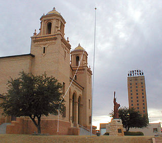
Big Spring is a city in and the county seat of Howard County, Texas, United States, at the crossroads of U.S. Highway 87 and Interstate 20. With a population of 27,282 as of the 2010 census, it is the largest city between Midland to the west, Abilene to the east, Lubbock to the north, and San Angelo to the south. Big Spring was established as the county seat of Howard County in 1882; it is the largest community in the county.

Gualala is an unincorporated community in Mendocino County in the U.S. state of California. It is located north of The Sea Ranch and south of Point Arena, California. Gualala shares its southern border with the southern border of Mendocino County. It is located on the Pacific coast at the mouth of the Gualala River, on State Route 1. It serves as a commercial center for the surrounding area. Gualala was once a logging town, but tourism is now its central economic activity.

Pleasant Grove is an area located in the southeast portion of Dallas.
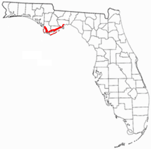
Florida's Forgotten Coast is a registered trademark, coined in the early 1990s, by the Apalachicola Bay Chamber of Commerce. The name is most commonly used to refer to a relatively quiet, undeveloped and largely uninhabited section of coastline stretching from Mexico Beach on the Gulf of Mexico to St. Marks on Apalachee Bay in the U.S. state of Florida. The nearest major cities are Tallahassee, about 90 miles (145 km) northeast of Apalachicola, and Panama City, home of Tyndall Air Force Base, about 60 miles (95 km) to the northwest.
Panamint Springs is an unincorporated community in Inyo County, California. It lies at an elevation of 1926 feet.

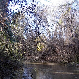
Spring Creek, in Sonoma County, California, is a 6.0-mile-long (9.7 km) stream that rises in the northern part of the Sonoma Mountains within Annadel State Park, draining the western slopes of Taylor Mountain and feeding into Matanzas Creek below the Matanzas Creek Reservoir.
St. Johns is an unincorporated community in northeast St. Johns County, Florida, United States and a suburb of Jacksonville. The population as of the 2000 census was 18,063, though considerable growth has taken place in the past ten years. As of 2016, the population is estimated to be approximately 86,400 people. It is located in the Jacksonville metropolitan area, and lies approximately halfway between downtown Jacksonville and downtown St. Augustine.

Carmel Mountain Ranch, sometimes shortened to simply Carmel Mountain, such as on maps, or abbreviated to CMR by local residents and organizations, is a community of San Diego, California, United States, in the northeastern part of the city. Despite its name, Carmel Mountain Ranch is actually in the shadow of Black Mountain. Carmel Mountain proper is about 10 miles west of the Carmel Mountain Ranch neighborhood.
Mark West is an unincorporated community immediately north of Santa Rosa, California in Sonoma County, California, United States. Mark West is located along Mark West Springs Road adjacent to U.S. Highway 101. The community of Mark West is named for Scottish American pioneer William Marcus West.

Doss is an unincorporated farming and ranching community at the crossroads juncture of FM 783 and FM 648 in northwestern Gillespie County, Texas, United States. It is 19 miles NW of Fredericksburg and 14 miles NE of Harper. Postal zip code is 78618. Elevation is 1729 feet.

Austin–Round Rock is a five-county metropolitan area in the U.S. state of Texas, as defined by the Office of Management and Budget. Commonly referred to as Greater Austin, the metropolitan area is situated in Central Texas on the eastern edge of the American Southwest, and borders San Antonio–New Braunfels to the south.
Mark West Creek is a 29.9-mile-long (48.1 km) stream that rises in the Mayacamas Mountains of Sonoma County, California, United States. Tributaries of Mark West Creek include Porter Creek and Hummingbird Creek, both of which originate in the same mountain range. Discharge waters of Mark West Creek reach the Russian River after a confluence with the Laguna de Santa Rosa. The Community Clean Water Institute has developed a program for monitoring pollutants in Mark West Creek.
Guernewood Park is an unincorporated community in western Sonoma County, California, on the Russian River, 17 mi (27 km) west of Santa Rosa, and 1 mi (1.6 km) west of Guerneville, just off State Route 116. Armstrong Redwoods State Reserve and Austin Creek State Recreation Area are to the north.

Tollhouse is an unincorporated community in Fresno County, California. It lies at an elevation of 1,919 feet (585 m). Tollhouse is located in the Sierra Nevada, 7 miles (11 km) southwest of Shaver Lake. It is home to 2,089 people.
The Hagerstown–Martinsburg Metropolitan Area, officially designated by the United States Office of Management and Budget (OMB) as Hagerstown–Martinsburg, Maryland–West Virginia Metropolitan Statistical Area (MSA), constitutes the primary cities of Hagerstown, Maryland, Martinsburg, West Virginia, and surrounding areas in three counties: Washington County, Maryland, Berkeley County, West Virginia, and Morgan County, West Virginia. The metro area lies mainly within the rich, fertile Cumberland and Shenandoah valleys, and is approximately a 60–90 minute drive from Washington, D.C., Baltimore, Maryland, and Harrisburg, Pennsylvania; Hagerstown is approximately 75 miles (121 km) driving distance from all three cities. The population of the metropolitan area as of 2008 is 263,753.

Calpack is an unincorporated community in Merced County, California. It is located 2 miles (3.2 km) west of Planada, at an elevation of 213 feet. The community was named for the California Packing Corporation. It has a population of 50.

Bell Creek is a 10-mile-long (16 km) tributary of the Los Angeles River, in the Simi Hills of Ventura County and the San Fernando Valley of Los Angeles County and City, in Southern California.

Lake Sabrina is a lake created by damming the middle fork of Bishop Creek. It is located south-west of Bishop, California on California State Route 168, in the Inyo National Forest. It has a cafe as well as a dock. The dam was built in 1907-8 to supply a constant flow of water to the hydraulic power plants. The lake is part of the Bishop Creek system.
Cuddy Valley is a valley in the San Andreas Rift Zone south of the San Emigdio Mountains west of Tejon Pass, and unincorporated community in Kern County, California, and part of the Mountain Communities. It lies at an elevation of 5,282 feet 1610 m).