Camp Meeker, California

Last updated
Camp Meeker, California
Camp Meeker 3493.jpg
Welcome arch on Bohemian Highway
USA California location map.svg
Red pog.svg
Camp Meeker, California
Location within the state of California
Usa edcp location map.svg
Red pog.svg
Camp Meeker, California
Camp Meeker, California (the United States)
Coordinates: 38°25′31″N122°57′34″W / 38.42528°N 122.95944°W / 38.42528; -122.95944
Country United States
State California
County Sonoma
Elevation
[1]
331 ft (101 m)
Time zone UTC-8 (PST)
  Summer (DST) UTC-7 (PDT)
ZIP code
95419
Area code 707
FIPS code 06-10466
GNIS feature ID1658200
Website http://www.campmeeker.org/

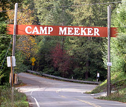
Camp Meeker is an unincorporated community, Sonoma County, United States, located on the Bohemian Highway, between Occidental and Monte Rio. It has approximately 350 homes on properties ranging from a couple thousand square feet to many acres, some flat and sunny, some on steep narrow gauge railroad type one-way streets. The population hovers around 425. [2]

Contents

Set amidst redwoods directly on Dutch Bill Creek, it gets an average of 55 inches of rainfall spread over about 69 average days during the winter season.

History

Camp Meeker, 1907 Camp Meeker. California (1907).jpg
Camp Meeker, 1907

Camp Meeker takes its name from Melvin Cyrus Meeker, a lumber baron who established several mills in the area c. 1866.

Located on the North Pacific Coast Railroad (since abandoned), Camp Meeker was a center for logging the coast redwoods that built and then rebuilt San Francisco after the 1906 earthquake. After logging the trees, Meeker subdivided Camp Meeker into lots (each 25ft by 12ft (7.6m by 3.7m) with a one-room cabin) in 1898, they sold for $75. Around 1900, it was primarily a vacation place for people from San Francisco.

Facilities

Camp Meeker is the home of St. Dorothy's Rest, a retreat center and summer camp.

Fire protection is provided by the Camp Meeker Volunteer Fire Department. In 2003, the department claimed that Camp Meeker was the only place in Sonoma County which places fire hydrants every 500 ft (150 m). [3]

As of December 2001, one-year class wild coho salmon were spawning in Dutch Bill Creek. In 2002 Dutch Bill Creek was part of the captive broadstock program, and since 2006 juvenile coho have been released in the creek as a part of this program. [4]

In November 2009, Camp Meeker revamped its recreational park on Dutch Bill Creek by removing a WPA-era dam and installing a bridge in its place. The entire area was rebuilt by PCI, Inc. under contract with the Gold Ridge Resource Conservation District after years of study. [5]

Before becoming a village Camp Meeker was a lumber town followed by a summer enclave with the year rounders and the summer folk.

Related Research Articles

<span class="mw-page-title-main">Fort Bragg, California</span> City in California, United States

Fort Bragg, officially the City of Fort Bragg, is a city along the Pacific Coast of California along Shoreline Highway in Mendocino County. The city is 24 miles (39 km) west of Willits, at an elevation of 85 feet (26 m). Its population was 6,983 at the 2020 census.

<span class="mw-page-title-main">Muir Woods National Monument</span> United States National Monument in California

Muir Woods National Monument is a United States National Monument managed by the National Park Service, named after naturalist John Muir. It is located on Mount Tamalpais near the Pacific coast, in southwestern Marin County, California. It is part of the Golden Gate National Recreation Area, and is 12 miles (19 km) north of San Francisco. It protects 554 acres (224 ha), of which 240 acres (97 ha) are old growth coast redwood forests, one of a few such stands remaining in the San Francisco Bay Area.

<span class="mw-page-title-main">Eel River (California)</span> River in northern California, United States

The Eel River is a major river, about 196 miles (315 km) long, of northwestern California. The river and its tributaries form the third largest watershed entirely in California, draining a rugged area of 3,684 square miles (9,540 km2) in five counties. The river flows generally northward through the Coast Ranges west of the Sacramento Valley, emptying into the Pacific Ocean about 10 miles (16 km) downstream from Fortuna and just south of Humboldt Bay. The river provides groundwater recharge, recreation, and industrial, agricultural and municipal water supply.

<span class="mw-page-title-main">Henry Cowell Redwoods State Park</span> State park in Santa Cruz County, California, United States

Henry Cowell Redwoods State Park is a state park of California, United States, preserving mainly forest and riparian areas in the watershed of the San Lorenzo River, including a grove of old-growth coast redwood. It is located in Santa Cruz County, primarily in the area between the cities of Santa Cruz and Scotts Valley, near the community of Felton and the University of California at Santa Cruz. The park includes a non-contiguous extension in the Fall Creek area north of Felton. The 4,623-acre (1,871 ha) park was established in 1953.

<span class="mw-page-title-main">Cazadero, California</span> Unincorporated community in California, United States

Cazadero is an unincorporated community and census-designated place (CDP) in western Sonoma County, California, United States with a population of 354 in 2010. The downtown of Cazadero consists of two churches, a general store, a post office, a hardware store, an auto repair garage, private office space, and the Cazadero Volunteer Fire Department.

<span class="mw-page-title-main">Humboldt Bay</span> Bay on the North Coast of California

Humboldt Bay is a natural bay and a multi-basin, bar-built coastal lagoon located on the rugged North Coast of California, entirely within Humboldt County, United States. It is the largest protected body of water on the West Coast between San Francisco Bay and Puget Sound, the second-largest enclosed bay in California, and the largest port between San Francisco and Coos Bay, Oregon. The largest city adjoining the bay is Eureka, the regional center and county seat of Humboldt County, followed by the city of Arcata. These primary cities, together with adjoining unincorporated communities and several small towns, comprise a Humboldt Bay Area with a total population of nearly 80,000 people. This comprises nearly 60% of the population of Humboldt County. The bay is home to more than 100 plant species, 300 invertebrate species, 100 fish species, and 200 bird species. In addition, the bay and its complex system of marshes and grasses support hundreds of thousands of migrating and local shore birds. Commercially, this second-largest estuary in California is the site of the largest oyster production operations on the West Coast, producing more than half of all oysters farmed in California.

<span class="mw-page-title-main">Waddell Creek (California)</span> River in California, United States

Waddell Creek is the name given to both the creek and the watershed that run through Big Basin Redwoods State Park in Santa Cruz County, California. The Waddell Creek mainstem is formed by the confluence of East and West Waddell Creeks, and empties into the Pacific Ocean at Waddell Beach, just south of Año Nuevo Point.

<span class="mw-page-title-main">Northwestern Pacific Railroad</span> Regional railroad in California, US

The “Northwestern Pacific Railroad” was a 271 mile mainline railroad from the ferry connections in Sausalito north to Eureka with a connection to the national railroad system at Schellville. The railroad has gone through a history of different ownership and operators but has maintained a generic name of reference as “The Northwestern Pacific.” Currently, only a 62-mile (100 km) stretch of mainline on the “South End” is operated by Sonoma-Marin Area Rail Transit (SMART), which operates both commuter and freight trains with plans for future extension north to Cloverdale. The “North End,” from Willits to Eureka which includes connections to the California Western Railroad] is currently out of service but saved by 2018 legislation to be converted into the Great Redwood Trail.

<span class="mw-page-title-main">Albion River</span> River in Mendocino County, California (USA)

The Albion River is an 18.1-mile-long (29.1 km) river in Mendocino County, California. The river drains about 43 square miles (110 km2) on the Mendocino Coast and empties into the Pacific Ocean near the town of Albion, California, where California State Route 1 crosses it on the Albion River Bridge. The river's overall direction is east to west, but it moves significantly in the north-south direction. The tributaries of the river include Railroad Gulch, Pleasant Valley Creek, Duck Pond Gulch, South Fork Albion River, Tom Bell Creek, North Fork Albion River, and Marsh Creek. The river's most inland point is only 15 miles (24 km) from the coast, and its highest elevation is about 1,570 feet (480 m) above sea level. There is a large estuary at the mouth of the river, and tidal waters travel up to 5 miles (8 km) upstream. The Albion River was previously used to power a sawmill on the river mouth, but there are no major dams or reservoirs on the river. The river provides recreation, groundwater recharge and industrial water supply for the community of Albion, and wildlife habitat including cold freshwater habitat for fish migration and spawning.

<span class="mw-page-title-main">Noyo River</span> River in Mendocino County, California (USA) with its mouth at Fort Bragg

The Noyo River is a river on the north coast of California in Mendocino County. The river's headwaters are in the steep Mendocino Range, but downstream the river flows through gently sloping marine terraces before draining into the Pacific Ocean. The 113 square miles (290 km2) watershed extends east to the small city of Willits and the river's mouth is at Noyo Harbor in Fort Bragg, which uses the river for drinking water; it is neighbored on the south by Hare Creek and the Big River, on the east by the South Fork Eel River, and on the north by Ten Mile River, named for its distance from the Noyo River. The average annual rainfall is between 40 inches (1,000 mm) and 65 inches (1,700 mm).

<span class="mw-page-title-main">Big River (California)</span> River in Mendocino County, California (USA), south of Mendocino Village

The Big River is a 41.7-mile-long (67.1 km) river in Mendocino County, California, that flows from the northern California Coast Range to the Pacific Ocean at Mendocino, Mendocino County, California. From the mouth, brackish waters extend 8 miles (13 km) upstream, forming the longest undeveloped estuary in the state.

<span class="mw-page-title-main">Russian River (California)</span> River in California

The Russian River is a southward-flowing river that drains 1,485 sq mi (3,850 km2) of Sonoma and Mendocino counties in Northern California. With an annual average discharge of approximately 1,600,000 acre feet (2.0 km3), it is the second-largest river flowing through the nine-county Greater San Francisco Bay Area, with a mainstem 115 mi (185 km) long.

<span class="mw-page-title-main">Redwood Creek (Marin County)</span> River in California, United States

Redwood Creek is a mostly perennial stream in Marin County, California. 4.7 miles (7.6 km) long, it drains a 7-square-mile (18 km2) watershed which includes the Muir Woods National Monument, and reaches the Pacific Ocean north of the Golden Gate at Muir Beach.

San Leandro Creek is a 21.7-mile-long (34.9 km) year-round natural stream in the hills above Oakland in Alameda County and Contra Costa County of the East Bay in northern California.

<span class="mw-page-title-main">Pescadero Creek</span> River in California, United States

Pescadero Creek is a major stream in Santa Cruz and San Mateo counties in California, United States. At 26.6 miles (42.8 km), it is the longest stream in San Mateo County and flows all year from springs in the Santa Cruz Mountains. Its source is at 1,880 feet (570 m) above sea level on the western edge of Castle Rock State Park, with additional headwaters in Portola Redwoods State Park, and its course traverses Pescadero Creek County Park and San Mateo County Memorial Park before entering Pescadero Marsh Natural Preserve at Pescadero State Beach and thence to the Pacific Ocean 14.4 miles (23 km) south of Half Moon Bay.

<span class="mw-page-title-main">Salmon Creek (Sonoma County, California)</span> River in California, United States

Salmon Creek is an 18.3-mile-long (29.5 km) stream in western Sonoma County, California that springs from coastal hills west of the town of Occidental and empties into the Pacific Ocean north of Bodega Head.

<span class="mw-page-title-main">Redwood Empire Council</span>

Redwood Empire Council is the local council of the Boy Scouts of America that serves youth in Mendocino and Sonoma counties in California.

<span class="mw-page-title-main">Dutch Bill Creek</span> River in California, United States

Dutch Bill Creek is a 6.5-mile-long (10.5 km) north-flowing stream in the hills of western Sonoma County, California, which empties into the Russian River at Monte Rio about 7 miles (11 km) from the Pacific Ocean.

The Caspar, South Fork & Eastern Railroad provided transportation for the Caspar Lumber Company in Mendocino County, California. The railroad operated the first steam locomotive on the coast of Mendocino County in 1875. Caspar Lumber Company lands became Jackson Demonstration State Forest in 1955, named for Caspar Lumber Company founder, Jacob Green Jackson.

References

  1. U.S. Geological Survey Geographic Names Information System: Camp Meeker
  2. Camp Meeker
  3. "Hydrant Update: Camp Meeker Volunteer Fire Department". Archived from the original on 2008-08-07. Retrieved 2007-12-09.
  4. CA Dept of Fish, & Game (2000). "Department of Fish and Game Coho Recovery Report" . Retrieved 2008-12-07.
  5. "Dutch Bill Creek Watershed Fish Barrier Elimination Program" (PDF). Retrieved July 30, 2010.

Official website