Joe Rodota Trail

Last updated
Joe Rodota Trail
Length8.5 miles (13.7 km)
Location Sonoma County, California, United States
Surface paved
Joe Rodota Trail
BSicon fSTRq.svg
BSicon fTEEa.svg
BSicon fSTRq.svg
Prince Greenway
BSicon WCONTgq.svg
BSicon fWBRUCKE1.svg
BSicon WASSERq.svg
Santa Rosa Creek
BSicon hRP4+l.svg
BSicon fSKRZ-G4hr.svg
BSicon RP4q.svg
California 12.svg SR 12
BSicon hRP4.svg
BSicon fTEEl.svg
BSicon fxKRZ.svg
SMART Trail
BSicon hRP4e.svg
BSicon feKRZ.svg
BSicon RP2xRP2.svg
Dutton Avenue
BSicon RP4.svg
BSicon fSTR.svg
BSicon RP2.svg
BSicon RP4uRP2.svg
BSicon feKRZ.svg
BSicon RP2xRP2.svg
Stony Point Road
BSicon RP4.svg
BSicon fOBJrl.svg
BSicon RP2.svg
Homeless encampment
BSicon RP4.svg
BSicon fSTRl.svg
BSicon fxABZg+r.svg
BSicon RP4eRP2.svg
BSicon RP2q.svg
BSicon RP2xRP2.svg
Wright Road
BSicon RP4yRP2.svg
BSicon RP2.svg
Sebastopol Road
BSicon RP2eRP2.svg
BSicon RP2q.svg
BSicon feKRZ.svg
Merced Avenue
BSicon RP22+n.svg
BSicon RP2c3.svg
BSicon fSTR.svg
BSicon RP2c1.svg
BSicon RP2s+4.svg
BSicon fSTR.svg
BSicon RP2eRP2.svg
BSicon feKRZ.svg
Llano Road
BSicon RP2.svg
BSicon fSTR.svg
BSicon RP2.svg
BSicon fSTR.svg
BSicon WCONTgq.svg
BSicon RP2oW.svg
BSicon fWBRUCKE1.svg
Laguna de Santa Rosa
BSicon RP2l.svg
BSicon fBHF-M.svg
Sebastopol
BSicon fSTR.svg
West County Trail

The Joe Rodota Trail is a 8.5-mile (13.7 km) paved rail trail in Sonoma County, California that spans from near the intersection of Mill Station Road and Highway 116 in Sebastopol to the area of West 3rd Street and Roberts Avenue in Santa Rosa. The trail provides a safety separation for pedestrians and bicycles from motor vehicle traffic on the parallel California State Route 12/Luther Burbank Memorial Highway. [1]

Contents

The trail has hosted a homeless encampment that grew exponentially in the late 2010s. The encampment was a topic of concern for residents and politicians, resulting in elected officials approving $12 million for housing units. In January 2020, the encampment was dispersed and some of its campers and inhabitants relocated to other areas in Santa Rosa or Sonoma County.

History

The trail was built on the former roadbed of the Petaluma and Santa Rosa Railroad built in 1904 to provide interurban service from a ferry connection in Petaluma through Sebastopol to Santa Rosa. The line was purchased by the Northwestern Pacific Railroad in 1932. [2] The right-of-way was converted to a walking and bicycle path by the Sonoma County Regional Parks Department after declining freight traffic caused abandonment of rail service over the route in the 1980s. [3] The trail is named after Joseph “Joe” Rodota, Sr, father of writer and political consultant Joseph Rodota, Jr.; Rodota, Sr. was the county's district's first director. [4]

Homeless encampment

Following housing losses of the Tubbs Fire, the trail became the site of a major homeless encampment located nearby Stony Point Road, which was the largest in Sonoma County history. [5] As of December 2019, the encampment had encompassed over one mile of the trail and had over 220 homeless inhabitants, which steadily increased over the several months prior. An article from the San Francisco Chronicle put an estimation of 300 homeless residents, which accounted for approximately ten percent of Sonoma County's homeless population at the time. A 150-resident homeless encampment, located one mile (1.6 km) away behind a Dollar Tree on Sebastopol Road in Santa Rosa, was dismantled in August 2018, and a lawsuit was filed over the teardown of that camp which resulted in a federal court injunction preventing officials from taking matter over homeless camps unless they had shelter and storage for campers’ personal belongings. Sixty percent of the people from that encampment relocated to the Joe Rodota Trail encampment. [6] Incidents such as fires and arson took place in the encampment three times in a span of two months from November 2019 to January 2020, including a tank explosion on New Year's Eve 2019. [7] A county supervisor voiced concern that the campsite had steered away many would-be trail pedestrians and cyclists, and had become a nuisance for people who live in the neighborhood. [6]

The Sonoma County Board of Supervisors approved a plan to provide housing for some of the homeless campers, in a $11.63 million leasing that will provide at least six units for at least twenty people. [8] The county will spend up to $5 million to buy six multi-bedroom houses that could shelter 60 people, $3.2 million to hire seven new staffers and fund contracts for drug treatment beds and medical support, and $750,000 into annual leases of six to seven units to serve another 20 residents. [9] In January 2020, the encampment was dismantled by local authorities, and some of its inhabitants moved elsewhere locally, including a homeless community in Oakmont.

Related Research Articles

<span class="mw-page-title-main">Sonoma County, California</span> County in California, United States

Sonoma County is a county located in the U.S. state of California. As of the 2020 United States Census, its population was 488,863. Its seat of government and largest city is Santa Rosa. It is to the north of Marin County and the south of Mendocino County. It is west of Napa and Lake Counties.

<span class="mw-page-title-main">Sebastopol, California</span> City in California, United States

Sebastopol is a city in Sonoma County, in California with a recorded population of 7,521, per the 2020 U.S. Census.
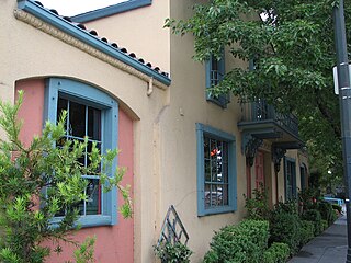
<span class="mw-page-title-main">Roseland, California</span> Place in California, United States

Roseland is a neighborhood in Santa Rosa, California. As of the 2010 census, the population was 6,325. Roseland was an unincorporated enclave within the City of Santa Rosa until the area was annexed by Santa Rosa on November 1, 2017.

<span class="mw-page-title-main">Santa Rosa, California</span> City in California, United States

Santa Rosa is a city and the county seat of Sonoma County, in the North Bay region of the Bay Area in California. Its estimated 2019 population was 178,127. It is the largest city in California's Wine Country and Redwood Coast. It is the fifth most populous city in the Bay Area after San Jose, San Francisco, Oakland, and Fremont; and the 25th most populous city in California.

<span class="mw-page-title-main">Windsor, California</span> City in California, United States

Windsor is an incorporated town in Sonoma County, California, United States. The town is 9 miles north of Santa Rosa and 63 miles north of San Francisco. The population was 26,801 as of the 2010 census. Windsor was once home to a waterslide park known as Windsor Waterworks, or as the Doom Flume, from 1980 to 2006. Windsor also has a bowling center which sits right next to the site where the former Windsor Waterworks waterslide park sat until its 2006 closure.

<span class="mw-page-title-main">Penngrove, California</span> Census-designated place in California, United States

Penngrove is a census-designated place (CDP) in Sonoma County, California, United States, situated between the cities of Petaluma and Cotati, at the foot of the western flank of Sonoma Mountain. It is part of the North Bay subregion of the San Francisco Bay Area. The population was 2,522 at the 2010 census.

<span class="mw-page-title-main">Sonoma–Marin Area Rail Transit</span> Rail service

Sonoma–Marin Area Rail Transit (SMART) is a rail line and bicycle-pedestrian pathway project in Sonoma and Marin counties of the U.S. state of California. When completed, the entire system will serve a 70-mile (110 km) corridor between Cloverdale in northern Sonoma County and Larkspur Landing in Marin County. In 2022, the system had a ridership of 474,500, or about 2,200 per weekday as of the fourth quarter of 2022.

<span class="mw-page-title-main">Northwestern Pacific Railroad</span> Regional railroad in California, US

The “Northwestern Pacific Railroad” was a 271 mile mainline railroad between the national railroad interchange at Schellville and the northernmost point at Eureka, with branches from Ignacio into Marin County. The railroad has gone through a history of different ownership and operators but has maintained a generic name of reference as “The Northwestern Pacific.” Currently, only a 62-mile (100 km) stretch of mainline is operated by Sonoma-Marin Area Rail Transit (SMART), which operates both commuter and freight trains with plans for extension north to Cloverdale, on the “South End.” The “North End,” from Willits to Eureka is saved by 2018 legislation to be converted into the Great Redwood Trail.

<span class="mw-page-title-main">Petaluma and Santa Rosa Railroad</span>

Petaluma and Santa Rosa Railroad was a 600 volt DC electric interurban railway in Sonoma County, California, United States. It operated between the cities of Petaluma, Sebastopol, Forestville, and Santa Rosa. Company-owned steamboats provided service between Petaluma and San Francisco.

<span class="mw-page-title-main">Sonoma County Transit</span> Public transportation system in California, United States

Sonoma County Transit is a public transportation system based in Sonoma County, California.

<span class="mw-page-title-main">Mark West Creek</span> River in California, United States

Mark West Creek is a 29.9-mile-long (48.1 km) stream that rises in the Mayacamas Mountains of Sonoma County, California, United States. Tributaries of Mark West Creek include Porter Creek and Hummingbird Creek, both of which originate in the same mountain range. Discharge waters of Mark West Creek reach the Russian River after a confluence with the Laguna de Santa Rosa. The Community Clean Water Institute has developed a program for monitoring pollutants in Mark West Creek.

<span class="mw-page-title-main">San Francisco and North Pacific Railroad</span> Northern California railroad from Ukiah to Tiburon with ferry to San Francisco (1869-1907)

San Francisco and North Pacific Railroad (SF&NP) provided the first extensive standard gauge rail service to Sonoma County and became the southern end of the regional Northwestern Pacific Railroad. Although first conceived of by Asbury Harpending, who had even obtained many of the right of ways, the SF & NP was bought and subsequently constructed by Peter Donahue, who drove the first spike on August 30, 1869.

<span class="mw-page-title-main">Petaluma and Santa Rosa Railway Powerhouse</span> Building in California, United States

The Petaluma and Santa Rosa Railway Power House is a historic building in Sebastopol, California, U.S., built to serve the Petaluma and Santa Rosa Railroad, an electric interurban railway of Sonoma County. It is also known as the Hogan Building and the P&SR Substation. It was listed on the National Register of Historic Places in 1991.

<span class="mw-page-title-main">Sonoma County Library</span>

The Sonoma County Library is a medium-sized public library system that serves the nine cities and unincorporated areas of Sonoma County, California. The library system is a joint powers authority, with administration located at the Administrative Offices, 6135 State Farm Dr, Rohnert Park, CA 94928.

<span class="mw-page-title-main">Sebastopol station (Petaluma and Santa Rosa Railroad)</span> United States historic place

Sebastopol station was an interurban train station in Sebastopol, California. It was served by the Petaluma and Santa Rosa Railroad and was adjacent to the railway's powerhouse. Official operations ceased in 1932 with the rest of P&SR passenger service. It was leased as retail space for a time before being converted to a museum. The station was added to the National Register of Historic Places in 1996 as Sebastopol Depot of the Petaluma and Santa Rosa Railway .

<span class="mw-page-title-main">Petaluma North station</span>

Petaluma North station is a planned Sonoma–Marin Area Rail Transit station in Petaluma, California located at Corona Boulevard and North McDowell Avenue. The station was planned as an infill station to be constructed after the initial phase of the system's construction had been completed. The site may include a 150-space parking facility.

<span class="mw-page-title-main">Tubbs Fire</span> 2017 wildfire in Napa and Sonoma counties, California, US

The Tubbs Fire was a wildfire in Northern California during October 2017. At the time, the Tubbs Fire was the most destructive wildfire in California history, burning parts of Napa, Sonoma, and Lake counties, inflicting its greatest losses in the city of Santa Rosa. Its destructiveness was surpassed only a year later by the Camp Fire of 2018. The Tubbs Fire was one of more than a dozen large fires that broke out in early October 2017, which were simultaneously burning in eight Northern California counties, in what was called the "Northern California firestorm". By the time of its containment on October 31, the fire was estimated to have burned 36,810 acres (149 km2); at least 22 people were believed to have been killed in Sonoma County by the fire.

<span class="mw-page-title-main">Tubbs Island</span> Island in California

Tubbs Island is an island in San Pablo Bay. It is in Sonoma County, California, and parts of it are managed as part of the Napa-Sonoma Marshes Wildlife Area. Its coordinates are 38°08′59″N122°25′27″W, and the United States Geological Survey measured its elevation as 0 ft (0 m) in 1981. It, long with Island No. 1, Island No. 2 and Green Island, are labeled on a 1902 USGS map of the area.

<span class="mw-page-title-main">The Jungle (San Jose)</span> Homeless encampment in San Jose, California

The Jungle was a large homeless encampment located in San Jose, California. It was located off Story Road and along Coyote Creek, in an area called Coyote Meadow, and consisted of various makeshift dwellings, shacks, tree houses and tents on around 75 acres (30 ha) of land. During the time of its existence, it was often considered to be one of the largest homeless encampments in the United States.

References

  1. "Joe Rodota Trail". Sonoma County Regional Parks . Retrieved January 13, 2020.
  2. Ellison, Robert; Sievers, Walt (1952). "Petaluma and Santa Rosa Railroad Company". The Western Railroader. Francis A. Guido. 15 (148): 3–14.
  3. "West County Regional Trail" . Retrieved 13 January 2020.
  4. Rush, Laura Hagar (May 29, 2017). "Sonoma County Regional Parks celebrates 50 years". Sonoma West.
  5. Johnson, Doug (10 October 2018). "How the Tubbs Fire Affected Santa Rosa's Homeless Population". FOX40. Retrieved 13 January 2020.
  6. 1 2 Fagan, Kevin (December 16, 2019). "Santa Rosa struggles with biggest homeless camp in county history". San Francisco Chronicle .
  7. Fixler, Kevin (January 12, 2020). "Santa Rosa fire crew responds to small fire at Joe Rodota Trail homeless encampment". Press Democrat.
  8. Lanaras, James (January 11, 2020). "Sonoma County supervisors scheduled to vote on housing proposals for homeless". KTVU.
  9. Silvy, Tyler (December 24, 2019). "Sonoma County supervisors approve $11 million in emergency spending on Santa Rosa homeless encampment". Sonoma Index-Tribune.