
Santa Barbara County, officially the County of Santa Barbara, is located in Southern California. As of the 2020 census, the population was 448,229. The county seat is Santa Barbara, and the largest city is Santa Maria.

The Angeles National Forest (ANF) of the U.S. Forest Service is located in the San Gabriel Mountains and Sierra Pelona Mountains, primarily within Los Angeles County in southern California. The ANF manages a majority of the San Gabriel Mountains National Monument.
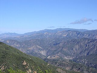
The San Rafael Mountains are a mountain range in central Santa Barbara County, California, U.S., separating the drainages of the Santa Ynez River and the Santa Maria River. They are part of the Transverse Ranges system of Southern California which in turn are part of the Pacific Coast Ranges system of western North America.

Mount San Antonio, commonly referred to as Mount Baldy or Old Baldy, is a 10,064 ft (3,068 m) summit in the San Gabriel Mountains on the border of Los Angeles and San Bernardino counties of California. Lying within the San Gabriel Mountains National Monument and Angeles National Forest, it is the high point of the range, the County of Los Angeles, and the Los Angeles metropolitan area.

The Cleveland National Forest encompasses 460,000 acres/720 sq mi (1,900 km2) of inland montane regions—approx. 60 miles from the Pacific Ocean—within the counties of San Diego, Riverside, and Orange, California. The landscape varies somewhat, with mostly chaparral canyons, arroyos and high desert, but dotted with meadows and oak and conifer forests. Near water sources, riparian environments and perennial aquatic plants attract native and migratory wildlife, such as at San Diego’s man-made Lake Cuyamaca. A generally warm and dry, inland-Mediterranean climate prevails over the forest, with the cooler months producing morning frost and snowfall. It is the southernmost U.S. National Forest of California. The area is administered by the U.S. Forest Service, a government agency within the United States Department of Agriculture, and is locally overseen by the Descanso, Palomar and Trabuco Ranger Districts.

The Ocala National Forest is the second largest nationally protected forest in the U.S. State of Florida. It covers 607 square miles (1,570 km2) of northern Florida. It is located three miles (5 km) east of Ocala and 16 miles (26 km) southeast of Gainesville. The Ocala National Forest, established in 1908, is the oldest national forest east of the Mississippi River and the southernmost national forest in the continental U.S. The word Ocala is thought to be a derivative of a Timucuan term meaning "fair land" or "big hammock". The forest is headquartered in Tallahassee, as are all three National Forests in Florida, but there are local ranger district offices located in Silver Springs and Umatilla.

The San Bernardino National Forest is a United States National Forest in Southern California encompassing 823,816 acres (3,333.87 km2) of which 677,982 acres (2,743.70 km2) are federal. The forest is made up of two main divisions, the eastern portion of the San Gabriel Mountains and the San Bernardino Mountains on the easternmost of the Transverse Ranges, and the San Jacinto and Santa Rosa Mountains on the northernmost of the Peninsular Ranges. Elevations range from 2,000 to 11,499 feet. The forest includes seven wilderness areas: San Gorgonio, Cucamonga, San Jacinto, South Fork, Santa Rosa, Cahuilla Mountain and Bighorn Mountain. Forest headquarters are located in the city of San Bernardino. There are district offices in Lytle Creek, Idyllwild, and Fawnskin.
Los Padres National Forest is a United States national forest in southern and central California. Administered by the United States Forest Service, Los Padres includes most of the mountainous land along the California coast from Ventura to Monterey, extending inland. Elevations range from sea level to 8,847 feet (2,697 m).

Mount Pinos is a mountain located in the Los Padres National Forest on the boundary between Ventura and Kern counties in California. The summit, at 8,847 feet (2,697 m), is the highest point in Ventura County. The mountain is the highest point of the Transverse Ranges west of Tejon Pass, as well as the southernmost point of the Salinian Block.
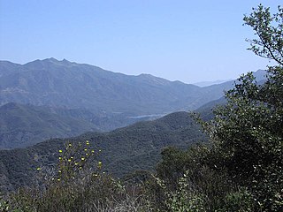
The Ventana Wilderness of Los Padres National Forest is a federally designated wilderness area located in the Santa Lucia Range along the Central Coast of California. This wilderness was established in 1969 when the Ventana Wilderness Act redesignated the 55,800-acre (22,600 ha) Ventana Primitive Area as the Ventana Wilderness and added land, totalling 98,000 acres. In 1978, the Endangered American Wilderness Act added 61,000 acres, increasing the total wilderness area to about 159,000 acres. The California Wilderness Act of 1984 added about 2,750 acres. The Los Padres Condor Range and River Protection Act of 1992 created the approximately 14,500-acre (5,900 ha) Silver Peak Wilderness and added about 38,800 acres to the Ventana Wilderness in addition to designating the Big Sur River as a Wild and Scenic River. The Big Sur Wilderness and Conservation Act of 2002 expanded the wilderness for the fifth time, adding nearly 35,000 acres (14,000 ha), increasing the total acreage of the wilderness to its present size of 240,026 acres (97,135 ha).

The San Rafael Wilderness is a wilderness area in the mountains of north central Santa Barbara County, California, United States. It is north of the city of Santa Barbara and east of Santa Maria within the Los Padres National Forest. Formed in 1968, it was the first wilderness area to be created from a previously designated Primitive Area after the passage of the 1964 Wilderness Act. It also includes the Sisquoc Condor Sanctuary, created in 1937, which is the oldest designated sanctuary for the large endangered birds.

The Dick Smith Wilderness is a wilderness area in the mountains of eastern Santa Barbara County, California, United States, with a portion in Ventura County. It is completely contained within the Los Padres National Forest, and is northeast of the city of Santa Barbara and north of the city of Ojai. It is most easily accessible from two trailheads off State Route 33, which runs north from Ojai. It is adjacent to the large San Rafael Wilderness on the west and the Matilija Wilderness on the south. Across Highway 33 to the east, and also in the Los Padres National Forest, is the large Sespe Wilderness.

The Zaca Fire was a wildfire in the San Rafael Mountains, northeast of the Santa Ynez Valley in Santa Barbara County, California. It was the single largest wildfire of the 2007 California wildfire season. The fire started on July 4, 2007, and by August 31, it had burned over 240,207 acres (972.083 km2), making it California's second largest fire in recorded history at that time after the Cedar Fire of 2003. As of 2023, it is California's 12th-largest recorded fire in modern history. The fire was contained on September 4, 2007, with the fire being brought under control on October 29, 2007.
Big Pine Mountain is a mountain located in the San Rafael Mountains of the California Transverse Ranges. High enough to receive snowfall during the winter, The summit, at 6800+ feet (2,074+ m), is the highest point in the San Rafael Mountains, the Dick Smith Wilderness, and Santa Barbara County. The peak and the surrounding area were severely impacked by the Zaca fire in 2007.

Sykes Camp is located 10 miles (16 km) from the Pfeiffer Big Sur State Park trailhead along the Pine Ridge Trail. There were seven campsites along both sides of the Big Sur River upstream and downstream from where the trail intersects the river. There was a pit toilet downstream of this intersection.

The Silver Peak Wilderness is located in the southwestern corner of Monterey County in the Santa Lucia Mountains along the Central Coast of California. It southern boundary largely follows the Monterey County/San Luis Obispo County line. Its eastern boundary is defined by Ft. Hunter Liggett, while on the west it follows closely along Highway 1 and the Big Sur coastline. It is one of ten wilderness areas within the Los Padres National Forest and managed by the US Forest Service.

Little Pine Mountain is a mountain in Santa Barbara County, California, in the Los Padres National Forest at the southern edge of the San Rafael Mountains. It separates the drainages of Oso Creek, which flows into the upper Santa Ynez River, from the drainage of Santa Cruz Creek, which flows into the middle section of the river via Lake Cachuma. The mountain is named for a thin grove of Coulter pines located on the summit.

The La Brea Fire was a fast-moving 2009 wildfire which occurred in Southern California in the United States. The fire began near La Brea Creek in Santa Barbara County, in the Los Padres National Forest. The fire started burning on August 8, and just 5 days later on August 13 had grown by 10,000 acres, or 40 km2. When the wildfire was finally contained on August 22, it had burned 89,489 acres of land. The huge Zaca Fire burned in the same region as the La Brea Fire, and occurred just two years prior in 2007.
The Matilija Wilderness is a 29,207-acre (11,820 ha) wilderness area in Ventura and Santa Barbara Counties, Southern California. It is managed by the U.S. Forest Service, being situated within the Ojai Ranger District of the Los Padres National Forest. It is located adjacent to the Dick Smith Wilderness to the northwest and the Sespe Wilderness to the northeast, although it is much smaller than either one. The Matilija Wilderness was established in 1992 in part to protect California condor habitat.
The Ventana Wilderness Alliance, founded in 1998, is a group dedicated to preserving and protecting public lands along California's Big Sur coast. Its mission is to protect, preserve and restore the wilderness qualities and biodiversity of the public lands within California's Northern Santa Lucia Mountains and Big Sur region.
