Sonoma County is a county in the U.S. state of California. As of the 2010 United States Census, its population was 483,878. Its county seat and largest city is Santa Rosa. It is to the north of Marin County and the south of Mendocino County. It is west of Napa County and Lake County.
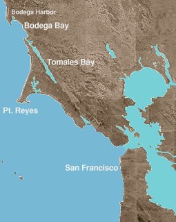
Bodega Bay is a shallow, rocky inlet of the Pacific Ocean on the coast of northern California in the United States. It is approximately 5 mi (8 km) across and is located approximately 40 mi (60 km) northwest of San Francisco and 20 mi (32 km) west of Santa Rosa. The bay straddles the boundary between Sonoma County to the north and Marin County to the south. The bay is a marine habitat used for navigation, recreation, and commercial and sport fishing including shellfish harvesting.

Bodega Head is a small promontory on the Pacific coast of northern California in the United States. It is located in Sonoma County at 38.311°N 123.066°W, approximately 40 mi (64 km) northwest of San Francisco and approximately 20 mi (32 km) west of Santa Rosa.

Bodega Harbor is a small shallow natural harbor on the Pacific coast of northern California in the United States, approximately 40 mi (64 km) northwest of San Francisco. The harbor is approximately 2 square miles in area.

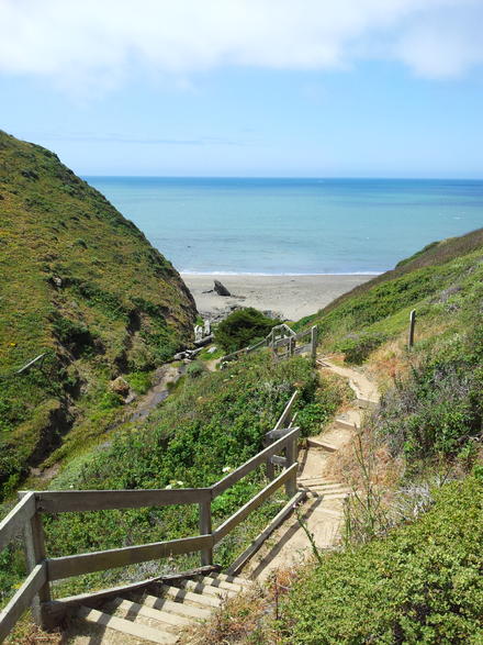
Goat Rock Beach is a sand beach in northwestern Sonoma County, California, United States. This landform is a sub-unit of Sonoma Coast State Beach, owned and managed by the State of California. At the northern terminus of Goat Rock Beach is the mouth of the Russian River, and the southern end of this crescent shaped expanse is the massive Goat Rock, an iconic outcrop of the Sonoma Coast, which is barely attached to the mainland by a narrow isthmus.
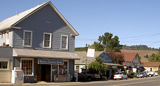
Bodega is an unincorporated community and census-designated place (CDP) in Sonoma County in the U.S. state of California. The town had a population of 220 as of the 2010 Census.

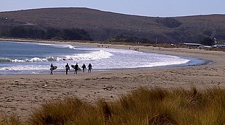
Montara State Beach is a beach located eight miles north of Half Moon Bay on State Route 1 in California, USA. It is operated by the California State Department of Parks and Recreation under the San Mateo Coast Sector Office. It is one of the cleanest beaches in the state and is known for surfing and fishing.
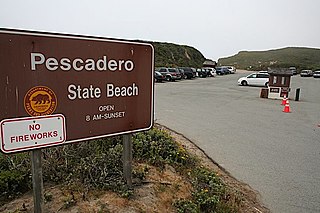
Pescadero State Beach is alongside State Route 1, located 14.5 miles south of Half Moon Bay and 1.5 miles west of the city of Pescadero in San Mateo County, California.

Sonoma Coast State Park is a State of California property in Sonoma County consisting of public access use on lands adjoining the Pacific Ocean. This extent of beach runs from a coastal point about 4 miles (6 km) north of Jenner and continues for approximately 17 miles (27 km) to the south to terminate at Bodega Head. The property lies along State Route 1 and consists of a number of named beaches including Arched Rock Beach, Gleason Beach and Goat Rock Beach. The ecosystem consists of alternating sandy beaches and rocky shoreline, with a marine terrace extending above the entire extent with an upland California coastal prairie habitat.

Sonoma Mountain is a prominent landform within the Sonoma Mountains of southern Sonoma County, California. At elevation of 2,463 ft (751 m), Sonoma Mountain offers expansive views of the Pacific Ocean to the west and the Sonoma Valley to the east. In fact, the viticultural area extends in isolated patches up the eastern slopes of Sonoma Mountain to almost 1,700 feet (520 m) in elevation.
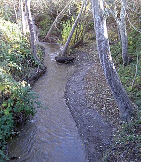
Salmon Creek is an 18.3-mile-long (29.5 km) stream in western Sonoma County, California that springs from coastal hills west of the town of Occidental and empties into the Pacific Ocean north of Bodega Head.
Doran Regional Park is a regional park south of Bodega Bay, California, U.S.A. that is maintained by the Sonoma County Regional Parks Department. It covers an area of 127 acres (51 ha). It is located at 38.314°N 123.0428°W on the sand spit separating Bodega Harbor from Bodega Bay. The park address is 201 Doran Beach Road, Bodega Bay, CA.
Black Point is a cape on the Pacific Coast of northern California in the United States. It is located in the Sea Ranch area of Sonoma County at 38.679°N 123.432°W, approximately 80 miles (130 km) northwest of San Francisco and approximately 40 miles (60 km) northwest of Santa Rosa.
Sea Lion Cove State Marine Conservation Area (SMCA) is a marine protected area that lies onshore, just south of Point Arena in Mendocino County on California’s north central coast. The marine protected area covers 0.22 square miles. Sea Lion Cove SMCA prohibits the commercial and recreational take of invertebrates, algae and other plants, but allows the take of all other species.

Saunders Reef State Marine Conservation Area (SMCA) is a marine protected area that extends offshore, just south of Schooner Gulch State Beach and north of Sail Rock in Mendocino County on California’s north central coast. The marine protected area covers 9.35 square miles. Saunders Reef SMCA prohibits the take of all living marine resources, except the commercial and recreational take of salmon by trolling and the commercial take of urchin.
Estero Americano State Marine Recreational Management Area (SMRMA) is a marine protected area that splits Sonoma and Marin counties on California’s north central coast. The marine protected area covers 0.15 square miles. Estero Americano SMRMA prohibits the take of all living marine resources, except the recreational hunting of waterfowl, unless otherwise restricted by hunting regulations.

Estero de San Antonio State Marine Recreational Management Area (SMRMA) is a marine protected area 1.5 miles north of Dillon Beach in Marin County on California’s north central coast. The marine protected area covers 0.09 square miles. Estero de San Antonio SMRMA prohibits the take of all living marine resources, except the recreational hunting of waterfowl, unless otherwise restricted by hunting regulations.
Point Arena State Marine Reserve (SMR) and Point Arena State Marine Conservation Area (SMCA) are two adjoining marine protected areas that extend offshore of Point Arena in Mendocino County on California’s north central coast. The combined area of these marine protected areas is 11.11 square miles (28.8 km2), with 4.38 square miles (11.3 km2) in the SMR and 6.73 square miles (17.4 km2) in the SMCA. Point Arena SMR prohibits the take of all living marine resources. Point Arena SMCA prohibits the take of all living marine resources, except commercial and recreational salmon trolling.

Bodega Head State Marine Reserve (SMR) and Bodega Head State Marine Conservation Area (SMCA) are two adjoining marine protected areas off Bodega Bay in Sonoma County on California’s north-central coast. The combined area of these marine protected areas is 21.64 square miles (56.0 km2), with 9.3 square miles (24 km2) in the SMR, and 12.34square miles in the SMCA. Bodega Head SMR prohibits the take of all living marine resources. Bodega Head SMCA prohibits the take of all living marine resources, except the recreational and commercial take of pelagic finfish with troll fishing gear or seine, Dungeness crab by trap, and market squid by hand-held dip net and round haul net.

Russian River State Marine Recreational Management Area (SMRMA) and Russian River State Marine Conservation Area (SMCA) are two adjoining marine protected areas in the Russian River estuary area in Sonoma County, California, on the north-central coast of the state. The combined area of these marine protected areas is 1.21 square miles (3.1 km2), with 0.35 square miles (0.91 km2) in the SMRMA and 0.86 square miles (2.2 km2) in the SMCA.