Richmond Greenway | |||||||||||||||||||||||||||||||||||||||||||||||||||||||||||||||||||||||||||||||||||||||||||||||||||||||||||||||||||||||||||||||||||||||||||||||||||||||||||||||||||||
|---|---|---|---|---|---|---|---|---|---|---|---|---|---|---|---|---|---|---|---|---|---|---|---|---|---|---|---|---|---|---|---|---|---|---|---|---|---|---|---|---|---|---|---|---|---|---|---|---|---|---|---|---|---|---|---|---|---|---|---|---|---|---|---|---|---|---|---|---|---|---|---|---|---|---|---|---|---|---|---|---|---|---|---|---|---|---|---|---|---|---|---|---|---|---|---|---|---|---|---|---|---|---|---|---|---|---|---|---|---|---|---|---|---|---|---|---|---|---|---|---|---|---|---|---|---|---|---|---|---|---|---|---|---|---|---|---|---|---|---|---|---|---|---|---|---|---|---|---|---|---|---|---|---|---|---|---|---|---|---|---|---|---|---|---|---|
| |||||||||||||||||||||||||||||||||||||||||||||||||||||||||||||||||||||||||||||||||||||||||||||||||||||||||||||||||||||||||||||||||||||||||||||||||||||||||||||||||||||
The Richmond Greenway is a pedestrian and bicycle path in Richmond, California. [1]
It runs along what was formerly the right-of-way of the Atchison, Topeka and Santa Fe Railway parallel to Ohio Avenue, between the end of the Ohlone Greenway adjacent to the intersection of Macdonald and San Pablo Avenues, and Point Richmond. [1] There is a connector from the trail to the Macdonald 80 Shopping Center in the North & East neighborhood.
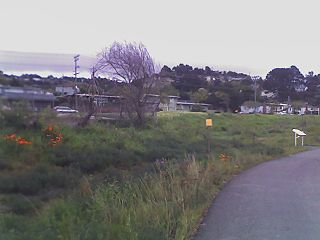
The trail is landscaped with community gardens, native vegetation, daylighted portions of Baxter Creek, and an artificial creek channel used to filter pollution along its frontage. [1]
The western end of the trail connects in Point Richmond with a bikeway through Point Molate and onto the Richmond–San Rafael Bridge. Pedestrian bridges may be added in the future to cross major avenues such as San Pablo Avenue and 23rd Street. An additional side project will add a bike lane/bike trail between the Richmond Greenway and the Ohlone Greenway at Potrero Avenue via 23rd Street, Carlson Boulevard, Cutting Boulevard, and Potrero. [2]
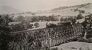
Beginning in 1904, the Atchison, Topeka and Santa Fe Railway lines carried freight through the city of Richmond. [3] These transit networks enabled much of Richmond's considerable industrial activity. As a result, the Richmond Greenway was host to numerous "environmental hardships." [4]
During the late 1960s Richmond resident Lillie Mae Jones became a Greenway activist, working to turn the right of way of the former Santa Fe Rail Line. [5] She organized community cleanups, created a garden and an animal farm, and took groups of children to the Greenway to teach them about nature and pollution. Ms. Jones's advocacy "made possible the park we enjoy today." [6]
In 2006, an organization called Friends of the Richmond Greenway started organizing community events, advocating for the trail's expansion and helping with maintenance. [7]

Richmond is a city in western Contra Costa County, California, United States. The city was incorporated on August 7, 1905, and has a city council. Located in the San Francisco Bay Area's East Bay region, Richmond borders San Pablo, Albany, El Cerrito and Pinole in addition to the unincorporated communities of North Richmond, Hasford Heights, Kensington, El Sobrante, Bayview-Montalvin Manor, Tara Hills, and East Richmond Heights, and for a short distance San Francisco on Red Rock Island in the San Francisco Bay.

The Cardinal Greenway (TGC) is a multi-use recreational network combining a rail trail and an on-street route that together cross 62 miles (100 km) and five counties — in east central Indiana. The greenway, which was designated a National Recreation Trail in June 2003 and in 2018 was named to the Rails-to-Trails Conservancy's "Rail Trail Hall of Fame." uses the former CSX railroad track between Richmond and Marion. It is named after the Cardinal, the last regular passenger train service on the (Chicago-Cincinnati-Washington) route. Currently it is Indiana's longest rail trail project.
The California and Nevada Railroad was a 3 ft narrow gauge steam railroad which ran in the East Bay of the San Francisco Bay Area in the late 19th century. It was incorporated on March 25, 1884. J.S. Emery was listed as the railroad's president - the present day city of Emeryville is named after him. On March 1, 1885, the track was completed between Oakland and San Pablo via Emeryville. The track to Oak Grove was completed on January 1, 1887.

The Ohlone Greenway is a 4.5-mile (7.2 km) pedestrian and bicycle path in the East Bay region of the San Francisco Bay Area. The path is named for the Native American Ohlone, who live in the area.
Westbrae is a neighborhood in the northern part of Berkeley, California in the East Bay section of the San Francisco Bay Area. Westbrae is "centered" on the intersection of Santa Fe Avenue and Gilman Street, although the main extent is east, south and west of this intersection, with the Albany city limit only a short distance north. It lies at an elevation of 79 feet. The neighborhood is mainly residential, with a small commercial section along Gilman from Santa Fe to Tevlin Street. In the past, businesses consisted of liquor and grocery stores but now are small restaurants, a natural food store, bakeries, and a nursery. The elevated tracks of the BART Richmond line cut diagonally across Westbrae, crossing over Gilman in the commercial section. There is a church formerly named the Westbrae Bible Church, now the Evangel Bible Church of Berkeley, located nearby on the corner of Hopkins and Ordway about three blocks from the center of the Westbrae neighborhood.

Richmond Heights, formerly East Richmond and also known as Mira Vista, is a district of eastern Richmond, California, in the San Francisco Bay Area.
Richmond Annex or The Annex is a neighborhood in southeastern Richmond, California. It is mostly residential and located between San Pablo Avenue/El Cerrito to the east, San Francisco Bay to the west, Central Avenue/Cerrito Creek/Albany Hill/Albany/Alameda County to the south, and Potrero Avenue/Pullman to the north. Carlson Boulevard is the main thoroughfare through the annex, connecting downtown Richmond with downtown El Cerrito.
The Iron Triangle, sometimes known as Central Richmond, is a neighborhood in Richmond, California. It is a largely residential area but includes the downtown Richmond business district along Macdonald Avenue. Commercial areas on Cutting Boulevard and near Interstate 580 are also in the neighborhood if the more extensive of two possible definitions of its area is used.

North & East is a historic neighborhood in central Richmond, California.
Baxter Creek or Stege Creek, is a three-branch creek in Richmond and El Cerrito, California, United States, forming the Baxter Creek watershed. The creek has three sources and flows from the Berkeley Hills to Stege Marsh and the San Francisco Bay. The Baxter Creek watershed at-large has 10 sources.

Downtown Oakland is the central business district of Oakland, California, United States. It is located roughly bounded by both the Oakland Estuary and Interstate 880 on the southwest, Interstate 980 on the northwest, Grand Avenue on the northeast, and Lake Merritt on the east.

Rails with trails (RWT) are a small subset of rail trails in which a railway right-of-way remains in use by trains yet also has a parallel recreational trail. Hundreds of kilometers of RWTs exist in Canada, Europe, the United States, Australia, and the United Arab Emirates.

Macdonald 80 Shopping Center, or Macdonald 80, is a 200,000 sq. ft. (18,580m³) regional shopping mall in the North & East neighborhood in Richmond, California, anchored by a Target store. The center was largely demolished and rebuilt after suffering from urban decay and blight. It is the only entirely LEED certified mall. It is anchored by a large Target store.

This is a list of trails and greenways in Detroit.

Los Angeles River Bikeway, also known as LARIO, is a 29.1 mi (46.8 km) bikeway along the lower Los Angeles River in southern Los Angeles County, California. It is one of the completed sections of the Los Angeles River Bicycle Path planned to run along the entire 51 miles (82 km) length of the LA River.
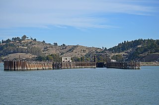
Ferry Point is a cape on the San Francisco Bay in western Richmond, California, United States. Once the Northern California terminal for the Atchison, Topeka and Santa Fe Railway, the area has been developed as a regional park.

The Venice–Inglewood Line is a former Pacific Electric interurban railway line in Los Angeles County, California. Service was very sparse, providing a suburban route between Venice and Inglewood.

The Expo Bike Path is a 12-mile-long (19 km) rail with trail bicycle path and pedestrian route in Los Angeles County, California that travels roughly parallel to the Los Angeles Metro Rail's E Line between La Cienega/Jefferson and 17th Street/SMC stations. The Expo Bike Path is one of two major bicycle routes in Los Angeles that share dedicated rights-of-way with public transport, the other being the G Line Bikeway in the San Fernando Valley.
