Pacific East Mall

Last updated
Pacific East Mall
Pacificeastmall.jpeg
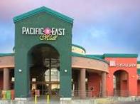
The main entrance to the mall
Pacific East Mall
Location Richmond, California, United States
Coordinates 37°53′56″N122°18′26″W / 37.89885°N 122.3072°W / 37.89885; -122.3072
Opening date1998 (1998)
DeveloperPacific Infinity Co. Inc.
Owner Regency Centers Corporation
No. of stores and services52
No. of anchor tenants 1
No. of floors2
ParkingSurface

Pacific East Mall is a shopping mall anchored by an Asian supermarket in Richmond, California. It is owned by Pacific Infinity Company Incorporated. [1]

Contents

History

The mall opened in 1998 in Richmond's Annex neighborhood, [2] directly adjacent to the borders of El Cerrito and Albany, at a former Breuner's location. The commercial center's largest tenant is a 99 Ranch Supermarket, and the rest of the mall is flanked by Asian-owned shops and restaurants. The mall went "through major exterior and interior renovations" [3] in early 2022, increasing the number of food options as part of the shift to attract the increasing Asian demographic in the East Bay. [4]

The mall is located along Pierce Street a frontage road that runs parallel to Interstate 80, near Interstate 580. The nearest major junction is at Central Avenue, allowing access to the two freeways and to San Pablo Avenue. [5] AC Transit line L stops at Pierce Street and Central Avenue, near the mall offering increased convenience. [6]

Cerrito Creek

Cerrito Creek lies adjacent to Pacific East Mall, and runs through a portion of the parking lot. The president of Friends of Five Creeks, a local environmental organization, has criticized the mall management for allegedly allowing herbicide to spread into the creek area, mowing areas containing native plants, and failing to establish a remediation plan. [7]

Related Research Articles

<span class="mw-page-title-main">Richmond, California</span> City in California, United States

Richmond is a city in western Contra Costa County, California, United States. The city was incorporated on August 7, 1905, and has a city council. Located in the San Francisco Bay Area's East Bay region, Richmond borders San Pablo, Albany, El Cerrito and Pinole in addition to the unincorporated communities of North Richmond, Hasford Heights, Kensington, El Sobrante, Bayview-Montalvin Manor, Tara Hills, and East Richmond Heights, and for a short distance San Francisco on Red Rock Island in the San Francisco Bay.

<span class="mw-page-title-main">Albany, California</span> City in California, United States

Albany is a city on the east shore of San Francisco Bay in northwestern Alameda County, California. The population was 20,271 at the 2020 census.

<span class="mw-page-title-main">El Cerrito, California</span> City in California, United States

El Cerrito is a city in Contra Costa County, California, United States, and forms part of the San Francisco Bay Area. It has a population of 25,962 according to the 2020 census. El Cerrito was founded by refugees from the 1906 San Francisco earthquake. It was incorporated in 1917 as a village with 1,500 residents. As of the census in 2000, there were 23,171 people, 10,208 households and 5,971 families in the city.

<span class="mw-page-title-main">San Pablo, California</span> City in California, United States

San Pablo is an enclave city in Contra Costa County, California, United States. The city of Richmond surrounds nearly the whole city. The population was 32,127 at the 2020 census. The current Mayor is Abel Pineda. Currently, the City Council consists of Abel Pineda, Patricia Ponce, Arturo Cruz, Elizabeth Pabon-Alvarado, and Rita Xavier. Ponce is the Vice Mayor, and Cruz, Pabon-Alvarado, and Xavier are Council Members. Dorothy Gantt is the city Clerk. Viviana Toledo is the city Treasurer.

<span class="mw-page-title-main">Little Saigon</span> Ethnic enclaves of expatriate Vietnamese in some cities

Little Saigon is a name given to ethnic enclaves of expatriate Vietnamese mainly in English-speaking countries. Alternate names include Little Vietnam and Little Hanoi, depending on the enclave's political history. To avoid political undertones due to the renaming of Saigon to Ho Chi Minh City, it is occasionally called by the neutral name Vietnamtown. Saigon is the former name of the capital of the former South Vietnam, where a large number of first-generation Vietnamese immigrants arriving to the United States originate, whereas Hanoi is the current capital of Vietnam.

<span class="mw-page-title-main">California State Route 123</span> Highway in California

State Route 123 is a 7.39-mile (11.89 km) state highway in the U.S. state of California in the San Francisco Bay Area. Named San Pablo Avenue for almost its entire length except for its northernmost 0.10 miles (0.16 km), SR 123 is a major north–south state highway along the flats of the urban East Bay. Route 123 runs between Interstate 580 in Oakland in the south and Interstate 80 at Cutting Boulevard in Richmond in the north. San Pablo Avenue itself, a portion of Historic US 40, continues well past the SR 123 designation south to Downtown Oakland and north to Crockett.

Solano Avenue in Berkeley and Albany, California is a two-mile (3.2 km) long east-west street. Solano Avenue is one of the larger shopping districts in the Berkeley area. Businesses along Solano Avenue cover a wide range, including grocery stores, coffee shops, drugstores, bookstores, antique dealers, apparel outlets, ethnic restaurants and a movie theater.

<span class="mw-page-title-main">El Cerrito Plaza (shopping center)</span> Shopping mall in California, United States

El Cerrito Plaza is a shopping center in El Cerrito, California, a suburb in the San Francisco Bay Area.

<span class="mw-page-title-main">Albany Hill</span>

Albany Hill is a prominent hill along the east shore of San Francisco Bay in the city of Albany, California. Geologically, the hill is predominantly Jurassic sandstone, carried to the western edge of North America on the Pacific Plate and scraped off there in the course of subduction. Albany Hill is part of a range of hills uplifted long before today's Berkeley Hills. These hills include Fleming Point and Point Isabel, Brooks Island, the Potrero San Pablo, and the hills across San Pablo Strait.

<span class="mw-page-title-main">Ohlone Greenway</span>

The Ohlone Greenway is a 4.5-mile (7.2 km) pedestrian and bicycle path in the East Bay region of the San Francisco Bay Area. The path is named for the Native American Ohlone, who live in the area.

<span class="mw-page-title-main">Codornices Creek</span> River in California, United States

Codornices Creek, 2.0 miles (3.2 km) long, is one of the principal creeks which runs out of the Berkeley Hills in the East Bay area of the San Francisco Bay Area in California. In its upper stretch, it passes entirely within the city limits of Berkeley, and marks the city limit with the adjacent city of Albany in its lower section. Before European settlement, Codornices probably had no direct, permanent connection to San Francisco Bay. Like many other small creeks, it filtered through what early maps show as grassland to a large, northward-running salt marsh and slough that also carried waters from Marin Creek and Schoolhouse Creek. A channel was cut through in the 19th century, and Codornices flows directly to San Francisco Bay by way of a narrow remnant slough adjacent to Golden Gate Fields racetrack.

<span class="mw-page-title-main">Fairmede-Hilltop, Richmond, California</span>

Hilltop District, more commonly known simply as Hilltop, is a neighborhood located in the northeastern area of Richmond, California.

<span class="mw-page-title-main">Richmond Heights, Richmond, California</span> Place in Richmond, California, United States of America

Richmond Heights, formerly East Richmond and also known as Mira Vista, is a district of eastern Richmond, California in the San Francisco Bay Area.

Richmond Annex or The Annex is a neighborhood in southeastern Richmond, California. It is mostly residential and located between San Pablo Avenue/El Cerrito to the east, San Francisco Bay to the west, Central Avenue/Cerrito Creek/Albany Hill/Albany/Alameda County to the south, and Potrero Avenue/Pullman to the north. Carlson Boulevard is the main thoroughfare through the annex, connecting downtown Richmond with downtown El Cerrito.

<span class="mw-page-title-main">Cerrito Creek</span> River in California, United States

Cerrito Creek is one of the principal watercourses running out of the Berkeley Hills into San Francisco Bay in northern California. It is significant for its use as a boundary demarcation historically, as well as presently. In the early 19th century, it separated the vast Rancho San Antonio to the south from the Castro family's Rancho San Pablo to the north. Today, it marks part of the boundary between Alameda County and Contra Costa County. The main stem, running through a deep canyon that separates Berkeley from Kensington, is joined below San Pablo Avenue by a fan of tributaries, their lower reaches mostly in culverts. The largest of these is Middle or Blackberry Creek, a southern branch.

<span class="mw-page-title-main">Eastmont Town Center</span> Shopping mall in California, United States

Eastmont Town Center is a shopping mall and social services hub located on 33 acres (130,000 m2) bounded by Foothill Boulevard, Bancroft Avenue, 73rd Avenue, and Church Street, in the Frick neighborhood of East Oakland. The mall opened in phases between 1966 and 1974 on the site of a 1920s-era Chevrolet automobile factory called Oakland Assembly. Architect William Pereira designed the building. It is physically almost next to, and by entry access a few blocks away from the similarly sized Evergreen Cemetery. The official grand opening ceremony was held in November 1970.

<span class="mw-page-title-main">Macdonald 80 Shopping Center</span> Shopping mall in California, United States

Macdonald 80 Shopping Center, or Macdonald 80, is a 200,000 sq. ft. (18,580m³) regional shopping mall in the North & East neighborhood in Richmond, California, anchored by a Target store. The center was largely demolished and rebuilt after suffering from urban decay and blight. It is the only entirely LEED certified mall. It is anchored by a large Target store.

Friends of Five Creeks is a regional community volunteer organization founded in 1996 by Sonja Wadman originally dedicated to the stewardship of creeks in northern Alameda County and western Contra Costa, California, United States. Education about wildlife and restoration is also a major facet of the FFC's mission.

Abella Center formerly International Marketplace and originally El Portal Shopping Center is a mixed-use city services, business, shopping center and housing village transit-oriented development that was formerly a mall in San Pablo, California.

References

  1. "Pacific East Shopping Mall". Archived from the original on November 26, 2010. Retrieved January 22, 2011.
  2. "Richmond Neighborhoods Map". City of Richmond. 2011. Retrieved January 23, 2011.
  3. https://www.loopnet.com/viewer/pdf?file=https%3a%2f%2fimages1.loopnet.com%2fd2%2f1_lx2IrUYV-4_1AbTfpjgcDm1TTU3VJ3-PJJ3zReQzg%2fPacific%2520East%2520OM%252032023.pdf
  4. Weir, Laura. "'Indoor Asian Night Market' planned for East Bay's Pacific East Mall". Hoodline. SFist LLC. Retrieved 23 July 2023.
  5. "Location". Pacific East Mall. Retrieved April 5, 2022.
  6. https://www.actransit.org/bus-lines-schedules/L
  7. Ron Sullivan (January 26, 2007). "Garden Variety: An Ecological Calamity Below Albany Hill". Berkeley Daily Planet. Retrieved January 23, 2011.