Telegraph Avenue

Last updated

Telegraph Avenue
Telegraph Ave., Berkeley looking north 1.JPG
The northern end of Telegraph Avenue in Berkeley
Length4.5 mi (7.2 km)
Location Berkeley and Oakland, California
South endBroadway in Downtown Oakland
Major
junctions
North endBancroft Way at the southern edge of UC Berkeley

Telegraph Avenue is a street that begins, at its southernmost point, in the midst of the historic downtown district of Oakland, California, and ends, at its northernmost point, at the southern edge of the University of California, Berkeley campus in Berkeley, California. It is approximately 4.5 miles (7.2 km) in length.

Contents

Among some Berkeley residents, especially University of California students, Telegraph refers mainly to a four-block section just south of the university, from Bancroft Way (which borders the campus) to Dwight Way. As a center of campus and community life, this section of Telegraph Avenue is home to many restaurants, bookstores, and clothing shops, along with street vendors occupying its wide sidewalks. Here Telegraph Avenue attracts a diverse audience of visitors, including college students, tourists, hippies, artists, street punks, eccentrics, and the homeless.

Origins

Looking north on Telegraph from Downtown around the turn of the 19th and 20th centuries North on Telegraph, Downtown Oakland.png
Looking north on Telegraph from Downtown around the turn of the 19th and 20th centuries

Telegraph Avenue originated from several separately named thoroughfares.

In 1859, a telegraph line was constructed between Oakland and Martinez by the Alta Telegraph Company, and the existing roads which ran alongside it were then renamed "Telegraph Road". The segment of the Telegraph Road which ran from downtown Oakland out to the Peralta estate in Temescal was previously known as the "Peralta Road". The segment which ran to and up Harwood's (now Claremont) Canyon was first known as "Harwood's Road", named for William Harwood, [1] [ better source needed ] an early Oakland politician who leased grazing land in the canyon.

The Telegraph Road followed the route of present-day Telegraph Avenue from Downtown Oakland to Temescal, then ran along what is now the route of Claremont Avenue up to the summit of the Berkeley Hills where it became Fish Ranch Road, named some time after 1870, the year the Oakland Trout Company incorporated its fish and frog farm in the vicinity. [2]

In Berkeley, the trustees of the private College of California (the predecessor of the University of California) laid out a residential subdivision south of their new campus in order to finance its construction. The streets were named alphabetically from east to west; the third street was named "Choate Street", after Rufus Choate. Oakland subsequently extended a road to connect with Berkeley's Choate, but named it "Humboldt Avenue".

Oakland's first horsecar line was built in 1869 and ran along Telegraph Road to 36th Street. It was extended to Temescal a year later, then to the university campus via Humboldt and Choate after the university relocated from Oakland in 1873. A business district grew up along Choate and Humboldt Streets. The horsecar line was eventually replaced by a steam dummy line, and later by an electric streetcar line. [3] This transportation corridor stimulated the development of neighborhoods along its route, as well as an amusement park, Idora Park, between 56th and 58th Streets.

When the segment of Telegraph Road leading up to Harwood's Canyon was renamed "Claremont" to suit the interests of a developer of the district (see Claremont, Oakland/Berkeley, California), the cities of Berkeley and Oakland opted to change Humboldt and Choate to Telegraph since Oakland's portion of the thoroughfare was already aligned with what remained of the old Telegraph Road between the new Claremont and downtown Oakland. Since Telegraph Road was a county road, a petition to change its name to Claremont Avenue was presented to the Alameda County Board of Supervisors on January 12, 1880. The petition was granted. [4]

Although the 1880 petition included it, the segment of the old Telegraph Road that ran up the canyon to the summit of the Berkeley Hills was renamed Claremont Road by the Oakland City Council (which by then had annexed the previously unincorporated area) on February 14, 1913, acting on a petition by the owners of the Claremont Hotel. [5] The only discernible difference in naming was the substitution of "Road" for "Avenue" for the canyon segment.

Berkeley changed Choate Street to Telegraph Avenue in 1890. [6]

Early-mid 20th century

The Fox Theatre is located on the southern end of Telegraph Avenue, in Downtown Oakland. Fox Oakland Theatre.jpg
The Fox Theatre is located on the southern end of Telegraph Avenue, in Downtown Oakland.

In 1910, Sather Gate was built at the northern end of Telegraph Avenue. The university built Sproul Hall on Telegraph in the 1940s. In the 1950s the campus expanded south to Bancroft Way; Telegraph Avenue was shortened by 1½ blocks and buildings were demolished to make room for Sproul Plaza and several other new buildings including the new student union building.

The Berkeley end of Telegraph Avenue, along with Sproul Plaza, has been the site of numerous protests and riots beginning in the 1960s. In 1969, Telegraph was the site of massive confrontation between police and demonstrators during the conflict over People's Park. Alameda County Sheriff's deputies killed one man (James Rector) and permanently blinded another (Alan Blanchard) when they fired buckshot loaded shotguns at people sitting on the roof above Telegraph Ave. At one point, protesters were chased down Telegraph as far as Willard Junior High School (now Willard Middle School) at Derby Street, with Sheriff's deputies firing teargas canisters onto the school grounds.

The 1960s also saw the construction of the Grove Shafter Freeway, which parallels Telegraph Avenue half a block west, between Downtown Oakland and 56th Street. The freeway created a wall between Telegraph Avenue and present day Martin Luther King Jr. Way (formerly Grove Street), and sliced the Temescal District in half.

Post–Vietnam War era

Telegraph Avenue in 2023 Telegraph Ave in 2023 1.jpg
Telegraph Avenue in 2023

The events of the 1960s and 1970s had made Telegraph, as well as Berkeley, a symbol of the counterculture of the 1960s. Over the next couple of decades the Berkeley end of Telegraph became home to increasing numbers of homeless people and panhandlers, and by the 1990s had become a destination point for runaways from around the United States. The numbers of panhandlers have decreased since a series of police sweeps in the late 1990s. [7] University students remain the largest daily population on Telegraph, which still serves as the anchor of food, culture and student life on the south side of campus.

More recently, a Korean business district has emerged just south of Temescal along Telegraph Ave. Attempts to change the name of the area to Koreatown have led to controversy, as most residents of the surrounding neighborhoods do not identify as Korean or Korean-American. [8] A large Ethiopian and Eritrean population has also resulted in a string of Ethiopian restaurants, cafes and social clubs, stretching along Telegraph from about 30th Street in Oakland all the way into Berkeley.

As a result of heavy foot traffic and the narrow width of the street, the area near the Berkeley campus is designated as a one-way street by the city, and there have been talks of completely eliminating car access, a topic still hotly debated in the city council. A proposal by AC Transit to build a Bus rapid transit line on Telegraph has stirred up controversy, especially on the northern end where it might result in the elimination of parking and/or car access.

See also

Related Research Articles

<span class="mw-page-title-main">Berkeley, California</span> City in California, United States

Berkeley is a city on the eastern shore of San Francisco Bay in northern Alameda County, California, United States. It is named after the 18th-century Anglo-Irish bishop and philosopher George Berkeley. It borders the cities of Oakland and Emeryville to the south and the city of Albany and the unincorporated community of Kensington to the north. Its eastern border with Contra Costa County generally follows the ridge of the Berkeley Hills. The 2020 census recorded a population of 124,321.

<span class="mw-page-title-main">Claremont Canyon Regional Preserve</span>

Claremont Canyon Regional Preserve is a small regional park mainly located in the city of Oakland, California, and administered by the East Bay Regional Park District. The park is named for the canyon in which it is situated, Claremont Canyon, out of which Claremont Creek flows on its way to its confluence with Temescal Creek. Originally, the canyon was named Harwood's Canyon, and then later as Telegraph Canyon. The name was changed to Claremont by a developer of the nearby Claremont district.

<span class="mw-page-title-main">California State Route 24</span> Highway in California

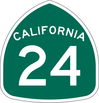
State Route 24 is a heavily traveled east–west state highway in the U.S. state of California that serves the eastern side of the San Francisco Bay Area. A freeway throughout its entire length, it runs from the Interstate 580/Interstate 980 interchange in Oakland, and through the Caldecott Tunnel under the Berkeley Hills, to the Interstate 680 junction in Walnut Creek. It lies in Alameda County, where it is highly urban, and Contra Costa County, where it passes through wooded hillsides and suburbs. SR 24 is a major connection between the San Francisco–Oakland Bay Bridge/MacArthur Maze complex and the inland cities of the East Bay.

<span class="mw-page-title-main">Caldecott Tunnel</span> Four-bore passage for CA SR 24 under the Berkeley Hills

The Caldecott Tunnel is a four-bore highway tunnel through the Berkeley Hills between Oakland and Orinda, California. Its four bores carry California State Route 24. Named after Thomas E. Caldecott, former mayor of Berkeley, it opened in 1937 as a two-bore tunnel. The third bore opened in 1964 and the fourth bore in 2013. Currently, the two oldest bores carry eastbound traffic and the two newest bores carry westbound traffic.

<span class="mw-page-title-main">Rockridge, Oakland, California</span> Neighborhood of Oakland in Alameda, California, US

Rockridge is a residential neighborhood and commercial district in Oakland, California. Rockridge is generally defined as the area east of Telegraph Avenue, south of the Berkeley city limits, west of the Oakland hills and north of the intersection of Pleasant Valley Avenue/51st Street and Broadway. Rockridge was listed by Money Magazine in 2002 as one of the "best places to live".

<span class="mw-page-title-main">Claremont Hotel & Spa</span> Hotel in the hills of Berkeley, California

The Claremont Club & Spa, A Fairmont Hotel is an historic, American hotel that is situated at the foot of Claremont Canyon in the Berkeley Hills. Located in the Claremont district, near the intersection of Claremont Avenue and Ashby Avenue, the site straddles the city limits of Berkeley and Oakland. The border between the neighboring cities runs down the former Key System E train right of way that now serves as a pathway between the tennis courts which belong to the Berkeley Tennis Club.

<span class="mw-page-title-main">Lake Temescal</span> Lake in California, USA

Lake Temescal is a small reservoir in the Oakland hills, in northeastern Oakland, California. It is the centerpiece of Temescal Regional Recreation Area, also known as Temescal Regional Park. It is a part of the East Bay Regional Park District.

<span class="mw-page-title-main">Temescal, Oakland, California</span> Neighborhood of Oakland in Alameda, California, United States

Temescal is one of the oldest neighborhoods in Oakland, California, located in North Oakland, and centered on Telegraph Avenue. The neighborhood derives its name from Temescal Creek, a significant watercourse in the city.

<span class="mw-page-title-main">Strawberry Creek</span> River in California, United States

Strawberry Creek is the principal watercourse running through the city of Berkeley, California. Two forks rise in the Berkeley Hills of the California Coast Ranges, and form a confluence at the campus of the University of California, Berkeley. The creek then flows westward across the city to discharge into San Francisco Bay.

<span class="mw-page-title-main">Berkeley Hills</span> Region of the Pacific Coast Ranges

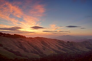
The Berkeley Hills are a range of the Pacific Coast Ranges that overlook the northeast side of the valley that encompasses San Francisco Bay. They were previously called the "Contra Costa Range/Hills", but with the establishment of Berkeley and the University of California, the current usage was applied by geographers and gazetteers.

<span class="mw-page-title-main">Grizzly Peak (Berkeley Hills)</span> Summit in California, United States

Grizzly Peak is a summit in the Berkeley Hills above Berkeley, California. The peak is located on the border between Alameda and Contra Costa counties, within the boundaries of Tilden Regional Park, and directly behind the University of California, Berkeley campus.

<span class="mw-page-title-main">Temescal Creek (Northern California)</span> River in California, United States

Temescal Creek is one of the principal watercourses in the city of Oakland, California, United States.

<span class="mw-page-title-main">Claremont, Oakland/Berkeley, California</span> Place in California, United States

The Claremont district is a neighborhood straddling the city limits of Oakland and Berkeley in the East Bay section of the San Francisco Bay Area in California, United States. The main thoroughfares are Claremont and Ashby Avenues.

<span class="mw-page-title-main">Sacramento Northern Railway</span> Rail line

The Sacramento Northern Railway was a 183-mile (295 km) electric interurban railway that connected Chico in northern California with Oakland via the California capital, Sacramento. In its operation it ran directly on the streets of Oakland, Sacramento, Yuba City, Chico, and Woodland and ran interurban passenger service until 1941 and freight service into the 1960s.

<span class="mw-page-title-main">Downtown Berkeley, Berkeley, California</span> Neighborhood of Berkeley in Alameda, California, United States

Downtown Berkeley is the central business district of the city of Berkeley, California, United States, around the intersection of Shattuck Avenue and Center Street, and extending north to Hearst Avenue, south to Dwight Way, west to Martin Luther King Jr. Way, and east to Oxford Street. Downtown is the mass transit hub of Berkeley, with several AC Transit and UC Berkeley bus lines converging on the city's busiest BART station, as well as the location of Berkeley's civic center, high school, and Berkeley City College.

<span class="mw-page-title-main">Downtown Oakland</span> Central business district of Oakland, California

Downtown Oakland is the central business district of Oakland, California, United States. It is located roughly bounded by both the Oakland Estuary and Interstate 880 on the southwest, Interstate 980 on the northwest, Grand Avenue on the northeast, and Lake Merritt on the east.

<span class="mw-page-title-main">Southside, Berkeley, California</span> Neighborhood of Berkeley, California, US

Southside, also known by the older names South of Campus or South Campus, is a neighborhood in Berkeley, California. Southside is located directly south of and adjacent to the University of California, Berkeley campus. Because of the large student presence in the neighborhood, proximity to Sproul Plaza, and history of the area, Southside is the neighborhood most closely associated with the university.

<span class="mw-page-title-main">Shattuck Avenue</span>

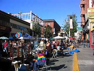
Shattuck Avenue is a major city street running north–south through Berkeley and Oakland, California. At its southern end, the street branches from Telegraph Avenue in Oakland's Temescal district, then ends at Indian Rock Park in the Berkeley Hills to the north. Shattuck Avenue is the main street of Berkeley, forming the spine of that city's downtown, and the site of the Gourmet Ghetto in North Berkeley. The street was named for Francis Kittredge Shattuck, an early landowner and booster who later served as Mayor of Oakland. Shattuck was largely responsible for the original construction of the road as well as for a railroad built along its route.

<span class="mw-page-title-main">Oakland Railroad Company</span>

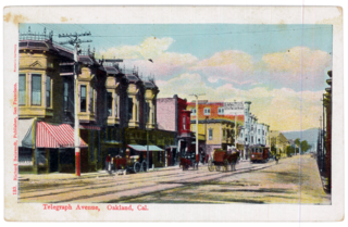
The Oakland Railroad Company operated the first horsecar railroad in Oakland, California. The company was incorporated in 1864 to offer transportation for students of private schools on Academy Hill Service began in 1869 over strap iron rails laid on wooden stringers connected by wooden cross ties. The line initially ran along Broadway from First Street to Telegraph Road, and thence along Telegraph Avenue to the city limit at 36th Street. The line was extended to Temescal Creek in 1870 and to the University of California, Berkeley campus in 1873 for a total distance of 5.5 miles (8.9 km). By 1874 a stable of 51 horses was pulling 13 one-horse cars for normal runs and 6 two-horse cars used when larger numbers of passengers were expected. The large car barn and stable on 51st street was later converted to a supermarket. A round trip from Oakland to Temescal and return was scheduled to take one hour, and three such trips were a day's work for the horses while their drivers worked a 14-hour day, 7 days a week. A steam dummy replaced horses on one of the larger cars in 1875.

References

  1. William Harwood, Oakland LocalWiki
  2. Sacramento Daily Union, 2 January 1871, p.2
  3. "Extension". Oakland Enquirer. April 11, 1892. p. 1. Retrieved November 21, 2023 via Newspapers.com. Lock-green.svg
  4. "Claremont". Oakland Tribune. January 13, 1880. p. 1 via Newspapers.com. Lock-green.svg
  5. "Street names changed". San Francisco Call. February 15, 1913. p. 22.
  6. Berkeley, The First Seventy Five Years (Report). 1941. p. 30.{{cite report}}: Unknown parameter |agency= ignored (help)
  7. "Berkeley Sends Message to Telegraph / Short-term actions helped rid avenue of street crime". SFGate. November 10, 1998. Retrieved June 4, 2013.
  8. "Seoul searching for new name in Oakland". SFGate. February 1, 2010. Retrieved June 4, 2013.
Template:Attached KML/Telegraph Avenue
KML is from Wikidata