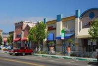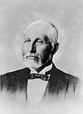
San Pablo is an enclave city in Contra Costa County, California, United States. The population was 32,127 at the 2020 census. The current mayor is Patricia Ponce. Currently, the city council consists of Abel Pineda, Arturo Cruz, Elizabeth Pabon-Alvarado, and Rita Xavier. Ponce is mayor, and Cruz, Pabon-Alvarado, and Xavier are council members. Dorothy Gantt is the city Clerk. Viviana Toledo is the city treasurer.

El Cerrito Plaza station is a Bay Area Rapid Transit (BART) station in El Cerrito, California, located adjacent to the El Cerrito Plaza shopping center. It primarily serves southern El Cerrito, northern Albany, and Kensington, along with nearby portions of Berkeley and Richmond. Nearly identical in form to El Cerrito del Norte station, El Cerrito Plaza station has two side platforms serving the line's two elevated tracks, with a fare lobby underneath. The Ohlone Greenway runs through the station area. The station is served by the Orange and Red lines.

The Richmond Parkway Transit Center, or RPTC, is a park and ride lot and bus terminal located in Richmond, California. It is named after the adjacent Richmond Parkway and serves as a transfer point for WestCAT and AC Transit. The center is situated on the corner of Richmond Parkway and Blume Drive, near the Pinole border and adjacent to Interstate 80 and the Hilltop Plaza shopping center.

The Shops at Tanforan is a regional shopping mall in San Bruno, California, United States. It is located on the San Francisco Peninsula, 10 miles (16 km) south of San Francisco city limits.

Downtown Berkeley is the central business district of the city of Berkeley, California, United States, around the intersection of Shattuck Avenue and Center Street, and extending north to Hearst Avenue, south to Dwight Way, west to Martin Luther King Jr. Way, and east to Oxford Street. Downtown is the mass transit hub of Berkeley, with several AC Transit and UC Berkeley bus lines converging on the city's busiest BART station, as well as the location of Berkeley's civic center, high school, and Berkeley City College.
Emporium Centre San Francisco is a shopping mall located in San Francisco, California, United States. Best known by its former name, San Francisco Centre, it is anchored by Bloomingdale's. It connects directly to the Powell Street station via an underground entrance on the concourse floor.

The Emporium, from 1880 to 1995 Emporium-Capwell, was a mid-line department store chain headquartered in San Francisco, California, which operated for 100 years—from 1896 to 1996. The flagship location on San Francisco's Market Street was a destination shopping location for decades, and several branch stores operated in the various suburbs of the Bay Area. The Emporium and its sister department store chains were acquired by Federated Department Stores in 1995, and many converted to Macy's locations.

Hilltop District, more commonly known simply as Hilltop, is a neighborhood located in the northeastern area of Richmond, California.

Point Isabel Regional Shoreline in Richmond, California, is operated by East Bay Regional Park District, and is a multi-use park for joggers, windsurfers, kayakers, photographers, picnickers, and people walking dogs. It has access for pedestrians and via public transit, private vehicles, and bikes. It also features a concession offering food for people and grooming for pets. A longtime community organization and nonprofit, Point Isabel Dog Owners and Friends (PIDO), is active in the maintenance and improvement of the park.
Point Isabel is a promontory on the eastern shore of San Francisco Bay in the Richmond Annex neighborhood of Richmond, United States.
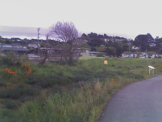
Baxter Creek or Stege Creek, is a three-branch creek in Richmond and El Cerrito, California, United States, forming the Baxter Creek watershed. The creek has three sources and flows from the Berkeley Hills to Stege Marsh and the San Francisco Bay. The Baxter Creek watershed at-large has 10 sources.

Cerrito Creek is one of the principal watercourses running out of the Berkeley Hills into San Francisco Bay in northern California. It is significant for its use as a boundary demarcation historically, as well as presently. In the early 19th century, it separated the vast Rancho San Antonio to the south from the Castro family's Rancho San Pablo to the north. Today, it marks part of the boundary between Alameda County and Contra Costa County. The main stem, running through a deep canyon that separates Berkeley from Kensington, is joined below San Pablo Avenue by a fan of tributaries, their lower reaches mostly in culverts. The largest of these is Middle or Blackberry Creek, a southern branch.

Downtown Hayward is the original and current central business district of Hayward, California, United States, and is home to the current Hayward City Hall, along with the two previous city halls, Alex Giualini Plaza and the City Center Building. The Hayward Fault runs through the area, and is the cause of the two previous city halls being taken out of use.

Don Víctor Ramón Castro was a Californio ranchero, politician, and businessman. He was one of the largest landowners in Contra Costa and served as a Contra Costa County Supervisor. He operated one of the first ferries in the Bay Area.

Hercules Transit Center is a major commuter hub in the western Contra Costa County city of Hercules, California. It is anchored by WestCAT bus services. The center was originally on San Pablo Avenue. In August 2009, the transit center was relocated to the other side of I-80 with additional paid parking, which is $3/day.

Macdonald 80 Shopping Center, or Macdonald 80, is a 200,000 sq. ft. (18,580m³) regional shopping mall in the North & East neighborhood in Richmond, California, anchored by a Target store. The center was largely demolished and rebuilt after suffering from urban decay and blight. It is the only entirely LEED certified mall. It is anchored by a large Target store.
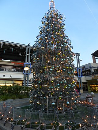
Bay Street Emeryville is a large mixed-use development in Emeryville, California which currently has 65 stores, ten restaurants, a sixteen-screen movie theater, 230 room hotel, and 400 residential units with 1,000 residents.
Friends of Five Creeks is a regional community volunteer organization founded in 1996 by Sonja Wadman originally dedicated to the stewardship of creeks in northern Alameda County and western Contra Costa, California, United States. Education about wildlife and restoration is also a major facet of the FFC's mission.
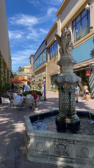
Broadway Plaza is an outdoor shopping mall located in downtown Walnut Creek. The shopping center opened on October 11, 1951 and is owned and operated by Macerich. The mall is anchored by Nordstrom and Macy's, and features nearly 80 stores including Crate & Barrel, flagship H&M and ZARA stores, a standalone Apple store with an adjoining outdoor plaza, an Industrious co-working space, a Life Time Fitness sports club, and a planned Pinstripes entertainment center and restaurant.
