Piedmont Avenue (Oakland, California)

Last updated

Piedmont Avenue (Oakland, California)
Piedmont Avenue, Oakland.jpg
A look up Piedmont Avenue
Oakland piedmont avenue locator map.png
Location in Oakland
Coordinates: 37°49′35″N122°15′09″W / 37.8264°N 122.2524°W / 37.8264; -122.2524
Country United States
State California
County Alameda
City Oakland

The Piedmont Avenue neighborhood is a residential and commercial district in the North Oakland region of Oakland, California. It is named for Piedmont Avenue, a commercial street known for dining and retail. The neighborhood is roughly bounded by Temescal and Broadway on the west, Oakland Avenue and the City of Piedmont (a separate municipality, an enclave within Oakland) on the east, the Mountain View Cemetery on the north, and the MacArthur Freeway section of Interstate 580 on the south.

Contents

History

The Piedmont Avenue neighborhood was founded in the late 1800s. [1] It developed after Mountain View Cemetery opened in 1863, bringing visitors and public transportation. [2] The area was annexed into Oakland in 1897. [3]

The Key System ran their C Line streetcar down Piedmont between 41st Street and Grave Avenue, with passenger operations running between 1924 and 1958. [4] [5]

Landmarks and features

The gates of the Mountain View Cemetery at the end of Piedmont Avenue Mtview-gates.jpg
The gates of the Mountain View Cemetery at the end of Piedmont Avenue

At the north end of Piedmont Avenue and Pleasant Valley Avenue is the hillside Mountain View Cemetery, which was designed by Frederick Law Olmsted and opened in 1863. [6] It is known for Millionaire's Row, a section high on the hill lined with the ornate mausoleums of wealthy families, including those of Domingo Ghirardelli, Henry J. Kaiser, and Charles Crocker. Other notable people buried in the cemetery include civil rights activists Fred Korematsu and Bobby Hutton, poet Ina Coolbrith, and architect Julia Morgan, who also designed the nearby Chapel of the Chimes. The cemetery was featured prominently in the 2018 movie Blindspotting . [7]

Near the center of the Piedmont Avenue commercial strip, at 4021 Piedmont Ave. is another Julia Morgan-designed building, originally built as the Fred C. Turner Stores. This 1916 red brick building hosts both restaurants and retail, and features glazed terra cotta in the style of the della Robbia family. [2]

Next door, at 4037 Piedmont Ave., is the location of the original Longs Drugs store, which opened in 1938. [8] The building currently hosts a Posh Bagel.

Piedmont Avenue also has "the Bay Area's Book Row," with multiple independent bookstores concentrated within a six-block radius; [9] the Piedmont Theatre, which is the oldest still-operating theater in Oakland (built in 1917); [10] and the 1893 ice cream parlor Fentons Creamery, which was featured in Pixar's 2009 movie Up . [11]

4063 Piedmont Ave., which was formerly a Key System station Piedmont Avenue former train station.jpg
4063 Piedmont Ave., which was formerly a Key System station

At Piedmont Avenue and 41st Street are the Key Route Plaza and what is left of the Key System's C-line station, which was built in 1939. The former station is an angular building with a clock tower, which was restored by a group led by neighborhood activist Michael Lydon. [12] In 2005, with support from the Piedmont Avenue Neighborhood Improvement League, Rocky Riche-Baird painted a mural recognizing the building's history, including the Key System's founder, Francis Marion Smith. [13] However, a large part of the mural was controversially destroyed during renovations in 2014. [14] [15]

Another Riche-Baird mural about the area's native Ohlone people, "The Capture of the Solid. The Escape of the Soul," can be seen on the exterior 41st Street wall of 4150 Piedmont Ave. [16]

Kaiser Permanente's flagship hospital campus is located in the southern part of the neighborhood. Nearby is Oak Glen Park, which contains an open-air section of Glen Echo Creek. [17]

Education

Fentons Creamery, an ice cream parlor on Piedmont Avenue Fentons Creamery in Oakland.jpg
Fentons Creamery, an ice cream parlor on Piedmont Avenue

Related Research Articles

<span class="mw-page-title-main">Piedmont, California</span> City in California, United States

Piedmont is a small city located in Alameda County, California, United States, enclaved by the city of Oakland. Its residential population was 11,270 at the 2020 census. The name comes from the region of Piedmont in Italy, and it means 'foothill'. Piedmont was incorporated in 1907, and was developed significantly in the 1920s and 1930s.

<span class="mw-page-title-main">Key System</span> Former local electric railway service in the East Bay

The Key System was a privately owned company that provided mass transit in the cities of Oakland, Berkeley, Alameda, Emeryville, Piedmont, San Leandro, Richmond, Albany, and El Cerrito in the eastern San Francisco Bay Area from 1903 until 1960, when it was sold to a newly formed public agency, AC Transit. The Key System consisted of local streetcar and bus lines in the East Bay, and commuter rail and bus lines connecting the East Bay to San Francisco by a ferry pier on San Francisco Bay, later via the lower deck of the Bay Bridge. At its height during the 1940s, the Key System had over 66 miles (106 km) of track. The local streetcars were discontinued in 1948 and the commuter trains to San Francisco were discontinued in 1958. The Key System's territory is today served by BART and AC Transit bus service.

<span class="mw-page-title-main">Grand Lake, Oakland, California</span> Neighborhood of Oakland in Alameda, California, United States

Grand Lake, or the Grand Lake District, is a neighborhood in Oakland, California, United States. The neighborhood is located in the northeast corner of Lake Merritt, where Grand Avenue and Lakeshore Avenue pass under Interstate 580. It borders Adams Point to the west, Trestle Glen/Crocker Highlands to the east, and the city of Piedmont to the north. It lies at an elevation of 52 feet.

<span class="mw-page-title-main">Solano Avenue</span> Street in California, United States

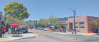
Solano Avenue in Berkeley and Albany, California is a two-mile (3.2 km) long east-west street. Solano Avenue is one of the larger shopping districts in the Berkeley area. Businesses along Solano Avenue cover a wide range, including grocery stores, coffee shops, drugstores, bookstores, antique dealers, apparel outlets, ethnic restaurants and a movie theater.

<span class="mw-page-title-main">Maxwell Park, Oakland, California</span> Neighborhood of Oakland in Alameda, California, United States

Maxwell Park is a neighborhood in Oakland, California located in the foothills of the city. It is geographically bordered by MacArthur Boulevard, High Street, Trask Street, Foothill Boulevard, and 55th Avenue and is adjacent to Mills College, I-580, Brookdale Park, and the Fairfax neighborhood. It lies at an elevation of from 138 feet to its highest point of 266 feet on Knowland Ave.

<span class="mw-page-title-main">Temescal, Oakland, California</span> Neighborhood of Oakland in Alameda, California, United States

Temescal is one of the oldest neighborhoods in Oakland, California, located in North Oakland, and centered on Telegraph Avenue. The neighborhood derives its name from Temescal Creek, a significant watercourse in the city.

<span class="mw-page-title-main">Shipyard Railway</span> Former railway line in California, US

The Shipyard Railway was an electric commuter rail/interurban line that served workers at the Richmond Shipyards in Richmond, California, United States, during World War II. It was funded by the United States Maritime Commission and was built and operated by the Key System, which already operated similar lines in the East Bay. The line ran from a pair of stations on the Emeryville/Oakland border – where transfer could be made to other Key System lines – northwest through Emeryville, Berkeley, Albany, and Richmond to the shipyards. It operated partially on city streets and partially on a dedicated right-of-way paralleling the Southern Pacific Railroad mainline.

<span class="mw-page-title-main">East Bay Electric Lines</span> Former railway lines in the San Francisco Bay Area

The East Bay Electric Lines were a unit of the Southern Pacific Railroad that operated electric interurban-type trains in the East Bay region of the San Francisco Bay Area. Beginning in 1862, the SP and its predecessors operated local steam-drawn ferry-train passenger service in the East Bay on an expanding system of lines, but in 1902 the Key System started a competing system of electric lines and ferries. The SP then drew up plans to expand and electrify its system of lines and this new service began in 1911. The trains served the cities of Berkeley, Albany, Emeryville, Oakland, Alameda, and San Leandro transporting commuters to and from the large Oakland Pier and SP Alameda Pier. A fleet of ferry boats ran between these piers and the docks of the Ferry Building on the San Francisco Embarcadero.

The Berkeley Branch Railroad was a 3.84-mile (6.18 km) long branch line of the Central Pacific Railroad (CPRR) from a junction in what later became Emeryville called "Shellmound" to what soon became downtown Berkeley, adjacent to the new University of California campus.

Albert Lincoln Farr was an American residential architect, who designed homes in the Craftsman and Georgian styles.

<span class="mw-page-title-main">Uptown Oakland</span> Neighborhood of Oakland in Alameda, California, United States

Uptown Oakland is a neighborhood in Oakland, California, located in the northern end of Downtown. It is located roughly between West Grand Avenue to the north, Interstate 980 to the west, City Center and 14th Street to the south, and Broadway to the east. The neighborhood has become an important entertainment district in recent years.

Thousand Oaks is a neighborhood of Berkeley in Alameda County, California. Located at the base of the Berkeley Hills, it lies at an elevation of 239 feet.

<span class="mw-page-title-main">Northbrae Tunnel</span> Road tunnel in Berkeley, California, US

The Northbrae Tunnel, also referred to as the Solano Avenue Tunnel, was built as a commuter electric railroad tunnel in the northern part of Berkeley, California, and was later converted to street use.

<span class="mw-page-title-main">Glen Echo Creek</span> River in California, United States

Glen Echo Creek is a creek that runs from the Oakland Hills to Lake Merritt in Oakland, California. Although most of it is underground, the creek does surface in several locations. It has two branches, the Rockridge Branch and the Broadway Branch.

<span class="mw-page-title-main">F (AC Transit)</span> Bus service in Oakland and San Leandro, California

The F is a bus service operated by AC Transit in the San Francisco Bay Area. It is one of the operator's many transbay routes, which are intended to provide riders a long-distance service across the San Francisco Bay between the East Bay and San Francisco. The service is descendant of the foundational Key System streetcar and ferry line that operated prior to the formation of AC Transit.

<span class="mw-page-title-main">E (AC Transit)</span> Bus service in Oakland and San Leandro, California

The E is a bus service operated by AC Transit in the San Francisco Bay Area. It is one of the operator's many transbay routes, which are intended to provide riders a long-distance service across the San Francisco Bay between the East Bay and San Francisco. The service is descendant of a Key System streetcar and ferry line that operated prior to the formation of AC Transit. The line is noted for its role in the development of the Claremont Hotel.

The C was a bus service operated by AC Transit in the San Francisco Bay Area. It is one of the operator's many transbay routes, which are intended to provide riders a long-distance service across the San Francisco Bay between the East Bay and San Francisco. The service was descendant of a Key System streetcar and ferry line that operated prior to the formation of AC Transit. The line was suspended in response to the COVID-19 pandemic.

The B was a bus service operated by AC Transit in the San Francisco Bay Area. It is one of the operator's many transbay routes, which are intended to provide riders a long-distance service across the San Francisco Bay between the East Bay and San Francisco. The service was descendant of a Key System streetcar and ferry line that operated prior to the formation of AC Transit. The line was suspended in response to the COVID-19 pandemic.

References

  1. "Piedmont Avenue | The Piedmont Neighborhood in Oakland, CA". www.visitoakland.com. Retrieved September 5, 2018.
  2. 1 2 Wurm, Ted (Winter–Spring 1990). "Historic Piedmont Avenue". Oakland Heritage Alliance News. pp. 2, 5. Retrieved September 5, 2018.
  3. "PANIL - Neighborhood Chronology". panil.org. Retrieved September 5, 2018.
  4. Demoro, Harre W. (1985). The Key Route: Transbay Commuting by Train and Ferry, Part 1. Interurbans Specials. Vol. 95. Glendale, California: Interurban Press. ISBN   0-916374-66-1.
  5. Walker, Jim (1978). Key System Album. Interurbans Specials. Vol. 68. Glendale, California: Interurban Press. ISBN   0-916374-31-9. OL   4742432M.
  6. "How an Oakland cemetery became a popular park". East Bay Times. July 27, 2017. Retrieved September 6, 2018.
  7. "'Blindspotting' is a Spot-On Portrait of an Oakland in Flux". KQED. July 17, 2018. Retrieved September 5, 2018.
  8. "Longs was the last regional chain drugstore". SFGate. August 14, 2008. Retrieved September 6, 2018.
  9. "Drummond: Oakland's Piedmont Avenue show bookstores' death reports exaggerated". www.marinij.com. March 10, 2006. Retrieved February 13, 2016.
  10. "About Piedmont Theatre | Landmark Theatres".
  11. "Oakland's Fentons Creamery in Pixar film 'Up'".
  12. "Michael Lydon, 'The Mayor of Piedmont Avenue,' fondly remembered by residents, merchants". East Bay Times. November 13, 2017. Retrieved September 10, 2018.
  13. "Key to the Past / A Piedmont mural captures the glory of a bygone transit system". SFGate. April 3, 2005. Retrieved September 8, 2018.
  14. "Piedmont Avenue: Landmark neighborhood mural is destroyed". East Bay Times. December 17, 2014. Retrieved September 6, 2018.
  15. "More perspectives on the Kronnerburger-Piedmont mural dispute". Inside Scoop SF. December 19, 2014. Retrieved September 6, 2018.
  16. "Mural raises eyebrows with look at Ohlone plight". East Bay Times. April 14, 2006. Retrieved September 10, 2018.
  17. "Glen Echo Creek's Parks - Oakland Magazine - July-August 2012 - Oakland, California". www.oaklandmagazine.com. Retrieved September 5, 2018.
Template:Attached KML/Piedmont Avenue (Oakland, California)
KML is not from Wikidata