A geographic coordinate system is a coordinate system that enables every location on Earth to be specified by a set of numbers, letters or symbols. The coordinates are often chosen such that one of the numbers represents a vertical position and two or three of the numbers represent a horizontal position; alternatively, a geographic position may be expressed in a combined three-dimensional Cartesian vector. A common choice of coordinates is latitude, longitude and elevation. To specify a location on a plane requires a map projection.
Oakland Hills is the city neighborhoods lying within the eastern portion of Oakland, California. The northernmost neighborhoods were devastated by the Oakland firestorm of 1991.
California is a state in the Pacific Region of the United States. With 39.6 million residents, California is the most populous U.S. state and the third-largest by area. The state capital is Sacramento. The Greater Los Angeles Area and the San Francisco Bay Area are the nation's second- and fifth-most populous urban regions, with 18.7 million and 9.7 million residents respectively. Los Angeles is California's most populous city, and the country's second-most populous, after New York City. California also has the nation's most populous county, Los Angeles County, and its largest county by area, San Bernardino County. The City and County of San Francisco is both the country's second-most densely populated major city after New York City and the fifth-most densely populated county, behind only four of the five New York City boroughs.
Per citidata.com and realestate surveys such as trulia and zillow, Oakmore demographics skew generally upper-middle class and, as of 2014, the area boasts a median home price of $750,000. However, Upper Oakmore represents an even greater concentration of affluence, as this section of Oakmore has, since its inception, featured large, architecturally outstanding hillside estates, many of which now have earned multimillion-dollar listings and rival the mansions and estates found in Oakland's better known upper-end neighborhoods such as Crocker Highlands, Montclair-Piedmont Pines, and upper Rockridge/Claremont Pines.
External links
Oakmore.org - General Oakmore neighborhood information
This page is based on this Wikipedia article Text is available under the CC BY-SA 4.0 license; additional terms may apply. Images, videos and audio are available under their respective licenses.
Related Research Articles
Washington Park is a neighborhood in east central Seattle, Washington, named after the city park to its northwest. It is bounded on the east by 38th and 37th Avenues E. and Hillside Drive E., beyond which are Madison Park and Denny-Blaine; on the south by Lake Washington Boulevard, beyond which is Denny-Blaine and Madison Valley; on the west by Washington Park, and on the north by the private Broadmoor community and golf club. Washington Park is home to many historic homes including one from 1907 that houses the current President of the University of Washington. This house is situated on 5 acres (20,000 m2) looking over Lake Washington and has grounds rivaled by few homes in the city. The house and land was donated to the University with the clause that it must be occupied by the President of U.W.
Leimert Bridge is located in the Oakmore neighborhood of Oakland, California. It spans 357 ft (109 m) and is 117 ft (36 m) high above Sausal Creek. It is a cement and steel arch bridge. When it was built in 1926, it was the largest single-span bridge on the West Coast.
Montclair is a neighborhood in Oakland, California, United States. Montclair is located along the western slope of the Oakland hills from a valley formed by the Hayward Fault to the upper ridge of the hills.
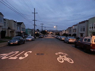
Westwood Park is an affluent residential neighborhood located in southwestern San Francisco, California, near St. Francis Wood and City College of San Francisco. Westwood Park was built as a segregated neighborhood for white families, with the development's 1917 founding documents reading: "No person of African, Japanese, Chinese or any Mongolian descent shall be allowed to purchase, own or lease any real property in said Westwood Park."
Adams Point is a neighborhood of Oakland, California. It is located on the northern shore of Lake Merritt, directly adjacent to Downtown Oakland and the Grand Lake district. It is a triangle bounded by Grand Avenue on the south, Harrison Street on the northwest, and the MacArthur Freeway on the northeast. It lies at an elevation of 79 feet. Neighborhood landmarks include the Veteran's Memorial Building, the Earl Warren House, the art deco Bellevue-Staten Building, Lakeside Park, one of Oakland's larger parks, and Children's Fairyland, which is in the park.
Ridgemont is a neighborhood in Oakland, California, next to Merritt College along Campus Drive, the main thoroughfare at the ridgeline. First developed in the 1970s and 1980s, the neighborhood began as a subdivision of large, pre-designed, fairly uniform, redwood suburban-style homes. As the Ridgemont subdivision grew, new construction brought to it large estates, both subdivision planned and individual architect-designed. These, the largest homes of the neighborhood, were placed on the neighborhood crest and nearby highest points of the hillsides to take advantage of three-bridge views of the Bay. A newer subdivision,"Monte Vista Homes," on the lower slopes below the Ridgemont subdivision, commenced in 2005 as Desilva, a real estate developer, began building on slopes of the defunct Leona quarry. In preparation for the new subdivision, the development team subcontracted land restoration teams so that the former quarry underwent extensive land recovery ––including the replanting of fire-resistant, native plants for soil retention and beautification––prior to homes construction. But the quarry's outlines – the massive carving out of the hillside over decades – is still visible from as far away as San Francisco.
Temescal is one of the oldest neighborhoods in Oakland, California, located in North Oakland, and centered on Telegraph Avenue. The neighborhood derives its name from Temescal Creek, a significant watercourse in the city.
The Dimond District is a neighborhood centered on the intersection of MacArthur Boulevard and Fruitvale Avenue in East Oakland, Oakland, California, in the United States. It is located about two miles east of Lake Merritt, north of the Fruitvale District, and west of the Laurel District. It lies at an elevation of 213 feet. Dimond's ZIP code is 94602. It is a multicultural neighborhood where the hills meet the flatlands and is a unique melting pot of cultures and social classes. Dimond Park is located in the district.
The Claremont district is a neighborhood straddling the city limits of Oakland and Berkeley in the East Bay section of the San Francisco Bay Area in California, United States. The main thoroughfares are Claremont and Ashby Avenues.
Glenview is a neighborhood in Oakland, California developed in the early decades of the 20th century, mostly with mid-sized 2 and 3-bedroom craftsman bungalows. The neighborhood lies in the Oakland foothills, bordering Dimond Park on the eastern side of the district, and Park Boulevard on the northwestern side. The upper portion of the neighborhood sits on the west side of Park Boulevard and is bordered by the Trestle Glen neighborhood as well as the City of Piedmont. Park Boulevard, as the neighborhood spine, also serves as the local shopping node, with a number of convenience shops and several restaurants stretching a few blocks. To the south, the neighborhood is delimited by MacArthur Blvd and the I-580 freeway.
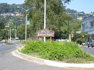
Redwood Heights is a mostly middle-class and highly diverse residential neighborhood in the hills of Oakland, California. It is centered on Redwood Road, which was once a logging road. Currently, Redwood Road is the designation for 35th Avenue starting about a mile north of MacArthur Boulevard between Victor Avenue and the Warren Freeway. It includes Redwood Heights Elementary School and a recreation center that doubles as an after-school daycare. It lies at an elevation of 476 feet.
Crocker Highlands, a neighborhood of Oakland, California, overflows with an abundance of character and charm, described as having "the genteel ambiance of an old Hollywood movie set," is one of several distinct neighborhoods comprising a larger area collectively known as the "Lower Hills" that lies in between the 580 and 13 freeways.
Piedmont Pines is a wealthy, heavily residential district in Oakland, California. It is generally bounded by Highway 13 to the west, Shepherd Canyon Rd. to the north, Skyline Dr. to the east, and Joaquin Miller Park to the south. Two Oakland public schools are included in the area, Montera Middle School and Joaquin Miller Elementary School. There is no business section in Piedmont Pines. Although listed as a distinct district, realtors-architects, city government, and many Piedmont Pines residents have long considered the neighborhood as part of the larger Montclair district. Piedmont Pines is relatively remote from the city center and generally less known than Montclair; many Oaklanders do not seem to know of Piedmont Pines and consider this area to be part of the Montclair district, given that architecturally, geographically, demographically, and economically, the two affluent areas are virtually indistinguishable.
The Millsmont neighborhood located in the foothills of Oakland, California encompasses the area of East Oakland to the south and east of Mills College. Seminary Avenue is considered the northern border, and Edwards Avenue the approximate southern border; MacArthur Boulevard bounds it to the west, and Interstate 580 to the east. It lies at an elevation of 239 feet.
North Oakland is an area in Oakland, California, United States, bordered by Downtown Oakland, Oakland Hills, and the adjacent cities of Berkeley, Emeryville and Piedmont. Annexed to Oakland in 1897. It is known as the birthplace of the Black Panther Party and is the childhood home of both the co-founders, which are Dr. Huey P. Newton and Bobby Seale. It is also the birthplace and childhood home of Sue Draheim, internationally recognized fiddler.
The Parkside is a neighborhood in the western part of San Francisco, California. It is located in the southern part of the Avenues south of Quintara and north of Sloat Boulevard.
The neighborhood has the unique distinction of more parks per capita than any other neighborhood in San Francisco. They include: Parkside Square, Pine Lake, Pine Lake Park, Concert Meadow, Charlie Sava Pool, Carl Larsen Park, Stern Grove, McCoppin Park, and McCoppin Square.
International Boulevard, East 14th Street, and Mission Boulevard are a major road in Alameda County, California. The section now known as International Boulevard was also named East 14th Street until 1996, owing to its position in the East Oakland grid plan; though fully deprecated within the city of Oakland today, this name is still commonly used, especially in casual speech. Mission Boulevard is so named as number 43300 is the location of Mission San José.
Eastmont is a neighborhood in Oakland, the county seat of Alameda County, California. It lies at an elevation of 95 feet. It was formerly an unincorporated community.