El Sobrante is a census-designated place (CDP) in Contra Costa County, California, United States. The population was 12,669 at the 2010 census.

Point Pinole Regional Shoreline is a regional park on the shores of the San Pablo Bay, California, in the United States. It is approximately 2,315 acres (9.37 km2) in area, and is operated by the East Bay Regional Park District. It includes the Dotson Family Marsh and the Point Pinole Lagoon and hosts the North Richmond Shoreline Festival.

The Richmond Parkway Transit Center, or RPTC, is a park and ride lot and bus terminal located in Richmond, California. It is named after the adjacent Richmond Parkway and serves as a transfer point for WestCAT and AC Transit. The center is situated on the corner of Richmond Parkway and Blume Drive, near the Pinole border and adjacent to Interstate 80 and the Hilltop Plaza shopping center.
California's 11th congressional district is a congressional district in the U.S. state of California represented by former Speaker of the House Nancy Pelosi.

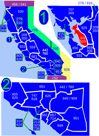
Area codes 510 and 341 are telephone area codes in the North American Numbering Plan (NANP) serving much of the East Bay in the U.S. state of California. They cover parts of Contra Costa County and western Alameda County, including the city of Oakland, but excluding Dublin, Livermore, Pleasanton, and Sunol.
Pullman is a neighborhood in Richmond, California. This area was named after the Pullman Company, founded by prolific industrialist George Mortimer Pullman, who in 1910 built the main facility on the 22 acres (89,000 m2) that would someday become this neighborhood. This facility, named The Pullman Shops, served as the main manufacturing and repair facility for the famous Pullman sleeping car ubiquitous throughout the United States for much of the 20th century. During World War II, this facility played an important role in the war effort. The Pullman shop in Richmond was closed on December 31, 1959.

Carriage Hills, a residential subdivision and the neighborhood is an incorporated integral part of Richmond in the U.S. state of California.

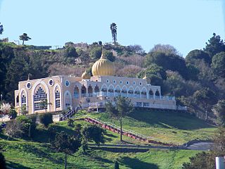
The Sikh Center of San Francisco Bay Area is a Sikh gurdwara in the hills of unincorporated El Sobrante, California, in the East Bay of the San Francisco Bay Area.

Hilltop District, more commonly known simply as Hilltop, is a neighborhood located in the northeastern area of Richmond, California.

Richmond Heights, formerly East Richmond and also known as Mira Vista, is a district of eastern Richmond, California, in the San Francisco Bay Area.

Parchester Village is a planned majority African-American village in northwestern Richmond, California that was the first in the state to sell to blacks.
Richmond Annex or The Annex is a neighborhood in southeastern Richmond, California. It is mostly residential and located between San Pablo Avenue/El Cerrito to the east, San Francisco Bay to the west, Central Avenue/Cerrito Creek/Albany Hill/Albany/Alameda County to the south, and Potrero Avenue/Pullman to the north. Carlson Boulevard is the main thoroughfare through the annex, connecting downtown Richmond with downtown El Cerrito.
Sobrante Ridge Regional Park, or simply Sobrante Ridge, is a regional park of the East Bay Regional Parks District in Richmond, California. It covers 277 acres (1.1 km2) and protects the extremely endangered Alameda manzanita, a native plant of the area. The park has 2+1⁄2 miles (4.0 km) of trails. The endangered manzanita grow on 9 acres (0.036 km2).
Campus Bay is an 87-acre (350,000 m2) property in the city of Richmond, California located off Interstate 580 (California), and situated between the San Francisco Bay, the Richmond Annex, and Point Isabel neighborhoods. The area receives its name from its proximity to the UC Berkeley Richmond Field Station.
Sobrante Ridge Regional Preserve (SRRP) is a regional park in Richmond, Contra Costa County, California and is part of the East Bay Regional Parks (EBRPD) system. The park preserves one of the few habitats of the Alameda manzanita, which is deemed extremely rare, according to EBRPD.
Sobrante Park is a neighborhood located in East Oakland, California, which is partially separated from the rest of the city by two railroad tracks and San Leandro Creek. It was built shortly after World War II, first as a White-Only Lockout and then gradually becoming a White flight red-zone in the mid to late 1950s, and in the early 1960s it became a working-class black neighborhood. It was projected by planners that there would be no in-road into San Leandro's Davis St. residential area which was developed during the same period.
Fluvius Innominatus or Central Creek is a stream in Richmond and El Cerrito, California, in western Contra Costa County. There is one main source and a secondary unnamed tributary. The creek drains into Hoffman Marsh and then flows into the bay through Point Isabel Regional Shoreline's Hoffman Channel. However, before the area was developed and as early as 1899 the creek had as many as 11 sources which stretched far higher into the Berkeley Hills.
Hilltop Green or "The Green"is a neighborhood in Richmond, California bordering the city of Pinole, the census-designated place of El Sobrante, the neighborhood of Hilltop, and Hilltop Mall.
Stege Marsh, also known as the South Richmond Marshes, is a tidal marshland wetlands area in Richmond, California in western Contra Costa County.

Rancho El Sobrante was a 20,565-acre (83.22 km2) Mexican land grant in present-day Contra Costa County, California given in 1841 by Governor Juan Alvarado to Juan Jose Castro and Victor Castro. The name refers to a "surplus" in Spanish—the grant's boundaries were determined by the boundaries of the surrounding grants: San Antonio, San Pablo, El Pinole, La Boca de la Cañada del Pinole, Acalanes, and La Laguna de los Palos Colorados. This grant included the area between present day El Sobrante and Orinda.


