Richmond is a city in western Contra Costa County, California, United States. The city was incorporated on August 3, 1905, and has a city council. Located in the San Francisco Bay Area's East Bay region, Richmond borders San Pablo, Albany, El Cerrito and Pinole in addition to the unincorporated communities of North Richmond, Hasford Heights, Kensington, El Sobrante, Bayview-Montalvin Manor, Tara Hills, and East Richmond Heights, and for a short distance San Francisco on Red Rock Island in the San Francisco Bay.

San Pablo is an enclave city in Contra Costa County, California, United States. The population was 32,127 at the 2020 census. The current mayor is Patricia Ponce. Currently, the city council consists of Abel Pineda, Arturo Cruz, Elizabeth Pabon-Alvarado, and Rita Xavier. Ponce is mayor, and Cruz, Pabon-Alvarado, and Xavier are council members. Dorothy Gantt is the city Clerk. Viviana Toledo is the city treasurer.

AC Transit is an Oakland-based public transit agency serving the western portions of Alameda and Contra Costa counties in the East Bay of the San Francisco Bay Area. AC Transit also operates "Transbay" routes across San Francisco Bay to San Francisco and selected areas in San Mateo and Santa Clara counties. AC Transit is constituted as a special district under California law. It is governed by seven elected members. It is not a part of or under the control of Alameda or Contra Costa counties or any local jurisdictions.

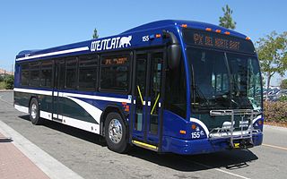
WestCAT is a public transportation service in western Contra Costa County. It is a service of the Western Contra Costa Transit Authority.

The East Bay is the eastern region of the San Francisco Bay Area and includes cities along the eastern shores of the San Francisco Bay and San Pablo Bay. The region has grown to include inland communities in Alameda and Contra Costa counties. With a population of roughly 2.5 million in 2010, it is the most populous subregion in the Bay Area.
The West Contra Costa Unified School District is the school district for western Contra Costa County, California. It is based in Richmond, California. In addition to Richmond, the district covers the cities of El Cerrito, San Pablo, Pinole, and Hercules and the unincorporated areas of Bayview-Montalvin Manor, East Richmond Heights, El Sobrante, Kensington, North Richmond, and Tara Hills.

Richmond station is an Amtrak intercity rail and Bay Area Rapid Transit (BART) station located in downtown Richmond, California. Richmond is the north terminus of BART service on the Orange Line and Red Line; it is a stop for Amtrak's Capitol Corridor, San Joaquins, and California Zephyr routes. The accessible station has one island platform for the two BART tracks, with a second island platform serving two of the three tracks of the Union Pacific Railroad Martinez Subdivision for Amtrak trains. It is one of two transfer points between BART and Amtrak, along with Oakland Coliseum station.

El Cerrito del Norte station is a Bay Area Rapid Transit (BART) station located on Cutting Boulevard in El Cerrito, California. The station is served by the Orange and Red lines. Located near San Pablo Avenue and Interstate 80, it serves as a regional transit hub for local AC Transit bus services, and for commuter feeder services from Solano, Napa, and Marin Counties in the North Bay plus western Contra Costa County. Opened in 1973, the station was renovated in 2017–2021 to add additional elevators, stairs, and lobby space.

El Cerrito Plaza station is a Bay Area Rapid Transit (BART) station in El Cerrito, California, located adjacent to the El Cerrito Plaza shopping center. It primarily serves southern El Cerrito, northern Albany, and Kensington, along with nearby portions of Berkeley and Richmond. Nearly identical in form to El Cerrito del Norte station, El Cerrito Plaza station has two side platforms serving the line's two elevated tracks, with a fare lobby underneath. The Ohlone Greenway runs through the station area. The station is served by the Orange and Red lines.

Hilltop District, more commonly known simply as Hilltop, is a neighborhood located in the northeastern area of Richmond, California.

Richmond Heights, formerly East Richmond and also known as Mira Vista, is a district of eastern Richmond, California, in the San Francisco Bay Area.

Parchester Village is a planned majority African-American village in northwestern Richmond, California that was the first in the state to sell to blacks.

Macdonald Avenue is the main east-to-west artery in Richmond, California.

West County Detention Facility is a large coeducational adult medium security Contra Costa County jail in Richmond, California opened in 1991.

Downtown Oakland is the central business district of Oakland, California, United States. It is located roughly bounded by both the Oakland Estuary and Interstate 880 on the southwest, Interstate 980 on the northwest, Grand Avenue on the northeast, and Lake Merritt on the east.
Hilltop Green or "The Green"is a neighborhood in Richmond, California bordering the city of Pinole, the census-designated place of El Sobrante, the neighborhood of Hilltop, and Hilltop Mall.

Hercules Transit Center is a major commuter hub in the western Contra Costa County city of Hercules, California. It is anchored by WestCAT bus services. The center was originally on San Pablo Avenue. In August 2009, the transit center was relocated to the other side of I-80 with additional paid parking, which is $3/day.

Hercules station is a proposed intermodal infill train station and ferry terminal in Hercules, California in Contra Costa County. It is to be the first direct Amtrak-to-ferry transit hub in the San Francisco Bay Area and will be constructed in between the existing Richmond and Martinez stations. By July 2018, three of the station's six construction phases had been complete, including street at Bay Trail approaches. However, no proposed opening date has yet been announced by the City of Hercules.

Macdonald 80 Shopping Center, or Macdonald 80, is a 200,000 sq. ft. (18,580m³) regional shopping mall in the North & East neighborhood in Richmond, California, anchored by a Target store. The center was largely demolished and rebuilt after suffering from urban decay and blight. It is the only entirely LEED certified mall. It is anchored by a large Target store.
Abella Center formerly International Marketplace and originally El Portal Shopping Center is a mixed-use city services, business, shopping center and housing village transit-oriented development that was formerly a mall in San Pablo, California.


