National Register of Historic Places listings in Alameda County, California

Last updated

Location of Alameda County in California Map of California highlighting Alameda County.svg
Location of Alameda County in California

This is a list of the National Register of Historic Places listings in Alameda County, California.

Contents

This is intended to be a complete list of the properties and districts on the National Register of Historic Places in Alameda County, California, United States. Latitude and longitude coordinates are provided for many National Register properties and districts; these locations may be seen together in an online map. [1]

There are 160 properties and districts listed on the National Register in the county, including 8 National Historic Landmarks. Another property was once listed but has been removed.


    This National Park Service list is complete through NPS recent listings posted March 22, 2024. [2]

Color markings (highest noted listing)

US National Register of Historic Places
National Historic Landmark

Current listings

[3] Name on the Register [4] ImageDate listed [5] Location City or townDescription
1 10th Street Market
10th Street Market 10th St. Market (Oakland, CA).JPG
10th Street Market
August 3, 2001
(#01000826)
901–921 Washington St.
37°48′05″N122°16′29″W / 37.801414°N 122.274586°W / 37.801414; -122.274586 (10th Street Market)
Oakland
2 The Abbey-Joaquin Miller House
The Abbey-Joaquin Miller House Joaquin Miller House (Oakland, CA).JPG
The Abbey-Joaquin Miller House
October 15, 1966
(#66000204)
Joaquin Miller Rd. and Sanborn Dr.
37°48′38″N122°11′35″W / 37.810669°N 122.193039°W / 37.810669; -122.193039 (The Abbey-Joaquin Miller House)
Oakland 1889 home of author and poet Joaquin Miller [6] [7]
3 Alameda City Hall
Alameda City Hall Alameda City Hall (Alameda, CA) 2.JPG
Alameda City Hall
October 14, 1980
(#80000791)
Santa Clara Ave. and Oak St.
37°45′59″N122°14′37″W / 37.766389°N 122.243539°W / 37.766389; -122.243539 (Alameda City Hall)
Alameda
4 Alameda County Building and Loan Association Building
Alameda County Building and Loan Association Building Alameda County Building and Loan Association Building.jpg
Alameda County Building and Loan Association Building
April 12, 2016
(#16000152)
1601-1605 Clay St.
37°48′24″N122°16′22″W / 37.806770°N 122.272826°W / 37.806770; -122.272826 (Alameda County Building and Loan Association Building)
Oakland
5 Alameda Free Library
Alameda Free Library Alameda Free Library (Alameda, CA).JPG
Alameda Free Library
June 25, 1982
(#82002152)
2264 Santa Clara Ave.
37°45′57″N122°14′37″W / 37.765922°N 122.243639°W / 37.765922; -122.243639 (Alameda Free Library)
Alameda
6 Alameda High School
Alameda High School Alameda High School (Alameda, CA).JPG
Alameda High School
May 12, 1977
(#77000280)
2200 Central Ave.
37°45′55″N122°14′45″W / 37.765144°N 122.245814°W / 37.765144; -122.245814 (Alameda High School)
Alameda
7 Alameda Veterans' Memorial Building
Alameda Veterans' Memorial Building Veterans Memorial Building (Alameda, CA).JPG
Alameda Veterans' Memorial Building
September 27, 2007
(#07000995)
2203 Central Ave.
37°45′58″N122°14′47″W / 37.766186°N 122.246475°W / 37.766186; -122.246475 (Alameda Veterans' Memorial Building)
Alameda
8 Altenheim
Altenheim Altenheim (Oakland, CA).JPG
Altenheim
January 10, 2007
(#06001218)
1720 MacArthur Blvd.
37°48′03″N122°13′15″W / 37.800786°N 122.220839°W / 37.800786; -122.220839 (Altenheim)
Oakland
9 American Bag Co.-Union Hide Co.
American Bag Co.-Union Hide Co. American Bag Co.-Union Hide Co. (Oakland, CA).JPG
American Bag Co.-Union Hide Co.
August 13, 1999
(#99000896)
299 Third St.
37°47′42″N122°16′20″W / 37.795036°N 122.272156°W / 37.795036; -122.272156 (American Bag Co.-Union Hide Co.)
Oakland
10 Anna Head School for Girls
Anna Head School for Girls Anna Head School for Girls (Berkeley, CA).JPG
Anna Head School for Girls
August 11, 1980
(#80000795)
2538 Channing Way
37°52′00″N122°15′26″W / 37.866667°N 122.257336°W / 37.866667; -122.257336 (Anna Head School for Girls)
Berkeley
11 Thomas Foxwell Bachelder Barn
Thomas Foxwell Bachelder Barn Thomas Foxwell Bachelder Barn (Sunol, CA).JPG
Thomas Foxwell Bachelder Barn
April 15, 1994
(#94000359)
1011 Kilkare Rd.
37°36′35″N121°53′44″W / 37.609592°N 121.895436°W / 37.609592; -121.895436 (Thomas Foxwell Bachelder Barn)
Sunol
12 Bank of Italy
Bank of Italy Bank of Italy (Livermore, CA).JPG
Bank of Italy
November 16, 1978
(#78000648)
2250 1st St.
37°40′57″N121°46′07″W / 37.682422°N 121.768475°W / 37.682422; -121.768475 (Bank of Italy)
Livermore
13 The Bellevue-Staten
The Bellevue-Staten The Bellevue-Staten (Oakland, CA).JPG
The Bellevue-Staten
December 27, 1991
(#91001896)
492 Staten Ave.
37°48′29″N122°15′14″W / 37.807933°N 122.2538°W / 37.807933; -122.2538 (The Bellevue-Staten)
Oakland
14 Berkeley Day Nursery
Berkeley Day Nursery Berkeley Day Nursery (Berkeley, CA).jpg
Berkeley Day Nursery
September 15, 1977
(#77000281)
2031 6th St.
37°52′02″N122°17′50″W / 37.867156°N 122.297125°W / 37.867156; -122.297125 (Berkeley Day Nursery)
Berkeley
15 Berkeley High School Campus Historic District
Berkeley High School Campus Historic District Old Berkeley High School (Berkeley, CA).JPG
Berkeley High School Campus Historic District
January 7, 2008
(#07001350)
1980 Allston Wy.
37°52′08″N122°16′16″W / 37.868989°N 122.271031°W / 37.868989; -122.271031 (Berkeley High School Campus Historic District)
Berkeley
16 Berkeley Hillside Club
Berkeley Hillside Club Berkeley Hillside Club (Berkeley, CA).JPG
Berkeley Hillside Club
April 16, 2004
(#04000332)
2286 Cedar St.
37°52′44″N122°15′54″W / 37.878792°N 122.264925°W / 37.878792; -122.264925 (Berkeley Hillside Club)
Berkeley
17 Berkeley Historic Civic Center District
Berkeley Historic Civic Center District Martin Luther King Jr Civic Center (Berkeley, CA).JPG
Berkeley Historic Civic Center District
December 3, 1998
(#98000963)
Roughly bounded by McKinney Ave., Addison St., Shattuck Ave., and Kittredge St.
37°52′10″N122°16′14″W / 37.869528°N 122.270531°W / 37.869528; -122.270531 (Berkeley Historic Civic Center District)
Berkeley
18 Berkeley Public Library
Berkeley Public Library Berkeley Public Library (Kittredge St., Berkeley, CA).JPG
Berkeley Public Library
June 25, 1982
(#82002156)
2090 Kittredge St.
37°52′05″N122°16′07″W / 37.868164°N 122.268611°W / 37.868164; -122.268611 (Berkeley Public Library)
Berkeley
19 Berkeley Women's City Club
Berkeley Women's City Club Berkeley Women's City Club (Berkeley, CA).JPG
Berkeley Women's City Club
October 28, 1977
(#77000282)
2315 Durant Ave.
37°52′03″N122°15′46″W / 37.867506°N 122.262742°W / 37.867506; -122.262742 (Berkeley Women's City Club)
Berkeley
20 Boone's University School
Boone's University School Boone's University School (Berkeley, CA).JPG
Boone's University School
November 1, 1982
(#82000994)
2029 Durant Ave.
37°52′01″N122°16′08″W / 37.866817°N 122.268806°W / 37.866817; -122.268806 (Boone's University School)
Berkeley Now the Persian Center
21 Bowles Hall
Bowles Hall Bowles Hall from Maxwell Family Field.JPG
Bowles Hall
March 16, 1989
(#89000195)
Stadium and Gayley Way
37°52′24″N122°15′11″W / 37.873361°N 122.252919°W / 37.873361; -122.252919 (Bowles Hall)
Berkeley
22 Brooklyn Presbyterian Church September 18, 2017
(#100001600)
1433 12th Ave.
37°47′28″N122°14′50″W / 37.791162°N 122.247232°W / 37.791162; -122.247232 (Brooklyn Presbyterian Church)
Oakland
23 California Cotton Mills Company Factory
California Cotton Mills Company Factory Hdr 00074 0 1.jpg
California Cotton Mills Company Factory
January 30, 2013
(#12001234)
1091 Calcot Pl.
37°46′54″N122°14′17″W / 37.781552°N 122.238053°W / 37.781552; -122.238053 (California Cotton Mills Company Factory)
Oakland
24 California Hall
California Hall California Hall.JPG
California Hall
March 25, 1982
(#82004638)
Oxford St.
37°52′19″N122°15′37″W / 37.871886°N 122.260375°W / 37.871886; -122.260375 (California Hall)
Berkeley
25 California Hotel
California Hotel California Hotel (Oakland, CA).JPG
California Hotel
June 30, 1988
(#88000969)
3443–3501 San Pablo Ave.
37°49′34″N122°16′43″W / 37.826061°N 122.278536°W / 37.826061; -122.278536 (California Hotel)
Oakland
26 California Memorial Stadium
California Memorial Stadium California Memorial Stadium aerial.jpg
California Memorial Stadium
November 27, 2006
(#06001086)
Bet. Piedmont Ave., Stadium Rim Way, Canyon Rd., Bancroft Way and Prospect St.
37°52′16″N122°15′03″W / 37.871003°N 122.250775°W / 37.871003; -122.250775 (California Memorial Stadium)
Berkeley
27 California Nursery Co. Guest House
California Nursery Co. Guest House Vallejo adobe.jpg
California Nursery Co. Guest House
May 6, 1971
(#71000130)
California Nursery Co., Niles Blvd. at Nursery Ave.
37°34′45″N121°59′30″W / 37.579219°N 121.991786°W / 37.579219; -121.991786 (California Nursery Co. Guest House)
Fremont
28 Camron-Stanford House
Camron-Stanford House Cameron-Stanford House (Oakland, CA).JPG
Camron-Stanford House
June 13, 1972
(#72000213)
1426 Lakeside Dr.
37°48′05″N122°15′44″W / 37.801417°N 122.26225°W / 37.801417; -122.26225 (Camron-Stanford House)
Oakland
29 Casa Peralta
Casa Peralta Casa Peralta (San Leandro, CA).JPG
Casa Peralta
January 4, 1982
(#82002168)
384 W. Estudillo Ave.
37°43′27″N122°09′30″W / 37.724269°N 122.158394°W / 37.724269; -122.158394 (Casa Peralta)
San Leandro
30 Chamber of Commerce Building
Chamber of Commerce Building Chamber of Commerce Building, (Berkeley, CA).JPG
Chamber of Commerce Building
August 29, 1985
(#85001916)
2140–2144 Shattuck Ave. & 2071–2089 Center St.
37°52′14″N122°16′08″W / 37.870508°N 122.268872°W / 37.870508; -122.268872 (Chamber of Commerce Building)
Berkeley
31 Church of the Good Shepherd-Episcopal
Church of the Good Shepherd-Episcopal USA-Berkeley-Episcopal Church of the Good Shepherd-1.jpg
Church of the Good Shepherd-Episcopal
December 1, 1986
(#86003361)
1001 Hearst St. at Ninth St.
37°52′12″N122°17′41″W / 37.870033°N 122.294819°W / 37.870033; -122.294819 (Church of the Good Shepherd-Episcopal)
Berkeley
32 City Hall
City Hall Old City Hall (Berkeley, CA).JPG
City Hall
September 11, 1981
(#81000142)
2134 Martin Luther King Jr. Way
37°52′09″N122°16′24″W / 37.869225°N 122.273267°W / 37.869225; -122.273267 (City Hall)
Berkeley 1907 building by John Bakewell, Jr. and Arthur Brown, Jr.; [8] renamed the Maudelle Shirek Building, March 2007 [9]
33 Clay Building
Clay Building Clay Building (Oakland, CA).JPG
Clay Building
November 20, 1978
(#78000650)
1001–1007 Clay St.
37°48′10″N122°16′31″W / 37.802775°N 122.275403°W / 37.802775; -122.275403 (Clay Building)
Oakland
34 Cloyne Court Hotel
Cloyne Court Hotel Cloyne Court Hotel (Berkeley, CA).JPG
Cloyne Court Hotel
December 24, 1992
(#92001718)
2600 Ridge Rd.
37°52′34″N122°15′29″W / 37.876144°N 122.257947°W / 37.876144; -122.257947 (Cloyne Court Hotel)
Berkeley
35 Alfred H. Cohen House
Alfred H. Cohen House Alfred H. Cohen House (Oakland, CA).JPG
Alfred H. Cohen House
June 19, 1973
(#73000394)
1440 29th Ave.
37°46′47″N122°13′41″W / 37.779753°N 122.228067°W / 37.779753; -122.228067 (Alfred H. Cohen House)
Oakland
36 College Women's Club
College Women's Club College Women's Club (Berkeley, CA).JPG
College Women's Club
January 21, 1982
(#82002157)
2680 Bancroft Way
37°52′08″N122°15′18″W / 37.868989°N 122.254958°W / 37.868989; -122.254958 (College Women's Club)
Berkeley 1928 building by Walter T. Steilberg; now known as the Bancroft Hotel [8]
37 Corder Building
Corder Building Corder Building (Berkeley, CA).JPG
Corder Building
January 11, 1982
(#82002158)
2300–2350 Shattuck Ave.
37°52′02″N122°16′05″W / 37.867092°N 122.268047°W / 37.867092; -122.268047 (Corder Building)
Berkeley
38 Cowell Memorial Hospital
Cowell Memorial Hospital Cowell hospital architectural.jpg
Cowell Memorial Hospital
January 6, 1993
(#92001730)
2215 College Ave.
37°52′18″N122°15′11″W / 37.871667°N 122.253056°W / 37.871667; -122.253056 (Cowell Memorial Hospital)
Berkeley 1930 building by Arthur Brown, Jr.; demolished 1993 [10]
39 Croll Building
Croll Building Croll Building (Alameda, CA).JPG
Croll Building
October 4, 1982
(#82000960)
1400 Webster St.
37°46′18″N122°16′36″W / 37.771644°N 122.276597°W / 37.771644; -122.276597 (Croll Building)
Alameda
40 Doe Memorial Library
Doe Memorial Library UCB-University-Library.jpg
Doe Memorial Library
March 25, 1982
(#82004639)
Oxford St.
37°52′20″N122°15′34″W / 37.872108°N 122.2594°W / 37.872108; -122.2594 (Doe Memorial Library)
Berkeley
41 Downtown Oakland Historic District
Downtown Oakland Historic District Downtown Oakland Historic District.jpg
Downtown Oakland Historic District
July 1, 1998
(#98000813)
Roughly along Broadway from 17th to 11th St.
37°48′17″N122°16′11″W / 37.804722°N 122.269722°W / 37.804722; -122.269722 (Downtown Oakland Historic District)
Oakland
42 Drawing Building
Drawing Building UC Berkeley Naval Architecture Building - back - 2015-07-25.JPG
Drawing Building
November 18, 1976
(#76000475)
Hearst Ave., University of California campus
37°52′30″N122°15′27″W / 37.875086°N 122.257556°W / 37.875086; -122.257556 (Drawing Building)
Berkeley 1914 building by John Galen Howard, subsequently known as the Naval Architecture Building, [11] now part of Blum Hall [12] [13]
43 Dunns Block
Dunns Block Dunns Block (Oakland, CA).JPG
Dunns Block
November 15, 1978
(#78000652)
725 Washington St.
37°48′02″N122°16′32″W / 37.800511°N 122.275442°W / 37.800511; -122.275442 (Dunns Block)
Oakland
44 Dunsmuir House
Dunsmuir House Dunsmuir-house.jpg
Dunsmuir House
May 19, 1972
(#72000214)
Peralta Oaks Ct.
37°44′35″N122°08′47″W / 37.743056°N 122.146389°W / 37.743056; -122.146389 (Dunsmuir House)
Oakland
45 Durant Hall
Durant Hall Durant Hall - 2015-07-25.JPG
Durant Hall
March 25, 1982
(#82004640)
Oxford St.
37°52′17″N122°15′36″W / 37.871258°N 122.260128°W / 37.871258; -122.260128 (Durant Hall)
Berkeley 1911 building by John Galen Howard; formerly Boalt Hall of Law [11]
46 Eden Congregational Church
Eden Congregational Church Eden Congregational Church (Hayward, CA).JPG
Eden Congregational Church
August 3, 2007
(#07000788)
1046 Grove Way
37°40′51″N122°05′37″W / 37.680969°N 122.093611°W / 37.680969; -122.093611 (Eden Congregational Church)
Hayward
47 George C. Edwards Stadium
George C. Edwards Stadium George C. Edwards Stadium (Berkeley, CA).jpg
George C. Edwards Stadium
April 1, 1993
(#93000263)
Junction of Bancroft Way and Fulton St., UC Berkeley campus
37°52′08″N122°15′53″W / 37.869°N 122.264828°W / 37.869; -122.264828 (George C. Edwards Stadium)
Berkeley
48 Elliston
Elliston Elliston (Sunol, CA).JPG
Elliston
June 19, 1985
(#85001327)
463 and 341 Kilkare Rd.
37°36′05″N121°53′25″W / 37.601261°N 121.890269°W / 37.601261; -121.890269 (Elliston)
Sunol
49 Faculty Club
Faculty Club Faculty Club (Berkeley, CA).jpg
Faculty Club
March 25, 1982
(#82004641)
Oxford St.
37°52′18″N122°15′21″W / 37.871783°N 122.255903°W / 37.871783; -122.255903 (Faculty Club)
Berkeley 1902 building by Bernard Maybeck [14]
50 Federal Realty Building
Federal Realty Building Federal Realty Building (Oakland, CA) 2.JPG
Federal Realty Building
January 2, 1979
(#79000467)
1615 Broadway
37°48′23″N122°16′13″W / 37.806294°N 122.270214°W / 37.806294; -122.270214 (Federal Realty Building)
Oakland
51 First Church of Christ, Scientist
First Church of Christ, Scientist First Church of Christ Scientist.jpg
First Church of Christ, Scientist
December 22, 1977
(#77000283)
2619 Dwight Way
37°51′56″N122°15′21″W / 37.865683°N 122.255939°W / 37.865683; -122.255939 (First Church of Christ, Scientist)
Berkeley 1910 building by Bernard Maybeck [15]
52 First Presbyterian Church Sanctuary Building
First Presbyterian Church Sanctuary Building First Presbyterian Church (Alameda, CA).JPG
First Presbyterian Church Sanctuary Building
November 25, 1980
(#80000792)
2001 Santa Clara Ave.
37°46′11″N122°15′06″W / 37.769756°N 122.251572°W / 37.769756; -122.251572 (First Presbyterian Church Sanctuary Building)
Alameda
53 First Unitarian Church
First Unitarian Church First Unitarian Church (Berkeley, CA).JPG
First Unitarian Church
December 10, 1981
(#81000143)
2401 Bancroft Way
37°52′07″N122°15′40″W / 37.868642°N 122.261169°W / 37.868642; -122.261169 (First Unitarian Church)
Berkeley 1898 building by A. C. Schweinfurth; now home to the University of California, Berkeley's Dramatic Arts Department [16]
54 First Unitarian Church of Oakland
First Unitarian Church of Oakland 1stUnitarianChurch OaklandCA.jpg
First Unitarian Church of Oakland
June 16, 1977
(#77000284)
685 14th St.
37°48′25″N122°16′31″W / 37.806944°N 122.275278°W / 37.806944; -122.275278 (First Unitarian Church of Oakland)
Oakland
55 Founders' Rock
Founders' Rock FoundersRock.JPG
Founders' Rock
March 25, 1982
(#82004642)
Oxford St.
37°52′31″N122°15′25″W / 37.875319°N 122.256897°W / 37.875319; -122.256897 (Founders' Rock)
Berkeley Site of dedication of the College of California, April 16, 1860 [17]
56 Fox Court
Fox Court Fox Court (Berkeley, CA).JPG
Fox Court
February 4, 1982
(#82002159)
1472–1478 University Ave.
37°52′12″N122°16′57″W / 37.869978°N 122.282628°W / 37.869978; -122.282628 (Fox Court)
Berkeley 1930 Tudor Revival building by Carl Fox [18]
57 Fox Oakland Theatre
Fox Oakland Theatre Fox Oakland Theatre (Oakland, CA).JPG
Fox Oakland Theatre
February 2, 1979
(#79000468)
1807–1829 Telegraph Ave.
37°48′32″N122°16′09″W / 37.808889°N 122.269167°W / 37.808889; -122.269167 (Fox Oakland Theatre)
Oakland
58 Garfield Intermediate School
Garfield Intermediate School Garfield Intermediate School (Berkeley, CA).JPG
Garfield Intermediate School
June 14, 1982
(#82002160)
1414 Walnut St.
37°52′54″N122°16′07″W / 37.881592°N 122.268733°W / 37.881592; -122.268733 (Garfield Intermediate School)
Berkeley 1915 building by Ernest Coxhead; also known as Garfield Junior High School; now the Jewish Community Center [8]
59 Giannini Hall
Giannini Hall Giannini Hall (Berkeley, CA).JPG
Giannini Hall
March 25, 1982
(#82004643)
Oxford St.
37°52′25″N122°15′44″W / 37.873544°N 122.262361°W / 37.873544; -122.262361 (Giannini Hall)
Berkeley 1930 building by William C. Hays named for Bank of America founder Amadeo Giannini; built to house the Giannini Foundation of Agricultural Economics [11]
60 Girton Hall
Girton Hall Julia Morgan Hall - 2015-07-25.JPG
Girton Hall
September 26, 1991
(#91001473)
University of California Botanical Garden
37°52′29″N122°14′18″W / 37.874722°N 122.238333°W / 37.874722; -122.238333 (Girton Hall)
Berkeley 1911 building by Julia Morgan. Initially known as Senior Women's Hall, [11] now known as Julia Morgan Hall. Moved from UC Berkeley central campus to UC Botanical Garden in 2014. [19]
61 Golden Sheaf Bakery
Golden Sheaf Bakery Golden Sheaf Bakery (Berkeley, CA).JPG
Golden Sheaf Bakery
March 31, 1978
(#78000644)
2069–2071 Addison St.
37°52′17″N122°16′08″W / 37.8713°N 122.2690°W / 37.8713; -122.2690 (Golden Sheaf Bakery)
Berkeley 1905 brick and terra-cotta building by Clinton Day; once part of the Golden Sheaf Bakery, where the first bakers' union was founded in 1904 [20]
62 Greek Orthodox Church of the Assumption
Greek Orthodox Church of the Assumption Greek Orthodox Church of the Assumption (Oakland, CA).JPG
Greek Orthodox Church of the Assumption
May 22, 1978
(#78000651)
9th and Castro Sts.
37°48′13″N122°16′43″W / 37.8035°N 122.2787°W / 37.8035; -122.2787 (Greek Orthodox Church of the Assumption)
Oakland
63 Green Shutter Hotel
Green Shutter Hotel Green Shutter Hotel (Hayward, CA).JPG
Green Shutter Hotel
June 16, 2004
(#04000594)
22650 Main St.
37°40′21″N122°04′56″W / 37.6724°N 122.0822°W / 37.6724; -122.0822 (Green Shutter Hotel)
Hayward
64 Hagemann Ranch Historic District
Hagemann Ranch Historic District Hagemann Ranch (Livermore, CA).JPG
Hagemann Ranch Historic District
January 10, 2008
(#07001351)
455 Olivina Ave.
37°40′57″N121°47′51″W / 37.6824°N 121.7974°W / 37.6824; -121.7974 (Hagemann Ranch Historic District)
Livermore
65 Harrison and Fifteenth Sts. Historic District
Harrison and Fifteenth Sts. Historic District Harrison & 15th Sts Historic District (Oakland, CA).JPG
Harrison and Fifteenth Sts. Historic District
November 7, 1996
(#96001277)
1401–1501 Harrison St., 300–312 14th St., 300–349 15th St.
37°48′14″N122°15′59″W / 37.8039°N 122.2664°W / 37.8039; -122.2664 (Harrison and Fifteenth Sts. Historic District)
Oakland
66 Weston Havens House
Weston Havens House Weston Havens House from downhill.jpg
Weston Havens House
June 11, 2008
(#05000597)
255 Panoramic Way
37°52′09″N122°14′50″W / 37.8691°N 122.2473°W / 37.8691; -122.2473 (Weston Havens House)
Berkeley 1941 house by Harwell Hamilton Harris bequeathed to the University of California by the last direct descendant of Berkeley founder, Francis Kittredge Shattuck [21]
67 Haviland Hall
Haviland Hall Haviland Hall (Berkeley, CA).JPG
Haviland Hall
February 1, 1982
(#82002161)
University of California Campus
37°52′25″N122°15′40″W / 37.8737°N 122.2611°W / 37.8737; -122.2611 (Haviland Hall)
Berkeley 1924 building by John Galen Howard [11]
68 Hearst Greek Theatre
Hearst Greek Theatre Hearst Greek Theatre (Berkeley, CA).JPG
Hearst Greek Theatre
March 25, 1982
(#82004644)
Oxford St.
37°52′25″N122°15′15″W / 37.8737°N 122.2543°W / 37.8737; -122.2543 (Hearst Greek Theatre)
Berkeley 1903 outdoor theater by John Galen Howard named for donor and publisher William Randolph Hearst [11]
69 Hearst Gymnasium for Women
Hearst Gymnasium for Women Hearst Gymnasium for Women (Berkeley, CA).jpg
Hearst Gymnasium for Women
March 25, 1982
(#82004645)
Oxford St.
37°52′10″N122°15′24″W / 37.8694°N 122.2568°W / 37.8694; -122.2568 (Hearst Gymnasium for Women)
Berkeley 1927 building by Bernard Maybeck and Julia Morgan named in honor of William Randolph Hearst's mother Phoebe Apperson Hearst [11]
70 Hearst Memorial Mining Building
Hearst Memorial Mining Building Hearst Memorial Mining Building (Berkeley, CA).JPG
Hearst Memorial Mining Building
March 25, 1982
(#82004646)
Oxford St.
37°52′27″N122°15′26″W / 37.8742°N 122.2572°W / 37.8742; -122.2572 (Hearst Memorial Mining Building)
Berkeley 1902–1907 building by John Galen Howard, named for Senator George Hearst [11]
71 Heathcote-MacKenzie House
Heathcote-MacKenzie House Heathcote-MacKenzie House (Pleasanton, CA).JPG
Heathcote-MacKenzie House
October 29, 1991
(#91001538)
4501 Pleasanton Ave.
37°39′37″N121°53′06″W / 37.6602°N 121.8849°W / 37.6602; -121.8849 (Heathcote-MacKenzie House)
Pleasanton
72 Heinold's First and Last Chance Saloon
Heinold's First and Last Chance Saloon Heinold's First and Last Chance 2007.jpg
Heinold's First and Last Chance Saloon
September 1, 2000
(#00001067)
56 Jack London Square
37°47′38″N122°16′23″W / 37.7939°N 122.2731°W / 37.7939; -122.2731 (Heinold's First and Last Chance Saloon)
Oakland
73 Hilgard Hall
Hilgard Hall Hilgard Hall (Berkeley, CA).JPG
Hilgard Hall
March 25, 1982
(#82004647)
Oxford St.
37°52′24″N122°15′48″W / 37.8733°N 122.2634°W / 37.8733; -122.2634 (Hilgard Hall)
Berkeley 1917 building by John Galen Howard; named for Eugene W. Hilgard, renowned pedologist and first dean of the University of California College of Agriculture [11]
74 Hillside School
Hillside School Hillside School (Berkeley, CA).JPG
Hillside School
October 29, 1982
(#82000961)
1581 Leroy Ave.
37°52′51″N122°15′32″W / 37.8807°N 122.2588°W / 37.8807; -122.2588 (Hillside School)
Berkeley 1925 school by Walter H. Ratcliff, Jr. [8]
75 Hotel Menlo
Hotel Menlo The-Menlo-Hotel-Ca-Oakland 1920.jpg
Hotel Menlo
December 29, 2020
(#100005984)
344 13th St.
37°48′10″N122°16′08″W / 37.8027°N 122.2690°W / 37.8027; -122.2690 (Hotel Menlo)
Oakland
76 Immanuel Evangelical Lutheran Church of Alameda
Immanuel Evangelical Lutheran Church of Alameda USA-Alameda-Emmanuel Lutheran Church-2.jpg
Immanuel Evangelical Lutheran Church of Alameda
September 21, 2023
(#100009369)
1420 Lafayette St.
37°46′10″N122°15′11″W / 37.7695°N 122.2531°W / 37.7695; -122.2531 (Immanuel Evangelical Lutheran Church of Alameda)
Alameda
77 Kahn's Department Store
Kahn's Department Store Kahn's Department Store (Oakland, CA).JPG
Kahn's Department Store
March 30, 1989
(#89000194)
1501–39 Broadway
37°48′21″N122°16′15″W / 37.8057°N 122.2708°W / 37.8057; -122.2708 (Kahn's Department Store)
Oakland
78 John W. Kottinger Adobe Barn
John W. Kottinger Adobe Barn John W. Kottinger Adobe Barn (Pleasanton, CA).JPG
John W. Kottinger Adobe Barn
September 12, 1985
(#85002305)
200 Ray St.
37°39′48″N121°52′21″W / 37.6632°N 121.8725°W / 37.6632; -121.8725 (John W. Kottinger Adobe Barn)
Pleasanton Formerly used as a jail by John W. Kottinger, a justice of peace in Murray Township. Now occupied by an antique shop. [22]
79 Ladies' Relief Society Children's Home
Ladies' Relief Society Children's Home Ladies' Relief Society Children's Home (Oakland, CA).JPG
Ladies' Relief Society Children's Home
July 13, 2006
(#06000612)
365 45th St.
37°49′58″N122°15′26″W / 37.8327°N 122.2571°W / 37.8327; -122.2571 (Ladies' Relief Society Children's Home)
Oakland
80 Lake Merritt Wild Duck Refuge
Lake Merritt Wild Duck Refuge Lake Merritt Wild Duck Refuge (Oakland, CA).JPG
Lake Merritt Wild Duck Refuge
October 15, 1966
(#66000205)
Lakeside Park, Grand Ave.
37°48′23″N122°15′18″W / 37.8065°N 122.2550°W / 37.8065; -122.2550 (Lake Merritt Wild Duck Refuge)
Oakland Established March 18, 1870; first official wildlife refuge in the United States [23]
81 LeConte Hall
LeConte Hall LeConte Hall (Berkeley, CA).jpg
LeConte Hall
June 25, 2004
(#04000622)
Hearst and Gayley
37°52′21″N122°15′24″W / 37.8725°N 122.2568°W / 37.8725; -122.2568 (LeConte Hall)
Berkeley
82 Liberty Hall
Liberty Hall Liberty Hall (Oakland, CA).JPG
Liberty Hall
March 30, 1989
(#89000199)
1483–1485 8th St.
37°48′23″N122°17′44″W / 37.8064°N 122.2955°W / 37.8064; -122.2955 (Liberty Hall)
Oakland Built in 1877; [24] meeting hall of the Oakland chapter of the Universal Negro Improvement Association [25]
83 Lightship WAL-605, RELIEF
Lightship WAL-605, RELIEF Lightship Relief (Oakland, CA).JPG
Lightship WAL-605, RELIEF
December 20, 1989
(#89002462)
Oakland Estuary in Brooklyn Basin
37°47′44″N122°16′50″W / 37.795686°N 122.280561°W / 37.795686; -122.280561 (Lightship WAL-605, RELIEF)
Oakland
84 Livermore Carnegie Library and Park
Livermore Carnegie Library and Park Livermore Carnegie Library Front View.JPG
Livermore Carnegie Library and Park
December 3, 2011
(#11000876)
2155 3rd St.
37°40′47″N121°46′07″W / 37.679642°N 121.768542°W / 37.679642; -121.768542 (Livermore Carnegie Library and Park)
Livermore
85 Livermore Veterans Administration Hospital, Building 62 April 23, 2020
(#100005208)
4951 Arroyo Rd., Livermore Division Campus
37°37′32″N121°45′47″W / 37.6255°N 121.7631°W / 37.6255; -121.7631 (Livermore Veterans Administration Hospital, Building 62)
Livermore
86 Locke House
Locke House Locke House (Oakland, CA).JPG
Locke House
April 7, 1989
(#89000258)
3911 Harrison St.
37°49′19″N122°15′01″W / 37.821928°N 122.250306°W / 37.821928; -122.250306 (Locke House)
Oakland
87 Loring House
Loring House Loring House (Berkeley, CA).JPG
Loring House
July 13, 1989
(#89000857)
1730 Spruce St.
37°52′35″N122°15′56″W / 37.876467°N 122.265611°W / 37.876467; -122.265611 (Loring House)
Berkeley
88 Madison Park Apartments
Madison Park Apartments Madison Park Apartments (Oakland, CA).JPG
Madison Park Apartments
April 1, 1982
(#82002164)
100 9th St.
37°47′53″N122°15′55″W / 37.797975°N 122.265253°W / 37.797975; -122.265253 (Madison Park Apartments)
Oakland
89 Main Post Office and Federal Building
Main Post Office and Federal Building Main Post Office (Oakland, CA).JPG
Main Post Office and Federal Building
October 23, 1980
(#80000796)
201 13th St.
37°48′05″N122°15′59″W / 37.801339°N 122.266406°W / 37.801339; -122.266406 (Main Post Office and Federal Building)
Oakland
90 Masonic Temple
Masonic Temple Masonic Temple (Berkeley, CA).JPG
Masonic Temple
July 15, 1982
(#82002162)
2105 Bancroft Way and 2295 Shattuck Ave.
37°52′04″N122°16′03″W / 37.867772°N 122.267464°W / 37.867772; -122.267464 (Masonic Temple)
Berkeley
91 Masonic Temple and Lodge
Masonic Temple and Lodge USA-Alameda-Masonic Temple and Lodge-1.jpg
Masonic Temple and Lodge
March 25, 1982
(#82002153)
1329–31 Park St. and 2312 Alameda Ave.
37°45′48″N122°14′38″W / 37.763361°N 122.243897°W / 37.763361; -122.243897 (Masonic Temple and Lodge)
Alameda
92 McCrea House
McCrea House McCrea House (Oakland, CA).JPG
McCrea House
February 11, 1982
(#82002165)
3500 Mountain Blvd.
37°48′03″N122°11′12″W / 37.800781°N 122.186608°W / 37.800781; -122.186608 (McCrea House)
Oakland
93 Meek Mansion and Carriage House
Meek Mansion and Carriage House Meek Mansion (Hayward, CA).JPG
Meek Mansion and Carriage House
June 4, 1973
(#73000393)
240 Hampton Rd.
37°41′04″N122°06′48″W / 37.684453°N 122.11345°W / 37.684453; -122.11345 (Meek Mansion and Carriage House)
Hayward
94 Melrose Baptist Church
Melrose Baptist Church Melrose Baptist Church Facade 01.jpg
Melrose Baptist Church
March 27, 2017
(#100000778)
1638 47th Ave.
37°46′20″N122°12′34″W / 37.772188°N 122.209453°W / 37.772188; -122.209453 (Melrose Baptist Church)
Oakland
95 Mills Hall
Mills Hall Mills Hall (Oakland, CA).JPG
Mills Hall
October 14, 1971
(#71000132)
Mills College campus
37°46′47″N122°10′56″W / 37.779689°N 122.182086°W / 37.779689; -122.182086 (Mills Hall)
Oakland
96 Mission San José
Mission San Jose Mission San Jose (Fremont, CA).JPG
Mission San José
July 14, 1971
(#71000131)
Mission Blvd. at Washington Blvd.
37°32′00″N121°55′11″W / 37.533425°N 121.919686°W / 37.533425; -121.919686 (Mission San José)
Fremont

97 Montgomery Ward & Company
Montgomery Ward & Company Montgomery Ward and Company, Oakland, CA in the 1920's.jpg
Montgomery Ward & Company
June 15, 1999
(#99000691)
2825 E. 14th St.
37°46′47″N122°13′48″W / 37.779617°N 122.230061°W / 37.779617; -122.230061 (Montgomery Ward & Company)
Oakland Demolished in 2001 [26]
98 D. J. Murphy House
D. J. Murphy House D.J. Murphy House (Livermore, CA).JPG
D. J. Murphy House
April 6, 1978
(#78000649)
291 McLeod St.
37°40′54″N121°45′58″W / 37.681594°N 121.766022°W / 37.681594; -121.766022 (D. J. Murphy House)
Livermore
99 Naval Air Station Alameda Historic District
Naval Air Station Alameda Historic District US carriers at Alameda 1974 (colour).jpg
Naval Air Station Alameda Historic District
January 23, 2013
(#12001191)
NAS Alameda
37°47′10″N122°18′09″W / 37.786182°N 122.302566°W / 37.786182; -122.302566 (Naval Air Station Alameda Historic District)
Alameda
100 Niles Canyon Transcontinental Railroad Historic District
Niles Canyon Transcontinental Railroad Historic District NCRyTrain2006.jpg
Niles Canyon Transcontinental Railroad Historic District
October 13, 2010
(#10000843)
Railway corridor from Niles to Pleasanton
37°35′40″N121°53′19″W / 37.594444°N 121.888611°W / 37.594444; -121.888611 (Niles Canyon Transcontinental Railroad Historic District)
Fremont, Pleasanton, and Sunol
101 North Gate Hall
North Gate Hall North Gate Hall (Berkeley, CA).JPG
North Gate Hall
March 25, 1982
(#82004648)
Oxford St.
37°52′30″N122°15′35″W / 37.874919°N 122.259831°W / 37.874919; -122.259831 (North Gate Hall)
Berkeley
102 Oakland Auditorium
Oakland Auditorium Municipal Auditorium, Oakland, Calif (74114).jpg
Oakland Auditorium
February 1, 2021
(#100006085)
10 10th St.
37°47′51″N122°15′42″W / 37.7975°N 122.2617°W / 37.7975; -122.2617 (Oakland Auditorium)
Oakland Now the Kaiser Convention Center
103 Oakland City Hall
Oakland City Hall Oakland City Hall (Oakland, CA) 2.JPG
Oakland City Hall
September 15, 1983
(#83001170)
1 Frank H. Ogawa Plaza
37°48′19″N122°16′21″W / 37.805311°N 122.272542°W / 37.805311; -122.272542 (Oakland City Hall)
Oakland
104 Oakland Free Library-23rd Avenue Branch
Oakland Free Library-23rd Avenue Branch Oakland Free Library-23rd Ave. Branch (Oakland, CA).JPG
Oakland Free Library-23rd Avenue Branch
February 16, 1996
(#96000106)
1449 Miller Ave., 2347 E. 15th St.
37°47′01″N122°14′04″W / 37.783503°N 122.234444°W / 37.783503; -122.234444 (Oakland Free Library-23rd Avenue Branch)
Oakland
105 Oakland Free Library-Alden Branch
Oakland Free Library-Alden Branch Oakland Free Library-Alden Branch (Oakland, CA).JPG
Oakland Free Library-Alden Branch
February 16, 1996
(#96000105)
5205 Telegraph Ave., 500 52nd St.
37°50′18″N122°15′45″W / 37.838197°N 122.262494°W / 37.838197; -122.262494 (Oakland Free Library-Alden Branch)
Oakland Now the Temescal Branch.
106 Oakland Free Library-Golden Gate Branch
Oakland Free Library-Golden Gate Branch Oakland Free Library-Golden Gate Branch (Oakland, CA).JPG
Oakland Free Library-Golden Gate Branch
February 16, 1996
(#96000103)
5606 San Pablo Ave., 1098 56th St.
37°50′21″N122°16′56″W / 37.839225°N 122.282219°W / 37.839225; -122.282219 (Oakland Free Library-Golden Gate Branch)
Oakland
107 Oakland Free Library-Melrose Branch
Oakland Free Library-Melrose Branch Oakland Free Library-Melrose Branch (Oakland, CA).JPG
Oakland Free Library-Melrose Branch
February 16, 1996
(#96000104)
4805 Foothill Blvd., 1738 48th Ave.
37°46′21″N122°12′27″W / 37.772511°N 122.207564°W / 37.772511; -122.207564 (Oakland Free Library-Melrose Branch)
Oakland
108 Oakland Hotel
Oakland Hotel Oakland Hotel (Oakland, CA).JPG
Oakland Hotel
September 4, 1979
(#79000470)
260 13th St.
37°48′09″N122°16′02″W / 37.802378°N 122.267228°W / 37.802378; -122.267228 (Oakland Hotel)
Oakland
109 Oakland Iron Works-United Works, and the Remillard Brick Company
Oakland Iron Works-United Works, and the Remillard Brick Company Oakland Ironworks (Oakland, CA).JPG
Oakland Iron Works-United Works, and the Remillard Brick Company
August 25, 1983
(#83001171)
552–592 2nd St.
37°47′50″N122°16′44″W / 37.797203°N 122.278867°W / 37.797203; -122.278867 (Oakland Iron Works-United Works, and the Remillard Brick Company)
Oakland
110 Oakland Lamp Works March 24, 2015
(#15000098)
1614 Campbell St.
37°48′49″N122°17′37″W / 37.8136°N 122.2937°W / 37.8136; -122.2937 (Oakland Lamp Works)
Oakland
111 Oakland Public Library
Oakland Public Library African American Museum and Library at Oakland (2008).jpg
Oakland Public Library
August 11, 1983
(#83001173)
659 14th St.
37°48′22″N122°16′35″W / 37.806175°N 122.276403°W / 37.806175; -122.276403 (Oakland Public Library)
Oakland Now the African American Museum and Library.
112 Oakland Waterfront Warehouse District
Oakland Waterfront Warehouse District Oakland Waterfront Warehouse District (Oakland, CA).JPG
Oakland Waterfront Warehouse District
April 24, 2000
(#00000361)
Roughly bounded by I-880, Madison St., 2nd St., and Webster St.
37°47′43″N122°16′16″W / 37.795278°N 122.270997°W / 37.795278; -122.270997 (Oakland Waterfront Warehouse District)
Oakland
113 Oakland YWCA Building
Oakland YWCA Building Oakland YWCA (Oakland, CA).JPG
Oakland YWCA Building
September 20, 1984
(#84000755)
1515 Webster St.
37°48′17″N122°16′06″W / 37.804611°N 122.268239°W / 37.804611; -122.268239 (Oakland YWCA Building)
Oakland Now Common Webster and the Envision Academy of Arts & Technology
114 Donald and Helen Olsen House
Donald and Helen Olsen House Donald and Helen Olsen House.jpg
Donald and Helen Olsen House
October 1, 2010
(#10000812)
771 San Diego Rd.
37°53′46″N122°16′21″W / 37.896111°N 122.2725°W / 37.896111; -122.2725 (Donald and Helen Olsen House)
Berkeley
115 Pacific Gas & Electric Company Building
Pacific Gas & Electric Company Building Pacific Gas & Electric Company Building (Oakland, CA).JPG
Pacific Gas & Electric Company Building
July 17, 1986
(#86001665)
1625 Clay and 551 17th Sts.
37°48′26″N122°16′22″W / 37.807086°N 122.272689°W / 37.807086; -122.272689 (Pacific Gas & Electric Company Building)
Oakland
116 Pacific Press Building April 14, 1975
(#75000421)
1117 Castro St.
37°48′17″N122°16′42″W / 37.804722°N 122.278333°W / 37.804722; -122.278333 (Pacific Press Building)
Oakland demolished
117 Panoramic Hill
Panoramic Hill Panoramic Hill 1.jpg
Panoramic Hill
October 21, 2005
(#05000424)
Panoramic Wy, Canyon Rd., Mosswood, Orchard Ln., Arden Rd.
37°52′07″N122°14′13″W / 37.868617°N 122.236967°W / 37.868617; -122.236967 (Panoramic Hill)
Berkeley
118 Paramount Theatre
Paramount Theatre Paramount Theatre (Oakland, CA).JPG
Paramount Theatre
August 14, 1973
(#73000395)
2025 Broadway
37°48′35″N122°16′05″W / 37.809639°N 122.268114°W / 37.809639; -122.268114 (Paramount Theatre)
Oakland
119 Pardee House
Pardee House Pardee House (Oakland, CA).JPG
Pardee House
May 24, 1976
(#76000476)
672 11th St.
37°48′17″N122°16′40″W / 37.804722°N 122.277894°W / 37.804722; -122.277894 (Pardee House)
Oakland
120 Park Street Historic Commercial District
Park Street Historic Commercial District Park Street Historic Commercial District 32.jpg
Park Street Historic Commercial District
May 12, 1982
(#82002154)
Roughly bounded by Oak St., Park, Lincoln, and Encinal Aves.
37°45′53″N122°14′36″W / 37.764839°N 122.243217°W / 37.764839; -122.243217 (Park Street Historic Commercial District)
Alameda
121 George Washington Patterson Ranch-Ardenwood
George Washington Patterson Ranch-Ardenwood Memorial-Day-2003.jpg
George Washington Patterson Ranch-Ardenwood
November 29, 1985
(#85003043)
34600 Newark Blvd.
37°33′27″N122°02′57″W / 37.557519°N 122.049247°W / 37.557519; -122.049247 (George Washington Patterson Ranch-Ardenwood)
Fremont
122 People's Park
People's Park Restroom at People's Park DSC 0890 (7849708472).jpg
People's Park
May 24, 2022
(#100007288)
Between Haste St., Dwight Way, Telegraph Ave., and Bowditch St.
37°51′56″N122°15′25″W / 37.8656°N 122.2569°W / 37.8656; -122.2569 (People's Park)
Berkeley
123 Peralta House
Peralta House Peralta House (San Leandro, CA).JPG
Peralta House
November 22, 1978
(#78000654)
561 Lafayette Ave.
37°43′50″N122°09′42″W / 37.730447°N 122.161769°W / 37.730447; -122.161769 (Peralta House)
San Leandro
124 Antonio Maria Peralta House
Antonio Maria Peralta House Antonio Maria Peralta House (Oakland, CA).JPG
Antonio Maria Peralta House
November 17, 1977
(#77000285)
2465 34th Ave.
37°47′14″N122°13′03″W / 37.787106°N 122.217428°W / 37.787106; -122.217428 (Antonio Maria Peralta House)
Oakland
125 Peterson House
Peterson House Peterson House (Albany, CA).JPG
Peterson House
March 11, 1982
(#82002155)
1124 Talbot Ave.
37°53′01″N122°17′36″W / 37.883636°N 122.293442°W / 37.883636; -122.293442 (Peterson House)
Albany
126 Phi Delta Theta Chapter House
Phi Delta Theta Chapter House Phi Delta Theta Chapter House (Berkeley, CA).JPG
Phi Delta Theta Chapter House
January 11, 1983
(#83001172)
2717 Hearst Ave.
37°52′33″N122°15′22″W / 37.875861°N 122.255992°W / 37.875861; -122.255992 (Phi Delta Theta Chapter House)
Berkeley
127 Ravenswood
Ravenswood Ravenswood (Livermore, CA).JPG
Ravenswood
June 26, 1979
(#79000466)
South of Livermore on Arroyo Rd.
37°39′08″N121°46′11″W / 37.652122°N 121.769603°W / 37.652122; -121.769603 (Ravenswood)
Livermore
128 Remar Bakery
Remar Bakery Remar Bakery (Emeryville, CA).JPG
Remar Bakery
April 11, 2002
(#02000328)
1010 46th St.
37°50′09″N122°16′33″W / 37.835792°N 122.275958°W / 37.835792; -122.275958 (Remar Bakery)
Emeryville Now known as Bakery Lofts.
129 Room 307, Gilman Hall, University of California
Room 307, Gilman Hall, University of California Gilman Hall, UC Berkeley - Front Entrance.jpg
Room 307, Gilman Hall, University of California
October 15, 1966
(#66000203)
University of California at Berkeley campus
37°52′21″N122°15′23″W / 37.872617°N 122.256369°W / 37.872617; -122.256369 (Room 307, Gilman Hall, University of California)
Berkeley
130 St. Joseph's Home for the Aged
St. Joseph's Home for the Aged St. Joseph's Home for the Aged Rear View 02.jpg
St. Joseph's Home for the Aged
December 20, 2016
(#16000864)
2647 International Blvd.
37°46′51″N122°13′55″W / 37.780961°N 122.231876°W / 37.780961; -122.231876 (St. Joseph's Home for the Aged)
Oakland
131 Sather Gate and Bridge
Sather Gate and Bridge Sather Gate.Jpg
Sather Gate and Bridge
March 25, 1982
(#82004649)
U.C.Berkeley
37°52′13″N122°15′34″W / 37.87025°N 122.259486°W / 37.87025; -122.259486 (Sather Gate and Bridge)
Berkeley
132 Sather Tower
Sather Tower Sather-Tower.jpg
Sather Tower
March 25, 1982
(#82004650)
Oxford St.
37°52′19″N122°15′28″W / 37.872056°N 122.257819°W / 37.872056; -122.257819 (Sather Tower)
Berkeley
133 Security Bank and Trust Company Building
Security Bank and Trust Company Building Security Bank & Trust Co Building (Oakland, CA).JPG
Security Bank and Trust Company Building
July 26, 1982
(#82002166)
1000 Broadway
37°48′08″N122°16′19″W / 37.802281°N 122.272036°W / 37.802281; -122.272036 (Security Bank and Trust Company Building)
Oakland Also headquarters of Key System
134 Senior Hall
Senior Hall Senior Hall (Berkeley, CA).JPG
Senior Hall
November 5, 1974
(#74000506)
University of California, Berkeley campus
37°52′19″N122°15′19″W / 37.871931°N 122.255386°W / 37.871931; -122.255386 (Senior Hall)
Berkeley 1906 log cabin by John Galen Howard; also known as Senior Men's Hall and Golden Bear Lodge [27]
135 South Berkeley Community Church
South Berkeley Community Church South Berkeley Community Church (Berkeley, CA).JPG
South Berkeley Community Church
November 15, 2007
(#07001176)
1802 Fairview St.
37°51′01″N122°16′21″W / 37.850258°N 122.272508°W / 37.850258; -122.272508 (South Berkeley Community Church)
Berkeley
136 South Hall
South Hall South Hall--UC Berkeley--Panoramic.jpg
South Hall
March 25, 1982
(#82004651)
Oxford St.
37°52′17″N122°15′31″W / 37.871339°N 122.258517°W / 37.871339; -122.258517 (South Hall)
Berkeley
137 St. John's Presbyterian Church
St. John's Presbyterian Church St. John's Presbyterian Church (Berkeley, CA).JPG
St. John's Presbyterian Church
August 7, 1974
(#74000507)
2640 College Ave.
37°51′43″N122°15′13″W / 37.862067°N 122.253744°W / 37.862067; -122.253744 (St. John's Presbyterian Church)
Berkeley Now known as the Julia Morgan Center
138 St. Joseph's Basilica
St. Joseph's Basilica St. Joseph's Basilica (Alameda, CA).JPG
St. Joseph's Basilica
September 18, 1978
(#78000642)
1109 Chestnut St.
37°45′58″N122°15′17″W / 37.766144°N 122.254603°W / 37.766144; -122.254603 (St. Joseph's Basilica)
Alameda
139 St. Raymond's Church
St. Raymond's Church St. Raymond's Church (Dublin, CA).JPG
St. Raymond's Church
April 12, 2006
(#06000242)
6600 Donlon Way
37°42′00″N121°56′16″W / 37.700111°N 121.937861°W / 37.700111; -121.937861 (St. Raymond's Church)
Dublin
140 State Asylum for the Deaf, Dumb and Blind
State Asylum for the Deaf, Dumb and Blind State Asylum for the Deaf, Dumb & Blind (Berkeley, CA).JPG
State Asylum for the Deaf, Dumb and Blind
October 14, 1982
(#82000962)
Bounded by Dwight Way, City line, Derby and Warring Sts.
37°51′50″N122°14′53″W / 37.863911°N 122.248133°W / 37.863911; -122.248133 (State Asylum for the Deaf, Dumb and Blind)
Berkeley Now Clark Kerr Campus
141 Studio Building
Studio Building Studio Building (Berkeley, CA).JPG
Studio Building
April 6, 1978
(#78000645)
2045 Shattuck Ave.
37°52′18″N122°16′03″W / 37.871781°N 122.267553°W / 37.871781; -122.267553 (Studio Building)
Berkeley
142 William R. Thorsen House
William R. Thorsen House Thorsen House.jpg
William R. Thorsen House
November 20, 1978
(#78000646)
2307 Piedmont Ave.
37°52′08″N122°15′06″W / 37.868997°N 122.251797°W / 37.868997; -122.251797 (William R. Thorsen House)
Berkeley
143 Toverii Tuppa
Toverii Tuppa Toveri Tupa (Berkeley, CA).JPG
Toverii Tuppa
July 12, 1978
(#78000647)
1819 10th St.
37°52′15″N122°17′37″W / 37.870739°N 122.293586°W / 37.870739; -122.293586 (Toverii Tuppa)
Berkeley
144 Treadwell Mansion and Carriage House
Treadwell Mansion and Carriage House Treadwell Mansion (Oakland, CA).JPG
Treadwell Mansion and Carriage House
July 15, 1977
(#77000286)
5212 Broadway
37°50′08″N122°15′02″W / 37.835631°N 122.250633°W / 37.835631; -122.250633 (Treadwell Mansion and Carriage House)
Oakland 
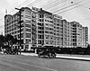
Formerly part of the California College of the Arts from 1922 until 2022; in 2017 CCA sold this property to a housing developer who intends to build between 400-600 apartments
145 Trinity Church
Trinity Church Trinity Church (Oakland, CA).JPG
Trinity Church
February 4, 1982
(#82002167)
525 29th St.
37°49′06″N122°16′05″W / 37.818303°N 122.268047°W / 37.818303; -122.268047 (Trinity Church)
Oakland
146 Tupper and Reed Building
Tupper and Reed Building Tupper & Reed Building (Berkeley, CA).JPG
Tupper and Reed Building
January 21, 1982
(#82002163)
2275 Shattuck Ave.
37°52′05″N122°16′03″W / 37.868131°N 122.267497°W / 37.868131; -122.267497 (Tupper and Reed Building)
Berkeley Now known as Beckett's Pub
147 U.S. Post Office
U.S. Post Office U.S. Post Office (Allston Way, Berkeley, CA).JPG
U.S. Post Office
January 29, 1981
(#81000144)
2000 Allston Way
37°52′08″N122°16′13″W / 37.868931°N 122.270214°W / 37.868931; -122.270214 (U.S. Post Office)
Berkeley
148 Union Iron Works Powerhouse
Union Iron Works Powerhouse Union Iron Works Powerhouse.jpg
Union Iron Works Powerhouse
January 10, 1980
(#80000793)
2308 Webster St.
37°47′12″N122°16′27″W / 37.786667°N 122.274167°W / 37.786667; -122.274167 (Union Iron Works Powerhouse)
Alameda
149 Union Iron Works Turbine Machine Shop
Union Iron Works Turbine Machine Shop Union Iron Works Turbine Machine Shop (Alameda, CA).jpg
Union Iron Works Turbine Machine Shop
April 10, 1980
(#80000794)
2200 Webster St.
37°47′04″N122°16′19″W / 37.784444°N 122.271944°W / 37.784444; -122.271944 (Union Iron Works Turbine Machine Shop)
Alameda
150 University Art Museum
University Art Museum Berkeley Art Museum and Pacific Film Archive.jpeg
University Art Museum
January 8, 2014
(#13001034)
2626 Bancroft Way
37°52′08″N122°15′21″W / 37.8689°N 122.2557°W / 37.8689; -122.2557 (University Art Museum)
Berkeley
151 University High School
University High School University High School (Oakland, CA).jpg
University High School
October 2, 1992
(#92001300)
5714 Martin Luther King Jr. Way
37°50′33″N122°16′10″W / 37.842583°N 122.269508°W / 37.842583; -122.269508 (University High School)
Oakland Now the North Oakland Senior Center and the Children's Hospital Oakland Research Institute
152 University House
University House University House (Berkeley, CA).JPG
University House
March 25, 1982
(#82004652)
Oxford St.
37°52′28″N122°15′44″W / 37.874419°N 122.262228°W / 37.874419; -122.262228 (University House)
Berkeley
153 USS HORNET
USS HORNET USS Hornet (Alameda, CA).JPG
USS HORNET
December 4, 1991
(#91002065)
Alameda Point
37°46′22″N122°18′10″W / 37.772644°N 122.302883°W / 37.772644; -122.302883 (USS HORNET)
Alameda Listed in the National Park Service NRIS database in Bremerton, Washington; moved to Naval Air Station Alameda and opened as a museum in 1998.
154 USS POTOMAC (yacht)
USS POTOMAC (yacht) USS Potomac (Oakland, CA).JPG
USS POTOMAC (yacht)
February 20, 1987
(#87000068)
1660 Embarcadero
37°47′43″N122°16′48″W / 37.795286°N 122.280056°W / 37.795286; -122.280056 (USS POTOMAC (yacht))
Oakland
155 Washington Union High School
Washington Union High School Washington Union High School (Fremont, CA).JPG
Washington Union High School
October 5, 1981
(#81000145)
38442 Fremont Blvd.
37°33′10″N121°59′41″W / 37.552831°N 121.994836°W / 37.552831; -121.994836 (Washington Union High School)
Fremont
156 Wellman Hall
Wellman Hall Wellman Hall (Berkeley, CA).JPG
Wellman Hall
March 25, 1982
(#82004653)
Oxford St.
37°52′23″N122°15′46″W / 37.873047°N 122.262714°W / 37.873047; -122.262714 (Wellman Hall)
Berkeley
157 Wetmore House
Wetmore House Wetmore House (Piedmont, CA).JPG
Wetmore House
April 14, 1978
(#78000653)
342 Bonita Ave.
37°49′27″N122°13′59″W / 37.824275°N 122.233178°W / 37.824275; -122.233178 (Wetmore House)
Piedmont
158 Wheeler Hall
Wheeler Hall Wheeler Hall--UC Berkeley--Panoramic.jpg
Wheeler Hall
March 25, 1982
(#82004654)
Oxford St.
37°52′16″N122°15′32″W / 37.871028°N 122.258997°W / 37.871028; -122.258997 (Wheeler Hall)
Berkeley
159 White Mansion
White Mansion White Mansion (Oakland, CA).JPG
White Mansion
October 31, 1980
(#80000797)
604 E. 17th St.
37°47′49″N122°15′00″W / 37.797003°N 122.249917°W / 37.797003; -122.249917 (White Mansion)
Oakland
160 Women's Athletic Club of Alameda County
Women's Athletic Club of Alameda County Women's Athletic Club of Alameda County 03.jpg
Women's Athletic Club of Alameda County
April 29, 2009
(#09000247)
525 Bellevue Ave.
37°48′28″N122°15′16″W / 37.807769°N 122.254553°W / 37.807769; -122.254553 (Women's Athletic Club of Alameda County)
Oakland

Former listing

[3] Name on the RegisterImageDate listedDate removedLocationCity or townDescription
1 Byrne House February 17, 1978
(#78000643)
November 11, 19901301 Oxford St.
Berkeley Destroyed by fire in 1984. [28] Also known as the Napoleon Bonaparte Byrne House & Grounds

See also

Related Research Articles

<span class="mw-page-title-main">Founders' Rock</span> United States historic place


Founders' Rock is a historical site located on the corner of Hearst Avenue and Gayley Road, in Berkeley, California, U.S.. The spot, according to college lore, where the 12 trustees of the College of California, the nascent University of California, Berkeley, stood on April 16, 1860, to dedicate the property they had just purchased. This is, supposedly, the same spot where Frederick H. Billings stood in 1866 when he remembered Bishop Berkeley's verse — "Westward the course of empire takes its way" — and thus inspired the name of the new city.

<span class="mw-page-title-main">Bernard Maybeck</span> American architect

Bernard Ralph Maybeck was an American architect in the Arts and Crafts Movement of the early 20th century. He was an instructor at University of California, Berkeley. Most of his major buildings were in the San Francisco Bay Area.

<span class="mw-page-title-main">Claremont Hotel & Spa</span> Hotel in the hills of Berkeley, California

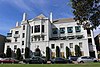
The Claremont Club & Spa, A Fairmont Hotel is an historic, American hotel that is situated at the foot of Claremont Canyon in the Berkeley Hills. Located in the Claremont district, near the intersection of Claremont Avenue and Ashby Avenue, the site straddles the city limits of Berkeley and Oakland. The border between the neighboring cities runs down the former Key System E train right of way that now serves as a pathway between the tennis courts which belong to the Berkeley Tennis Club.

<span class="mw-page-title-main">Berkeley Community Theater</span> Theater in Berkeley, California, U.S.

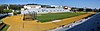
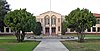
Berkeley Community Theater is a theater located in Berkeley, California, United States, on the campus of Berkeley High School. The theater is administered by the Berkeley Unified School District. It is listed as a Berkeley Landmark since December 7, 1992. It is part of the Berkeley High School Campus Historic District, and the Berkeley Historic Civic Center District.

<span class="mw-page-title-main">National Register of Historic Places listings in Los Angeles County, California</span>

This is a list of the National Register of Historic Places listings in Los Angeles County, California.

<span class="mw-page-title-main">National Register of Historic Places listings in San Francisco</span>

This is intended to be a complete list of the properties and districts on the National Register of Historic Places in San Francisco, California, United States. Latitude and longitude coordinates are provided for many National Register properties and districts; these locations may be seen together in an online map.

<span class="mw-page-title-main">National Register of Historic Places listings in Orange County, California</span>

This is a list of the National Register of Historic Places listings in Orange County, California.

<span class="mw-page-title-main">A. C. Schweinfurth</span> American architect

A. C. Schweinfurth (1864–1900), born Albert Cicero Schweinfurth, was an American architect. He is associated with the First Bay Tradition, an architectural style from the period of the 1880s to early 1920s.

<span class="mw-page-title-main">Episcopal Church of the Good Shepherd (Berkeley, California)</span> Historic church in California, United States

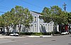
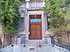
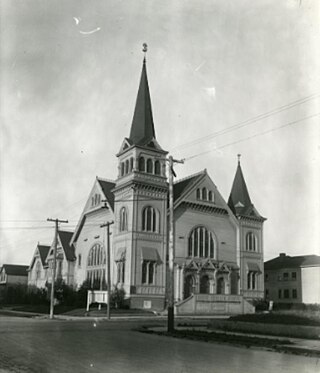
The Episcopal Church of the Good Shepherd is an historic Carpenter Gothic style Episcopal church building located at 1001 Hearst Street at Ninth Street in Berkeley, California. Built in 1878, it was designed in the Carpenter Gothic style of architecture by architect Charles L. Bugbee who was associated with his father Samuel C. Bugbee in the San Francisco firm of S. C. Bugbee & Son. Charles L. Bugbee patterned it after the Carpenter Gothic style Mendocino Presbyterian Church, which the firm had designed in 1867. While all of the Mendocino church's exterior walls are of board and batten siding, only the upper walls of Good Shepherd are board and batten while the lower walls are of Dutch lap weatherboarding. Both churches feature tall side-entrance bell towers, steep gabled roofs and lancet windows, but according to writer Daniella Thompson: "...the Church of the Good Shepherd is considerably more ornate and playful than its severe Presbyterian model, ..." On December 15, 1975, Good Shepherd became the second building in Berkeley to be named an Historic Landmark. On December 1, 1986, it was added to the National Register of Historic Places as the Church of the Good Shepherd-Episcopal.

<span class="mw-page-title-main">St. John's Presbyterian Church (Berkeley, California)</span> Historic church in California, United States

The Julia Morgan Theater, located in the former St. John's Presbyterian Church, is a historic building in Berkeley, California designed by architect Julia Morgan. The wooden building at 2640 College Avenue is built in the American Craftsman style with an exterior wood-shingle finish known as Berkeley Brown Shingle. The church building was desanctified and sold when the congregation moved to a new building in 1974. It now houses the Berkeley Playhouse. The structure is #8 on the city of Berkeley's list of historic landmarks. In 1975 it was added to the National Register of Historic Places.

List table of the properties and districts — listed on the California Historical Landmarks — within Alameda County, Northern California.

<span class="mw-page-title-main">Golden Sheaf Bakery</span> Historic building in Berkeley, California, US

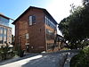
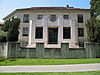
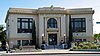
Golden Sheaf Bakery is a historical building and former bakery built in 1905 and located at 2069–2071 Addison Street in Berkeley, California, U.S. It is listed on the National Register of Historic Places since March 31, 1978; listed as a California Historical Landmark since March 31, 1978; and listed as a Berkeley Landmark since October 17, 1977.

<span class="mw-page-title-main">Berkeley Historic Civic Center District</span> Historic district in California, US

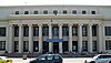
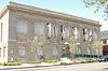
The Berkeley Historic Civic Center District is a 9.9-acre (4.0 ha) historic district in Berkeley, California, U.S. It comprises portions of a five-block area surrounding Martin Luther King Jr. Civic Center Park, primarily made up of civic-related buildings. It has been listed as one of the National Register of Historic Places since December 3, 1998; and listed as a Berkeley Landmark by the City of Berkeley since December 7, 1998.

<span class="mw-page-title-main">Temple of Wings</span> Historic house in Berkeley, California

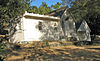
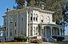
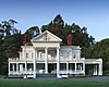
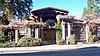
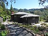
Temple of Wings is a historic Greco-Roman style private estate located at 2800 Buena Vista Way in the La Loma Park neighborhood of Berkeley, California. The main structure was designed by Bernard Maybeck and completed by A. Randolph Monro. It was originally designed as an open-air private home dedicated to modern and contemporary dance. It has been listed by the city as a Berkeley Landmark since January 6, 1992, and is listed in the California State Historic Resources Inventory. It is sometimes known as the Temple of Winds, the Boynton House, and the Charles C. Boynton House.

<span class="mw-page-title-main">Old Berkeley City Hall</span> Historic building in Berkeley, California

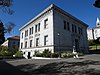
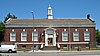
Old Berkeley City Hall, also known as the Maudelle Shirek Building, is a historic building in the Civic Center neighborhood of Berkeley, California, U.S.. It was originally located at 2134 Grove Street. It has is listed as one of the National Register of Historic Places under the name "City Hall" since September 11, 1981; and listed as a Berkeley Landmark by the city since December 15, 1975. It is one of the contributing buildings to the Berkeley Historic Civic Center District.

<span class="mw-page-title-main">Fox Court and Fox Common, Berkeley</span> United States historic place

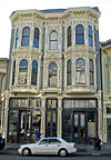
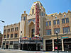
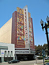
Fox Courtand Fox Common are two historic building complexes located at University Avenue in Berkeley, California, U.S.. Fox Court is listed on the National Register of Historic Places since February 4, 1982; and listed as a Berkeley Landmark by the city since November 20, 1978. Fox Common is listed as a Berkeley Landmark by the city since December 7, 1998.

<span class="mw-page-title-main">Brooklyn Presbyterian Church (Oakland, California)</span> Historic place in Oakland, California

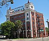
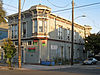
Brooklyn Presbyterian Church is a historical building in Oakland, California. The Brooklyn Presbyterian Church was built in 1887. The building was listed on the National Register of Historic Places on September 18, 2017. The building was also home to the Grace Temple Baptist Church of Oakland. Also at the Brooklyn Presbyterian Church is the Parish Hall also was built in 1887. The 1887 buildings were designed by Samuel Newsom and Joseph Newsom, who also designed the fourth city hall building in Oakland. Architect, George Bordwell, may have been part of the design also. Brooklyn Presbyterian Church used the church from 1887 to 1972. The church has a three-stage 66-foot bell tower and larger stained glass windows. Sunday school classroom wings were added later. After the church closed, the building was vacant for sometime, in 2022 Strive Wealth Builders started converting the church in to a 21,300 square feet 42 unit housing unit and 5,450 square feet for other uses. The building is in the Clinton neighborhood.

References

  1. The latitude and longitude information provided in this table was derived originally from the National Register Information System, which has been found to be fairly accurate for about 99% of listings. Some locations in this table may have been corrected to current GPS standards.
  2. National Park Service, United States Department of the Interior, "National Register of Historic Places: Weekly List Actions", retrieved March 22, 2024.
  3. 1 2 Numbers represent an alphabetical ordering by significant words. Various colorings, defined here, differentiate National Historic Landmarks and historic districts from other NRHP buildings, structures, sites or objects.
  4. "National Register Information System". National Register of Historic Places . National Park Service. July 9, 2010.
  5. The eight-digit number below each date is the number assigned to each location in the National Register Information System database, which can be viewed by clicking the number.
  6. "Joaquin Miller Park Points of Interest" . Retrieved November 18, 2011.
  7. Jones, Carolyn (October 21, 2009). "Joaquin Miller's Abbey to be restored". San Francisco Chronicle . Retrieved November 18, 2011.
  8. 1 2 3 4 "Berkeley Landmarks: Nos. 1–100". Berkeley, CA: Berkeley Architectural Heritage Association. 2009. Retrieved April 28, 2009.
  9. "Old City Hall renamed for Maudelle Shirek". City of Berkeley. March 22, 2007. Retrieved April 28, 2009.
  10. "Berkeley Landmarks: Nos. 101–200". Berkeley, CA: Berkeley Architectural Heritage Association. 2009. Retrieved April 28, 2009.
  11. 1 2 3 4 5 6 7 8 9 Stadtman, Verne A. (1967). "The Centennial Record of the University of California, 1868–1968". Berkeley, CA: University of California Regents. Retrieved April 28, 2009.
  12. "Building History". Blum Center for Developing Economies. University of California, Berkeley. Archived from the original on January 15, 2016. Retrieved July 26, 2015.
  13. "Campus to celebrate grand opening of Blum Hall today at 2 p.m." Berkeley News. University of California, Berkeley. October 8, 2010. Retrieved July 26, 2015.
  14. Thompson, Daniella (June 11, 2005). "Ken Cardwell recalls Bernard Maybeck". Berkeley, CA: Berkeley Architectural Heritage Association. Retrieved April 28, 2009.
  15. Cerny, Susan (August 24, 2002). "Church is a classic worth saving". Berkeley, CA: The Berkeley Daily Planet . Retrieved April 28, 2009.
  16. Thompson, Daniella (May 15, 2008). "East Bay, Then and Now: Schweinfurth's First Unitarian: A Powerhouse of a Church". Berkeley, CA: The Berkeley Daily Planet . Retrieved April 28, 2009.
  17. Cerny, Susan (March 3, 2001). "Founder's Rock marks the beginnings of UC". Berkeley, CA: The Berkeley Daily Planet . Retrieved April 28, 2009.
  18. Cerny, Susan (January 12, 2002). "Fox's romantic retreats hide within busy University Ave". Berkeley, CA: The Berkeley Daily Planet . Retrieved April 28, 2009.
  19. Whiting, Sam (January 13, 2014). "Moving day a success for UC Berkeley's Julia Morgan building". San Francisco Chronicle. Retrieved July 24, 2015.
  20. Cerny, Susan (October 27, 2001). "Berkeley bakery once the largest in the East Bay". Berkeley, CA: The Berkeley Daily Planet . Retrieved April 28, 2009.
  21. Loomis, John A. (July 17, 2004). "House on the hill: Architects of tomorrow get a chance to learn from a midcentury modern masterpiece". San Francisco Chronicle. San Francisco, CA. p. F-1. Retrieved April 28, 2009.
  22. Wainright, Mary-Jo (2007). Pleasanton. Charleston S.C: Arcadia Publishing. p. 118. ISBN   978-0-7385-4761-9.
  23. "National Historic Landmarks Program: Lake Merritt Wild Duck Refuge". National Park Service. Archived from the original on February 19, 2012. Retrieved November 18, 2011.
  24. Tramble, Thomas; Tramble, Wilma (2007). The Pullman Porters and West Oakland. Images of America. Arcadia Publishing. p. 68. ISBN   978-0-7385-4789-3.
  25. Curtis, Nancy C. (1996). Black heritage sites: an African American odyssey and finder's guide. ALA Editions. p. 587. ISBN   978-0-8389-0643-9.
  26. "Wards Demolition 'A Sad Occasion'". Oakland Post. Oakland, California: Alameda Publishing Corp. February 14, 2001. p. 4.
  27. Thompson, Daniella (October 27, 2006). "East Bay Then and Now: East Bay Buildings Inspired by Precedent, Part II". Berkeley, CA: The Berkeley Daily Planet . Retrieved April 28, 2009.
  28. "Fire hits oldest Berkeley house". The Oakland Tribune . December 21, 1984. p. A-9. Retrieved May 28, 2022 via Newspapers.com.