National Register of Historic Places listings in Calaveras County, California

Last updated

Location of Calaveras County in California Map of California highlighting Calaveras County.svg
Location of Calaveras County in California

This is a list of the National Register of Historic Places listings in Calaveras County, California. This is intended to be a complete list of the properties and districts on the National Register of Historic Places in Calaveras County, California, United States. Latitude and longitude coordinates are provided for many National Register properties and districts; these locations may be seen together in an online map. [1]

Contents

There are 17 properties and districts listed on the National Register in the county.


    This National Park Service list is complete through NPS recent listings posted March 10, 2023. [2]

Map all coordinates using: OpenStreetMap  
Download coordinates as: KML

Current listings

[3] Name on the Register [4] ImageDate listed [5] Location City or townDescription
1 Altaville Grammar School
Altaville Grammar School 2009-0724-CA-AltavilleGrammarSchool.jpg
Altaville Grammar School
August 24, 1979
(#79000471)
125 N. Main St.
38°04′58″N120°33′39″W / 38.082778°N 120.560833°W / 38.082778; -120.560833 (Altaville Grammar School)
Altaville
2 Angels Hotel
Angels Hotel 2009-0724-CA-AngelsHotel.jpg
Angels Hotel
March 24, 1972
(#72000220)
Main St. at Birds Way
38°04′07″N120°32′21″W / 38.06871°N 120.53910°W / 38.06871; -120.53910 (Angels Hotel)
Angels Camp
3 Calaveras County Bank
Calaveras County Bank 2009-0724-CA-CalaverasCountyBank.jpg
Calaveras County Bank
August 1, 1985
(#85001683)
1239 S. Main St.
38°04′10″N120°32′23″W / 38.06931°N 120.53983°W / 38.06931; -120.53983 (Calaveras County Bank)
Angels Camp
4 Calaveras County Courthouse
Calaveras County Courthouse 2009-0724-CA-SanAndreas-CalaverasCtyCt.jpg
Calaveras County Courthouse
February 28, 1972
(#72000221)
Main St.
38°11′48″N120°40′45″W / 38.196667°N 120.679167°W / 38.196667; -120.679167 (Calaveras County Courthouse)
San Andreas
5 Calaveritas Creek Bridge November 6, 2015
(#15000767)
Calaveritas Rd. at Calaveritas Cr.
38°09′22″N120°36′35″W / 38.1562°N 120.6098°W / 38.1562; -120.6098 (Calaveritas Creek Bridge)
Calaveritas
6 Chinatown Gardens Archaeological District March 9, 2023
(#100008712)
Address Restricted
Mokelumne Hill
7 Sam Choy Brick Store
Sam Choy Brick Store 2009-0724-CA-SamChoyBrickStore.jpg
Sam Choy Brick Store
September 20, 1984
(#84000759)
Bird Way
38°04′09″N120°32′18″W / 38.069167°N 120.538333°W / 38.069167; -120.538333 (Sam Choy Brick Store)
Angels Camp
8 Copperopolis Armory
Copperopolis Armory 2009-0724-CA-052-CopperopolisArmory.jpg
Copperopolis Armory
December 30, 1997
(#97001588)
695 Main St.
37°58′34″N120°38′04″W / 37.976111°N 120.634444°W / 37.976111; -120.634444 (Copperopolis Armory)
Copperopolis
9 Copperopolis Congregational Church
Copperopolis Congregational Church 2009-0724-CA-CopperopolisCongregational.jpg
Copperopolis Congregational Church
December 30, 1997
(#97001587)
411 Main St.
37°58′47″N120°38′16″W / 37.979722°N 120.637778°W / 37.979722; -120.637778 (Copperopolis Congregational Church)
Copperopolis
10 Douglas Flat School
Douglas Flat School Douglas Flat School.JPG
Douglas Flat School
May 24, 1973
(#73000397)
NE of Vallecito on SR 4
38°07′01″N120°27′11″W / 38.116944°N 120.453056°W / 38.116944; -120.453056 (Douglas Flat School)
Douglas Flat
11 Honigsberger Store
Honigsberger Store 2009-0724-CA-052-HonigsbergerStore.jpg
Honigsberger Store
April 2, 1992
(#92000310)
665 Main St.
37°58′34″N120°38′07″W / 37.976111°N 120.635278°W / 37.976111; -120.635278 (Honigsberger Store)
Copperopolis
12 Murphys Grammar School
Murphys Grammar School Murphys Grammar School.JPG
Murphys Grammar School
June 8, 1973
(#73000398)
Jones St.
38°08′10″N120°27′28″W / 38.13618°N 120.45790°W / 38.13618; -120.45790 (Murphys Grammar School)
Murphys
13 Murphys Hotel
Murphys Hotel MurphysHotel.jpg
Murphys Hotel
November 23, 1971
(#71000134)
Main and Algiers Sts.
38°08′15″N120°27′50″W / 38.1375°N 120.463889°W / 38.1375; -120.463889 (Murphys Hotel)
Murphys Also known as Mitchler Hotel
14 Reed's Store
Reed's Store 2009-0724-CA-052-ReedsStore.jpg
Reed's Store
April 2, 1992
(#92000309)
679 Main St.
37°58′34″N120°38′05″W / 37.976111°N 120.634722°W / 37.976111; -120.634722 (Reed's Store)
Copperopolis
15 John J. Snyder House
John J. Snyder House 2009-0724-CA-SanAndreas-SnyderHouse.jpg
John J. Snyder House
August 2, 1984
(#84000760)
247 W. St. Charles St.
38°11′51″N120°41′06″W / 38.1975°N 120.685°W / 38.1975; -120.685 (John J. Snyder House)
San Andreas
16 Thorn House
Thorn House 2009-0724-CA-SanAndreas-ThornHouse.jpg
Thorn House
February 23, 1972
(#72000222)
87 E. St. Charles St.
38°11′43″N120°40′40″W / 38.195278°N 120.677778°W / 38.195278; -120.677778 (Thorn House)
San Andreas
17 Utica Mansion
Utica Mansion Utica Mansion.JPG
Utica Mansion
May 31, 1984
(#84000764)
1103 Bush St.
38°04′17″N120°32′35″W / 38.07126°N 120.54310°W / 38.07126; -120.54310 (Utica Mansion)
Angels Camp

See also

Related Research Articles

<span class="mw-page-title-main">National Register of Historic Places listings in Humboldt County, California</span>

This is a list of the National Register of Historic Places listings in Humboldt County, California.

<span class="mw-page-title-main">National Register of Historic Places listings in Riverside County, California</span>

This is a list of the National Register of Historic Places listings in Riverside County, California.

<span class="mw-page-title-main">National Register of Historic Places listings in Santa Cruz County, California</span>

This is a list of the National Register of Historic Places listings in Santa Cruz County, California.

<span class="mw-page-title-main">National Register of Historic Places listings in Fresno County, California</span>

This is a list of the National Register of Historic Places listings in Fresno County, California.

<span class="mw-page-title-main">National Register of Historic Places listings in Tulare County, California</span>

This is a list of the National Register of Historic Places listings in Tulare County, California.

<span class="mw-page-title-main">National Register of Historic Places listings in Nevada County, California</span>

This is a list of the National Register of Historic Places listings in Nevada County, California.

<span class="mw-page-title-main">National Register of Historic Places listings in Shasta County, California</span>

This is a list of the National Register of Historic Places listings in Shasta County, California.

<span class="mw-page-title-main">National Register of Historic Places listings in Tuolumne County, California</span>

This is a list of the National Register of Historic Places listings in Tuolumne County, California.

<span class="mw-page-title-main">National Register of Historic Places listings in Colusa County, California</span>

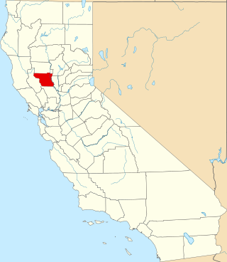
This is a list of the National Register of Historic Places listings in Colusa County, California.

<span class="mw-page-title-main">National Register of Historic Places listings in Lassen County, California</span>

This is a list of the National Register of Historic Places listings in Lassen County, California.

<span class="mw-page-title-main">National Register of Historic Places listings in Mono County, California</span>

This is a list of the National Register of Historic Places listings in Mono County, California.

<span class="mw-page-title-main">National Register of Historic Places listings in Plumas County, California</span>

This is a list of the National Register of Historic Places listings in Plumas County, California.

<span class="mw-page-title-main">National Register of Historic Places listings in Alpine County, California</span>

This is a list of the National Register of Historic Places listings in Alpine County, California.

<span class="mw-page-title-main">National Register of Historic Places listings in Stanislaus County, California</span>

This is a list of the National Register of Historic Places listings in Stanislaus County, California.

<span class="mw-page-title-main">National Register of Historic Places listings in Modoc County, California</span>

This is a list of the National Register of Historic Places listings in Modoc County, California.

<span class="mw-page-title-main">National Register of Historic Places listings in Amador County, California</span>

This is a list of the National Register of Historic Places listings in Amador County, California.

<span class="mw-page-title-main">National Register of Historic Places listings in Inyo County, California</span>

This is a list of the National Register of Historic Places listings in Inyo County, California.

<span class="mw-page-title-main">National Register of Historic Places listings in Merced County, California</span>

This is a list of the National Register of Historic Places listings in Merced County, California.

<span class="mw-page-title-main">National Register of Historic Places listings in Imperial County, California</span>

This is a list of the National Register of Historic Places listings in Imperial County, California.

<span class="mw-page-title-main">National Register of Historic Places listings in Trinity County, California</span>

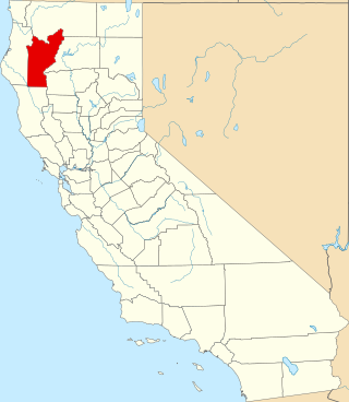
This is a list of the National Register of Historic Places listings in Trinity County, California.

References

  1. The latitude and longitude information provided in this table was derived originally from the National Register Information System, which has been found to be fairly accurate for about 99% of listings. Some locations in this table may have been corrected to current GPS standards.
  2. National Park Service, United States Department of the Interior, "National Register of Historic Places: Weekly List Actions", retrieved March 10, 2023.
  3. Numbers represent an alphabetical ordering by significant words. Various colorings, defined here, differentiate National Historic Landmarks and historic districts from other NRHP buildings, structures, sites or objects.
  4. "National Register Information System". National Register of Historic Places . National Park Service. July 9, 2010.
  5. The eight-digit number below each date is the number assigned to each location in the National Register Information System database, which can be viewed by clicking the number.