Poverty Bar, California

Last updated

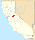
Poverty Bar [1] is a former settlement in Calaveras County, California, active from c. 1850s to 1862, and now covered by the waters of Camanche Reservoir. The nearest major town is Campo Seco, California. [1] [2]

Contents

History

Poverty Bar was founded south of the Mokelumne River from Lancha Plana in Amador County as a gold mining town during the California Gold Rush, nearby Camanche, California, Cat Camp, and Sand Hill. A post office was opened in Poverty Bar in 1858 and closed in 1864. [1]

Poverty Bar had a major fire on the night of September 7, 1859. The fire originated in the grocery store of Lorengo & Co., near the center of the town, and spread so rapidly in different directions that in a few minutes the entire town was in flames. It appeared to have been arson, the second such incident there during that summer. [3]

During the American Civil War the town raised the Union Guard a California Militia Company in 1861 and maintained it until its declining population forced it to be moved. "On July 23, 1866, the company was reorganized and their headquarters moved to Campo Seco." [4]

In 1962, before the Comanche Reservoir was filled, the graves in the cemetery of Poverty Bar were transferred to the Pioneer Cemetery, and the People's Cemetery in San Andreas, California. [5] [6]

Related Research Articles

<span class="mw-page-title-main">Calaveras County, California</span> County in California, United States

Calaveras County, officially the County of Calaveras, is a county in both the Gold Country and High Sierra regions of the U.S. state of California. As of the 2020 census, the population was 45,292. The county seat is San Andreas. Angels Camp is the county's only incorporated city. Calaveras is Spanish for "skulls"; the county was reportedly named for the remains of Native Americans discovered by the Spanish explorer Captain Gabriel Moraga.

<span class="mw-page-title-main">San Andreas, California</span> Census-designated place in California, United States

San Andreas is an unincorporated census-designated place and the county seat of Calaveras County, California. The population was 2,783 at the 2010 census, up from 2,615 at the 2000 census. Like most towns in the region, it was founded during the California Gold Rush. The town is located on State Route 49 and is registered as California Historical Landmark #252.

<span class="mw-page-title-main">Valley Springs, California</span> Census designated place in California, United States

Valley Springs is a census-designated place (CDP) in Calaveras County, California, United States, in the foothills of the Sierra Nevada Mountain Range. Valley Springs is registered as a California Historical Landmark, number 251.

<span class="mw-page-title-main">Mokelumne River</span> River in northern California

The Mokelumne River is a 95-mile (153 km)-long river in northern California in the United States. The river flows west from a rugged portion of the central Sierra Nevada into the Central Valley and ultimately the Sacramento–San Joaquin River Delta, where it empties into the San Joaquin River-Stockton Deepwater Shipping Channel. Together with its main tributary, the Cosumnes River, the Mokelumne drains 2,143 square miles (5,550 km2) in parts of five California counties. Measured to its farthest source at the head of the North Fork, the river stretches for 157 miles (253 km).

<span class="mw-page-title-main">Camanche, California</span> Former settlement in California, United States

Camanche is a former settlement in Calaveras County, California, United States. Located at an elevation of 220 feet, the town was once called Limerick, before it was renamed to Camanche in 1849. The settlement of Camanche is now submerged under Camanche Reservoir.

Campo Seco is an unincorporated community in Calaveras County, California. It sits at an elevation of 564 feet above sea level and is located at 38°13′38″N120°51′12″W. The community is in ZIP code 95226 and area code 209.

Milton is an unincorporated community in Calaveras County, California. It lies at an elevation of 394 feet and is located at 38°01′55″N120°51′08″W. The community is in ZIP code 95684 and area code 209.

Jenny Lind is an unincorporated community in Calaveras County, California. It lies at an elevation of 253 feet and is located at 38°6′N120°52′W. The community is in ZIP code 95252 and area code 209.

Carson Hill is a ghost town in Calaveras County, California. It sits at an elevation of 1447 feet above sea level and is located at 38°01′42″N120°30′24″W, about 4 miles (6.4 km) south-southeast of Angels Camp. It was one of the most productive mining camps in the state, with nearly $26 million in gold and quartz found in the area. Carson Hill is registered as California Historical Landmark #274. The town was served by the Sierra Railway's branchline to Angels Camp until 1935.

Fourth Crossing is an unincorporated community in Calaveras County, California. It lies at an elevation of 922 feet and is located on State Route 49 at 38°07′53″N120°38′05″W. The community is in ZIP code 95248 and area code 209.

<span class="mw-page-title-main">Area codes 209 and 350</span> Area codes in northern Central Valley, California

Area codes 209 and 350 are telephone area codes in the North American Numbering Plan (NANP) for the U.S. state of California. Their service area includes Stockton, Modesto, Turlock, Merced, Winton, Atwater, Livingston, Manteca, Ripon, Tracy, Lodi, Galt, Sonora, Los Banos, San Andreas, Mariposa, and Yosemite, the northern San Joaquin Valley, and the Sierra Foothills.

Sheep Ranch is an unincorporated community in Calaveras County, California. It lies at an elevation of 2359 feet.

Happy Valley is an unincorporated community in Calaveras County, California. It lies at an elevation of 1509 feet.

Rich Gulch is an unincorporated community in Calaveras County, California, 5 miles (8.0 km) east-northeast of Mokelumne Hill. It lies at an elevation of 1903 feet.

Telegraph City was an unincorporated town in Calaveras County, California. It lies at an elevation of 653 feet. First named Grasshopper City when it was started in the early 1860s, it was renamed in the 1870s for its location on the telegraph line between Stockton and Sonora. A post office operated here from 1862 to 1894.

Blue Mountain City is a former settlement in Calaveras County, California, along Licking Fork, approximately 20 miles (32 km) northeast of Mountain Ranch. The town was built on a flat bench of land above the mining camp which perched on a steep canyon slope on the west side of Licking Fork, just over a mile downstream from the headwaters. The town was first announced in January, 1863. The Heckendorn Gold and Silver Mining Company was organized by July, with C. C. Bowman as its secretary. A post office operated in Blue Mountain from 1863 to 1864.

Greasertown is a former gold rush settlement in Calaveras County, 4 miles (6.4 km) west of San Andreas, on the west side of the Calaveras River. It was first mentioned in a newspaper in 1851. When it caught fire the next year, "Spanish incendiaries" were blamed which so angered the locals that they drove out all the Hispanics they could find. However, it survived at least until 1868. It was submerged when the first Hogan Dam on the Calaveras River was built in the late 1920s. Greasertown was not renamed Petersburg; they were separate communities a mile apart. Petersburg was founded in 1858.

<span class="mw-page-title-main">Camanche Reservoir</span> Reservoir in Amador, Calaveras and San Joaquin counties

Camanche Reservoir is an artificial lake in the San Joaquin Valley in California in the United States, at the juncture of Amador, Calaveras, and San Joaquin counties. Its waters are impounded by Camanche Dam, which was completed in 1963. Camanche Reservoir is a source of water for industrial and municipal purposes and also provides flood control.

<span class="mw-page-title-main">Camanche Dam</span> Dam in San Joaquin County, California

Camanche Dam is an earthfill Dam on the Mokelumne River in the central California, about 20 mi (32 km) from East Lodi. The dam and reservoir lie in the Sierra Nevada foothills in San Joaquin County. Construction of Camanche Dam was started in 1963 and completed in 1964. East Bay Municipal Utilities District (EBMUD) owns and operates it. The purpose of Camanche Dam and reservoir is to provide flood control, water flows for agriculture, habitat for fisheries and recreation for community.

The Pioneer Cemetery, formerly known as the North Branch Cemetery, is a defunct cemetery established in c. 1851, and located along California State Route 12 in San Andreas, Calaveras County, California. It is the oldest known cemetery in Calaveras County.

References

  1. 1 2 3 Durham, David L. (1998). California's Geographic Names: A Gazetteer of Historic and Modern Names of the State. Clovis, Calif.: Word Dancer Press. p. 817. ISBN   1-884995-14-4.
  2. Poverty Bar, USGS WALLACE Quad, California, Topographic Map
  3. Weekly Stockton Democrat, Stockton, San Joaquin Co., CA, Sunday, 11 Sept 1859; from Ancestry.co.uk.
  4. Outline History of Calif. National Guard, Vol. 2, #107.
  5. Mildred Brooke Hoover, Douglas E. Kyle Historic spots in California, Stanford University Press, 2002, pg. 46.
  6. "California Historical Landmark #271: Pioneer Cemetery in Calaveras County". noehill.com. Retrieved 2023-01-08.

38°13′30″N120°54′30″W / 38.22500°N 120.90833°W / 38.22500; -120.90833