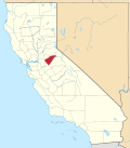
Valley Springs | |
---|---|
Coordinates: 38°11′30″N120°49′45″W / 38.19167°N 120.82917°W | |
Country | United States |
State | California |
County | Calaveras |
Area | |
• Total | 9.875 sq mi (25.579 km2) |
• Land | 9.872 sq mi (25.570 km2) |
• Water | 0.003 sq mi (0.009 km2) 0.04% |
Elevation | 669 ft (204 m) |
Population | |
• Total | 3,779 |
• Density | 380/sq mi (150/km2) |
Time zone | UTC-8 (Pacific) |
• Summer (DST) | UTC-7 (PDT) |
ZIP codes | 95226, 95252 |
Area code | 209 |
FIPS code | 06-81890 |
GNIS feature IDs | 1660090, 2409398 |
Website | Official website |
Reference no. | 251 |
Valley Springs (formerly known as Spring Valley and Valley Spring) is a census-designated place (CDP) in Calaveras County, California, United States, in the foothills of the Sierra Nevada Mountain Range. Valley Springs is registered as a California Historical Landmark, number 251. [3]
The earliest inhabitants of Valley Springs were Native Americans, specifically the Mi-Wuk and Yokuts tribes. Evidence of their presence includes grinding rocks found in the area. These tribes gathered acorns for trade and food before returning to their homes in the spring. The Mi-Wuk were later driven further into the hills due to the influx of gold miners. [4]
In 1849, the first saloon and store opened in the Valley Springs region. This development was followed by the establishment of small farms and large ranches to provide food for settlers. Stage stops emerged along what is now Highway 26, and lodging developed. Additionally, what is now Highway 12 linked roads to the surrounding areas. [4]
The need for more affordable freight rates, expansion of tourism to Big Trees, and timber interests led to the construction of a quicker mode of transport. Land sold quickly, and roads and buildings were constructed as settlers arrived. [4]
The San Joaquin & Sierra Nevada Railroad built a three-foot narrow gauge line from Brack’s Landing on the Mokelumne River to Valley Springs, completed in April 1885 at a cost of $409,570. [5] On April 25, 1885, the first train arrived at Valley Springs station, initially just a tent. Valley Springs became a center of freight distribution, with residents able to reach San Francisco in 7.5 hours, Stockton in 2.5 hours, and Sacramento in 3 hours by train. [4]
In September 1895, a large fire destroyed much of the central town. Despite rebuilding efforts, Valley Springs’ population growth remained below 1% per year. Electricity was installed in 1899. Around 1904, Southern Pacific converted the rail line to standard gauge. [5] However, from 1910 to 1930, the population drastically decreased, and by 1923, Valley Springs had only 350 residents. [4]
In 1925, Southern Pacific extended the rail line 13 miles east to Kentucky House to serve the Calaveras Cement Company. [5] This extension facilitated the development of the Pardee Dam and the shipment of cement to customers such as the Bay Area. Major projects like the McClellan and Travis Air Force bases, San Francisco Airport, Central Valley dams, and the San Francisco-Oakland Bay Bridge were built using cement transported from Valley Springs. The construction of the Hogan Dam and Pardee Dam increased employment. Local industries, including lumber, forest products, cement, and clay, boosted shipping needs. Agriculture remained the primary occupation, focusing on grains, livestock, and small-scale wine grapes and olives. Valley Springs’ strategic location was key to its importance. The 1930s and 1940s saw a 6% annual population increase. Population growth flattened in the 1950s but surged again in the 1960s due to the development of the Camanche Reservoir and the expansion of the Hogan Reservoir. [4]
Passenger service ended around 1932, but the rail line continued to operate as a freight line until the cement plant closed, with the last shipment in 1983. [5]
The 1970s experienced further population increases from developments like Rancho Calaveras and the La Contenta Golf Course. Despite the closure of major manufacturing in the 1980s, Valley Springs continues to grow in population and development, contributing to the development of major cities in the valley and the bay. [4]
A post office was opened in Valley Springs in 1872, closed in 1879, and re-established in 1882. [6] A post office currently operates in the town.
According to the United States Census Bureau, the CDP has a total area of 9.9 square miles (26 km2), 99.96% of it is land.
Valley Springs has a Mediterranean climate typical of the Sierra Nevada foothills. Winters are cool and wet with mild days, chilly nights, and substantial rainfall. Summers are hot and dry with very hot days, cool nights, and minimal rainfall. Due to the orographic effect, rainfall in all seasons is significantly greater than on the valley floor to the west.
Climate data for United States | |||||||||||||
---|---|---|---|---|---|---|---|---|---|---|---|---|---|
Month | Jan | Feb | Mar | Apr | May | Jun | Jul | Aug | Sep | Oct | Nov | Dec | Year |
Mean daily maximum °F (°C) | 55 (13) | 59 (15) | 63 (17) | 69 (21) | 80 (27) | 88 (31) | 94 (34) | 93 (34) | 89 (32) | 77 (25) | 65 (18) | 55 (13) | 74 (23) |
Daily mean °F (°C) | 46.0 (7.8) | 49.5 (9.7) | 52.5 (11.4) | 57.0 (13.9) | 65.0 (18.3) | 72.0 (22.2) | 76.4 (24.7) | 78.0 (25.6) | 73.5 (23.1) | 63.0 (17.2) | 53.5 (11.9) | 46.0 (7.8) | 61.0 (16.1) |
Mean daily minimum °F (°C) | 37 (3) | 40 (4) | 42 (6) | 45 (7) | 50 (10) | 56 (13) | 61 (16) | 62 (17) | 58 (14) | 49 (9) | 42 (6) | 37 (3) | 48 (9) |
Average precipitation inches (mm) | 4.13 (105) | 3.86 (98) | 3.82 (97) | 2.11 (54) | 1.18 (30) | 0.28 (7.1) | 0 (0) | 0.04 (1.0) | 0.23 (5.8) | 1.3 (33) | 2.28 (58) | 3.94 (100) | 23.17 (588.9) |
Source: [7] |
Summers are typically very warm to hot, springs and falls are temperate, and winters are cool with a slight dusting of snow and/or frost. Hot, dry summers make Valley Springs fire-prone; however, three fire stations, lake water, and adequate road access assist in extinguishing fires expediently. [8]
Valley Springs' total population is 3,553, at 50.00% each male and female (with 1 more male than female). [9]
Valley Springs voters are a majority Republican, about one-third Democrat, and roughly 9% independent. This is a greater percentage Republican and Independent than the United States average, and a lesser percentage Democrat. [10]
In the state legislature, Valley Springs is in the 4th Senate District , represented by Republican Marie Alvarado-Gil, [11] and the 8th Assembly District , represented by Republican David Tangipa. [12]
Federally, Valley Springs is in California's 5th congressional district , represented by Republican Tom McClintock. [13]
Calaveras County, officially the County of Calaveras, is a county in both the Gold Country and High Sierra regions of the U.S. state of California. As of the 2020 census, the population was 45,292. The county seat is San Andreas. Angels Camp is the county's only incorporated city. Calaveras is Spanish for "skulls"; the county was reportedly named for the remains of Native Americans discovered by the Spanish explorer Captain Gabriel Moraga.
Kern County is a county located in the U.S. state of California. As of the 2020 census, the population was 909,235. Its county seat is Bakersfield.
Nevada County is a county located in the U.S. state of California, in the Sierra Nevada. As of the 2020 census, its population was 102,241. The county seat is Nevada City. Nevada County comprises the Truckee-Grass Valley micropolitan statistical area, which is also included in the Sacramento-Roseville combined statistical area, part of the Mother Lode Country.
San Joaquin County, officially the County of San Joaquin, is a county located in the U.S. state of California. As of the 2020 census, the population was 779,233. The county seat is Stockton.
Tuolumne County, officially the County of Tuolumne, is a county located in the U.S. state of California. As of the 2020 census, the population was 55,620. The county seat and only incorporated city is Sonora.
The Central Valley is a broad, elongated, flat valley that dominates the interior of California. It is 40–60 mi (60–100 km) wide and runs approximately 450 mi (720 km) from north-northwest to south-southeast, inland from and parallel to the Pacific coast of the state. It covers approximately 18,000 sq mi (47,000 km2), about 11% of California's land area. The valley is bounded by the Coast Ranges to the west and the Sierra Nevada to the east.
Murphys, originally Murphys New Diggings then Murphy's Camp, is an unincorporated village located in the foothills of the Sierra Nevada mountains in Calaveras County, California, United States. The population was 2,213 at the 2010 census, up from 2,061 at the 2000 census.
San Andreas is an unincorporated census-designated place and the county seat of Calaveras County, California. The population was 2,783 at the 2010 census, up from 2,615 at the 2000 census. Like most towns in the region, it was founded during the California Gold Rush. The town is located on State Route 49 and is registered as California Historical Landmark #252.
Calistoga is a city in Napa County, California, United States. Located in the North Bay region of the San Francisco Bay Area, the city had a population of 5,228 as of the 2020 census.
Grass Valley is a city in Nevada County, California, United States. As of the 2010 United States Census, its population was 12,860. Situated at roughly 2,500 feet (760 m) in elevation in the western foothills of the Sierra Nevada mountain range, this northern Gold Country city is 57 miles (92 km) by car from Sacramento and 88 miles (142 km) west of Reno.
Folsom is a city in Sacramento County, California, United States. The population was 80,454 at the 2020 census, up from 72,203 residents at the 2010 census.
Rancho Calaveras is a census-designated place (CDP) in Calaveras County, California, United States. The population was 5,325 at the 2010 census, up from 4,182 at the 2000 census.
The Miwok are members of four linguistically related Native American groups indigenous to what is now Northern California, who traditionally spoke one of the Miwok languages in the Utian family. The word Miwok means people in the Miwok languages.
The Mokelumne River is a 95-mile (153 km)-long river in northern California in the United States. The river flows west from a rugged portion of the central Sierra Nevada into the Central Valley and ultimately the Sacramento–San Joaquin River Delta, where it empties into the San Joaquin River-Stockton Deepwater Shipping Channel. Together with its main tributary, the Cosumnes River, the Mokelumne drains 2,143 square miles (5,550 km2) in parts of five California counties. Measured to its farthest source at the head of the North Fork, the river stretches for 157 miles (253 km).
The Stanislaus River is a tributary of the San Joaquin River in north-central California in the United States. The main stem of the river is 96 miles (154 km) long, and measured to its furthest headwaters it is about 150 miles (240 km) long. Originating as three forks in the high Sierra Nevada, the river flows generally southwest through the agricultural San Joaquin Valley to join the San Joaquin south of Manteca, draining parts of five California counties. The Stanislaus is known for its swift rapids and scenic canyons in the upper reaches, and is heavily used for irrigation, hydroelectricity and domestic water supply.
The San Joaquin and Sierra Nevada Railroad was originally built as a 3 ft narrow gauge that ran from Bracks Landing to Woodbridge and Lodi and then east to the Sierra Nevada foothill town of Valley Springs. The railroad was incorporated on March 28, 1882 and construction was completed on April 15, 1885. The railroad was built as a common carrier with copper mining being its primary traffic. The track was built using 35/40 lb steel rails.
Pardee Dam is a 345-foot (105 m)-high structure across the Mokelumne River which marks the boundary between Amador and Calaveras Counties, located in the foothills of the Sierra Nevada approximately 30 miles (48 km) northeast of Stockton.
Burson is an unincorporated community in Calaveras County, California. It lies at an elevation of 98 feet. Although unincorporated, Burson has the ZIP code of 95225.
Camanche Reservoir is an artificial lake in the San Joaquin Valley in California in the United States, at the juncture of Amador, Calaveras, and San Joaquin counties. Its waters are impounded by Camanche Dam, which was completed in 1963. Camanche Reservoir is a source of water for industrial and municipal purposes and also provides flood control.
The Mokelumne Aqueduct is a 95-mile (153 km) water conveyance system in central California, United States. The aqueduct is supplied by the Mokelumne River and provides water to 35 municipalities in the East Bay in the San Francisco Bay Area. The aqueduct and the associated dams, pipelines, treatment plants and hydroelectric system are owned and operated by the East Bay Municipal Utility District (EBMUD) and provide over 90 percent of the water used by the agency.