Peter L. Traver Building

Last updated
Peter L. Traver Building
Murphys Old Timers Museum
USA California location map.svg
Red pog.svg
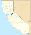
Location of Peter L. Traver Building
Murphys Old Timers Museum in California
Usa edcp location map.svg
Red pog.svg
Peter L. Traver Building (the United States)
Location470 Main Street
Murphys, California
Coordinates 38°08′16″N120°27′54″W / 38.137800°N 120.465100°W / 38.137800; -120.465100
Built1856
Reference no.266

Peter L. Traver Building is a historical building in Murphys, California in Calaveras County. The building was built by Peter L. Traver in 1856. The building is the oldest stone building in Murphys. Being made of stone, built with iron shutters and Peter L. Traver Building placing sand on the roof protected the building from the town's many fires. Fire swept through the town in 1859, 1874, and 1893. Peter L. Traver was a gold Rush miner who opened a general store in the building. Traver sold the building to the Manuel Estate Company in 1883. Over the years the building has been a general store, warehouse, a Wells Fargo office, and auto repair garage. From age and lack of repairs, the building was set to be taken down in 1949. Dr. Coke Wood and his wife Ethelyn after hearing this, purchased and restored the building. [1] The descendants of the Woods family have turned the Peter L. Traver Building into the Murphys Old Timers Museum. In 2016 the Museum became a community museum, run by volunteers and supported by donations and gift shop sales. Many in the community have donated artifacts to the Museum about Murphys' gold-rush history. [2] The Peter L. Traver Building is a California Historical Landmark No. 266. [3] [4]

See also

Related Research Articles

<span class="mw-page-title-main">Calaveras County, California</span> County in California, United States

Calaveras County, officially the County of Calaveras, is a county in both the Gold Country and High Sierra regions of the U.S. state of California. As of the 2020 census, the population was 45,292. The county seat is San Andreas. Angels Camp is the county's only incorporated city. Calaveras is Spanish for "skulls"; the county was reportedly named for the remains of Native Americans discovered by the Spanish explorer Captain Gabriel Moraga.

<span class="mw-page-title-main">Murphys, California</span> Census designated place in California, United States

Murphys, originally Murphys New Diggings then Murphy's Camp, is an unincorporated village located in the foothills of the Sierra Nevada mountains in Calaveras County, California, United States. The population was 2,213 at the 2010 census, up from 2,061 at the 2000 census.

<span class="mw-page-title-main">Gold Country</span> Historic gold-mining region in Northern California

The Gold Country is a historic region in the northern portion of the U.S. state of California, that is primarily on the western slope of the Sierra Nevada. It is famed for the mineral deposits and gold mines that attracted waves of immigrants, known as the 49ers, during the 1849 California Gold Rush.

<span class="mw-page-title-main">California State Route 49</span> Highway in California

State Route 49 is a north–south state highway in the U.S. state of California that passes through many historic mining communities of the 1849 California gold rush and it is known as the Golden Chain Highway. The highway's creation was lobbied by the Mother Lode Highway Association, a group of locals and historians seeking a single highway to connect many relevant locations along the Gold Rush to honor the 49ers. One of the bridges along SR 49 is named for the leader of the association, Archie Stevenot.

<span class="mw-page-title-main">Hotel Léger</span> Historic site in Mokelumne Hill, California

The Hotel Léger, in Mokelumne Hill, California is one of the oldest hotels still operating in California. The hotel and courthouse building are registered as California Historical Landmark #663, and located in present-day Calaveras County, California.

Greasertown is a former gold rush settlement in Calaveras County, 4 miles (6.4 km) west of San Andreas, on the west side of the Calaveras River. It was first mentioned in a newspaper in 1851. When it caught fire the next year, "Spanish incendiaries" were blamed which so angered the locals that they drove out all the Hispanics they could find. However, it survived at least until 1868. It was submerged when the first Hogan Dam on the Calaveras River was built in the late 1920s. Greasertown was not renamed Petersburg; they were separate communities a mile apart. Petersburg was founded in 1858.

Poverty Bar is a former settlement in Calaveras County, California, active from c. 1850s to 1862, and now covered by the waters of Camanche Reservoir. The nearest major town is Campo Seco, California.

Middle Bar is a former mining town on the Mokelumne River in Amador County, California. It is a California Historical Landmark.

<span class="mw-page-title-main">Calaveras County Courthouse</span> United States historic place

The Calaveras County Courthouse is a historic courthouse built in 1867 in San Andreas, California. The brick courthouse contained the county's courtroom, jail, and sheriff's office; until 1888, executions were also conducted in the building. The building's jail held outlaw Black Bart, a notorious Northern California highwayman, during his 1883 trial. The county's Hall of Records was built in front of the courthouse in 1893; the two buildings nearly touch and are considered part of the same complex.

The Byrne's Ferry bridge was a historic cantilevered covered bridge across the Stanislaus River between Calaveras County and Tuolumne County, California. Originally built during the California Gold Rush, the bridge was located on the O'Byrne's Ferry road between Chinese Camp and Copperopolis. Until the mid-20th century, it was one of the last remaining covered bridges in the state; the bridge was destroyed in 1957 to make way for the construction of Tulloch Dam.

Marysville Hebrew Cemetery also known as Marysville Jewish Cemetery, and Jewish Cemetery of Marysville, is a no longer active Jewish cemetery founded in 1855 by the Marysville Hebrew Benevolent Society, and is located at the southeast corner of Marysville Cemetery, in Marysville, California. In 1945, the cemetery was abandoned and forgotten; by 1995 it was restored.

<span class="mw-page-title-main">Big Bar (Amador County, California)</span> Gold mine in California, United States

The Big Bar, also called Upper Bar, is a gold mine in Jackson, California, United States. The mine opened in 1848 along the Mokelumne River and is registered as California Historical Landmark #41.

The site of the Old Mining Camp of Brownsville is a California Historical Landmark on Pennsylvania Gulch Road east of the town of Murphys, California in Calaveras County. The Mining Camp of Brownsville was a California Gold Rush camp in Pennsylvania Gulch in from 1850 to 1870. The camp is named after Alfred Brown, who was the former owner of the Table Mountain Ranch. There were many rich mines in the area and Brownsville Mining Camp supported this activity. So rich was the area, the Brownsville Mining District limited the size of mines in the District. Each miner could claim and own only one wet and one dry site, no larger than 150 square feet each. Brownsville Mining District was in the area of Pennsylvania Gulches and Missouri Gulches 2 miles from Murphys. There are no remains of the camp, but nearby is the Brownsville Mining District Cemetery. A plaque monument was dedicated on July 19, 1953, by California State Park Commission with the monument base built by Christa Parlor No. 137 and Ruby Parlor No. 49 of the Native Daughters of the Golden West.

<span class="mw-page-title-main">Congregational Church (Mokelumne Hill, California)</span> Historical Landmark and Church in California, United States

Mokelumne Hill Congregational Church, now Mokelumne Hill Community Church, is a historical building in Mokelumne Hill, California in Calaveras County built in 1856. The Congregational Church was founded on August 28, 1853. The first church building built in 1853 was lost in a fire in 1854. Mokelumne Hill Congregational Church is the fifth Congregational Church founded in California. The 1856 building was built by Pastor J. S. Zellie at a cost of $2,700. The funds for the building were donated by miners and fundraising of the women of the congregation. The new church was dedicated on March 8, 1857, by Pastor Joseph Benton of Sacramento. The church has a stone foundation and was built using wood board and batten. The Church's windows were imported by ship from the East Coast of the United States that sailed around the Straits of Magellan of South America. The name of the church changed in 1959 when it was incorporated to the Mokelumne Hill Community Church. The historical building and the church are open and visitors are welcome on Wednesdays at 7 pm and Sundays at 9:30am. The Church is California Historical Landmark No. 261

<span class="mw-page-title-main">Double Springs, California</span> Historical Landmark, form town in California, United States

Double Springs, California, is a historical site of the form town in Calaveras County, now in Valley Springs, California. The town was built during the California Gold Rush. Double Springs was founded on February 18, 1850, two years after the start of the California Gold Rush. Double Springs grew so quickly that it was the seat of Calaveras County in 1850. The County seat was a coveted honor and a year later, in 1851, Jackson was able to claim the title, but only for a year. In 1852 by popular vote, Mokelumne Hill was able to become the County seat until 1866 when it move to San Andreas. The Double Springs was in what is called the California Mother Lode mining region. The Double Springs old courthouse was built in 1849, and was moved, its original spot is now rural land. A foundation mark was placed at the site of the old courthouse, installed by the Calaveras Chamber of Commerce. The courthouse is now at the Calaveras County Museum Complex in San Andreas. Double Springs received its name from two springs nearby springs that are between the low hills nearby. Alexander R. Wheat built a large house from squared sandstone in 1860, the house is still there. One of the other remains of Double Springs is a family cemetery. Double Springs site is about 3.6 miles east of Valley Springs and is mostly rural land near Youngs Creek. The site of Double Springs is a California Historical Landmark No. 264.

Prince-Garibaldi Building is a historical building in Altaville, California in Calaveras County. Altaville, California is just north of the town of Angels Camp. The building was built by B. R. Prince and G. Garibardi in 1852 as a general store on the first floor. The building is built built by David Strosberger out of rhyolite tuff stones designed. In 1857 a second floor was added and used for the store owner's living space. For a time the building was the Prince Undertaking Parlor with a plumed horse hearse. The Prince-Garibaldi Building is a California Historical Landmark No. 735 of California State Route 49.

<span class="mw-page-title-main">Vallecito Bell Monument</span> Historical Landmark in Vallecito, California, United States

Vallecito Bell Monument is a historical bell in Vallecito, California in Calaveras County. The Vallecito Bell was cast in 1853 in the town of Troy, New York. The bell was sailed around the Straits of Magellan of South America to California arriving in 1854. Citizens of Vallecito donated the money to purchase the bell for the city. At first, the bell was hung in a large oak tree and used to gather the town for meetings or emergencies. On February 16, 1939, a storm fell the oak tree. The Vallecito Bell Monument is now at the intersection of Church Street and Cemetery Lane in Vallecito. Vallecito Bell is California Historical Landmark No. 370. Vallecito was named Little Valley by Mexicans of California. The city of Vallecito was a California Gold Rush town, with many miners. The Murphy brothers discovered gold nearby in 1849. The site was called Murphy's old diggings. for a time.

<span class="mw-page-title-main">Gaskill Brothers' Stone Store</span> Historical Landmark in San Diego, California, United States

Campo Stone Store, also called Gaskill's Brothers Stone Store is a historical building in Campo, California built in 1868 as a general store. The Campo Stone Store is a California Historical Landmark No. 411, listed on November 15, 1948. The Campo Stone Store was built by Gaskill brothers. All goods were stocked in bulk and sold by weight as the customer wanted, except prepackaged Arbuckle Coffee and Lion Coffee.

<span class="mw-page-title-main">Weber Point Home</span> Historical place in San Joaquin County, United States

Weber Point Home is a historical site in Stockton, California in San Joaquin County. The site of the former Weber Point Home is a California Historical Landmark No. 165, listed on January 11, 1935. The Weber Point Home was a built by Captain Charles M. Weber founder of Stockton. Weber was pioneer of California and built a two-story adobe-and-redwood house in 1850. At the time it was the largest house in Stockton. The house was built on the east end of the Stockton Channel. The house was surrounded by landscaped gardens built for his new wife Helen Murphy. Weber lived in the house till his death in 1881. The house was located on Center Street between Channel and Miner Street in Stockton. The Weber Point House was destroyed in a fire in 1917. The Weber Point House was the center of the 8,747 acre Mexican land grant Rancho Campo de los Franceses. The Rancho owned present day Stockton and lands south and east, most of the current San Joaquin County.

<span class="mw-page-title-main">Stone Corral, California</span> Historical place in Calaveras County, United States

The Stone Corral in Rancho Calaveras, California in Calaveras County is historical site of the old west California Gold Rush. The Stone Corral site is a California Historical Landmark No. 263 listed on September 3, 1937. The Stone Corral had a hotel, barns. It was named after the large horses and cattle corrals it had. The stop was built to support those stopping on their way from local mines to Stockton, California. On the road at the Stone Corral a Methodist church, the Stone Corral Community Church was built. The Stone Corral Community Church lost in 1913 fire, but was rebuilt and still stand in Stone Corral. The site is on the current California State Route 26, near Shelton Road, north of the Calaveras River and west of the Jenny Lind, California.

References

  1. "The Peter L. Traver Building (No. 466 California Historical Landmark) | Sierra Nevada Geotourism". sierranevadageotourism.org.
  2. "Murphys Old Timers Museum".
  3. "JENNY LIND". CA State Parks.
  4. "Peter L. Traver Building Historical Marker". www.hmdb.org.