Copperopolis, California

Last updated
Copperopolis
Calaveras County California Incorporated and Unincorporated areas Copperopolis Highlighted.svg
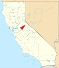
Location in Calaveras County and the state of California
Usa edcp location map.svg
Red pog.svg
Copperopolis
Location in the United States
Coordinates: 37°58′52″N120°38′31″W / 37.98111°N 120.64194°W / 37.98111; -120.64194
Country Flag of the United States.svg  United States
State Flag of California.svg  California
County Calaveras
Government
  MayorCopper the dog
Area
[1]
  Total15.61 sq mi (40.44 km2)
  Land15.59 sq mi (40.38 km2)
  Water0.02 sq mi (0.06 km2)  3.09%
Elevation
997 ft (304 m)
Population
 (2020)
  Total3,400
  Density218.09/sq mi (84.21/km2)
Time zone UTC-8 (Pacific (PST))
  Summer (DST) UTC-7 (PDT)
ZIP code
95228
Area code 209
FIPS code 06-16210
GNIS feature IDs 1655921, 2407658
Reference no.296

Copperopolis is an unincorporated town and census-designated place (CDP) in Calaveras County, California, United States. The population was 3,671 at the 2010 census, up from 2,363 at the 2000 census. The town is located along State Route 4 and is registered as California Historical Landmark #296. [2]

Contents

History

Unlike most of the mining towns in the Calaveras County, Copperopolis' claim to fame is not gold, but copper. It was founded in 1860 by William K. Reed, Dr. Allen Blatchly, and Thomas McCarty, at the site of the second major discovery of copper ore in the region (the first was nearby Telegraph City).

William K. Reed and Thomas McCarty founded the Union Copper Mine (and later the Keystone & Empire mines). In 1862, Reed sold out his interest in the mines and built a toll road from Copperopolis through Telegraph City. It connected with a road running westerly into Stockton. This road was called "Reeds Turnpike" and remained a toll road until 1865. Copperopolis was on the main stage road from Sonora to Sacramento.

The town grew rapidly, as the need for copper during the Civil War for material was great. The copper was sent to Stockton and then to San Francisco, where it was loaded onto ships and taken around Cape Horn before finally arriving in smelters on the East Coast.

After the war ended, mining and shipping copper proved too expensive and the population dwindled as the mines closed. However, a Boston company purchased the mines in the 1880s and mining operations resumed. The town went through boom periods during the two World Wars, when demand for copper went up again. By the time the mines closed in 1946, according to the U.S. Bureau of Mines, they had produced 72,598,883 pounds of copper worth over $12 million, which adjusted for inflation is worth approximately $160 million as of 2016. [3] No copper mining has been done since.

The first post office was established in 1861. [4]

Copperopolis has four buildings listed on the National Register of Historic Places:

Geography

According to the United States Census Bureau, the CDP has a total area of 22.1 square miles (57 km2), of which, 21.5 square miles (56 km2) of it is land and 0.6 square miles (1.6 km2) of it (2.89%) is water.

Climate

Copperopolis has a hot-summer Mediterranean climate (Köppen climate classification Csa).

There are cool winters during which intense rainfall is broken by weeks of cool, sunny weather. It has hot, dry summers with no rainfall in July and August.

Snow is rare in Copperopolis, averaging only 0.2 inches or 0.51 centimetres per year, entirely in winter months. [5]

Climate data for Copperopolis, California
MonthJanFebMarAprMayJunJulAugSepOctNovDecYear
Average high °F (°C)55.3
(12.9)
59.9
(15.5)
64.3
(17.9)
70.1
(21.2)
79.3
(26.3)
88.5
(31.4)
95.8
(35.4)
94.4
(34.7)
88.8
(31.6)
78.4
(25.8)
64.1
(17.8)
55.5
(13.1)
74.5
(23.6)
Daily mean °F (°C)45.9
(7.7)
49.3
(9.6)
53.2
(11.8)
56.1
(13.4)
62.2
(16.8)
72.5
(22.5)
79.0
(26.1)
77.8
(25.4)
72.9
(22.7)
64.3
(17.9)
53.2
(11.8)
41.1
(5.1)
61.4
(16.3)
Average low °F (°C)36.5
(2.5)
38.7
(3.7)
42.1
(5.6)
45.1
(7.3)
50.8
(10.4)
56.5
(13.6)
61.9
(16.6)
61.1
(16.2)
56.9
(13.8)
50.2
(10.1)
42.2
(5.7)
36.6
(2.6)
48.2
(9.0)
Record low °F (°C)21
(−6)
20
(−7)
24
(−4)
28
(−2)
31
(−1)
37
(3)
35
(2)
41
(5)
39
(4)
32
(0)
28
(−2)
17
(−8)
17
(−8)
Average precipitation inches (mm)5.4
(140)
4.8
(120)
4.5
(110)
2.4
(61)
1.3
(33)
0.3
(7.6)
0
(0)
0
(0)
0.4
(10)
1.5
(38)
3.2
(81)
4.7
(120)
28.5
(720)
Average snowfall inches (cm)0
(0)
0.2
(0.51)
0
(0)
0
(0)
0
(0)
0
(0)
0
(0)
0
(0)
0
(0)
0
(0)
0
(0)
0
(0)
0.2
(0.51)
Source: Bestplaces.net [6]

Demographics

Historical population
CensusPop.Note
2020 3,400
U.S. Decennial Census [7]

2010

At the 2010 census Copperopolis had a population of 3,671. The population density was 171.3 inhabitants per square mile (66.1/km2). The racial makeup of Copperopolis was 3,318 (90.4%) White, 31 (0.8%) African American, 43 (1.2%) Native American, 36 (1.0%) Asian, 12 (0.3%) Pacific Islander, 83 (2.3%) from other races, and 148 (4.0%) from two or more races. Hispanic or Latino of any race were 454 people (12.4%). [8]

The whole population lived in households, no one lived in non-institutionalized group quarters and no one was institutionalized.

There were 1,466 households, 413 (28.2%) had children under the age of 18 living in them, 898 (61.3%) were opposite-sex married couples living together, 114 (7.8%) had a female householder with no husband present, 58 (4.0%) had a male householder with no wife present. There were 92 (6.3%) unmarried opposite-sex partnerships, and 12 (0.8%) same-sex married couples or partnerships. 291 households (19.8%) were one person and 115 (7.8%) had someone living alone who was 65 or older. The average household size was 2.50. There were 1,070 families (73.0% of households); the average family size was 2.86.

The age distribution was 783 people (21.3%) under the age of 18, 253 people (6.9%) aged 18 to 24, 710 people (19.3%) aged 25 to 44, 1,270 people (34.6%) aged 45 to 64, and 655 people (17.8%) who were 65 or older. The median age was 46.9 years. For every 100 females, there were 102.4 males. For every 100 females age 18 and over, there were 103.0 males.

There were 2,336 housing units at an average density of 109.0 per square mile (42.1/km2),of which 1,466 were occupied, 1,089 (74.3%) by the owners and 377 (25.7%) by renters. The homeowner vacancy rate was 6.7%; the rental vacancy rate was 8.7%. 2,549 people (69.4% of the population) lived in owner-occupied housing units and 1,122 people (30.6%) lived in rental housing units.

Politics

In the state legislature, Copperopolis is in the 8th Senate District , represented by Democrat Angelique Ashby, [9] and the 5th Assembly District , represented by Republican Joe Patterson. [10] Federally, Copperopolis is in California's 4th congressional district , represented by Democrat Mike Thompson. [11]

Literature

Copperopolis is near Tuttletown, which has a shack on Jack Ass Hill, where Mark Twain is supposed to have written one of his most famous works, "The Celebrated Jumping Frog of Calaveras County". Author K. Martin Gardner expounds on this literary history, and Twain's friendship with renowned scientist of the time, Nikola Tesla, in his novel Copperopolis.

See also

Related Research Articles

<span class="mw-page-title-main">Calaveras County, California</span> County in California, United States

Calaveras County, officially the County of Calaveras, is a county in both the Gold Country and High Sierra regions of the U.S. state of California. As of the 2010 census, the population was 45,292. The county seat is San Andreas. Angels Camp is the county's only incorporated city. Calaveras is Spanish for "skulls"; the county was reportedly named for the remains of Native Americans discovered by the Spanish explorer Captain Gabriel Moraga.

<span class="mw-page-title-main">Morenci, Arizona</span> CDP in Greenlee County, Arizona

Morenci is a census-designated place (CDP) and company town in Greenlee County, Arizona, United States, and was founded by the Detroit Copper Mining Company of Arizona. The population was 2000 at the 2000 census and 1,489 at the 2010 census. The biggest employer in Morenci and the owner of the town is Freeport-McMoRan, the owner of the Morenci Mine, the largest copper mining operation in North America, and one of the largest copper mines in the world. The town was a site of the Arizona Copper Mine Strike of 1983. The large open-pit mine is north of the town.

<span class="mw-page-title-main">Kearny, Arizona</span> Town in Pinal County, Arizona

Kearny is a town in Pinal County, Arizona, United States. The town was named after General Stephen Watts Kearny, who passed through the area on November 7, 1846, while leading 100 dragoons to California. According to the 2010 census, the population of the town is 1,950. The economic base of Kearny and nearby towns is the Ray mine and Hayden Smelter, both owned and operated by ASARCO.

<span class="mw-page-title-main">Bagdad, Arizona</span> CDP in Yavapai County, Arizona

Bagdad is a copper mining community and census-designated place (CDP) in Yavapai County, Arizona, United States, in the western part of the state. It is one of only two remaining company towns in Arizona. The population was 1,876 at the 2010 census, up from 1,578 in 2000.

<span class="mw-page-title-main">Jackson, California</span> City in California, United States

Jackson is a city in and the county seat of Amador County, California. Its population was 4,651 at the 2010 census, up from 3,989 at the 2000 census. The city is accessible by both State Route 49 and State Route 88.

<span class="mw-page-title-main">Palermo, California</span> Census-designated place in California, United States

Palermo is a census-designated place (CDP) in Butte County, California, United States. The population was 5,382 at the 2010 census, down from 5,720 at the 2000 census.

<span class="mw-page-title-main">Angels Camp, California</span> City in California, United States

Angels Camp, also known as City of Angels and formerly Angel's Camp, Angels, Angels City, Carson's Creek and Clearlake, is the only incorporated city in Calaveras County, California, United States. The population was 3,836 at the 2010 census, up from 3,004 at the 2000 census. It lies at an elevation of 1378 feet.

<span class="mw-page-title-main">Arnold, California</span> Census-designated place in Calaveras County, California, United States

Arnold is a census-designated place (CDP) in Calaveras County, California, United States. The population was 3,843 at the 2010 census, down from 4,218 at the 2000 census. Arnold is located on State Route 4.

<span class="mw-page-title-main">Murphys, California</span> Census designated place in California, United States

Murphys, originally Murphys New Diggings then Murphy's Camp, is an unincorporated village located in the foothills of the Sierra Nevada mountains in Calaveras County, California, United States. The population was 2,213 at the 2010 census, up from 2,061 at the 2000 census.

<span class="mw-page-title-main">Rail Road Flat, California</span> Census-designated place in California, United States

Rail Road Flat is a census-designated place (CDP) in Calaveras County, California, United States. The population was 475 at the 2010 census, down from 549 at the 2000 census.

<span class="mw-page-title-main">San Andreas, California</span> Census-designated place in California, United States

San Andreas is an unincorporated census-designated place and the county seat of Calaveras County, California. The population was 2,783 at the 2010 census, up from 2,615 at the 2000 census. Like most towns in the region, it was founded during the California Gold Rush. The town is located on State Route 49 and is registered as California Historical Landmark #252.

<span class="mw-page-title-main">Wallace, California</span> Census-designated place in California, United States

Wallace is a census-designated place (CDP) at the far west edge of Calaveras County, California, United States on State Route 12. The population was 403 at the 2010 census, up from 220 at the 2000 census.

<span class="mw-page-title-main">Georgetown, California</span> Census-designated place in California, United States

Georgetown is a census-designated place (CDP) in El Dorado County, California. It is the northeasternmost town in the California Mother Lode. The population was 2,367 at the 2010 census, up from 962 in 2000. The town is registered as California Historical Landmark #484.

<span class="mw-page-title-main">Johannesburg, California</span> Census-designated place in California, United States

Johannesburg is a census-designated place (CDP) in Kern County, California, in a mining district of the Rand Mountains. Johannesburg is located 1 mile (1.6 km) east-northeast of Randsburg, at an elevation of 3,517 feet (1,072 m). The terminus of the Randsburg Railway was here from 1897 to 1933. The population was 172 at the 2010 census, down from 176 at the 2000 census. Johannesburg is divided from the neighboring community of Randsburg by a ridge. The town is frequently referred to as "Jo-burg" by locals and frequent visitors to the northwest Mojave.

<span class="mw-page-title-main">Randsburg, California</span> California Historical Landmark

Randsburg is a census-designated place (CDP) in Kern County, California, United States. Randsburg is located 17 miles (27 km) south of Ridgecrest, at an elevation of 3,504 feet (1,068 m). The population was 69 in the 2010 census, down from 77 in the 2000 census.

<span class="mw-page-title-main">Columbia, California</span> Census-designated place in California, United States

Columbia is a census-designated place (CDP) located in the Sierra Nevada foothills in Tuolumne County, California, United States. It was founded as a boomtown in 1850 when gold was found during the California Gold Rush, and was known as the "Gem of the Southern Mines."

<span class="mw-page-title-main">Rancho Calaveras, California</span> Census-designated place in California, United States

Rancho Calaveras is a census-designated place (CDP) in Calaveras County, California, United States. The population was 5,325 at the 2010 census, up from 4,182 at the 2000 census.

<span class="mw-page-title-main">McGill, Nevada</span> CDP in Nevada, United States

McGill is a census-designated place (CDP) in White Pine County, Nevada, United States. The population was 1,148 at the 2010 census.

<span class="mw-page-title-main">Ravensdale, Washington</span> Census-designated place in Washington, United States

Ravensdale is a census-designated place (CDP) in King County, Washington, United States. The population was 555 at the 2020 census.

Posey is a census-designated place in Tulare County, California, United States. Posey is 21 miles (34 km) east-southeast of Ducor. Posey has a post office with ZIP code 93260, which opened in 1915. The population was 23 at the 2020 United States census, up from 10 at the 2010 census. The elevation of Posey is 3573 feet.

References

  1. "2020 U.S. Gazetteer Files". United States Census Bureau. Retrieved October 30, 2021.
  2. "Copperopolis". Office of Historic Preservation, California State Parks. Retrieved 2012-10-06.
  3. "Dollar Times Inflation Calculator". Dollar Times. HBrothers. Retrieved 30 March 2016.
  4. Durham, David L. (1998). California's Geographic Names: A Gazetteer of Historic and Modern Names of the State. Clovis, Calif.: Word Dancer Press. p. 761. ISBN   1-884995-14-4.
  5. "Copperopolis Climate, CALIFORNIA - Climate Summary" . Retrieved July 17, 2020.
  6. "Copperopolis,CA". July 2020. Retrieved 17 July 2020.
  7. "Census of Population and Housing". Census.gov. Retrieved June 4, 2016.
  8. "2010 Census Interactive Population Search: CA - Copperopolis CDP". U.S. Census Bureau. Archived from the original on July 15, 2014. Retrieved July 12, 2014.
  9. "Senators". State of California. Retrieved March 21, 2013.
  10. "Members Assembly". State of California. Retrieved March 21, 2013.
  11. "California's 4th Congressional District - Representatives & District Map". Civic Impulse, LLC. Retrieved March 2, 2013.