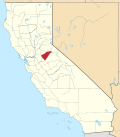
Melones | |
---|---|
Former settlement | |
Coordinates: 38°00′45″N120°29′55″W / 38.01250°N 120.49861°W | |
Country | United States |
State | California |
County | Calaveras County |
Elevation | 955 ft (291 m) |
Melones (Spanish for "Melons") is a former settlement in Calaveras County, California, now submerged beneath a reservoir named New Melones Lake. It lay at an elevation of 955 feet (291 m). Melones was founded on the site of a ferry operated from 1848 by John W. Robinson and Stephen Mead. The town initially took its name from the ferry. [2]
The first post office opened in Robinsons Ferry in 1879, the name was changed to Robinson's in 1895, and to Melones in 1902. [2] The post office was closed in 1932, re-established in 1933 and closed for good in 1942. [2]
In January 1923 Paramount Pictures chose Melones to construct a complete 1849 mining camp set there for the motion picture The Covered Wagon. The studio sent an authentic Sierra Railroad train built in 1897 to the location via the Angels Branch line to Melones.[ citation needed ]
The site was submerged under New Melones Lake when the New Melones Dam finished construction and began to fill in April 1, 1978.
Calaveras County, officially the County of Calaveras, is a county in both the Gold Country and High Sierra regions of the U.S. state of California. As of the 2020 census, the population was 45,292. The county seat is San Andreas. Angels Camp is the county's only incorporated city. Calaveras is Spanish for "skulls"; the county was reportedly named for the remains of Native Americans discovered by the Spanish explorer Captain Gabriel Moraga.
Stanislaus County is a county located in the San Joaquin Valley of the U.S. state of California. As of 2023, its estimated population is 564,404. The county seat is Modesto.
Angels Camp, also known as City of Angels, is the only incorporated city in Calaveras County, California, United States. The population was 3,836 at the 2010 census, up from 3,004 at the 2000 census. It lies at an elevation of 1378 feet.
State Route 49 is a north–south state highway in the U.S. state of California that passes through many historic mining communities of the 1849 California gold rush and it is known as the Golden Chain Highway. The highway's creation was lobbied by the Mother Lode Highway Association, a group of locals and historians seeking a single highway to connect many relevant locations along the Gold Rush to honor the 49ers. One of the bridges along SR 49 is named for the leader of the association, Archie Stevenot.
New Melones Dam is an earth and rock filled embankment dam on the Stanislaus River, about 5 miles (8.0 km) west of Jamestown, California, United States, on the border of Calaveras County and Tuolumne County. The water impounded by the 625-foot-tall (191 m) dam forms New Melones Lake, California's fourth-largest reservoir, in the foothills of the Sierra Nevada east of the San Joaquin Valley. The dam serves mainly for irrigation water supply, and also provides hydropower generation, flood control, and recreation benefits.
The Stanislaus River is a tributary of the San Joaquin River in north-central California in the United States. The main stem of the river is 96 miles (154 km) long, and measured to its furthest headwaters it is about 150 miles (240 km) long. Originating as three forks in the high Sierra Nevada, the river flows generally southwest through the agricultural San Joaquin Valley to join the San Joaquin south of Manteca, draining parts of five California counties. The Stanislaus is known for its swift rapids and scenic canyons in the upper reaches, and is heavily used for irrigation, hydroelectricity and domestic water supply.
Jenny Lind is an unincorporated community in Calaveras County, California. It lies at an elevation of 253 feet and is located at 38°6′N120°52′W. The community is in ZIP code 95252 and area code 209.
Carson Hill is a ghost town in Calaveras County, California. It sits at an elevation of 1447 feet above sea level and is located at 38°01′42″N120°30′24″W, about 4 miles (6.4 km) south-southeast of Angels Camp. It was one of the most productive mining camps in the state, with nearly $26 million in gold and quartz found in the area. Carson Hill is registered as California Historical Landmark #274. The town was served by the Sierra Railway's branchline to Angels Camp until 1935.
Knights Ferry is an unincorporated historic community and census-designated place (CDP) in Stanislaus County, California, United States. Nestled in the foothills of the Sierra Nevada, it is about 30 miles (48 km) east of Modesto on the Stanislaus River. The Williams Ranch near the town was one of many filming locations for the television series Bonanza and Little House on the Prairie.
Area codes 209 and 350 are telephone area codes in the North American Numbering Plan (NANP) for the U.S. state of California. Their service area includes Stockton, Modesto, Turlock, Merced, Winton, Atwater, Livingston, Manteca, Ripon, Tracy, Lodi, Galt, Sonora, Los Banos, San Andreas, Mariposa, and Yosemite, the northern San Joaquin Valley, and the Sierra Foothills.
New Melones Lake is a reservoir on the Stanislaus River in the central Sierra Nevada foothills, within Calaveras County and Tuolumne County, California.
Calaveras Big Tree National Forest, in the Sierra Nevada, was established in California on May 11, 1954 with 390 acres (1.6 km2) to protect a grove of Giant Sequoias, although it had been authorized since February 18, 1909.
Lost City is an unincorporated community in Calaveras County, California, 11 miles (18 km) from Angels Camp along Bear Creek. It lies at an elevation of 1053 feet. Lost City was constructed in the 1870s by Eugene Barbe. It consists of roughly one dozen stone buildings, which may have been an early Icarian commune. The settlement was abandoned by 1896, though a few walls of the original dry-laid field stone buildings remain. The ruins are currently on private land.
Robinson's Ferry may refer to:
Hills Ferry was a small unincorporated community of the northern San Joaquin Valley in Stanislaus County, California. Hills Ferry was located at 37°20′56″N120°58′47″W, on the southern border of Stanislaus County with Merced County, 3 miles (4.8 km) northeast of the city of Newman.
Rancho del Río Estanislao was a 48,887-acre (197.84 km2) Mexican land grant in present-day Stanislaus County and Calaveras County, California given in 1843 by Governor Manuel Micheltorena to Francisco Rico and José Castro. The grant was located on the north side of the Stanislaus River, which was called Rio Estanislao during the Mexican era, and the grant encompassed present-day Knights Ferry.
The Byrne's Ferry bridge was a historic cantilevered covered bridge across the Stanislaus River between Calaveras County and Tuolumne County, California. Originally built during the California Gold Rush, the bridge was located on the O'Byrne's Ferry road between Chinese Camp and Copperopolis. Until the mid-20th century, it was one of the last remaining covered bridges in the state; the bridge was destroyed in 1957 to make way for the construction of Tulloch Dam.
Angels Creek is a 19-mile (31 km)-long tributary of the Stanislaus River in Calaveras County, California in the United States. It flows generally southwest from Forest Meadows, through the foothills of the Sierra Nevada, to join the Stanislaus River in New Melones Lake. The creek takes its name from the historic Gold Rush town of Angels Camp. There are two hydroelectric plants on the creek operated by the Utica Water and Power Authority.
The site of the Old Mining Camp of Brownsville is a California Historical Landmark on Pennsylvania Gulch Road east of the town of Murphys, California in Calaveras County. The Mining Camp of Brownsville was a California Gold Rush camp in Pennsylvania Gulch in from 1850 to 1870. The camp is named after Alfred Brown, who was the former owner of the Table Mountain Ranch. There were many rich mines in the area and Brownsville Mining Camp supported this activity. So rich was the area, the Brownsville Mining District limited the size of mines in the District. Each miner could claim and own only one wet and one dry site, no larger than 150 square feet each. Brownsville Mining District was in the area of Pennsylvania Gulches and Missouri Gulches 2 miles from Murphys. There are no remains of the camp, but nearby is the Brownsville Mining District Cemetery. A plaque monument was dedicated on July 19, 1953, by California State Park Commission with the monument base built by Christa Parlor No. 137 and Ruby Parlor No. 49 of the Native Daughters of the Golden West.
Robinson's Ferry is a historical site in Angels Camp, California in Calaveras County. John W. Robinson and Stephen Mead founded a ferry in 1848. The ferry crossed the river, where New Melones Lake is now. The New Melones Lake Bridge now crosses where the ferry was. The ferry was used to move California Gold Rush miners, their cargo and animals across the river. Harvey Wood purchased the ferry in 1856. The fare to cross was 50 cents for each person or animal crossing. The site of Robinson's Ferry a California Historical Landmark No. 276. A marker is on California State Route 49 near the bridge across New Melones Lake. The historical marker was placed there in 1949 by California Centennial Commission, and the base was built Angels Camp Lions Club. The Marker is 5.6 miles south of Angels Camp and 0.3 miles north of New Melones Lake Reservoir.
38°00′45″N120°29′55″W / 38.01250°N 120.49861°W