Milton, California

Last updated

Coordinates: 38°01′55″N120°51′08″W / 38.03194°N 120.85222°W / 38.03194; -120.85222

Geographic coordinate system Coordinate system

A geographic coordinate system is a coordinate system that enables every location on Earth to be specified by a set of numbers, letters or symbols. The coordinates are often chosen such that one of the numbers represents a vertical position and two or three of the numbers represent a horizontal position; alternatively, a geographic position may be expressed in a combined three-dimensional Cartesian vector. A common choice of coordinates is latitude, longitude and elevation. To specify a location on a plane requires a map projection.

Contents

Milton
Unincorporated community
California Locator Map with US.PNG
Red pog.svg
Milton
Location in California
Usa edcp location map.svg
Red pog.svg
Milton
Milton (the US)
Coordinates: 38°01′55″N120°51′08″W / 38.03194°N 120.85222°W / 38.03194; -120.85222
Country United States
State California
County Calaveras County
Elevation [1] 394 ft (120 m)
Reference no. 262

Milton is an unincorporated community in Calaveras County, California. It lies at an elevation of 394 feet (120 m) and is located at 38°01′55″N120°51′08″W / 38.03194°N 120.85222°W / 38.03194; -120.85222 . The community is in ZIP code 95684 and area code 209.

Unincorporated area Region of land not governed by own local government

In law, an unincorporated area is a region of land that is not governed by a local municipal corporation; similarly an unincorporated community is a settlement that is not governed by its own local municipal corporation, but rather is administered as part of larger administrative divisions, such as a township, parish, borough, county, city, canton, state, province or country. Occasionally, municipalities dissolve or disincorporate, which may happen if they become fiscally insolvent, and services become the responsibility of a higher administration. Widespread unincorporated communities and areas are a distinguishing feature of the United States and Canada. In most other countries of the world, there are either no unincorporated areas at all, or these are very rare; typically remote, outlying, sparsely populated or uninhabited areas.

Calaveras County, California County in California

Calaveras County, officially the County of Calaveras, is a county in the northern portion of the U.S. state, California. As of the 2010 census, the population was 40,171. The county seat is San Andreas. Angels Camp is the only incorporated city in the county. Calaveras is the Spanish word for skulls; the county was reportedly named for the remains of Native Americans discovered by the Spanish explorer Captain Gabriel Moraga.

California State of the United States of America

California is a state in the Pacific Region of the United States. With 39.6 million residents, California is the most populous U.S. state and the third-largest by area. The state capital is Sacramento. The Greater Los Angeles Area and the San Francisco Bay Area are the nation's second and fifth most populous urban regions, with 18.7 million and 9.7 million residents respectively. Los Angeles is California's most populous city, and the country's second most populous, after New York City. California also has the nation's most populous county, Los Angeles County, and its largest county by area, San Bernardino County. The City and County of San Francisco is both the country's second-most densely populated major city after New York City and the fifth-most densely populated county, behind only four of the five New York City boroughs.

Completion of the Southern Pacific Railroad in 1871 marked the birth of the town of Milton. Named after Milton Latham, one of the railroad construction engineers, this town was the first in Calaveras County to have a railroad. Freight and passengers continued their journeys to other parts of Calaveras County by wagon and stagecoach. The town was also the terminus of the Stockton and Copperopolis Railroad. [2]

Stagecoach type of covered wagon

A stagecoach is a four-wheeled public coach used to carry paying passengers and light packages on journeys long enough to need a change of horses. It is strongly sprung and generally drawn by four horses.

The town today is registered as California Historical Landmark #262. [3]

California Historical Landmark buildings, structures, sites, or places in California determined to have historical significance

California Historical Landmarks (CHLs) are buildings, structures, sites, or places in the U.S. state of California that have been determined to have statewide historical landmark significance.

A post office was established in 1871 and closed in 1942. [2]

Politics

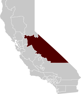
In the state legislature, Milton is in the 8th Senate District , represented by Republican Tom Berryhill, [4] and the 5th Assembly District , represented by Republican Frank Bigelow. [5] Federally, Milton is in California's 4th congressional district , represented by Republican Tom McClintock. [6]

California State Legislature state legislature of the U.S. state of California

The California State Legislature is a bicameral legislature consisting of a lower house, the California State Assembly, with 80 members; and an upper house, the California State Senate, with 40 members. Both houses of the Legislature convene at the California State Capitol in Sacramento. The California State Legislature is one of just ten full-time state legislatures in the United States.

Californias 8th State Senate district

California's 8th State Senate district is one of 40 California State Senate districts. It is currently represented by Republican Andreas Borgeas of Fresno.

The California Republican Party (CAGOP) is the California affiliate of the United States Republican Party. The party is based in Sacramento, and is led by Chairwoman Jessica Patterson.

Related Research Articles

Stronghold, California Unincorporated community in California, United States

Stronghold is an unincorporated community in Modoc County, California. It is located on the Southern Pacific Railroad, 3 miles (4.8 km) northwest of Newell, at an elevation of 4035 feet.

Sandy Gulch, California Unincorporated community in California, United States

Sandy Gulch is a small community in Calaveras County, California, just southwest of West Point on State Route 26. It lies at an elevation of 2592 feet above sea level and is located at 38°22′49″N120°31′58″W. The community is in ZIP code 95248 and area code 209.

Calaveritas, California Unincorporated community in California, United States

Calaveritas is an unincorporated community in Calaveras County, California. It sits on the banks of the Calaveritas Creek at an elevation of 1,109 feet above sea level and is located at 38°09′29″N120°36′36″W. The community is in ZIP code 95249 and area code 209.

Campo Seco, California Unincorporated community in California, United States

Campo Seco is an unincorporated community in Calaveras County, California. It sits at an elevation of 564 feet above sea level and is located at 38°13′38″N120°51′12″W. The community is in ZIP code 95226 and area code 209.

Jenny Lind, California Unincorporated community in California, United States

Jenny Lind is an unincorporated community in Calaveras County, California. It lies at an elevation of 253 feet and is located at 38°6′N120°52′W. The community is in ZIP code 95252 and area code 209.

Douglas Flat, California Unincorporated community in California, United States

Douglas Flat is an unincorporated community in Calaveras County, California. It lies at an elevation of 1965 feet and is located at 38°06′52″N120°27′18″W. The community is in ZIP code 95229 and area code 209.

Glencoe, California Unincorporated community in California, United States

Glencoe is an unincorporated community in Calaveras County, California. It lies at an elevation of 2749 feet and is located at 38°21′15″N120°35′06″W. The community is in ZIP code 95232 and area code 209.

The Shores of Poker Flat, California Unincorporated community in California, United States

The Shores of Poker Flat is an unincorporated community in Calaveras County, California. It lies at an elevation of 584 feet above sea level and is located at 37°54′11″N120°34′56″W, on the shore of the Tulloch Reservoir. The community is in ZIP code 95228 and area code 209.

Jesus Maria, California Unincorporated community in California, United States

Jesus Maria is an unincorporated community in Calaveras County, California. It lies at an elevation of 1043 feet and is located at 38°17′08″N120°38′51″W. The community is in ZIP code 95222 and area code 209.

Altaville, California Unincorporated community in California, United States

Altaville is a former unincorporated community in Calaveras County, California, now located in the northwest portion of the city of Angels Camp. It sits at an elevation of 1,542 feet above sea level and is located at 38°05′02″N120°33′43″W, at the intersections of SR 49 and SR 4. The community is in ZIP code 95221 and area code 209.

Paloma, California Unincorporated community in California, United States

Paloma is an unincorporated community in Calaveras County, California. It lies at an elevation of 1362 feet and is located at 38°15′34″N120°45′48″W. The community is in ZIP code 95252 and area code 209.

Cave City, California Unincorporated community in California, United States

Cave City is an unincorporated community in Calaveras County, California. It lies at an elevation of 1,617 feet (493 m) and is located at 38°12′09″N120°30′31″W. The community is in ZIP code 95222 and area code 209.

Fourth Crossing, California Unincorporated community in California, United States

Fourth Crossing is an unincorporated community in Calaveras County, California. It lies at an elevation of 922 feet and is located on State Route 49 at 38°07′53″N120°38′05″W. The community is in ZIP code 95248 and area code 209.

Confidence is an unincorporated community on State Route 108 in Tuolumne County, California, United States, with a population of 50 people. The town sits at an average elevation of 4,200 feet (1,300 m). The ZIP Code of the area is 95383. The community is inside area code 209.

El Dorado, California Unincorporated community in California, United States

El Dorado, not to be confused with the nearby El Dorado Hills, is an unincorporated community in El Dorado County, California. It is located 4 miles (6.4 km) southwest of Placerville, at an elevation of 1608 feet. The population was 4,096 at the 2000 census. The town is registered as California Historical Landmark #486. The ZIP code is 95623. The community is inside area code 530.

Glenn, California Unincorporated community in California, United States

Glenn is an unincorporated community in Glenn County, California. It lies at an elevation of 98 feet. The town is located on the Sacramento River, at the intersection of State Route 45 and State Route 162. It is about ten miles (16 km) east of Interstate 5 and Willows on the U.S. Geological Survey 7.5-minute quadrangle, Glenn, California. The U.S. Geological Survey, National Geographic Names Database, calls its existence official with a feature ID of 1658621 and lists the NAD27 coordinates of the community as 39°31′19″N122°00′50″W. The ZIP Code, shared with Ordbend and Bayliss, is 95943. The community is inside area code 530. This area is flagged as rural by the U.S. Census Bureau.

Ogilby, California Ghost town in California, United States

Ogilby is a ghost town in Imperial County, California, United States. Ogilby is located on the Southern Pacific Railroad 42 miles (68 km) east of El Centro, and 3.8 miles (6.1 km) north of Interstate 8 on County Road S34. The name is official for federal use, and a feature ID number of 252950 has been assigned. Ogilby is defined by the US Geological Survey as a populated place at 356 feet (109 m) AMSL elevation. NAD27 latitude and longitude are listed at 32°49′01″N114°50′20″W on the "Ogilby, California" 7.5-minute quadrangle (map). It is included in the Imperial County Air Pollution Control District. It lies at an elevation of 364 feet (111 m).

East Biggs, California Unincorporated community in California, United States

East Biggs is a small unincorporated community in Butte County, California. Its zip code is 95917 and its area code is 530. It lies at an elevation of 121 feet.

Dayton, California Unincorporated community in California, United States

Dayton is a small unincorporated community in Butte County, California. Its zip code is 95928 and its area code is 530. It lies at an elevation of 141 feet.

Burson, California Unincorporated community in California, United States

Burson is an unincorporated community in Calaveras County, California. It lies at an elevation of 413 feet. Although unincorporated, Burson has the ZIP code of 95225.

References

  1. U.S. Geological Survey Geographic Names Information System: Milton, California
  2. 1 2 Durham, David L. (1998). California's Geographic Names: A Gazetteer of Historic and Modern Names of the State. Clovis, Calif.: Word Dancer Press. p. 803. ISBN   1-884995-14-4.
  3. "Milton". Office of Historic Preservation, California State Parks. Retrieved 2012-10-06.
  4. "Senators". State of California. Retrieved March 21, 2013.
  5. "Members Assembly". State of California. Retrieved March 21, 2013.
  6. "California's 4th Congressional District - Representatives & District Map". Civic Impulse, LLC. Retrieved March 1, 2013.