Avery, California

Last updated

Avery
Calaveras County California Incorporated and Unincorporated areas Avery Highlighted.svg
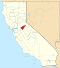
Location in Calaveras County and the state of California
Usa edcp location map.svg
Red pog.svg
Avery
Location in the United States
Coordinates: 38°12′16″N120°22′12″W / 38.20444°N 120.37000°W / 38.20444; -120.37000
Country Flag of the United States (23px).png  United States
State Flag of California.svg  California
County Calaveras
Area
[1]
  Total2.12 sq mi (5.50 km2)
  Land2.10 sq mi (5.45 km2)
  Water0.02 sq mi (0.05 km2)  0%
Elevation
3,389 ft (1,033 m)
Population
 (2020)
  Total636
  Density302.28/sq mi (116.72/km2)
Time zone UTC-8 (Pacific (PST))
  Summer (DST) UTC-7 (PDT)
ZIP code
95224
Area code 209
FIPS code 06-03316
GNIS feature IDs 218477, 2407784

Avery is a census-designated place (CDP) in Calaveras County, California, United States. The population was 646 at the 2010 census, down from 672 at the 2000 census. Avery is located on State Route 4 and is home to the oldest continually operating hotel in the county, the Avery Hotel Restaurant & Saloon. Built in 1853, it was known as the "Half Way House," being located between Murphys, Arnold, and Calaveras Big Trees State Park.

Contents

Geography

According to the United States Census Bureau, the CDP has a total area of 4.5 square miles (12 km2), all of it land.

History

The place is named after George J. Avery, its first postmaster. The first post office was established in 1885, closed in 1943, and re-established in 1949. [2]

Demographics

Historical population
CensusPop.Note
2000 672
2010 646−3.9%
2020 636−1.5%
U.S. Decennial Census [3]
1850–1870 [4] [5] 1880-1890 [6]
1900 [7] 1910 [8] 1920 [9]
1930 [10] 1940 [11] 1950 [12]
1960 [13] 1970 [14] 1980 [15]
1990 [16] 2000 [17] 2010 [18]

At the 2010 census Avery had a population of 646. The population density was 143.5 inhabitants per square mile (55.4/km2). The racial makeup of Avery was 604 (93.5%) White, 5 (0.8%) African American, 7 (1.1%) Native American, 3 (0.5%) Asian, 1 (0.2%) Pacific Islander, 2 (0.3%) from other races, and 24 (3.7%) from two or more races. Hispanic or Latino of any race were 38 people (5.9%). [19]

The whole population lived in households, no one lived in non-institutionalized group quarters and no one was institutionalized.

There were 281 households, 68 (24.2%) had children under the age of 18 living in them, 149 (53.0%) were opposite-sex married couples living together, 22 (7.8%) had a female householder with no husband present, 7 (2.5%) had a male householder with no wife present. There were 20 (7.1%) unmarried opposite-sex partnerships, and 2 (0.7%) same-sex married couples or partnerships. 80 households (28.5%) were one person and 30 (10.7%) had someone living alone who was 65 or older. The average household size was 2.30. There were 178 families (63.3% of households); the average family size was 2.80.

The age distribution was 129 people (20.0%) under the age of 18, 40 people (6.2%) aged 18 to 24, 126 people (19.5%) aged 25 to 44, 210 people (32.5%) aged 45 to 64, and 141 people (21.8%) who were 65 or older. The median age was 48.1 years. For every 100 females, there were 105.7 males. For every 100 females age 18 and over, there were 102.0 males.

There were 388 housing units at an average density of 86.2 per square mile (33.3/km2),of which 281 were occupied, 218 (77.6%) by the owners and 63 (22.4%) by renters. The homeowner vacancy rate was 7.6%; the rental vacancy rate was 11.3%. 495 people (76.6% of the population) lived in owner-occupied housing units and 151 people (23.4%) lived in rental housing units.

Politics

In the state legislature, Avery is in the 8th Senate District , represented by Democrat Angelique Ashby, [20] and the 5th Assembly District , represented by Republican Joe Patterson. [21] Federally, Avery is in California's 4th congressional district , represented by Democrat Mike Thompson. [22]

Related Research Articles

<span class="mw-page-title-main">Alpine Village, California</span> Census-designated place in California, United States

Alpine Village is a census-designated place (CDP) in Alpine County, California, United States. The population was 114 at the 2010 census, down from 136 at the 2000 census.

<span class="mw-page-title-main">Bear Valley, Alpine County, California</span> Census-designated place in California, United States

Bear Valley is a census-designated place in Alpine County, California, best known as the location of the Bear Valley ski area. The population was 121 at the 2010 census, down from 133 at the 2000 census.

<span class="mw-page-title-main">Arnold, California</span> Census-designated place in Calaveras County, California, United States

Arnold is a census-designated place (CDP) in Calaveras County, California, United States. The population was 3,843 at the 2010 census, down from 4,218 at the 2000 census. Arnold is located on State Route 4.

<span class="mw-page-title-main">Biola, California</span> Census-designated place in California, United States

Biola is a census-designated place (CDP) in Fresno County, California, United States. The population was 1,623 at the 2010 census, up from 1,037 in 2000. Biola is located 6 miles (9.7 km) north-northeast of Kerman, at an elevation of 253 feet.

<span class="mw-page-title-main">Bowles, California</span> Census-designated place in California, United States

Bowles is a census-designated place (CDP) in Fresno County, California, United States. The population was 166 at the 2010 census, down from 182 at the 2000 census. Bowles is located 11 miles (18 km) south of downtown Fresno, at an elevation of 279 feet.

<span class="mw-page-title-main">Cantua Creek, California</span> Census-designated place in California, United States

Cantua Creek is a census-designated place (CDP) in Fresno County, California, United States. As of the 2010 census, the population was 466, down from the 655 reported at the 2000 census. Cantua Creek is located 11 miles (18 km) south-southwest of Tranquillity, at an elevation of 295 feet.

<span class="mw-page-title-main">Bayview, Humboldt County, California</span> Census-designated place in California, United States

Bayview is a census-designated place (CDP) located adjacent to the City of Eureka in Humboldt County, California, United States. Its population is 2,619 as of the 2020 census, up from 2,510 from the 2010 census. Many locals consider this area as part of "Pine Hill."

<span class="mw-page-title-main">Cartago, California</span> Census-designated place in California, United States

Cartago is a census-designated place in Inyo County, California, United States. Cartago is located on the west side of Owens Lake 3 miles (4.8 km) north-northwest of Olancha. The population was 92 at the 2010 census, down from 109 at the 2000 census.

<span class="mw-page-title-main">Bodfish, California</span> Census-designated place in California, United States

Bodfish is a census-designated place (CDP) in the southern Kern River Valley of the Southern Sierra Nevada, in Kern County, California.

<span class="mw-page-title-main">Blairsden, California</span> Census-designated place in California, United States

Blairsden is a census-designated place (CDP) in Plumas County, California, United States. Blairsden is located 20 miles (32.2 km) east-southeast of Quincy. It is located on the Feather River Route. The population was 39 at the 2010 census, down from 50 at the 2000 census.

<span class="mw-page-title-main">C-Road, California</span> Census-designated place in California, United States

C-Road is a census-designated place (CDP) in Plumas County, California, United States. The population was 150 at the 2010 census, down from 152 at the 2000 census.

<span class="mw-page-title-main">Bluewater, California</span> Census-designated place in California, United States

Bluewater is a census-designated place (CDP) in San Bernardino County, California, United States. The population was 172 at the 2010 census, down from 265 at the 2000 census.

<span class="mw-page-title-main">Camp Pendleton Mainside, California</span> Census-designated place in California, United States

Camp Pendleton Mainside is a census-designated place (CDP) in San Diego County, California, located at the southeast corner of the Marine Corps Base Camp Pendleton. Per the 2020 census, the population was 9,683. It was formerly known as Camp Pendleton North, but its name was changed for the 2020 Census. Along with Camp Pendleton South, it is one of two CDPs located on the base.

<span class="mw-page-title-main">Camp Pendleton South, California</span> Census-designated place in California, United States

Camp Pendleton South is a census-designated place (CDP) in San Diego County, California, located at the southwest corner of the Marine Corps Base Camp Pendleton. The population was 10,616 at the 2010 census, up from 8,854 at the 2000 census. Much of the population are residents of Camp Pendleton barracks situated in the area, as well as housing communities for married Marine and Navy personnel and their families. It, along with Camp Pendleton Mainside CDP, is one of two CDPs on the base.

<span class="mw-page-title-main">Challenge–Brownsville, California</span> Census-designated place in California, United States

Challenge–Brownsville is a census-designated place (CDP) in Yuba County, California, United States. The population was 1,161 according to the 2020 Census.

<span class="mw-page-title-main">Albion, California</span> Census-designated place in California, United States

Albion is a census-designated place in Mendocino County, California, United States. It is located 15 miles (24 km) south of Fort Bragg, at an elevation of 174 feet (53 m). Albion had a population of 153 at the 2020 census.

<span class="mw-page-title-main">Carnelian Bay, California</span> Census-designated place in California, United States

Carnelian Bay is an unincorporated community on the shore of Lake Tahoe in Placer County, California, United States. The Cornelian Bay post office operated from 1883 to 1887 and from 1891 to 1893. The Carnelian Bay post office opened in 1908.

<span class="mw-page-title-main">Bass Lake, California</span> Census-designated place in California, United States

Bass Lake is a census-designated place in Madera County, California, United States. It is located 4.5 miles (7.2 km) southeast of Yosemite Forks, at an elevation of 3,415 feet (1,041 m). The population was 575 at the 2020 census.

Clear Creek is a census-designated place (CDP) in Lassen County, California. It is located 2.5 miles (4 km) west-southwest of Westwood, at an elevation of 4970 feet. Its population is 175 as of the 2020 census, up from 169 from the 2010 census.

<span class="mw-page-title-main">Camanche North Shore, California</span> Census-designated place in California, United States

Camanche North Shore is a census-designated place in Amador County, California. Camanche North Shore sits at an elevation of 308 feet. The 2010 United States census reported Camanche North Shore's population was 979.

References

  1. "2020 U.S. Gazetteer Files". United States Census Bureau. Retrieved October 30, 2021.
  2. Durham, David L. (1998). California's Geographic Names: A Gazetteer of Historic and Modern Names of the State. Clovis, Calif.: Word Dancer Press. p. 741. ISBN   1-884995-14-4.
  3. "Decennial Census by Decade". United States Census Bureau .
  4. "1870 Census of Population - Population of Civil Divisions less than Counties - California - Almeda County to Sutter County" (PDF). United States Census Bureau .
  5. "1870 Census of Population - Population of Civil Divisions less than Counties - California - Tehama County to Yuba County" (PDF). United States Census Bureau .
  6. "1890 Census of Population - Population of California by Minor Civil Divisions" (PDF). United States Census Bureau .
  7. "1900 Census of Population - Population of California by Counties and Minor Civil Divisions" (PDF). United States Census Bureau .
  8. "1910 Census of Population - Supplement for California" (PDF). United States Census Bureau .
  9. "1920 Census of Population - Number of Inhabitants - California" (PDF). United States Census Bureau .
  10. "1930 Census of Population - Number and Distribution of Inhabitants - California" (PDF). United States Census Bureau .
  11. "1940 Census of Population - Number of Inhabitants - California" (PDF). United States Census Bureau .
  12. "1950 Census of Population - Number of Inhabitants - California" (PDF). United States Census Bureau .
  13. "1960 Census of Population - General population Characteristics - California" (PDF). United States Census Bureau .
  14. "1970 Census of Population - Number of Inhabitants - California" (PDF). United States Census Bureau .
  15. "1980 Census of Population - Number of Inhabitants - California" (PDF). United States Census Bureau .
  16. "1990 Census of Population - Population and Housing Unit Counts - California" (PDF). United States Census Bureau .
  17. "2000 Census of Population - Population and Housing Unit Counts - California" (PDF). United States Census Bureau .
  18. "2010 Census of Population - Population and Housing Unit Counts - California" (PDF). United States Census Bureau .
  19. "2010 Census Interactive Population Search: CA - Avery CDP". U.S. Census Bureau. Archived from the original on July 15, 2014. Retrieved July 12, 2014.
  20. "Senators". State of California. Retrieved March 21, 2013.
  21. "Members Assembly". State of California. Retrieved March 21, 2013.
  22. "California's 4th Congressional District - Representatives & District Map". Civic Impulse, LLC. Retrieved March 2, 2013.