Forest Meadows | |
---|---|
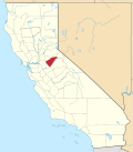
![]() Location in Calaveras County and the state of California | |
Coordinates: 38°10′05″N120°24′20″W / 38.16806°N 120.40556°W | |
Country | ![]() |
State | ![]() |
County | Calaveras |
Area | |
• Total | 5.655 sq mi (14.647 km2) |
• Land | 5.655 sq mi (14.647 km2) |
• Water | 0 sq mi (0 km2) 0% |
Elevation | 3,376 ft (1,029 m) |
Population | |
• Total | 1,276 |
• Density | 230/sq mi (87/km2) |
Time zone | UTC-8 (Pacific (PST)) |
• Summer (DST) | UTC-7 (PDT) |
ZIP code [4] | 95247 |
Area code | 209 |
FIPS code | 06-24897 |
GNIS feature IDs | 1804875, 2408228 |
Forest Meadows is a census-designated place (CDP) in Calaveras County, California, United States. The population was 1,249 at the 2010 census, up from 1,197 at the 2000 census.
According to the United States Census Bureau, the CDP has a total area of 5.7 square miles (15 km2), all of it land.
Brice Station is not inside the Forest Meadows HOA.
Census | Pop. | Note | %± |
---|---|---|---|
2000 | 1,197 | — | |
2010 | 1,249 | 4.3% | |
U.S. Decennial Census [5] |
At the 2010 census Forest Meadows had a population of 1,249. The population density was 220.9 inhabitants per square mile (85.3/km2). The racial makeup of Forest Meadows was 1,198 (95.9%) White, 0 (0.0%) African American, 4 (0.3%) Native American, 14 (1.1%) Asian, 0 (0.0%) Pacific Islander, 7 (0.6%) from other races, and 26 (2.1%) from two or more races. Hispanic or Latino of any race were 60 people (4.8%). [6]
The whole population lived in households, no one lived in non-institutionalized group quarters and no one was institutionalized.
There were 586 households, 81 (13.8%) had children under the age of 18 living in them, 367 (62.6%) were opposite-sex married couples living together, 39 (6.7%) had a female householder with no husband present, 11 (1.9%) had a male householder with no wife present. There were 23 (3.9%) unmarried opposite-sex partnerships, and 7 (1.2%) same-sex married couples or partnerships. 138 households (23.5%) were one person and 74 (12.6%) had someone living alone who was 65 or older. The average household size was 2.13. There were 417 families (71.2% of households); the average family size was 2.46.
The age distribution was 153 people (12.2%) under the age of 18, 72 people (5.8%) aged 18 to 24, 139 people (11.1%) aged 25 to 44, 466 people (37.3%) aged 45 to 64, and 419 people (33.5%) who were 65 or older. The median age was 58.0 years. For every 100 females, there were 99.5 males. For every 100 females age 18 and over, there were 95.0 males.
There were 845 housing units at an average density of 149.4 per square mile (57.7/km2),of which 586 were occupied, 488 (83.3%) by the owners and 98 (16.7%) by renters. The homeowner vacancy rate was 5.4%; the rental vacancy rate was 7.4%. 1,030 people (82.5% of the population) lived in owner-occupied housing units and 219 people (17.5%) lived in rental housing units.
In the state legislature, Forest Meadows is in the 8th Senate District , represented by Democrat Angelique Ashby, [7] and the 5th Assembly District , represented by Republican Joe Patterson. [8] Federally, Forest Meadows is in California's 4th congressional district , represented by Democrat Mike Thompson. [9]
Auberry is a census-designated place (CDP) in Fresno County, California, United States. The population was 2,369 at the 2010 census, up from 2,053 at the 2000 census. Auberry is located on Little Sandy Creek 9.5 miles (15 km) west of Shaver Lake Heights, at an elevation of 2,018 feet (615 m).
Bayview is a census-designated place (CDP) located adjacent to the City of Eureka in Humboldt County, California, United States. Its population is 2,619 as of the 2020 census, up from 2,510 from the 2010 census. Many locals consider this area as part of "Pine Hill."
Cutten, a census-designated place (CDP) in Humboldt County, California, United States, is an unincorporated community, which is part of Greater Eureka. The city was named for David Page Cutten and his family, who were prominent figures in the history of Humboldt County during the early 1850s. Cutten is located 2.5 miles (4 km) south-southeast of downtown Eureka, at an elevation of 200 feet. Its population is 3,223 as of the 2020 census, up from 3,108 from the 2010 census.
Dixon Lane-Meadow Creek is a census-designated place (CDP) in Inyo County, California, United States. The population was 2,645 at the 2010 census, down from 2,702 at the 2000 census.
South San Gabriel is a census-designated place (CDP) in Los Angeles County, California, United States. The population was 8,070 at the 2010 census, up from 7,595 at the 2000 census.
Laytonville is a census-designated place (CDP) in Mendocino County, California, United States. It is located 23 miles (37 km) north-northwest of Willits, at an elevation of 1,670 feet (510 m). The population was 1,152 at the 2020 census, down from 1,227 at the 2010 census.
Boronda is an unincorporated community and census-designated place (CDP) in Monterey County, California, United States. The population was 1,760 at the 2020 census. Boronda is located directly west of Salinas and is named after José Eusebio Boronda, a Californio ranchero, and located on the lands of his Rancho Rincón del Sanjón.
Meadow Vista is a census-designated place (CDP) in Placer County, California, United States. It is part of the Sacramento–Arden-Arcade–Roseville Metropolitan Statistical Area. The population was 3,217 at the 2010 census, up from 3,096 at the 2000 census.
Chester is a census-designated place (CDP) in Plumas County, California, United States. Chester is located on Lake Almanor, 30 miles (48.3 km) north-northwest of Quincy. The town is located along State Route 36. The US Postal Service ZIP code for the community is 96020. The population was 2,144 at the 2010 census, down from 2,316 at the 2000 census.
Meadow Valley is a census-designated place (CDP) in Plumas County, California, United States. The population was 453 at the 2020 census, down from 464 at the 2010 census.
Hidden Meadows is a census-designated place (CDP) near Escondido in San Diego County, California. The population was 3,485 at the 2010 census, up from 3,463 at the 2000 census.
Santa Ynez is a unincorporated community in the Santa Ynez Valley of Santa Barbara County, California, United States.
Day Valley is a census-designated place (CDP) in Santa Cruz County, California, United States. The population was 3,409 at the 2010 census.
Richgrove is a census-designated place (CDP) in Tulare County, California, United States. The population was 2,358 at the 2020 United States census, down from 2,882 at the 2010 census.
Stallion Springs is a census-designated place (CDP) in the Tehachapi Mountains, in Kern County, California, USA. The population was 2,488 at the 2010 census, up from 1,522 at the 2000 census. Stallion Springs is located in Cummings Valley within the Greater Tehachapi area.
Butte Meadows is a census-designated place in Butte County, California, 5 miles off State Route 32 on Humboldt Rd. The area is about 45 minutes or 33 miles (53 km) east of Chico on SR32. Its elevation is listed at 4,340 feet (1,323 m) above sea level: certain to get snow in winter of any year. The area code is Area code 530. The area is just over one mile (1.6 km) from the Tehama County line. The post office that served Butte Meadows moved back and forth across the county line several times from 1878 to 1888. Butte Meadows' population was 40 at the 2010 census.
Swall Meadows is an unincorporated community and census-designated place (CDP) in southern Mono County, California, United States. The population was 178 as of the 2020 census. The community is residential, including second homes and a volunteer fire department, but no commercial development. The ZIP Code is 93514. The community is inside area code 760.
Paradise is an unincorporated community and census-designated place (CDP) that is the southernmost community in Mono County, California, United States. The population was 174 at the 2020 census.
Verdi is a census-designated place (CDP) in Sierra County, California. Verdi sits at an elevation of 5,315 feet (1,620 m). The 2010 United States census reported Verdi's population was 162. It is just across the state line from Verdi, Nevada and below the Verdi Range.
Kennedy Meadows refers to a census-designated place (CDP) in Tulare County, California, United States part of the Springville-Johnsondale CCD, and consists of the community surrounding Kennedy Meadows. The CDP is located to the south-east of the Kennedy Meadows Campground. The 2020 United States census reported Kennedy Meadows's population of permanent residents at 58, up from 28 at the 2010 census. The census definition of the area may not precisely correspond to local understanding of the area with the same name.