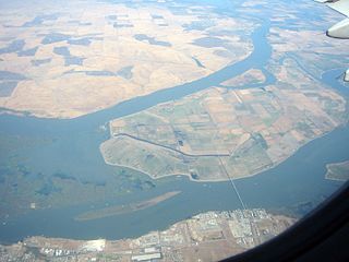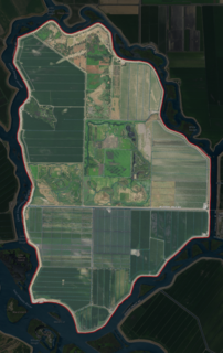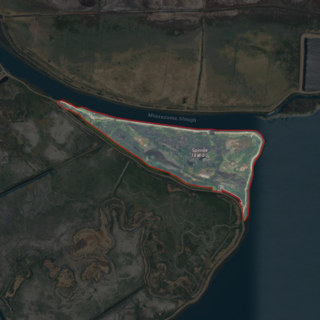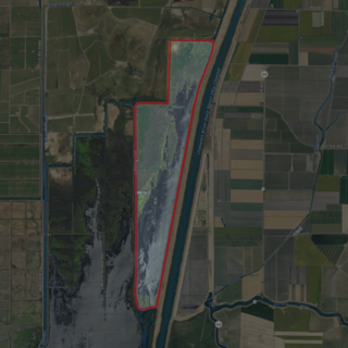
West Island is a small island in the San Joaquin River, California. It is part of Sacramento County. Its coordinates are 38°01′24″N121°46′43″W. It is shown, labeled "Webers Island", on an 1850 survey map of the San Francisco Bay area made by Cadwalader Ringgold and an 1854 map of the area by Henry Lange.

Brannan Island is a small island in the Sacramento–San Joaquin River Delta. It is part of Sacramento County, California, and managed by Reclamation District 2067. Its coordinates are 38°07′19″N121°38′37″W, and the United States Geological Survey measured its elevation as −13 ft (−4.0 m) in 1981. A "Brannan Island", with the same location but a slightly different shape, is labeled on an 1850 survey map of the San Francisco Bay area made by Cadwalader Ringgold as well as an 1854 map of the area by Henry Lange.

Headreach Island is a small island in the Sacramento–San Joaquin River Delta, in northern California. A naturally-formed island existing in a complex with Tule Island to the southeast and Fern Island to the northwest, it was used for farming as late as the 1920s. While several proposals for real estate development on the island were made in the late 20th century, it now consists mostly of marsh and submerged land. Black rails live on the island.

Ida Island is a small island in the Sacramento–San Joaquin River Delta. It is part of Sacramento County, California. Its coordinates are 38°10′14″N121°38′12″W, and the United States Geological Survey measured its elevation as 3 ft (0.91 m) in 1981. It appears on a 1978 USGS map of the area.

Kimball Island is a small island in the Sacramento–San Joaquin River Delta. Since its discovery, it has been used to grow barley, farm fish, cultivate cannabis, and as residential land. Currently, however, it is uninhabited; since 2000, it has been left to "forever be a wetland habitat".

Mallard Island is a small island in Suisun Bay, at the confluence of the Sacramento and San Joaquin rivers. It is part of Contra Costa County, California. Its coordinates are 38°02′31″N121°55′07″W, and the United States Geological Survey measured its elevation as 3 ft (0.91 m) in 1981. It appears in a 1953 USGS map of the area.

Spud Island is a small island of the San Joaquin River, located in the Sacramento–San Joaquin River Delta in northern California. It was once used to farm onions; while it is no longer used for agriculture, it remains inhabited. In the late 20th century it was the site of a county park, which offered camping, fishing and swimming amenities free of charge.

Tinsley Island is a small island in the Sacramento–San Joaquin River Delta, in San Joaquin County, California, next to the Stockton Deepwater Shipping Channel. It was created in the 1930s, when dredging to improve the navigability of the San Joaquin River cut it off from Roberts Island. Since 1958, it has been owned by the St. Francis Yacht Club. In 1960, the club transported a lighthouse from San Francisco Bay to serve as its clubhouse, and in the same year began an annual "Stag Cruise"; as of 2021, the club still owns the island and maintains a clubhouse there.

Tule Island is a small island in the Sacramento–San Joaquin River Delta, which exists as part of a complex of islands including directly-adjacent Fern Island and Headreach Island. It is a naturally-formed island, which was used in the early 20th century to farm potatoes, but now consists mostly of marsh. It is currently a habitat for waterfowl and is used as a fishing spot.

Vulcan Island is a small island in the Sacramento–San Joaquin River Delta. It is part of San Joaquin County, California. Its coordinates are 37°59′21″N121°24′22″W, and the United States Geological Survey measured its elevation as 7 ft (2.1 m) in 1981. It appears on a 1952 USGS map of the area.

Ward Island is a small island in the Sacramento–San Joaquin River Delta. It is part of San Joaquin County, California. Its coordinates are 38°02′30″N121°30′09″W, and the United States Geological Survey measured its elevation as 7 ft (2.1 m) in 1981. It appears on a 1952 USGS map of the area.

The Atlas Tract is an island in the Sacramento–San Joaquin River Delta, in San Joaquin County, California. It has been used for agriculture since it was first reclaimed in the late 19th century.

The Empire Tract is an island in the Sacramento–San Joaquin River Delta in San Joaquin County, California, United States. It has been used for agriculture since the 1800s; in the early 20th century it was used to plant potatoes, and United States president Herbert Hoover operated a beet farm there. In the 1960s, natural gas deposits were discovered beneath the island. In 1936, it was connected to the mainland by the Eight Mile Road Bridge, across King Island. As with many islands in the Delta, the Empire Tract has experienced considerable subsidence, and is well below sea level.

The Rio Blanco Tract is an island in the Sacramento–San Joaquin River Delta. It is part of San Joaquin County, California, and managed by Reclamation District 2114. Its coordinates are 38°04′46″N121°24′18″W, and the United States Geological Survey measured its elevation as 0 ft (0 m) in 1981. It appears on a 1952 USGS map of the area.

The Shin Kee Tract is an island in the Sacramento–San Joaquin River Delta. It is part of San Joaquin County, California, and not managed by any reclamation district. Its coordinates are 38°05′45″N121°25′09″W, and the United States Geological Survey measured its elevation as 0 ft (0 m) in 1981. It appears on a 1952 USGS map of the area.

The Palm Tract is an island in the Sacramento–San Joaquin River Delta. It is part of Contra Costa County, California. It, along with Orwood Tract to the south, are managed by Reclamation District 2024. Its coordinates are 37°57′14″N121°35′22″W, and the United States Geological Survey measured its elevation as 10 ft (3.0 m) in 1981. It appears on 1913 and 1952 United States Geological Survey maps of the area.

Chain Island is an island in Suisun Bay, downstream of the Sacramento–San Joaquin River Delta in northern California. In the late 1800s, it was considered an "obstruction to navigation" on the Sacramento River. As it was built up significantly from hydraulic mining tailings upstream on the river, plans were made in the early 20th century to remove it and recoup costs by mining the debris. However, this never happened; it was sold by the California State Lands Commission to a private individual in 1959, who listed it for sale the next year.

Montezuma Island is an island in Suisun Bay, an embayment of San Francisco Bay, and downstream of the Sacramento–San Joaquin River Delta. It is part of Sacramento County, California, and not managed by any reclamation district. Its coordinates are 38°04′28″N121°50′23″W, and the United States Geological Survey measured its elevation as 7 ft (2.1 m) in 1981. It is labeled "Burnett Island" on an 1850 survey map of the San Francisco Bay area made by Cadwalader Ringgold, and shown (unlabeled) on an 1854 map of the area by Henry Lange.

Spinner Island is an island in Suisun Bay, an embayment of San Francisco Bay, downstream of the Sacramento–San Joaquin River Delta. It is part of Solano County, California, and not managed by any reclamation district. Its coordinates are 38°04′11″N121°52′10″W, and the United States Geological Survey measured its elevation as 0 ft (0 m) in 1981. It is shown in an 1850 survey map of the San Francisco Bay area made by Cadwalader Ringgold, as well as an 1854 map of the area by Henry Lange.

The Little Holland Tract is a partially submerged island in the Sacramento–San Joaquin River Delta, in Yolo County, California. Its coordinates are 38°19′27″N121°39′20″W, and the United States Geological Survey gave its elevation as 13 ft (4.0 m) in 1981. It appears on a 1952 USGS map as a large rectangular tract; by 1978, survey maps show it cut diagonally by the Sacramento River Deep Water Ship Channel.


