 USGS aerial imagery. | |
 Venice Island  Venice Island | |
| Geography | |
|---|---|
| Location | Northern California |
| Coordinates | 38°04′30″N121°32′04″W / 38.07500°N 121.53444°W |
| Adjacent to | Sacramento-San Joaquin River Delta |
| Area | 3,100 acres (1,300 ha) |
| Administration | |
United States | |
| State | California |
| County | San Joaquin |
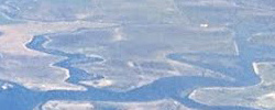
Venice Island is an island in the Sacramento-San Joaquin River Delta, fifteen kilometres (9.3 miles) northwest of Stockton. [1] [2] It is in San Joaquin County, California, and managed by Reclamation District 2023. [3]
It is owned by Barron Hilton and the DiNapoli family.[ citation needed ]
The 3,100-acre (1,300 ha) island is bounded on the north- and northeast by Potato Slough, on the southeast by Little Connection Slough, on the south by the Stockton Deepwater Channel Venice Cut, and on the west by the San Joaquin River-Stockton Deepwater Shipping Channel.

