Related Research Articles

Sutter's Fort was a 19th-century agricultural and trade colony in the Mexican Alta California province. The site of the fort was established in 1839 and originally called New Helvetia by its builder John Sutter, though construction of the fort proper wouldn't begin until 1841. The fort was the first non-Indigenous community in the California Central Valley. The fort is famous for its association with the Donner Party, the California Gold Rush, and the formation of the city of Sacramento, surrounding the fort. It is notable for its proximity to the end of the California Trail and Siskiyou Trails, which it served as a waystation.

Fremont is an unincorporated community in Yolo County, California. It is located on the Sacramento River and Interstate 5 in the east-northeastern portion of the county. Fremont's ZIP Code is 95691 and its area code 530. It is located on the Sacramento Northern and Sacramento and Woodland Railroads 11 miles (18 km) northeast of Davis, at an elevation of 23 feet.

Celilo Canal was a canal connecting two points of the Columbia River between the states of Oregon and Washington, U.S. just east of The Dalles.
Ingram Creek, originally Arroyo de la Suerte, is a 14-mile-long (23 km) tributary of the San Joaquin River in Stanislaus County, in the San Joaquin Valley of California.
Riverview is an unincorporated community in Yolo County, California. It lies on the west bank of the Sacramento River, on the Sacramento Northern and the Oakland, Antioch and Eastern Railroads 5 miles (8.0 km) south-southwest of West Sacramento, at an elevation of 16 feet.
Tyndall Landing is an unincorporated community in Yolo County, California. It is located on the Sacramento River 8 miles (13 km) east of Dunnigan, at an elevation of 36 feet.
Fremont Landing was a former settlement in Yolo County, California, United States. It was located on the Sacramento River 5.5 miles (8.9 km) east-southeast of Knights Landing, at an elevation of 26 feet.

Kelley Point Park is a city park in north Portland in the U.S. state of Oregon. Bounded by the Columbia Slough on the south, the Willamette River on the west, and the Columbia River on the north, the park forms the tip of the peninsula at the confluence of the rivers. Marine Terminal 6 of the Port of Portland lies immediately east of the park along the Columbia, while Terminal 5 is along the Willamette slightly south of the Columbia Slough. The park is at 45.6498384°N 122.7637106°W and rises to an elevation of 39 feet (12 m) above sea level. Sauvie Island is west of the park across the Willamette River. Hayden Island is slightly upstream of the park on the Columbia River opposite Marine Terminal 6.
Grand Island is an unincorporated community in Sacramento County, California, on the Sacramento River. It lies at an elevation of 33 feet.
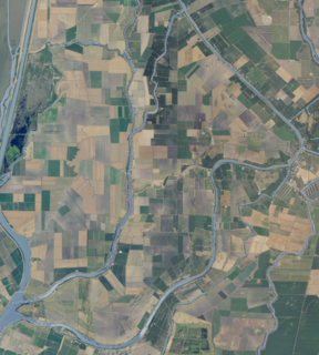
Grand Island is on the land lying between Sycamore Slough and the Sacramento River. A post office operated at Grand Island from 1854 to 1919.

The Split Rock River is a 3.5-mile-long (5.6 km) river of Minnesota, in the United States. It drains a small watershed of about 40 square miles (100 km2) on the North Shore of Lake Superior. The name was used as early as 1825 and is believed to refer either to the steep-walled gorge carved by the river or to two cliffs east of the river mouth that appear split apart. An indigenous name for the river was Gininwabiho-zibi, meaning "War Eagle Iron River." The river's lower course flows through Split Rock Lighthouse State Park, and the Superior Hiking Trail ascends and descends both banks. There is a separate stream called Split Rock Creek nearby.
Georgiana Slough, is a slough within Sacramento County, California. It is located in the Sacramento–San Joaquin River Delta, and links both the Sacramento River and the San Joaquin River above their confluence in the Delta near Pittsburg, at the head of Suisun Bay, through its connection with the Mokelumne River. The entrance to the slough on the Sacramento River is just below Walnut Grove, at 38°14′21″N121°30′59″W and runs between Tyler Island and Andrus Island to where it has its confluence with the Mokelumne River at 38°07′49″N121°34′40″W northwest of Bouldin Island just above that rivers confluence with the San Joaquin River.

Fremont Weir Wildlife Area is 1,461 acres at the north end of the Yolo Bypass floodway along the Sacramento River in Sutter County and Yolo County. It is 6 miles north-east of the city of Woodland and 15 miles north of Yolo Bypass Wildlife Area and the nearby Sacramento Bypass Wildlife Area. Whenever water in the river exceeds the height of the weir the excess flow runs over the weir and down the Yolo Bypass floodway, thereby reducing the risks of flooding in the city of Sacramento and nearby urban areas along the river.
Steamboats operated in California on San Francisco Bay and the Sacramento–San Joaquin River Delta, and Sacramento River as early as November 1847, when the Sitka built by William A. Leidesdorff briefly ran on San Francisco Bay and up the Sacramento River to New Helvetia. After the first discovery of gold in California the first shipping on the bays and up the rivers were by ocean going craft that were able to sail close to the wind and of a shallow enough draft to be able to sail up the river channels and sloughs, although they were often abandoned by their crews upon reaching their destination. Regular service up the rivers, was provided primarily by schooners and launches to Sacramento and Stockton, that would take a week or more to make the trip.
Norristown, or Hoboken, was an ephemeral California Gold Rush settlement and steamboat landing on the American River in present-day Sacramento County, California.
Port Isabel Slough was a deep slough in the Colorado River Delta near the mouth of the Colorado River during the 19th century, within the state of Sonora, Mexico.
Indian Slough is a slough, tributary to the Old River, an old channel of the San Joaquin River. Its mouth is at an elevation of 7 feet / 2 meters, at its confluence with the Old River. Its source is at its confluence with Kellogg Creek at an elevation of 7 feet / 2 meters at the location 37°54′58″N121°36′18″W.

Stockton Deepwater Shipping Channel also called the Baldwin-Stockton Deepwater Shipping Channel or Stockton Deep Water Channel is a manmade deepwater water channel that runs from Suisun Bay and the Sacramento River - Sacramento Deep Water Ship Channel to the Port of Stockton and the Stockton Channel in California. The Stockton Ship Channel is 41 mi (66 km) long and about 37 ft (11 m) deep, allowing up to Panama Canal size ocean ships access to the Port of Stockton at the City of Stockton. The Stockton Deepwater Shipping Channel is part of the vast Sacramento–San Joaquin River Delta that has a connection to the Pacific Ocean. Stockton Deepwater Shipping Channel is also called the lower San Joaquin River.
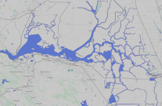
Sutter Island is a small island of the Sacramento River in California. It is bordered by the Sacramento River on the northeast, Steamboat Slough to the southease, and Sutter Slough to the west. It is located across the Sacramento River from Paintersville. It is part of Sacramento County. Its coordinates are 38°17′37″N121°35′32″W.
References
Coordinates: 38°10′55″N121°39′37″W / 38.18194°N 121.66028°W