
A cable ferry is a ferry that is guided across a river or large body of water by cables connected to both shores. Early cable ferries often used either rope or steel chains, with the latter resulting in the alternative name of chain ferry. Both of these were largely replaced by wire cable by the late 19th century.
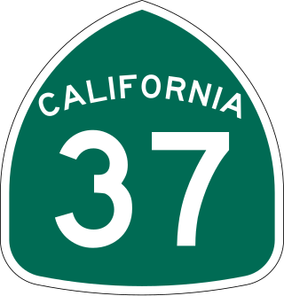
State Route 37 is a state highway in the U.S. state of California that runs 21 miles (34 km) along the northern shore of San Pablo Bay. It serves as a vital connection in the North Bay region of the San Francisco Bay Area, running from U.S. Route 101 in Novato, through northeastern Marin County, and the southern tips of both Sonoma and Solano Counties to Interstate 80 in Vallejo. Sonoma Raceway and Six Flags Discovery Kingdom are accessible from Highway 37.
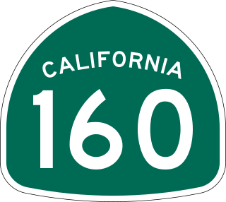
State Route 160 is a state highway in the U.S. state of California consisting of two sections. The longer, southern, section is a scenic highway through the alluvial plain of the Sacramento River, linking SR 4 in Antioch with Sacramento via the Antioch Bridge. The northern section, separated from the southern by Sacramento city streets, is the North Sacramento Freeway, running from the 16th Street Bridge over the American River to Interstate 80 Business towards Roseville.

State Route 84 is a state highway in the U.S. state of California that consists of two unconnected segments, one in the San Francisco Bay Area and the other primarily in the Sacramento–San Joaquin River Delta area.

The Carquinez Bridge is a pair of parallel bridges spanning the Carquinez Strait at the northeastern end of San Francisco Bay. They form the part of Interstate 80 between Crockett and Vallejo, California, United States.

The Antioch Bridge is an automobile, bicycle, and pedestrian bridge in the western United States. Located in northern California, it crosses the San Joaquin River-Stockton Deepwater Shipping Channel, linking Antioch in Contra Costa County with Sherman Island in southern Sacramento County, near Rio Vista.

The Yolo Causeway is a 3.2-mile (5.1 km) long elevated highway viaduct on Interstate 80 that crosses the Yolo Bypass floodplain, connecting the cities of West Sacramento, California and Davis, California. It is officially named the Blecher-Freeman Memorial Causeway after two California Highway Patrol officers who were killed in the line of duty just east of the causeway.

State Route 220 is a state highway in the U.S. state of California, defined to run between State Route 84 and State Route 160 on Ryer Island in the Sacramento–San Joaquin River Delta. At the eastern end of Ryer Island, the road crosses Steamboat Slough on the Howard Landing Ferry, a cable ferry.
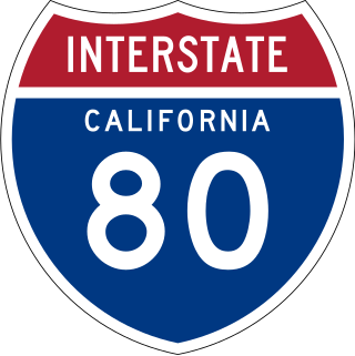
Interstate 80 (I-80) is a transcontinental Interstate Highway in the United States, stretching from San Francisco, California, to Teaneck, New Jersey. The segment of I-80 in California runs east from San Francisco across the San Francisco–Oakland Bay Bridge to Oakland, where it turns north and crosses the Carquinez Bridge before turning back northeast through the Sacramento Valley. I-80 then traverses the Sierra Nevada, cresting at Donner Summit, before crossing into the state of Nevada within the Truckee River Canyon. The speed limit is at most 65 mph (105 km/h) along the entire route instead of the state's maximum of 70 mph (110 km/h) as most of the route is in either urban areas or mountainous terrain. I-80 has portions designated as the Eastshore Freeway and Alan S. Hart Freeway.
State Route 529 is a Washington state highway that connects the cities of Everett and Marysville. The 7.88-mile-long (12.68 km) roadway extends north from an interchange with Interstate 5 (I-5), numbered exit 193, past the western terminus of U.S. Route 2 (US 2), its spur route, Downtown Everett and Naval Station Everett to cross the Snohomish River onto Smith Island. After crossing the Steamboat Slough, the road encounters an interchange with I-5, numbered exit 198, before crossing the Ebey Slough and entering Marysville. In Marysville, SR 529 ends at SR 528. Before being realigned in 1991, SR 529 started at exit 192 of I-5 and traveled north as Broadway through Downtown Everett to Marysville.

California's transportation system is complex and dynamic. Although known for its car culture and extensive network of freeways and roads, the state also has a vast array of rail, sea, and air transport. Several subway, light rail, and commuter rail networks are found in many of the state's largest population centers. In addition, with the state's location on the West Coast of the United States, several important ports in California handle freight shipments from the Pacific Rim and beyond. A number of airports are also spread out across the state, ranging from small general aviation airports to large international hubs like Los Angeles International Airport and San Francisco International Airport.

Ryer Island is an island in the Sacramento-San Joaquin River Delta surrounded by Miner Slough and Steamboat Slough at their confluence with the Sacramento River, 6.5 miles north-northeast of Rio Vista. It is in Solano County, California, and managed by Reclamation District 501. The 4,750 ha (11,700-acre) island is named in honor of a California pioneer, Dr. Washington M. Ryer, and his family. A map prepared at the time of statehood shows the area divided by the west fork of the Sacramento River, with the western half identified as Priest Island and the eastern half identified as Sutter Island.

The Ryer Island Ferry is a ferry that operates between Rio Vista and Ryer Island, crossing Cache Slough in the Sacramento–San Joaquin River Delta in Solano County, California. The California Department of Transportation (Caltrans) operates the vehicle roll-on/roll-off service, which is classified as part of California State Route 84. The free ferry service operates operates 24 hours a day, 7 days a week, leaving every 20 minutes; on the hour, 20 minutes after the hour, and 40 minutes after the hour.

The Kootenay Lake ferry is a ferry across Kootenay Lake in southeastern British Columbia, which operates between Balfour, on the west side of the lake, and Kootenay Bay, on the east side. The MV Osprey 2000 and the MV Balfour are the two vessels used.
The Real McCoy was a ferryboat that operated for 63 years from Rio Vista, California on the Ryer Island Ferry route as part of California State Route 84, and was the oldest and most reliable piece of equipment owned by the California Department of Transportation. During its operating life – making the trip 24 hours per day, 7 days per week and roughly 200 trips a day – totaling approximately 460,000 safe passages over the 800 foot gap in the Sacramento River delta, between Ryer Island and Rio Vista.
Steamboats operated in California on San Francisco Bay and the Sacramento–San Joaquin River Delta, and Sacramento River as early as November 1847, when the Sitka built by William A. Leidesdorff briefly ran on San Francisco Bay and up the Sacramento River to New Helvetia. After the first discovery of gold in California the first shipping on the bays and up the rivers were by ocean going craft that were able to sail close to the wind and of a shallow enough draft to be able to sail up the river channels and sloughs, although they were often abandoned by their crews upon reaching their destination. Regular service up the rivers, was provided primarily by schooners and launches to Sacramento and Stockton, that would take a week or more to make the trip.
Steamboat Slough is an alternate branch of the Sacramento River, named for its popular use by steamboats traveling between San Francisco and Sacramento. Its mouth is found at an elevation of 3 feet (0.9 m), 2 miles (3 km) above Rio Vista, between Grand Island and Ryer Island. Its head is 11 miles (18 km) above where it leaves the Sacramento River, between Sutter Island and Grand Island, at an elevation of 26 feet (8 m) at 38°18′17″N121°34′25″W.
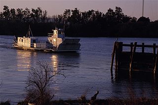
The Real McCoy II is a ferryboat that has operated since 2011 from Rio Vista, California on the Ryer Island Ferry route as part of California State Route 84, operated by the California Department of Transportation. It replaced the original Real McCoy in 2011. It operates 24 hours per day, 7 days per week, three trips per hour, over the 800 foot gap in California State Route 84 in the Sacramento River delta, between Ryer Island and Rio Vista. Real McCoy II is 88 feet long by 38 feet wide, has a capacity of 80,000 pounds, and can carry up to ten vehicles. There is a 16.25-ton weight limit, tractor-trailers are prohibited, and the length limit is at the discretion of the Coast Guard.

Stockton Deepwater Shipping Channel also called the Baldwin-Stockton Deepwater Shipping Channel or Stockton Deep Water Channel is a manmade deepwater water channel that runs from Suisun Bay and the Sacramento River - Sacramento Deep Water Ship Channel to the Port of Stockton and the Stockton Channel in California. The Stockton Ship Channel is 41 mi (66 km) long and about 37 ft (11 m) deep, allowing up to Panama Canal size ocean ships access to the Port of Stockton at the City of Stockton. The Stockton Deepwater Shipping Channel is part of the vast Sacramento–San Joaquin River Delta that has a connection to the Pacific Ocean. Stockton Deepwater Shipping Channel is also called the lower San Joaquin River.

The Empire Tract is an island in the Sacramento–San Joaquin River Delta in San Joaquin County, California, United States. It has been used for agriculture since the 1800s; in the early 20th century it was used to plant potatoes, and United States president Herbert Hoover operated a beet farm there. In the 1960s, natural gas deposits were discovered beneath the island. In 1936, it was connected to the mainland by the Eight Mile Road Bridge, across King Island. As with many islands in the Delta, the Empire Tract has experienced considerable subsidence, and is well below sea level.

