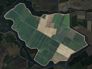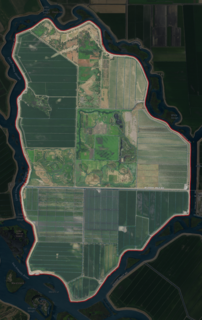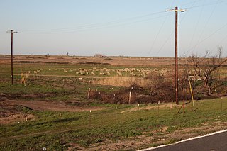
The Jones Tract is an island containing Lower Jones Tract and the Upper Jones Tract in the Sacramento-San Joaquin River Delta, fifteen kilometres west of Stockton. The 4,900 ha island is bounded on the north by Empire Cut, on the northeast by Whiskey Slough, on the southeast by Trapper Slough, and on the west, Middle River. The tracts are bifurcated by the parallel running Mokelumne Aqueduct, West Lower Jones Road, and a railroad originally built by the Achison Topeka and Santa Fe Railroad, which now carries freight trains of the BNSF Railway and Amtrak California's San Joaquin. It is in San Joaquin County, and managed by Reclamation District 2039. It appears on 1913 and 1952 United States Geological Survey maps of the area.

Woodward Island is an island in the Sacramento-San Joaquin River Delta, twenty kilometres east of Antioch, and twenty kilometres west of Stockton. The 725 ha (1,790-acre) island is bounded on the west by Old River, on the north by Bacon Island, on the east by Middle River, and Woodward Canal on the south. It is in San Joaquin County, and managed by Reclamation District 2072. It appears on 1913 and 1952 United States Geological Survey maps of the area.
Sutter Island is a small island of the Sacramento River in California. It is bordered by the Sacramento River on the northeast, Steamboat Slough to the southease, and Sutter Slough to the west. It is located across the Sacramento River from Paintersville. It is part of Sacramento County, and managed by Reclamation District 349. Its coordinates are 38°17′37″N121°35′32″W. It is shown, labeled "Schoolcraft Island", on an 1850 survey map of the San Francisco Bay area made by Cadwalader Ringgold and an 1854 map of the area by Henry Lange.

Fay Island is a small, partially submerged island in the San Joaquin River delta, in California. It is part of San Joaquin County, and managed by Reclamation District 2113. Its coordinates are 37.9485348°N 121.5652291°W. It appears, almost completely submerged, on a 1952 United States Geological Survey map of the area.

Medford Island is a small island in the San Joaquin River delta, in California. It is part of San Joaquin County, and managed by Reclamation District 2041. Its coordinates are 38.0371435°N 121.5113407°W.

Prospect Island is a small island in the San Joaquin River delta, in California. It is part of Solano County, and managed by Reclamation District 1667. Its coordinates are 38.2463030°N 121.6655110°W. It appears on a 1952 USGS map; by 1978, survey maps show it cut diagonally by the Sacramento River Deep Water Ship Channel.

Headreach Island is a small island in the Sacramento–San Joaquin River Delta, in northern California. A naturally-formed island existing in a complex with Tule Island to the southeast and Fern Island to the northwest, it was used for farming as late as the 1920s. While several proposals for real estate development on the island were made in the late 20th century, it now consists mostly of marsh and submerged land. Black rails live on the island.
Liberty Island is a mostly-flooded island in the Sacramento–San Joaquin River Delta, in Solano County, California. It is administered by Reclamation District 2093. Its coordinates are 38°17′13″N121°40′43″W, and the United States Geological Survey measured its elevation as 0 ft (0 m) in 1981.

Spud Island is a small island of the San Joaquin River, located in the Sacramento–San Joaquin River Delta in northern California. It was once used to farm onions; while it is no longer used for agriculture, it remains inhabited. In the late 20th century it was the site of a county park, which offered camping, fishing and swimming amenities free of charge.

The Atlas Tract is an island in the Sacramento–San Joaquin River Delta, in San Joaquin County, California. It has been used for agriculture since it was first reclaimed in the late 19th century.

The Rindge Tract is an island in the Sacramento–San Joaquin River Delta. It is part of San Joaquin County, California, and managed by Reclamation District 2037. Its coordinates are 38°01′20″N121°26′05″W, and the United States Geological Survey measured its elevation as −3 ft (−0.91 m) in 1981. It appears on a 1952 USGS map of the area.

The Empire Tract is an island in the Sacramento–San Joaquin River Delta in San Joaquin County, California, United States. It has been used for agriculture since the 1800s; in the early 20th century it was used to plant potatoes, and United States president Herbert Hoover operated a beet farm there. In the 1960s, natural gas deposits were discovered beneath the island. In 1936, it was connected to the mainland by the Eight Mile Road Bridge, across King Island. As with many islands in the Delta, the Empire Tract has experienced considerable subsidence, and is well below sea level.

The Rio Blanco Tract is an island in the Sacramento–San Joaquin River Delta. It is part of San Joaquin County, California, and managed by Reclamation District 2114. Its coordinates are 38°04′46″N121°24′18″W, and the United States Geological Survey measured its elevation as 0 ft (0 m) in 1981. It appears on a 1952 USGS map of the area.

The Terminous Tract is an island in the Sacramento–San Joaquin River Delta. It is part of San Joaquin County, California, and managed by Reclamation District 548. Its coordinates are 38°06′45″N121°27′27″W, and the United States Geological Survey measured its elevation as −7 ft (−2.1 m) in 1981. The census-designated place of Terminous, California is on the island.

The Shin Kee Tract is an island in the Sacramento–San Joaquin River Delta. It is part of San Joaquin County, California, and not managed by any reclamation district. Its coordinates are 38°05′45″N121°25′09″W, and the United States Geological Survey measured its elevation as 0 ft (0 m) in 1981. It appears on a 1952 USGS map of the area.

The Wright-Elmwood Tract is an island in the Sacramento–San Joaquin River Delta. It is part of San Joaquin County, California, and managed by Reclamation District 2119. Its coordinates are 37°59′23″N121°22′50″W, and the United States Geological Survey measured its elevation as 0 ft (0 m) in 1981.

Hog Island is an island in the San Joaquin River, and is one of many islands which constitute the Sacramento–San Joaquin River Delta. It was used for agriculture in the early 20th century, but has now mostly become marsh or submerged land; it remains a spot for fishing, particularly halibut and striped bass.

The Palm Tract is an island in the Sacramento–San Joaquin River Delta. It is part of Contra Costa County, California. It, along with Orwood Tract to the south, are managed by Reclamation District 2024. Its coordinates are 37°57′14″N121°35′22″W, and the United States Geological Survey measured its elevation as 10 ft (3.0 m) in 1981. It appears on 1913 and 1952 United States Geological Survey maps of the area.

The Holland Tract is an island in the Sacramento–San Joaquin River Delta. It is part of Contra Costa County, California, and managed by Reclamation District 2025. Its coordinates are 37°59′55″N121°36′08″W, and the United States Geological Survey measured its elevation as 7 ft (2.1 m) in 1981. It appears on a 1952 United States Geological Survey map of the area.

Randall Island is an island in the Sacramento River, in the Sacramento–San Joaquin River Delta. It is part of Sacramento County, California, and managed by Reclamation District 755. Its coordinates are 38°20′25″N121°33′03″W, and the United States Geological Survey measured its elevation as 0 ft (0 m) in 1981. It is shown, labelled "Hensley Island", on an 1850 survey map of the San Francisco Bay area made by Cadwalader Ringgold and an 1854 map of the area by Henry Lange.


