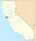
Alto | |
---|---|
Coordinates: 37°54′16″N122°31′32″W / 37.90444°N 122.52556°W Coordinates: 37°54′16″N122°31′32″W / 37.90444°N 122.52556°W | |
Country | United States |
State | California |
County | Marin County |
Metro | San Francisco Bay Area |
Area | |
• Total | 0.13 sq mi (0.33 km2) |
• Land | 0.13 sq mi (0.33 km2) |
• Water | 0.00 sq mi (0.00 km2) 0% |
Elevation | 26 ft (8 m) |
Population (2020) | |
• Total | 732 |
• Density | 5,809.52/sq mi (2,247.56/km2) |
Time zone | UTC-8 (Pacific (PST)) |
• Summer (DST) | UTC-7 (PDT) |
GNIS feature ID | 218191; 2582933 |
U.S. Geological Survey Geographic Names Information System: Alto, California; U.S. Geological Survey Geographic Names Information System: Alto, California |
Alto (Spanish for "Tall") is a census-designated place [3] adjacent to Mill Valley in Marin County, California. [2] It lies at an elevation of 26 feet (8 m). [2] The population was 732 at the 2020 census.
According to the United States Census Bureau, the CDP covered an area of 0.326 square kilometers (0.126 sq mi), all of it land.
Historical population | |||
---|---|---|---|
Census | Pop. | %± | |
2010 | 711 | — | |
2020 | 732 | 3.0% | |
U.S. Decennial Census [4] |
At the 2010 census Alto had a population of 711. The population density was 5,654.1 inhabitants per square mile (2,183.1/km2). The racial makeup of Alto was 619 (87.1%) White, 8 (1.1%) African American, 2 (0.3%) Native American, 30 (4.2%) Asian, 1 (0.1%) Pacific Islander, 16 (2.3%) from other races, and 35 (4.9%) from two or more races. Hispanic or Latino of any race were 51 people (7.2%). [5]
The census reported that 100% of the population lived in households.
There were 297 households, 108 (36.4%) had children under the age of 18 living in them, 140 (47.1%) were opposite-sex married couples living together, 34 (11.4%) had a female householder with no husband present, 6 (2.0%) had a male householder with no wife present. There were 17 (5.7%) unmarried opposite-sex partnerships, and 0 (0%) same-sex married couples or partnerships. 33.7% of households were one person and 10.1% were one person aged 65 or older. The average household size was 2.39. There were 180 families (60.6% of households); the average family size was 3.05.
The age distribution was 177 people (24.9%) under the age of 18, 47 people (6.6%) aged 18 to 24, 188 people (26.4%) aged 25 to 44, 236 people (33.2%) aged 45 to 64, and 63 people (8.9%) who were 65 or older. The median age was 41.0 years. For every 100 females, there were 81.8 males. For every 100 females age 18 and over, there were 79.2 males.
There were 313 housing units at an average density of 2,489.1 per square mile, of the occupied units 157 (52.9%) were owner-occupied and 140 (47.1%) were rented. The homeowner vacancy rate was 0.6%; the rental vacancy rate was 4.1%. 60.3% of the population lived in owner-occupied housing units and 39.7% lived in rental housing units.
Raisin City is a census-designated place (CDP) in Fresno County, California, United States. The population was 380 at the 2010 census, up from 165 at the 2000 census. Raisin City is located 13 miles (21 km) south-southwest of downtown Fresno, at an elevation of 236 feet.
Mesa is a census-designated place (CDP) in Inyo County, California, United States. The population was 251 at the 2010 census, up from 214 at the 2000 census.
North El Monte is a census-designated place (CDP) in the San Gabriel Valley, in Los Angeles County, California, United States. The population was 3,723 at the 2010 census, up from 3,703 at the 2000 census.
Spring Garden is a census-designated place (CDP) in Plumas County, California, United States. The population was 16 at the 2010 census, down from 55 at the 2000 census.
Storrie is a census-designated place (CDP) in Plumas County, California and about 20 miles northeast of Lake Oroville. As of the 2010 Census, the CDP had a population of four.
Loyola is a census-designated place in Santa Clara County, California, United States. The population was 3,491 at the 2020 census. The woodsy area is located between the cities of Los Altos and Los Altos Hills. It is the home of Facebook's first headquarters. Homes in the area range from cottages to mansions. It is named for Ignatius of Loyola, a Spanish saint and founder of the Jesuits.
Stanford is a census-designated place (CDP) in the northwest corner of Santa Clara County, California, United States and is the home of Stanford University. The population was 21,150 at the 2020 census.
Green Acres is a census-designated place in Riverside County, California. Green Acres sits at an elevation of 1,555 feet (474 m). The 2010 United States census reported Green Acres's population was 1,805.
Aspen Springs is a census-designated place in Mono County, California. It lies at an elevation of 7109 feet. The population was 65 at the 2010 census.
Camino Tassajara is a census-designated place in Contra Costa County, California. Camino Tassajara sits at an elevation of 814 feet (248 m). The 2010 United States census reported Camino Tassajara's population was 2,197.
Contra Costa Centre is an unincorporated census-designated place in Contra Costa County, California. Contra Costa Centre sits at an elevation of 92 feet. The 2010 United States census reported Contra Costa Centre's population was 5,364. Contra Costa Centre is served by the Pleasant Hill / Contra Costa Centre BART station.
San Miguel is a census-designated place in Contra Costa County, California. San Miguel sits at an elevation of 249 feet (76 m). The 2010 United States census reported San Miguel's population was 3,392.
Sunny Slopes is a census-designated place in Mono County, California. It sits at an elevation of 7,198 feet (2,194 m). Additionally, the 2010 United States census reported that Sunny Slopes' population was 182.
Timber Cove is a census-designated place (CDP) in Sonoma County, California. Timber Cove sits at an elevation of 554 feet (169 m). The 2010 United States census reported Timber Cove's population was 164.
Carmet is a census-designated place (CDP) in Sonoma County, California. Carmet sits at an elevation of 180 feet (55 m). The 2010 United States census reported Carmet's population was 47.
Pine Flat is a census-designated place (CDP) in Tulare County, California. Pine Flat sits at an elevation of 3,871 feet (1,180 m). The 2010 United States census reported Pine Flat's population was 166.
Plainview is a census-designated place (CDP) in Tulare County, California. Plainview sits at an elevation of 354 feet (108 m). The 2010 United States census reported Plainview's population was 945.
Poso Park is a census-designated place (CDP) in Tulare County, California. Poso Park sits at an elevation of 4,662 feet (1,421 m). The 2010 United States census reported Poso Park's population was 9.
West Goshen is a census-designated place (CDP) in Tulare County, California. West Goshen sits at an elevation of 272 feet (83 m). The 2010 United States census reported West Goshen's population was 511.
Idlewild is a census-designated place (CDP) in Tulare County, California. Idlewild sits at an elevation of 3,766 feet (1,148 m). The 2010 United States census reported Idlewild's population was 43.