Tectonic uplift

Last updated
Former sea bottom that raised during the 2013 Bohol earthquake - the water used to extend to the mangroves at right Loon 7 earthquake.JPG
Former sea bottom that raised during the 2013 Bohol earthquake - the water used to extend to the mangroves at right

Tectonic uplift is the geologic uplift of Earth's surface that is attributed to plate tectonics
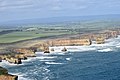
. While isostatic response is important, an increase in the mean elevation of a region can only occur in response to tectonic processes of crustal thickening (such as mountain building events), changes in the density distribution of the crust and underlying mantle, and flexural support due to the bending of rigid lithosphere.

Contents

Tectonic uplift results in denudation (processes that wear away the earth's surface) by raising buried rocks closer to the surface. This process can redistribute large loads from an elevated region to a topographically lower area as well – thus promoting an isostatic response in the region of denudation (which can cause local bedrock uplift). The timing, magnitude, and rate of denudation can be estimated by geologists using pressure-temperature studies.

Crustal thickening

Crustal thickening has an upward component of motion and often occurs when continental crust is thrust onto continental crust. Basically nappes (thrust sheets) from each plate collide and begin to stack one on top of the other; evidence of this process can be seen in preserved ophiolitic nappes (preserved in the Himalayas) and in rocks with an inverted metamorphic gradient. The preserved inverted metamorphic gradient indicates that nappes were actually stacked on top of each other so quickly that hot rocks did not have time to equilibrate before being thrust on top of cool rocks. The process of nappe stacking can only continue for so long, as gravity will eventually disallow further vertical growth (there is an upper limit to vertical mountain growth).

Density distribution of the crust and underlying mantle

Although the raised surfaces of mountain ranges mainly result from crustal thickening, there are other forces at play that are responsible for the tectonic activity. All tectonic processes are driven by gravitational force when density differences are present. A good example of this would be the large-scale circulation of the Earth's mantle. Lateral density variations near the surface (such as the creation, cooling, and subduction of oceanic plates) also drive plate motion.

The dynamics of mountain ranges are governed by differences in the gravitational energy of entire columns of the lithosphere (see isostasy). If a change in surface height represents an isostatically compensated change in crustal thickness, the rate of change of potential energy per unit surface area is proportional to the rate of increase of average surface height. The highest rates of working against gravity are required when the thickness of the crust (not the lithosphere) changes. [1]

Lithospheric flexure

Lithospheric flexure is the process by which the lithosphere bends under the action of forces such as the weight of a growing orogeny or changes in ice thickness related to glaciation. The lithosphere rests on the asthenosphere, a viscous layer that in geological time scales behaves like a fluid. Thus, when loaded, the lithosphere progressively reaches an isostatic equilibrium. For example, the lithosphere on the oceanward side of an oceanic trench at a subduction zone will curve upwards due to the elastic properties of the Earth's crust.

Orogenic uplift

Orogenic uplift is the result of tectonic-plate collisions and results in mountain ranges or a more modest uplift over a large region. Perhaps the most extreme form of orogenic uplift is a continental-continental crustal collision. In this process, two continents are sutured together, and large mountain ranges are produced. The collision of the Indian and Eurasian plates is a good example of the extent to which orogenic uplift can reach. Heavy thrust faulting (of the Indian plate beneath the Eurasian plate) and folding are responsible for the suturing together of the two plates. [2] The collision of the Indian and Eurasian plates produced the Himalayas and is also responsible for crustal thickening north into Siberia. [3] The Pamir Mountains, Tian Shan, Altai, Hindu Kush, and other mountain belts are all examples of mountain ranges formed in response to the collision of the Indian with the Eurasian plate.

The Ozark Plateau is a broad uplifted area which resulted from the Permian Ouachita Orogeny to the south in the states of Arkansas, Oklahoma, and Texas. Another related uplift is the Llano Uplift in Texas, a geographical location named after its uplift features. The Colorado Plateau which includes the Grand Canyon is the result of broad tectonic uplift followed by river erosion. [4]

When mountains rise slowly, either due to orogenic uplift or other processes (e.g., rebound after glaciation), an unusual feature known as a water gap may occur. In these, erosion from a stream occurs faster than mountain uplift, resulting in a gorge or valley that runs through a mountain range from low-lying country on one side to similar country on the other. Examples of such water gaps include the Manawatu Gorge in New Zealand and the Cumberland Narrows in Maryland.

Isostatic uplift

The removal of mass from a region will be isostatically compensated by crustal rebound. If we take into consideration typical crustal and mantle densities, erosion of an average 100 meters of rock across a broad, uniform surface will cause the crust to isostatically rebound about 85 meters and will cause only a 15-meter loss of mean surface elevation. [5] An example of isostatic uplift is post-glacial rebound following the melting of ice sheets. The Hudson Bay region of Canada, the Great Lakes of Canada and the United States, and Fennoscandia are currently undergoing gradual rebound as a result of the melting of ice sheets 10,000 years ago.

Crustal thickening, which for example is currently occurring in the Himalayas due to the continental collision between the Indian and the Eurasian plates, can also lead to surface uplift; but due to the isostatic sinking of thickened crust, the magnitude of surface uplift will only be about one-sixth of the amount of crustal thickening. Therefore, in most convergent boundaries, isostatic uplift plays a relatively small role, and high peak formation can be more attributed to tectonic processes. [6] Direct measures of the elevation change of the land surface can only be used to estimate erosion or bedrock uplift rates when other controls (such as changes in mean surface elevation, volume of eroded material, timescales and lags of isostatic response, variations in crustal density) are known.

Coral islands

In a few cases, tectonic uplift can be seen in coral islands. This is evidenced by the presence of various oceanic islands composed entirely of coral, which otherwise appear to be volcanic islands. Examples of such islands are found in the Pacific, notably the three phosphate islets of Nauru, Makatea, and Banaba, as well as Maré and Lifou in New Caledonia; Fatu Huku in the Marquesas Islands; and Henderson Island in the Pitcairn Islands. The uplift of these islands is the result of the movement of oceanic tectonic plates. Sunken islands or guyots with their coral reefs are the result of crustal subsidence as the oceanic plate carries the islands to deeper or lower oceanic crust areas.

Uplift vs. exhumation

The word "uplift" refers to displacement contrary to the direction of the gravity vector, and displacement is only defined when the object being displaced and the frame of reference is specified. Molnar and England [1] identify three kinds of displacement to which the term “uplift” is applied:

  1. Displacement of the Earth's surface with respect to the geoid. This is what we refer to as "surface uplift"; and surface uplift can be defined by averaging elevation and changes in elevation over surface areas of a specified size.
  2. The "uplift of rocks" refers to the displacement of rocks with respect to the geoid.
  3. The displacement of rocks with respect to the surface is called exhumation.

This simple equation relates the three kinds of displacement:

Surface uplift = uplift of rock - exhumation

The term geoid is used above to mean mean sea level and makes a good frame of reference. A given displacement within this frame of reference allows one to quantify the amount of work being done against gravity.

Measuring uplift and exhumation can be tricky. Measuring the uplift of a point requires measuring its elevation change – usually geoscientists are not trying to determine the uplift of a singular point but rather the uplift over a specified area. Accordingly, the change in elevation of all points on the surface of that area must be measured, and the rate of erosion must be zero or minimal. Also, sequences of rocks deposited during that uplift must be preserved. Needless to say, in mountain ranges where elevations are far above sea level these criteria are not easily met. Paleoclimatic restorations though can be valuable; these studies involve inferring changes in climate in an area of interest from changes with time of flora/fauna that is known to be sensitive to temperature and rainfall. [7] The magnitude of the exhumation a rock has been subjected to may be inferred from geothermobarometry (measuring previous pressure and temperature history of a rock or assemblage). Knowing the pressure and temperature history of a region can yield an estimate of the ambient geothermal gradient and bounds on the exhumation process; however, geobarometric/geothermometric studies do not produce a rate of exhumation (or any other information on time). Exhumation rates can be inferred from fission tracks and from radiometric ages as long as a thermal profile can be estimated.

Related Research Articles

<span class="mw-page-title-main">Orogeny</span> The formation of mountain ranges

Orogeny is a mountain-building process that takes place at a convergent plate margin when plate motion compresses the margin. An orogenic belt or orogen develops as the compressed plate crumples and is uplifted to form one or more mountain ranges. This involves a series of geological processes collectively called orogenesis. These include both structural deformation of existing continental crust and the creation of new continental crust through volcanism. Magma rising in the orogen carries less dense material upwards while leaving more dense material behind, resulting in compositional differentiation of Earth's lithosphere. A synorogenic process or event is one that occurs during an orogeny.

<span class="mw-page-title-main">Geology of the Alps</span> The formation and structure of the European Alps

The Alps form part of a Cenozoic orogenic belt of mountain chains, called the Alpide belt, that stretches through southern Europe and Asia from the Atlantic all the way to the Himalayas. This belt of mountain chains was formed during the Alpine orogeny. A gap in these mountain chains in central Europe separates the Alps from the Carpathians to the east. Orogeny took place continuously and tectonic subsidence has produced the gaps in between.

Obduction is a geological process whereby denser oceanic crust is scraped off a descending ocean plate at a convergent plate boundary and thrust on top of an adjacent plate. When oceanic and continental plates converge, normally the denser oceanic crust sinks under the continental crust in the process of subduction. Obduction, which is less common, normally occurs in plate collisions at orogenic belts or back-arc basins.

Isostasy or isostatic equilibrium is the state of gravitational equilibrium between Earth's crust and mantle such that the crust "floats" at an elevation that depends on its thickness and density. This concept is invoked to explain how different topographic heights can exist at Earth's surface. Although originally defined in terms of continental crust and mantle, it has subsequently been interpreted in terms of lithosphere and asthenosphere, particularly with respect to oceanic island volcanoes, such as the Hawaiian Islands.

<span class="mw-page-title-main">Convergent boundary</span> Region of active deformation between colliding tectonic plates

A convergent boundary is an area on Earth where two or more lithospheric plates collide. One plate eventually slides beneath the other, a process known as subduction. The subduction zone can be defined by a plane where many earthquakes occur, called the Wadati–Benioff zone. These collisions happen on scales of millions to tens of millions of years and can lead to volcanism, earthquakes, orogenesis, destruction of lithosphere, and deformation. Convergent boundaries occur between oceanic-oceanic lithosphere, oceanic-continental lithosphere, and continental-continental lithosphere. The geologic features related to convergent boundaries vary depending on crust types.

In tectonics, vertical displacement refers to the shifting of land in a vertical direction, resulting in uplift and subsidence. The displacement of rock layers can provide information on how and why Earth's lithosphere changes throughout geologic time. There are different mechanisms which lead to vertical displacement such as tectonic activity, and isostatic adjustments. Tectonic activity leads to vertical displacement when crust is rearranged during a seismic event. Isostatic adjustments result in vertical displacement through sinking due to an increased load or isostatic rebound due to load removal.

<span class="mw-page-title-main">Orogenic belt</span> Zone affected by mountain formation

An orogenic belt, orogen, or mobile belt, is a zone of Earth's crust affected by orogeny. An orogenic belt develops when a continental plate crumples and is uplifted to form one or more mountain ranges; this involves a series of geological processes collectively called orogenesis.

<span class="mw-page-title-main">Continental collision</span> Phenomenon in which mountains can be produced on the boundaries of converging tectonic plates

In geology, continental collision is a phenomenon of plate tectonics that occurs at convergent boundaries. Continental collision is a variation on the fundamental process of subduction, whereby the subduction zone is destroyed, mountains produced, and two continents sutured together. Continental collision is only known to occur on Earth.

<span class="mw-page-title-main">Magmatism</span> Emplacement of magma on the outer layers of a terrestrial planet, which solidifies as igneous rocks

Magmatism is the emplacement of magma within and at the surface of the outer layers of a terrestrial planet, which solidifies as igneous rocks. It does so through magmatic activity or igneous activity, the production, intrusion and extrusion of magma or lava. Volcanism is the surface expression of magmatism.

<span class="mw-page-title-main">Geology of Turkey</span> Overview of the geology of Turkey

The geology of Turkey is the product of a wide variety of tectonic processes that have shaped Anatolia over millions of years, a process which continues today as evidenced by frequent earthquakes and occasional volcanic eruptions.

<span class="mw-page-title-main">Forebulge</span>

In geology, a forebulge is a flexural bulge in front as a result of a load on the lithosphere, often caused by tectonic interactions and glaciations. An example of forebulge can be seen in the Himalayan foreland basin, a result of the Indian-Eurasian (continent-continent) plate collision, in which the Indian plate subducted and the Eurasian plate created a large load on the lithosphere, leading to the Himalayas and the Ganges foreland basin.

<span class="mw-page-title-main">Erosion and tectonics</span> Interactions between erosion and tectonics and their implications

The interaction between erosion and tectonics has been a topic of debate since the early 1990s. While the tectonic effects on surface processes such as erosion have long been recognized, the opposite has only recently been addressed. The primary questions surrounding this topic are what types of interactions exist between erosion and tectonics and what are the implications of these interactions. While this is still a matter of debate, one thing is clear, Earth's landscape is a product of two factors: tectonics, which can create topography and maintain relief through surface and rock uplift, and climate, which mediates the erosional processes that wear away upland areas over time. The interaction of these processes can form, modify, or destroy geomorphic features on Earth's surface.

In geology and geophysics, thermal subsidence is a mechanism of subsidence in which conductive cooling of the mantle thickens the lithosphere and causes it to decrease in elevation. This is because of thermal expansion: as mantle material cools and becomes part of the mechanically rigid lithosphere, it becomes denser than the surrounding material. Additional material added to the lithosphere thickens it and further causes a buoyant decrease in the elevation of the lithosphere. This creates accommodation space into which sediments can deposit, forming a sedimentary basin.

Tectonic subsidence is the sinking of the Earth's crust on a large scale, relative to crustal-scale features or the geoid. The movement of crustal plates and accommodation spaces produced by faulting brought about subsidence on a large scale in a variety of environments, including passive margins, aulacogens, fore-arc basins, foreland basins, intercontinental basins and pull-apart basins. Three mechanisms are common in the tectonic environments in which subsidence occurs: extension, cooling and loading.

A river anticline is a geologic structure that is formed by the focused uplift of rock caused by high erosion rates from large rivers relative to the surrounding areas. An anticline is a fold that is concave down, whose limbs are dipping away from its axis, and whose oldest units are in the middle of the fold. These features form in a number of structural settings. In the case of river anticlines, they form due to high erosion rates, usually in orogenic settings. In a mountain building setting, like that of the Himalaya or the Andes, erosion rates are high and the river anticline's fold axis will trend parallel to a major river. When river anticlines form, they have a zone of uplift between 50-80 kilometers wide along the rivers that form them.

Ultra-high-pressure metamorphism refers to metamorphic processes at pressures high enough to stabilize coesite, the high-pressure polymorph of SiO2. It is important because the processes that form and exhume ultra-high-pressure (UHP) metamorphic rocks may strongly affect plate tectonics, the composition and evolution of Earth's crust. The discovery of UHP metamorphic rocks in 1984 revolutionized our understanding of plate tectonics. Prior to 1984 there was little suspicion that continental rocks could reach such high pressures.

<span class="mw-page-title-main">Tectonic evolution of the Transantarctic Mountains</span>

The tectonic evolution of the Transantarctic Mountains appears to have begun when Antarctica broke away from Australia during the late Cretaceous and is ongoing, creating along the way some of the longest mountain ranges formed by rift flank uplift and associated continental rifting. The Transantarctic Mountains (TAM) separate East and West Antarctica. The rift system that formed them is caused by a reactivation of crust along the East Antarctic Craton. This rifting or seafloor spreading causes plate movement that results in a nearby convergent boundary which then forms the mountain range. The exact processes responsible for making the Transantarctic Mountains are still debated today. This results in a large variety of proposed theories that attempt to decipher the tectonic history of these mountains.

In geology, the term exhumation refers to the process by which a parcel of rock, approaches Earth's surface.

<span class="mw-page-title-main">Orogenic collapse</span> Thinning and spreading of a thickened crust

In geology, orogenic collapse is the thinning and lateral spread of thickened crust. It is a broad term referring to processes which distribute material from regions of high gravitational potential energy to regions of low gravitational potential energy. Orogenic collapse can begin at any point during an orogeny due to overthickening of the crust. Post-orogenic collapse and post-orogenic extension refer to processes which take place once tectonic forces have been released, and represent a key phase of the Wilson Cycle, between continental collision and rifting.

<span class="mw-page-title-main">Paleogeography of the India–Asia collision system</span>

The paleogeography of the India–Asia collision system is the reconstructed geological and geomorphological evolution within the collision zone of the Himalayan orogenic belt. The continental collision between the Indian and Eurasian plate is one of the world's most renowned and most studied convergent systems. However, many mechanisms remain controversial. Some of the highly debated issues include the onset timing of continental collision, the time at which the Tibetan plateau reached its present elevation and how tectonic processes interacted with other geological mechanisms. These mechanisms are crucial for the understanding of Mesozoic and Cenozoic tectonic evolution, paleoclimate and paleontology, such as the interaction between the Himalayas orogenic growth and the Asian monsoon system, as well as the dispersal and speciation of fauna. Various hypotheses have been put forward to explain how the paleogeography of the collision system could have developed. Important ideas include the synchronous collision hypothesis, the Lhasa-plano hypothesis and the southward draining of major river systems.

References

  1. 1 2 England and Molnar, 1990, Surface uplift, uplift of rocks, and exhumation of rocks, Geology, v. 18 no. 12 p. 1173-1177 Abstract
  2. Le Fort, Patrick. "Evolution of the Himalaya." (n.d.): 95-109. Print.
  3. Molnar, P., and P. Tapponnier. "Cenozoic Tectonics of Asia: Effects of a Continental Collision: Features of Recent Continental Tectonics in Asia Can Be Interpreted as Results of the India-Eurasia Collision." Science 189.4201 (1975): 419-26. Print.
  4. Karlstrom, K.E., et al., 2012, Mantle-driven dynamic uplift of the Rocky Mountains and Colorado Plateau and its surface response: Toward a unified hypothesis, Lithosphere, v. 4, p. 3–22 abstract
  5. Burbank, Douglas W., and Anderson, Robert S. Tectonic Geomorphology. Chichester, West Sussex: J. Wiley & Sons, 2011. Print.
  6. Gilchrist, A. R., M. A. Summerfield, and H. A. P. Cockburn. "Landscape Dissection, Isostatic Uplift, and the Morphologic Development of Orogens." Geology 22.11 (1994): 963-966. Print.
  7. Burbank, Douglas West., and Robert S. Anderson. Tectonic Geomorphology. Malden, MA: Blackwell Science, 2000. ISBN   978-0632043866