
Mojave National Preserve is a United States National Preserve located in the Mojave Desert of San Bernardino County, California, USA, between Interstate 15 and Interstate 40. The preserve was established October 31, 1994, with the passage of the California Desert Protection Act by the US Congress. Previously, it was the East Mojave National Scenic Area, under the jurisdiction of the Bureau of Land Management. At 1,542,776 acres (6,243 km2), it is the third largest unit of the National Park System in the contiguous United States.

The Great Basin Desert is part of the Great Basin between the Sierra Nevada and the Wasatch Range. The desert is a geographical region that largely overlaps the Great Basin shrub steppe defined by the World Wildlife Fund, and the Central Basin and Range ecoregion defined by the U.S. Environmental Protection Agency and United States Geological Survey. It is a temperate desert with hot, dry summers and snowy winters. The desert spans a large part of the state of Nevada, and extends into western Utah, eastern California, and Idaho. The desert is one of the four biologically defined deserts in North America, in addition to the Mojave, Sonoran, and Chihuahuan Deserts.

Cleveland National Forest encompasses 460,000 acres, mostly of chaparral, with a few riparian areas. A warm dry mediterranean climate prevails over the forest. It is the southernmost U.S. National Forest of California. It is administered by the U.S. Forest Service, a government agency within the United States Department of Agriculture. It is divided into the Descanso, Palomar and Trabuco Ranger Districts and is located in the counties of San Diego, Riverside, and Orange.

The Chocolate Mountains of California are located in Imperial and Riverside counties in the Colorado Desert of Southern California. The mountains stretch more than 60 miles (100 km) in a northwest to southeast direction, and are located east of the Salton Sea and south and west of the Chuckwalla Mountains and the Colorado River. To the northwest lie the Orocopia Mountains.
The Owens Peak Wilderness is a 73,767-acre (298.52 km2) wilderness area comprising the rugged eastern face of the Sierra Nevada Mountains. Owens Peak (8,445 ft) is the high point. The land was set aside with the passage of the California Desert Protection Act of 1994 by the US Congress.

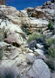
The Old Woman Mountains are located south of the town of Essex, California, and north of Danby Dry Lake. The range reaches an elevation of 5,325 feet (1,623 m) at the west end, and lies in San Bernardino County in the Mojave Desert.

The Little Picacho Wilderness is a 38,214-acre (15,465 ha) wilderness area under the jurisdiction of the Bureau of Land Management. The wilderness is found in a southeast extension of the Chocolate Mountains adjacent to the Colorado River, in the southeastern part of California. It should not be confused with the Picacho Peak Wilderness which is located to the northeast.
The Kingston Range, sometimes called the Kingston Mountains, is located in Inyo and San Bernardino counties in the Mojave Desert in eastern California. The range reaches a height of 7,323 feet (2,232 m) above sea level at Kingston Peak.

The Chemehuevi Mountains are found at the southeast border of San Bernardino County in southeastern California adjacent the Colorado River. Located south of Needles, California and northwest of the Whipple Mountains, the mountains lie in a north-south direction in general, and are approximately 15 miles in length.

The Palen Mountains are located in the southern Mojave Desert – northern Colorado Desert in eastern Riverside County, California, USA. The range lies southeast of the Coxcomb Mountains, and northeast of the Chuckwalla Mountains near Interstate 10. The mountains lie in a southwest-northeasterly direction, and are approximately 15 miles long and nine miles wide at their widest point.

The Turtle Mountains, are located in northeastern San Bernardino County, in the southeastern part of California. The colorful Turtle Mountains vary from deep reds, browns, tans and grays, to black. The area has numerous springs and seeps. The Turtle Mountains are also a National Natural Landmark, with two mountain sections of entirely different composition.
The Little Maria Mountains are located in southeastern California in the United States. The range lies in a northwest-southeasterly direction east of the Palen Mountains and west of the Big Maria Mountains. The mountain range is approximately 15 miles long and is located about 12.6 miles north of Interstate 10, and 12 miles southwest of the abandoned Rice Army Airfield near State Route 62. The Victor Mine is found at the southeastern end of the range near Midland.
The McCoy Mountains are located in southeastern California in the United States. The southeast terminus of the range lies adjacent the western edge of the Parker Valley in a southern stretch of the Lower Colorado River Valley corridor.
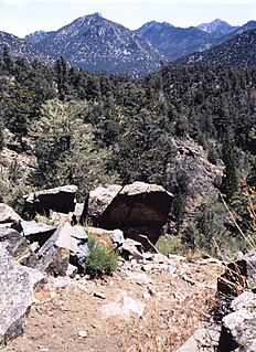
Old Woman Mountains Wilderness is a wilderness area in the Old Woman Mountains of the eastern Mojave Desert. It is located south of Essex in San Bernardino County, California.

The Kiavah Wilderness is a federally designated wilderness area located in the Mojave Desert, Scodie Mountains, and southern Sierra Nevada in Kern County, California, United States. California State Route 178 connects the town of Lake Isabella to State Highway 14 in the east, crossing Walker Pass at the north boundary of the wilderness.
The Piper Mountain Wilderness is a federally designated wilderness area located in the White Mountains 20 miles (32 km) northeast of Big Pine, California in Inyo County, California.
The Sylvania Mountains Wilderness is a federally designated wilderness area located 30 miles (48 km) east of Bishop in the state of California. The wilderness is 18,677acres in size and is managed by the Bureau of Land Management (BLM). The California Desert Protection Act of 1994 created the Sylvania Mountains Wilderness and was added to the National Wilderness Preservation System. The wilderness is bordered by Nevada stateline on the east, Piper Mountain Wilderness on the west and Death Valley National Park to the south.
The Mopah Range is a desert mountain range, in the Lower Colorado River Valley region, in southeastern San Bernardino County, California.
The Palo Verde Mountains are a mountain range in northeastern Imperial County, California. They are located along the west side of the Colorado River in the Lower Colorado River Valley and Colorado Desert. Palo Verde Peak, which rises to about 1,800 feet in the southern portion, is the highest point in the area. Thumb Peak stands to the north. Clapp Spring, a palm oasis, is located east of Thumb Peak. Clapp Spring is the only permanent water source in the area for wildlife species.

Sand to Snow National Monument is a U.S. National Monument located in San Bernardino County and northern Riverside County, Southern California.

