
San Bernardino County, officially the County of San Bernardino, is a county located in the southern portion of the U.S. state of California, and is located within the Inland Empire area. As of the 2020 U.S. Census, the population was 2,181,654, making it the fifth-most populous county in California and the 14th-most populous in the United States. The county seat is San Bernardino.

Crestline is a census-designated place in the San Bernardino Mountains of San Bernardino County, California, USA. The population was 10,770 at the 2010 census, up from 10,218 at the 2000 census.

Lake Arrowhead is an unincorporated community and a census-designated place (CDP) in the San Bernardino Mountains of San Bernardino County, California, surrounded by the San Bernardino National Forest, and surrounding the eponymous Lake Arrowhead Reservoir. Lake Arrowhead is located 13 miles north east of the San Bernardino city limits. The population of the CDP was estimated at 12,424 in the 2010 census. It was formerly called "Little Bear Lake", until around 1920, when a group from Los Angeles, the Arrowhead Lake Company, bought the lake and the land surrounding it, and changed its name to Arrowhead Lake.

San Bernardino is a city and county seat of San Bernardino County, California, United States. Located in the Inland Empire region of Southern California, the city had a population of 222,101 in the 2020 census, making it the 18th-largest city in California. San Bernardino is the economic, cultural, and political hub of the San Bernardino Valley and the Inland Empire. The governments of El Salvador, Guatemala, and Mexico have established the metropolitan area's only consulates in the downtown area of the city. Additionally, San Bernardino serves as an anchor city to the 3rd largest metropolitan area in California and the 13th largest metropolitan area in the United States; the San Bernardino-Riverside MSA.

Yucaipa is a city located 10 miles (16 km) east of San Bernardino, in San Bernardino County, California, United States. The population was 54,542 at the 2020 census, up from 51,367 at the 2010 census. Yucaipa has the distinction of being the longtime home to a large population of Serrano Native Americans.

Yermo is an unincorporated community in the Mojave Desert in San Bernardino County, California. It is 13 miles (21 km) east of Barstow on Interstate 15, just south of the Calico Mountains. Its population was an estimated 1,750 in 2009.

Angelus Oaks is an unincorporated community in San Bernardino County, California, United States, and has a population of 535 as of the 2010 U.S. Census, up from an estimated population of 312 in 2000. It is surrounded by the San Bernardino National Forest and located east of San Bernardino on California State Route 38.
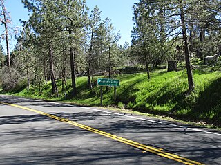
Blue Jay is an unincorporated community located in San Bernardino County in California. It is located in the San Bernardino Mountains, above a region of California known as the Inland Empire.
Oro Grande is an unincorporated community in the Mojave Desert of San Bernardino County, California, United States. It lies on the city boundary of Victorville and Adelanto. It is at 3,000 feet (910 m) elevation in Victor Valley north of the San Bernardino mountain range. It is located on old Route 66 near Interstate 15 between Victorville and Barstow. The ZIP code is 92368 and the community is inside area codes 442 and 760. Less than 1,000 residents live in the unincorporated area.
Green Valley Lake is an unincorporated community in San Bernardino County, California. It has a population of about 300. The ZIP Code is 92341 and the community is inside area code 909.

Lytle Creek is a census-designated place in the San Gabriel Mountains, within San Bernardino County.

Descanso is a small unincorporated community in the Cuyamaca Mountains, within the Mountain Empire area of southeastern San Diego County, California. The community's name is a Spanish word meaning "rest from labor".
Sugarloaf is an unincorporated community residential area less than a mile south of Big Bear City and 8 miles from the eastern tip of Big Bear Lake in the San Bernardino Mountains of San Bernardino County, California. The area is primarily residential with a convenience store and a post office located at the center of the community. The residential area is set at an elevation of 7,096 feet at its center, whereas its extreme northern border is 6,998 feet above sea level and the southern tip sits at 7,218 feet above sea level. There is no municipal organization for the area, and all fire, water, and police service is provided by San Bernardino County. The ZIP code for the community is 92386, the area code 909, and the population is 1,816. Big Bear High School is located in the northern part of the community.
Mountain Center is an unincorporated community and census-designated place in the San Jacinto Mountains, within western central Riverside County, California.

Lake Arrowhead is an artificial lake located in the San Bernardino Mountains on Little Bear Creek, a tributary of Deep Creek and the Mojave River. It has a surface area of approximately 780 acres (320 ha) and a capacity of 48,000 acre⋅ft (59,000 dam3). It is surrounded by the unincorporated community of Lake Arrowhead in San Bernardino County, California.

Forest Falls is an unincorporated community in San Bernardino County, California, 75 miles (121 km) due east of Los Angeles. The community has a population of 1,102 and contains 712 houses. Forest Falls is best known for the waterfalls on Vivian and Falls creeks and as a point of access for recreation in the San Bernardino National Forest, particularly the San Gorgonio Wilderness Area, which lies directly north of the community.
Cedar Glen is an unincorporated community in San Bernardino County, California, United States. This mountain community lies at an elevation of 5403 ft, and is located within the San Bernardino National Forest resort area immediately east of Lake Arrowhead. California State Highway 173 bisects Cedar Glen and passes through Lake Arrowhead.
Crest Park is an unincorporated community in San Bernardino County, California, United States. Crest Park is located in the San Bernardino Mountains on California State Route 18 1 mile (1.6 km) south of Lake Arrowhead. Crest Park had a post office with ZIP code 92326, which opened in 1949.
Twin Peaks is an unincorporated community in San Bernardino County, California, United States within the heart of the San Bernardino Mountains. California State Route 189 runs through the entire area before it reaches Lake Arrowhead. Twin Peaks has a post office with ZIP code 92391, which opened in 1916.


