Barnwell, California

Last updated
Barnwell,
Manvel
Ghost town
USA California location map.svg
Red pog.svg
Barnwell,
Manvel
Location within the state of California
Coordinates: 35°17′35″N115°14′09″W / 35.29306°N 115.23583°W / 35.29306; -115.23583 Coordinates: 35°17′35″N115°14′09″W / 35.29306°N 115.23583°W / 35.29306; -115.23583
Country United States
State California
County San Bernardino
Founded 1893
Time zone Pacific (PST) (UTC-8)
  Summer (DST) PDT (UTC-7)

Barnwell, originally a rail camp named Summit, then Manvel, was a former railhead serving local mining camps, now a ghost town, in San Bernardino County, California. It lies at an elevation 4806 feet in the New York Mountains. [1]

Ghost town city depopulated of inhabitants and that stays practically intact

A ghost town is an abandoned village, town, or city, usually one that contains substantial visible remains. A town often becomes a ghost town because the economic activity that supported it has failed, or due to natural or human-caused disasters such as floods, prolonged droughts, government actions, uncontrolled lawlessness, war, pollution, or nuclear disasters. The term can sometimes refer to cities, towns, and neighbourhoods that are still populated, but significantly less so than in past years; for example, those affected by high levels of unemployment and dereliction.

San Bernardino County, California County in California, United States

San Bernardino County, officially the County of San Bernardino, is a county located in the southern portion of the U.S. state of California, and is located within the Greater Los Angeles area. As of the 2010 U.S. Census, the population was 2,035,210, making it the fifth-most populous county in California, and the 12th-most populous in the United States. The county seat is San Bernardino.

Contents

History

Manvel

A mining magnate from Denver, Isaac G. Blake, in April 1892, with an interest in the silver mines in Sagamore Canyon in the New York Mountains, built the Needles Reduction Company mill, in the town of Needles and then in December 1892 began building the Nevada Southern Railway, toward those silver mines and the gold mining town of Vanderbilt from the Santa Fe Railroad station at Goffs, completing it to a rail camp with a post office, named Manvel, then later built it some miles on up nearer the mines, to a rail camp named Summit which was renamed Manvel when the post office relocated there, in July 1893. [2] :108 Manvel was the nearest railhead for nearby mining camps, including Vanderbilt, Goodsprings, Crescent, and Montgomery. However Blake's silver mines, mill and railroad empire was bankrupted by the crash of 1893 and tied up in litigation until after 1907.

Needles, California City in California in the United States

Needles is a city in San Bernardino County, California, United States. It lies on the western banks of the Colorado River in the Mohave Valley subregion of the Mojave Desert, near the borders of Arizona and Nevada and roughly 110 miles (180 km) from the Las Vegas Strip. It is the easternmost city of the San Bernardino-Riverside metropolitan area. Needles is geographically isolated from other cities in the county. Barstow, the nearest city within the county, is separated from Needles by over 140 miles of desert and 2 mountain ranges. The city is accessible via Interstate 40 and U.S. Route 95. The population was 4,844 at the 2010 census, up from 4,830 at the 2000 census.

Vanderbilt, California Ghost town in California, United States

Vanderbilt was a short-lived gold mining town located in San Bernardino County, California, United States. It existed between 1893 and 1895. At its peak it may have had a population of about 400 people.

Goffs, California Unincorporated community in California, United States

Goffs, an unincorporated community in San Bernardino County, California, is a nearly empty one-time railroad town at the route's high point in the Mojave Desert. Goffs was a stop on famous U.S. Route 66 until 1931 when a more direct road opened between Needles and Essex. Goffs was also home to workers of the nearby Santa Fe Railroad, with Homer east, Fenner south, and Blackburn and Purdy north.

The gold mines at Vanderbilt and those discovered to the east at Searchlight, Nevada in the later 1890s, helped to sustain Manvel. Manvel supported a flour, grain, and lumber dealer, a general store, a hotel, a blacksmith, the post office, and a stage line running to Montgomery in 1898 and a school district in January, 1900. In early 1902, the Nevada Southern completed a 15-mile extension into the Ivanpah Valley, to a new railhead at Ivanpah, to serve as the shipping point for the nearby Copper World Mine. [3]

Searchlight, Nevada Unincorporated town in Nevada, United States

Searchlight is an unincorporated town and census-designated place (CDP) in Clark County, Nevada, United States, at the topographic saddle between two mountain ranges. As of the 2010 census it had a population of 539.

The Ivanpah Valley is in southeastern California and southern Nevada in the United States. The valley is between the New York Mountains and the Ivanpah Mountains in San Bernardino County on the California side, and in Clark County on the Nevada side. The communities of Cima, California; Nipton, California; Jean, Nevada; and Primm, Nevada are in the valley. The Ivanpah Dry Lake, a popular place for land sailing, and the site of the proposed Ivanpah Valley Airport also lie in the valley.

Ivanpah, California Populated place in California, United States

Ivanpah is in the Mojave National Preserve in San Bernardino County, California. There are several residences in the area, but no real village.

At Searchlight, as production steadily increased, Manvel as its main rail shipping point for Searchlight, had a depot, telegraph office, a freight-forwarding house, and an agency of Wells, Fargo & Company. T. A. Brown, the co-founder of the Brown-Gosney Company store, largest in town, organized a telephone system; started several freight lines and a stage line; and opened branches in several nearby camps and towns.

Barnwell

In early 1905, the San Pedro, Los Angeles and Salt Lake Railroad was completed. The line passed only 20 miles from Searchlight and 15 miles from the Copper World Mine. With this competition in early 1907, the Santa Fé railroad completed a 23-mile extension to Searchlight, the Barnwell and Searchlight Railway. To prevent confusion with a town in Texas, Manvel was renamed Barnwell. The rail line was finished just as Searchlight’s production began to plunge. A depression followed in October. When blue pieces of scrip were introduced in Barnwell as money, families began to leave. In September 1908, a fire destroyed most of Barnwell’s business district, including the depot and the Brown-Gosney Company’s store. The depot never reopened and the Brown-Gosney Company which had earlier moved its headquarters to Searchlight, closed its store in Barnwell in February, 1910 and the town had another fire in May. After production at Searchlight fell drastically in 1911, T. A. Brown moved his family away in 1912. The railroad closed its agency in 1914. The post office was discontinued in April, 1915. The school district was abolished in 1918. All train service was discontinued in late 1923, and the rails were torn up. [3]

Barnwell and Searchlight Railway

The Barnwell and Searchlight Railway is a defunct 23-mile (37 km) short-line railroad that operated from 1906 - 1911. The railroad ran from Barnwell, California to Searchlight, Nevada. It was always operated by the Atchison, Topeka and Santa Fe Railway.

Barnwell today

There is a homestead and water tank at the former location of Barnwell. The railroad bed is still there and is still good in many places. [4]

Related Research Articles

Nipton, California Unincorporated community in California, United States

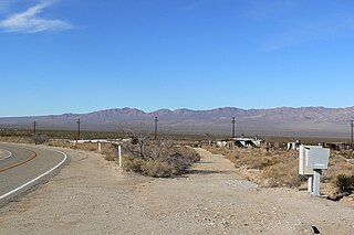
Nipton is an unincorporated community with a population of about 15 - 20, in San Bernardino County, California, on the northeastern border of Mojave National Preserve, approximately 12 miles southeast of Primm, Nevada and the Ivanpah Solar Power Facility. It is accessible via Nevada State Route 164.

Bagdad is a ghost town in the Mojave Desert, in San Bernardino County, California.

Yermo, California Town in California, United States

Yermo is a town in the Mojave Desert in San Bernardino County, California. Its name is derived from one of the Spanish words for "wilderness". It is 13 miles east of Barstow on Interstate 15, just south of the Calico Mountains. Its population was an estimated 1,750 in 2009.

Daggett, California Unincorporated community in California, United States

Daggett is an unincorporated community located in San Bernardino County, California in the United States. The town is located on Interstate 40 ten miles (16 km) east of Barstow. The town has a population of about 200. The ZIP code is 92327 and the community is inside area code 760.

Piute Range

The Piute Range is located in the Mojave Desert, primarily in northeast San Bernardino County, California, United States, with a north portion in Nevada. Most of the range is the eastern border of the Mojave National Preserve, a National Park Service natural area and park.

Ivanpah Lake lake of the United States of America

Ivanpah Lake is a dry lake bed in the Mojave Desert of San Bernardino County, California on the border of California and Nevada. Nestled in the Ivanpah Valley near Primm on Interstate 15, the 13-square-mile (34 km2) lake is almost entirely within California. At the north edge of the lake lie the Nevada Welcome Center (closed) and a California Lottery retailer. It is a popular place for land sailing and kite buggying.

Borate and Daggett Railroad

The Borate and Daggett Railroad was a 3 ft narrow gauge railroad built to carry borax in the Mojave Desert. The railroad ran about 11 miles (18 km) from Daggett, California, US, to the mining camp of Borate, three miles (4.8 km) to the east of Calico.

Ludlow, California Unincorporated community in California, United States

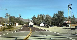
Ludlow is an unincorporated community in the Mojave Desert on Interstate 40, located in San Bernardino County, California, United States. The older remains of the ghost town are along historic Route 66.

Ivanpah (ghost town), California Ghost town in California, United States

Ivanpah was a short-lived silver mining town located in San Bernardino County, California, United States. It was founded in 1869 and existed until at least the mid-1880s.

Hart, California Ghost town in California, United States

Hart was a short-lived gold mining town located in the Mojave desert, in San Bernardino County, California. It existed between 1908 and 1915, and was located on the northeastern edge of Lanfair Valley near the New York Mountains. The area is now in the Mojave National Preserve, directed by the National Park Service.

Providence, San Bernardino County, California Ghost town in California, United States

Providence was a short-lived silver mining town located in San Bernardino County, California, United States. It existed between 1880 and 1886.

Piute Valley

The Piute Valley is a 45-mile-long (72 km) north–south valley southeast of Las Vegas, Nevada, and northwest of Needles. The north of the valley is at Searchlight, with some of the valley extending northwest from Searchlight. At the center-north lies Cal-Nev-Ari, Nevada.

Waterloo Mining Railroad

The Waterloo Mining Railroad, also known as the Calico Railroad or Daggett-Calico Railroad, was a 3 ft narrow gauge railroad built to carry silver ore from the mines in the Calico Mountains north of Calico to the mills located at Elephant Mountain near Daggett, California from 1888 to 1903.

Steamboats of the Colorado River

Steamboats on the Colorado River operated from the river mouth at the Colorado River Delta on the Gulf of California in Mexico, up to the Virgin River on the Lower Colorado River Valley in the Southwestern United States from 1852 until 1909, when the construction of the Laguna Dam was completed. The shallow draft paddle steamers were found to be the most economical way to ship goods between the Pacific Ocean ports and settlements and mines along the lower river, putting in at landings in Sonora state, Baja California Territory, California state, Arizona Territory, New Mexico Territory, and Nevada state. They remained the primary means of transportation of freight until the advent of the more economical railroads began cutting away at their business from 1878 when the first line entered Arizona Territory.

California Eastern Railway

California Eastern Railway, is a defunct 45-mile short-line railroad that operated from 1902 - 1911. The railroad ran from Goffs, California, to Ivanpah. It was first a private line operated by a mining company, that was acquired by the Atchison, Topeka and Santa Fe Railway.

Quartette or Quartette Mill or Quartette Landing, was a mining settlement, location of the stamp mill of the Quartette Mining Company, owner of the largest mine in the Searchlight Mining District and a steamboat landing on the Colorado River, in what is now Clark County, Nevada. It lay at an elevation of 646 feet.

References

  1. U.S. Geological Survey Geographic Names Information System: Barnwell
  2. Vredenburgh, L.M.; Shumway, G.L.; Hartill, R.D. (1981), Desert Fever, an overview of mining in the California Desert, living West Press: Canoga Park, CA
  3. 1 2 Hensher, Alan, 2005, The Historical Mining Towns of the Eastern Mojave Desert in Robert E. Reynolds editor, Old Ores, Mining History in the Eastern Mojave Desert: California State University, Desert Studies Consortium and LSA Associates, Inc. pages 22-27
  4. Barnwell Siding, (Manvel) California! from robertwynn.com accessed July 12, 2015.