San Bernardino County, officially the County of San Bernardino, is a county located in the southern portion of the U.S. state of California, and is located within the Inland Empire area. As of the 2020 U.S. Census, the population was 2,181,654, making it the fifth-most populous county in California and the 14th-most populous in the United States. The county seat is San Bernardino.
Muscoy is a census-designated place (CDP) in San Bernardino County, California, United States. The population was 10,644 at the 2010 census, up from 8,919 at the 2000 census. Muscoy shares ZIP code 92407 with the communities of Verdemont, Devore Heights, Rosena Ranch and Arrowhead Farms in northwestern San Bernardino. Residents enjoy a semi-rural setting with large lots where they can raise horses and other livestock, nursery plants, and fruit trees. For this reason, much of Muscoy is included in the county Additional Agriculture (AA) overlay, which specifies the types and quantities of animals that may be kept on each parcel. A distinctive feature of Muscoy life today is motor vehicles and equestrians sharing the roadways.

Rialto is a city in San Bernardino County, California, United States, 56 miles east of Los Angeles, near the Cajon Pass, Interstate 15, Interstate 10, State Route 210 and Metrolink routes.

San Bernardino is a city and county seat of San Bernardino County, California, United States. Located in the Inland Empire region of Southern California, the city had a population of 222,101 in the 2020 census, making it the 18th-largest city in California. San Bernardino is the economic, cultural, and political hub of the San Bernardino Valley and the Inland Empire. The governments of El Salvador, Guatemala, and Mexico have established the metropolitan area's only consulates in the downtown area of the city. Additionally, San Bernardino serves as an anchor city to the 3rd largest metropolitan area in California and the 13th largest metropolitan area in the United States; the San Bernardino-Riverside MSA.

The San Bernardino Mountains are a high and rugged mountain range in Southern California in the United States. Situated north and northeast of San Bernardino and spanning two California counties, the range tops out at 11,503 feet (3,506 m) at San Gorgonio Mountain – the tallest peak in Southern California. The San Bernardinos form a significant region of wilderness and are popular for hiking and skiing.

Yermo is an unincorporated community in the Mojave Desert in San Bernardino County, California. It is 13 miles (21 km) east of Barstow on Interstate 15, just south of the Calico Mountains. Its population was an estimated 1,750 in 2009.
The Arrowhead Trail or Arrowhead Highway was the first all-weather road in the Western United States that connected Los Angeles, California to Salt Lake City, Utah by way of Las Vegas, Nevada. Built primarily during the auto trails period of the 1910s, prior to the establishment of the U.S. numbered highway system, the road was replaced in 1926 by U.S. Route 91 (US 91) and subsequently Interstate 15 (I‑15). Small portions of the route in California and Las Vegas, Las Vegas Boulevard, are sometimes still referred to by the name, or as Arrow Highway.
Halloran Springs is a set of springs in the Mojave Desert in San Bernardino County, California, United States. It is located on Interstate 15 between Baker, California and Las Vegas, Nevada approximately 15 miles (24 km) northeast of Baker.
Cima is a small unincorporated community in the Mojave Desert of San Bernardino County, California, in the United States. It lies in a mountain pass on the divide between the Ivanpah Valley and the Mojave River basin, at an elevation of 4,175 feet (1,273 m). The Ivanpah Mountains and Interstate 15 are to the north, the New York Mountains are to the east, and the Providence Mountains are to the south. To the northwest is the Cima volcanic field, which contains Cima Dome at 5,745 feet (1,751 m) above sea level, a prominent landmark along I-15. Cima is also home to one of the densest Yucca brevifolia forests in California, located in the Cima Dome.

Chambless is a ghost town in the Mojave Desert of San Bernardino County, California, United States, south of Interstate 40 on the historic Route 66.
Siberia is a ghost town in the Mojave Desert of San Bernardino County, California, United States. It lies along historic Route 66 between Bagdad and Ludlow, in the ZIP code 92357 and area codes 442 and 760.

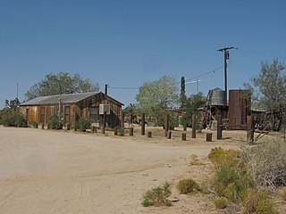
Red Mountain, formerly known as Osdick, is an unincorporated community in San Bernardino County, California, United States.
Cedar Glen, California is an unincorporated community in located in the San Bernardino National Forest resort area of San Bernardino County immediately east of Lake Arrowhead.
Rimforest is an unincorporated community in the San Bernardino Mountains of San Bernardino County, California, United States. It is located along California State Route 18. Rimforest has a post office with ZIP code 92378, which opened in 1949. Rimforest was featured in a season 5 episode of Storage Wars.
Cedarpines Park is an unincorporated community in San Bernardino County, California, United States. Cedarpines Park is 10 miles (16 km) north-northwest of San Bernardino. Cedarpines Park has a post office with ZIP code 92322. The post office opened in 1927 and was closed from 1943 to 1946.
Crest Park is an unincorporated community in San Bernardino County, California, United States. Crest Park is located in the San Bernardino Mountains on California State Route 18 1 mile (1.6 km) south of Lake Arrowhead. Crest Park had a post office with ZIP code 92326, which opened in 1949.
Patton is an unincorporated community in San Bernardino County, California, United States. Patton is 4.5 miles (7.2 km) northeast of downtown San Bernardino. Patton has a post office with ZIP code 92369, which opened in 1897.

Skyforest is an unincorporated community in San Bernardino County, California, United States.
Twin Peaks is an unincorporated community in San Bernardino County, California, United States, located on California State Route 189 2.5 miles (4.0 km) west-southwest of Lake Arrowhead. Twin Peaks has a post office with ZIP code 92391, which opened in 1916.