
San Jacinto is a city in Riverside County, California. It is located at the north end of the San Jacinto Valley, with Hemet to its south and Beaumont, California, to its north. The mountains associated with the valley are the San Jacinto Mountains. The population was 44,199 at the 2010 census. The city was founded in 1870 and incorporated on April 20, 1888, making it one of the oldest cities in Riverside County.

Chino is a city in the western end of San Bernardino County, California, United States, with Los Angeles County to its west and Orange County to its south in the Southern California region. Chino is adjacent to Chino Hills, California. Chino's surroundings have long been a center of agriculture and dairy farming, providing milk products in Southern California and much of the southwestern United States. Chino's agricultural history dates back to the Spanish land grant forming Rancho Santa Ana del Chino. The area specialized in fruit orchards, row crops, and dairy.

Chino Hills is a city located in the southwestern corner of San Bernardino County, California, United States. The city borders Los Angeles County on its northwest side, Orange County to its south and southwest, and Riverside County to its southeast.

San Bernardino is a city and county seat of San Bernardino County, California. Located in the Inland Empire region of Southern California, the city had a population of 222,101 in the 2020 census, making it the 18th-largest city in California. San Bernardino is the economic, cultural, and political hub of the San Bernardino Valley and the Inland Empire. The governments of El Salvador, Guatemala, and Mexico have established the metropolitan area’s only consulates in the downtown area of the city. Additionally, San Bernardino serves as an anchor city to the 3rd largest metropolitan area in California and the 13th largest metropolitan area in the United States; the San Bernardino-Riverside MSA.

Rancho Cucamonga was a 13,045-acre Mexican land grant in present-day San Bernardino County, California, given in 1839 to the dedicated soldier, smuggler and politician Tiburcio Tapia by Mexican governor Juan Bautista Alvarado. The grant formed parts of present-day California cities Rancho Cucamonga and Upland. It extended easterly from San Antonio Creek to what is now Hermosa Avenue, and from today's Eighth Street to the mountains.

The San Jacinto Mountains are a mountain range in Riverside County, located east of Los Angeles in southern California in the United States. The mountains are named for one of the first Black Friars, Saint Hyacinth, who is a popular patron in Latin America.

State Route 74, part of which forms the Palms to Pines Scenic Byway or Pines to Palms Highway, and the Ortega Highway, is a state highway in the U.S. state of California. It runs from Interstate 5 in San Juan Capistrano in Orange County to the city limits of Palm Desert in Riverside County. Stretching about 111 miles (179 km), it passes through several parks and National Forests between the Pacific coast and the Coachella Valley.
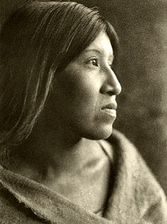
The Cahuilla, also known as ʔívil̃uqaletem or Ivilyuqaletem, are a Native American people of the various tribes of the Cahuilla Nation, living in the inland areas of southern California. Their original territory included an area of about 2,400 square miles (6,200 km2). The traditional Cahuilla territory was near the geographic center of Southern California. It was bounded to the north by the San Bernardino Mountains, to the south by Borrego Springs and the Chocolate Mountains, to the east by the Colorado Desert, and to the west by the San Jacinto Plain and the eastern slopes of the Palomar Mountains.

The San Bernardino National Forest is a United States National Forest in Southern California encompassing 823,816 acres (3,333.87 km2) of which 677,982 acres (2,743.70 km2) are federal. The forest is made up of two main divisions, the eastern portion of the San Gabriel Mountains and the San Bernardino Mountains on the easternmost of the Transverse Ranges, and the San Jacinto and Santa Rosa Mountains on the northernmost of the Peninsular Ranges. Elevations range from 2,000 to 11,499 feet. The forest includes seven wilderness areas: San Gorgonio, Cucamonga, San Jacinto, South Fork, Santa Rosa, Cahuilla Mountain and Bighorn Mountain. Forest headquarters are located in the city of San Bernardino. There are district offices in Lytle Creek, Idyllwild, and Fawnskin.

The San Bernardino Valley is a valley in Southern California located at the south base of the Transverse Ranges. It is bordered on the north by the eastern San Gabriel Mountains and the San Bernardino Mountains; on the east by the San Jacinto Mountains; on the south by the Temescal Mountains and Santa Ana Mountains; and on the west by the Pomona Valley. Elevation varies from 590 feet (180 m) on valley floors near Chino, where it gradually increases to about 1,380 feet (420 m) near San Bernardino and Redlands. The valley floor is home to over 80% of the more than 4 million people of the Inland Empire region.

Landers is an unincorporated community in the High Desert region of the Mojave Desert, in San Bernardino County, Southern California. Landers' population, as of 2017, is 2,982 people. Its residents are sometimes referred to as "Landroids"—an allusion to the popular UFO culture in the area—and its official slogan is "Beautiful Skies, Miles of Smiles," adopted pursuant to a contest held by the Landers Association in early 2014. It was submitted by Ms. McCall's 3rd and 4th grade class at Landers Elementary School and was unveiled on June 10, 2014. However, for almost half a century, Landers has been known to its residents as "the land of 1000 vistas".

High Desert is a vernacular region with non-discrete boundaries applying to areas of the western Mojave Desert in southern California. The "High Desert" region is an area that generally is situated between 2,000 feet (610 m) and 4,000 feet (1,200 m) in elevation, and located just north of the San Gabriel, San Bernardino, and Little San Bernardino Mountains.

Downtown San Bernardino is a district in the city of San Bernardino, California, in San Bernardino County, United States. It is home to city and county government buildings, and to the city's central business district. The downtown area of San Bernardino is home to multiple diplomatic missions for the Inland Empire, being one of only four California cities with multiple consulates. The governments of Guatemala and Mexico have established their consulates in the civic center. Downtown San Bernardino is bounded by I-215 to the west, Waterman Avenue to the east, Baseline Street to the north, and Mill Street to the south.

The Santa Rosa Wilderness is a 72,259-acre (292.42 km2) wilderness area in Southern California, in the Santa Rosa Mountains of Riverside and San Diego counties, California. It is in the Colorado Desert section of the Sonoran Desert, above the Coachella Valley and Lower Colorado River Valley regions in a Peninsular Range, between La Quinta to the north and Anza Borrego Desert State Park to the south. The United States Congress established the wilderness in 1984 with the passage of the California Wilderness Act, managed by both the US Forest Service and the Bureau of Land Management. In 2009, the Omnibus Public Land Management Act was signed into law which added more than 2,000 acres (8.1 km2). Most of the Santa Rosa Wilderness is within the Santa Rosa and San Jacinto Mountains National Monument.
Edgemont was an unincorporated community in Riverside County, California, and is now part of the City of Moreno Valley.
Verdemont, also known as Verdemont Heights, is a foothill and suburban neighborhood located in the northern portion of the city of San Bernardino, California. The neighborhood contains the Western Region Little League headquarters. Verdemont is one of the city's most desirable neighborhoods, holding the city's high income families, along with Arrowhead Springs, and the University District. Verdemont is home to most of the city's million dollar homes.

Forest Falls is an unincorporated community in San Bernardino County, California, 75 miles (121 km) due east of Los Angeles. The community has a population of 1,102 and contains 712 houses. Forest Falls is best known for the waterfalls on Vivian and Falls creeks and as a point of access for recreation in the San Bernardino National Forest, particularly the San Gorgonio Wilderness Area, which lies directly north of the community.
Cedar Glen, California is an unincorporated community in located in the San Bernardino National Forest resort area of San Bernardino County immediately east of Lake Arrowhead.

Riverside County is a county located in the southern portion of the U.S. state of California. As of the 2020 census, the population was 2,418,185, making it the fourth-most populous county in California and the 10th-most populous in the United States. The name was derived from the city of Riverside, which is the county seat.


