It has been suggested that this article be merged into History of San Bernardino, California . (Discuss) Proposed since June 2021. |
This is a historical timeline of San Bernardino, California.

| History of California |
|---|
 |
| Periods |
| Topics |
| Cities |
| Regions |
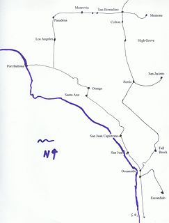
- 1810 – Padre Francisco Dumetz, a Spanish priest, names San Bernardino (the valley) on May 20, 1810, feast day of St. Bernardine of Siena. [1] Politana, a mission chapel and supply station of the Mission San Gabriel, was the first Spanish settlement in the San Bernardino Valley.
- 1812
- The M6.9–7.5 San Juan Capistrano earthquake affected Alta California with a maximum Mercalli intensity of VII (Very strong) to IX (Violent), killing 40 parishioners at Mission San Juan Capistrano.
- Serrano attacked and destroyed Politana.
- 1829 – San Bernardino Asistencia, a more permanent outpost structure of Mission San Gabriel, constructed. [2]
- 1830 – January 28, the expedition of Antonio Armijo descended to the San Bernardino Valley, from the head of the Mojave River to the mouth of Cajon Canyon to establish the first route of the Old Spanish Trail trade between Nuevo Mexico and Alta California [3]
- 1842 – Rancho San Bernardino granted to Antonio Maria Lugo, encompassing the entire San Bernardino Valley. [4]
- 1845 – Agua Mansa founded on land donated by Don Juan Bandini from his Rancho Jurupa to a group of colonists from Abiquiú, New Mexico.
- 1848 – Treaty of Guadalupe Hidalgo cedes California to the United States [5]
- 1851 – Mormon colony founded on the land of the Rancho San Bernardino purchased from the Lugo family. [6]
- 1851 – Jews arrive with the Mormon settlers. They establish the oldest Jewish cemetery in continuous use on the West Coast. Congregation Emanu El was later chartered in 1891.

- 1852 – Colonel Henry Washington erects survey monument in San Bernardino Mountains, founds the San Bernardino Base and Meridian. The Base Line is along the street of the same name. [7]
- 1854 – San Bernardino incorporated on April 13, 1854 [8]
- 1857 – Brigham Young recalls Mormons to Utah. San Bernardino disincorporated. [9] The first orange trees are brought to the valley. [10] The Fort Tejon earthquake ruptured the San Andreas Fault, the last major earthquake on the San Bernardino portion of the fault to this day. [11]
- 1859 – San Bernardino County votes to secede from California to form the Territory of Colorado, voting 421–29 in favor of secession. [12]
- 1862 – A flood causes the Santa Ana River to carry three times its usual volume, altering its banks, wiping out nearby Agua Mansa.
- 1863 – A smallpox plague from Los Angeles County hits San Bernardino. This epidemic caused severe mortality among the Native American population of Southern California, reducing them to a minority of the population.
- 1863 – 1864 Great Drought, destroys most of the cattle of the ranchos, ending the era of the great Californio ranchos.
- 1870 – Regional rival Riverside, California formed by John W. North.
- 1873 – The Southern Pacific Railroad enters into negotiations with the City to build a railroad through town. Talks break down.
- 1874 – The first permanent court house [13] is founded on Court Street near "E" Street.
- 1875 – The Southern Pacific reaches the valley but stops at Slover Mountain Colony. The station is named Colton after Southern Pacific Official David D. Colton, and will become the City of Colton.
- 1882 – Julia and Joseph Meyer arrive in the area today known as Verdemont in Northwestern San Bernardino, and eventually they will own 2,000 acres (8 km2) which they use to grow wine grapes.
- 1883 – California Southern Railroad reaches San Bernardino on September 13. San Bernardino High School becomes the first high school in the county.
- 1885 – On November 9, 1885, the last spike is driven on the California Southern Railroad, linking San Bernardino to the Atlantic Pacific Railroad.
- 1886 – San Bernardino reincorporated. A passenger rail fare war erupts between Southern Pacific and Santa Fe dropping the price from $125 to $1. All of Southern California booms.
- 1890 – The sanitarium that later becomes Patton State Hospital is founded.
- 1893 – Rival city Riverside secedes from San Bernardino County and forms its own County, with the City of Riverside its county seat.
- 1894 – The Sun Newspaper begins publishing.
- 1901 – San Bernardino's first permanent City Hall is located on a Corner of Third and "D" Street.
- 1902 – San Bernardino Valley Traction Company forms to operate electric trolleys in and between Colton, San Bernardino, Redlands and Highland.
- 1905 – San Bernardino passes its first Charter. Harris Company opens inside a small dry goods store. It becomes a small regional department store until it merges with Gottschalks in the 1990s.
- 1911 – First National Orange Show held.
- 1923 – On July 22, a 6.0 Mw earthquake shook the Inland Empire area of Southern California with a maximum Mercalli intensity of VII (Very strong). At Redlands and San Bernardino, chimneys fell and buildings were damaged. [14]
- 1925 – Future President Lyndon B. Johnson works as an elevator operator in the Platt Building in downtown San Bernardino
- 1926 – San Bernardino Valley College built.
- 1927 – The San Bernardino County Court House is built on the site of Fort San Bernardino, as Court Street is extended to Arrowhead.
- 1930 – San Bernardino's population grows to 37,481 [15]
- 1938 – A major flood from the mountains damages the city.
- 1940 – San Bernardino's population reaches 43,646 [16]
- 1941 – Dorothy Inghram becomes the first African American teacher in San Bernardino, and later the first African American school administrator in the state.
- 1942 – San Bernardino Air Material Command opens (later Norton Air Force Base).
- 1944 – San Bernardino native Leland Francis Norton was killed in action over Amiens, France on May 27, 1944. He was dive-bombing a target in an A-20 attack/bomber.
- 1947 – San Bernardino Air Depot deactivated, Congressman Harry Shepard gets it reactivated and expanded.
- 1948 – On December 12, brothers Richard and Maurice McDonald convert their "barbecue" restaurant on "E" Street into a fast food restaurant, McDonald's, by introducing their Speedee Service System. Glen Bell, inspired by their success, opens Bell's Hamburgers on the corner of Oak and Mount Vernon Avenues. Bell would later open Taco Tia at Base Line and Acacia in 1954, El Taco, and in 1962, Taco Bell in Downey, California.
- 1950 – Norton Air Force Base named after Leland Norton. San Bernardino's population reaches 73,827.
- 1951 – San Bernardino's first ice hockey team, the Shamrocks, is founded by Fontana resident Bill Gray, Sr. Composed mostly of young Northern airmen stationed at Norton AFB and workers at Kaiser Steel, the team plays its home games on the ice rink at the National Orange Show's Swing Auditorium.
- 1952 – Neal Baker, a friend of Glen Bell's and an admirer of the McDonald's, opens the first Baker's Drive Thru. This local chain now has 35 stores in the Inland Empire.
- 1961 – Dick and Mac McDonald sell Ray Kroc business rights to their restaurants for $2.7 million; they retain the original McDonald's as "The Big M." Kroc opens a McDonald's across the street. Today, both restaurants have been demolished, though a McDonald's museum exists at the original site (within the Civic Light Opera building built in the 1970s). The museum is run by Albert Okura, founder of the local chicken chain, Juan Pollo.
- 1965 – California State University, San Bernardino founded.
- 1970 – W.R. "Bob" Holcomb is first elected mayor. He would serve until 1985, and then again from 1989 to 1993.
- 1973 – A new city hall is opened on what was once the middle of Third Street between "D" and "E". This modern, eight level, glass and concrete building, designed by Gruen and Associates is the current seat of City government.
- 1976 – Omnitrans is formed, replacing the San Bernardino Transit System. [17]
- 1978 The Roman Catholic Diocese of San Bernardino is founded, covering San Bernardino and Riverside Counties, with its cathedral at Our Lady of the Rosary Cathedral in San Bernardino on Arrowhead Avenue at 25th Street.
- 1980 – Starting on November 24, and raging for six days, the Panorama Fire scorches 24,000 acres (97 km2), left four dead, destroyed 284 homes, and damaged 49 others. Many city firefighters lost their homes to this devastating firestorm. Low interest FEMA loans (at a time with record high mortgage interest rates) allowed most victims to rebuild and even expand their homes. The [Census] counts 118,794 residents. [18]
- 1985 – Norman F. Feldheym Library is dedicated. It is named after Rabbi Norman F. Feldheym, a prominent local leader who sat on the Library Board of Trustees for many years, among other civic accomplishments. Evlyn Wilcox is elected the first female mayor. The County Government Center (nicknamed the "Taj Mahal") opens at Fourth Street and Arrowhead Avenue, just north of the courthouse.
- 1987 – Professional (Single-A) baseball arrives when a team from Ventura, California moves to Fiscalini Field in Perris Hill Park and is renamed the San Bernardino Spirit. James F. Penman is first elected as City Attorney, replacing Ralph Prince, who had been City Attorney since the 1950s.
- 1989 – San Bernardino train disaster: Southern Pacific Railroad freight train derails, killing four on Duffy Street. Days later, the Cal-Nev gasoline pipeline ruptures and ignites at the same location from damage sustained in the derailment cleanup. The Miss USA Pageant is held in San Bernardino on July 25, and televised on CBS. Seeking free airtime, the City invests in an 800 number, which CBS does not show on the air. W.R. "Bob" Holcolmb, after four years out of power, is re-elected mayor.
- 1990 – San Bernardino's population reaches 164,164. [18]
- 1994 – Norton Air Force Base closed by decree of President William Jefferson Clinton.
- 1996 – San Bernardino Stadium (renamed Arrowhead Credit Union Park in 2003) is opened with the San Bernardino Stampede (formerly the San Bernardino Spirit) baseball club as its lead tenant. This stadium on South E Street replaced Fiscalini Field in Perris Hill Park as the home of the minor league baseball team. (They are later renamed the Inland Empire 66ers).
- 1997 – Mayor Judith Valles (Smith) is elected as mayor. She is the first Latino elected mayor in the city's history.
- 1999 – On January 31, the Harris' Department Store on E Street closes. George Brown, Jr., (D-Colton) the area's long-time representative in the United States House of Representatives dies in office.
- 2000 – In December, the city closes the Cypress Inn mobile home park off of Mount Vernon Avenue in the city's Westside. The park is closed by the city's Fire Prevention Unit because of life safety issues involving a gas leak and illegal/unsafe electrical hook-ups. The park is largely inhabited by monolingual Spanish speakers. The city, using money set aside for redevelopment, relocates the park's inhabitants to local motels. One resident, Valente Duran, complains about the treatment by the City. He says "In Mexico, they treat us better than here." San Bernardino City Attorney James F. Penman writes Valente Duran a letter in English and in Spanish that says in part "The people of this City have no desire to deprive you or your family of what you may believe would be better treatment by the government of Mexico. Therefore, in substitution for the housing, food, and other assistance the City of San Bernardino is voluntarily providing, we want to give you the option of continuing to receive this assistance or accepting our offer to arrange and pay for transportation for you and your family, one way, to Mexico." The letter causes a political firestorm.
- 2001 – Mayor Judith Valles is elected for a second term, running unopposed. Local newspapers allege this is a first in city history, but it is probably unlikely that someone ran against Apostle Amasa M. Lyman in 1854.
- 2003 – On October 25, 2003, the Old Fire (also known as the Old Waterman Canyon Fire), started by arson, destroys hundreds of structures in the foothills and in Del Rosa before heading into the San Bernardino Mountains. Many San Bernardino City Fire Department firefighters were battling the Grand Prix Fire (which at the time was largely in Fontana and Rancho Cucamonga) at the time, reducing the City's full resource response. Two City firefighters lost their homes to the Old Fire. The hills denuded, floods devastate the KOA campground just outside the city limits on Christmas Day and the manager, Jan Bradley, is killed.
- 2006 – Judge Patrick "Pat" J. Morris wins a mayoral run-off against City Attorney James "Jim" Frank Penman. On March 4, 2006, thousands of concertgoers start a riot at the Orange Show after a concert (see San Bernardino punk riot).
- 2012 – City goes bankrupt. [19]
- 2015 – 14 people are killed and 22 others injured in a terrorist attack at Inland Regional Center. [20]