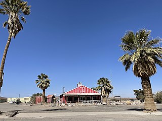
Barstow is a city in San Bernardino County, California, in the Mojave Desert of Southern California. Located in the Inland Empire region of California, the population was 25,415 at the 2020 census. Barstow is an important crossroads for the Inland Empire and home to Marine Corps Logistics Base Barstow.

Victorville is a city in Victor Valley in San Bernardino County, California. Its population as of the 2020 census was 134,810.

The Mojave River is an intermittent river in the eastern San Bernardino Mountains and the Mojave Desert in San Bernardino County, California, United States. Most of its flow is underground, while its surface channels remain dry most of the time, except for the headwaters and several bedrock gorges in the lower reaches.

State Route 58 is a major east-west state highway in the U.S. state of California that runs across the Coast Ranges, the southern San Joaquin Valley, the Tehachapi Mountains, which border the southern Sierra Nevada, and the Mojave Desert. It runs between U.S. Route 101 near Santa Margarita and Interstate 15 in Barstow. It has junctions with Interstate 5 near Buttonwillow, State Route 99 in Bakersfield, State Route 202 in Tehachapi, State Route 14 near Mojave, and U.S. Route 395 at Kramer Junction. SR 58 also provides access to Edwards Air Force Base. At various points it is known as the Calf Canyon Highway, Carrisa Highway, Bakersfield-McKittrick Highway, Rosa Parks Highway, Rosedale Highway, Barstow-Bakersfield Highway, Bakersfield Tehachapi Highway, Kern County Korean War Veterans Memorial Highway, and Mojave-Barstow Highway.

Amboy Crater is a dormant cinder cone volcano that rises above a 70-square-kilometer (27 sq mi) lava field in the eastern Mojave Desert of southern California, within Mojave Trails National Monument.

The Victor Valley is a valley in the Mojave Desert and subregion of the Inland Empire, in San Bernardino County in Southern California.
Bagdad is a ghost town in the Mojave Desert, in San Bernardino County, California.
Oro Grande is an unincorporated community in the Mojave Desert of San Bernardino County, California, United States. It lies on the city boundary of Victorville and Adelanto. It is at 3,000 feet (910 m) elevation in Victor Valley north of the San Bernardino mountain range. It is located on old Route 66 near Interstate 15 between Victorville and Barstow. The ZIP code is 92368 and the community is inside area codes 442 and 760. Less than 1,000 residents live in the unincorporated area.

Newberry Springs is an unincorporated community in the western Mojave Desert of Southern California, located at the foot of the Newberry Mountains in San Bernardino County, California, United States. Newberry Spring is a spring that in the 19th century supplied water to the local Santa Fe Railway and originally was a camping place. The population at the 2000 census was 2,895.

Helendale or Silver Lakes is an unincorporated community and census-designated place located in the Victor Valley of the Mojave Desert, within San Bernardino County, California.

U.S. Route 66 is a part of a former United States Numbered Highway in the state of California that ran from the west in Santa Monica on the Pacific Ocean through Los Angeles and San Bernardino to Needles at the Arizona state line. It was truncated during the 1964 renumbering and its signage removed in 1974. The highway is now mostly replaced with several streets in Los Angeles, State Route 2 (SR 2), SR 110, SR 66, San Bernardino County Route 66 (CR 66), Interstate 15 (I-15), and I-40.
Ludlow is an unincorporated community in the Mojave Desert on Interstate 40, located in San Bernardino County, California, United States. The older remains of the ghost town are along historic Route 66.

The Barstow Harvey House, also known as Harvey House Railroad Depot and Barstow station, is a historic building in Barstow, California. Originally built in 1911 as Casa del Desierto, a Harvey House hotel and Santa Fe Railroad depot, it currently serves as an Amtrak station and government building housing city offices, the Barstow Chamber of Commerce and Visitor Center, and two museums.

Interstate 40 (I-40) is a major east–west Interstate Highway in the United States, stretching from Barstow, California, to Wilmington, North Carolina. The segment of I-40 in California is sometimes called the Needles Freeway. It goes east from its western terminus at I-15 in Barstow across the Mojave Desert in San Bernardino County past the Clipper Mountains to Needles, before it crosses over the Colorado River into Arizona east of Needles. All 155 miles (249 km) of I-40 in California are in San Bernardino County.

High Desert is a vernacular region with non-discrete boundaries applying to areas of the western Mojave Desert in southern California. The "High Desert" region is an area that generally is situated between 2,000 feet (610 m) and 4,000 feet (1,200 m) in elevation, and located just north of the San Gabriel, San Bernardino, and Little San Bernardino Mountains.
Rasor Off-Highway Vehicle Area is a remote public use area for the off-highway vehicle user located in the Mojave Desert about 50 miles (80 km) east of Barstow, California, administered by the Bureau of Land Management.
Bryman, is a populated place in the central Mojave Desert, within San Bernardino County, California. It lies along the Mojave River in the northern Victor Valley, at an elevation of 2,526 feet . It is on the historic U.S. Route 66, 5 miles north of Oro Grande, and south of Helendale.

Mojave Trails National Monument is a large U.S. National Monument located in the state of California between Interstates 15 and 40. It partially surrounds the Mojave National Preserve. It was designated by President Barack Obama on February 12, 2016, along with Castle Mountains National Monument and Sand to Snow National Monument, also in southern California. It is under the administration of the Bureau of Land Management.
Barstow Yard is a classification yard operated by BNSF Railway in Barstow, California. With 48 directional tracks and a total area of approximately 600 acres (240 ha), it is the second largest classification yard west of the Rocky Mountains after the JR Davis Yard. Today almost all freight traffic to and from Southern California runs through it.


