Sleepy Hollow is a village in the town of Mount Pleasant in Westchester County, New York, United States.

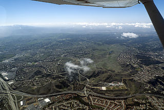
Chino Hills is a city located in the southwestern corner of San Bernardino County, California, United States. The city borders Los Angeles County on its northwest side, Orange County to its south and southwest, and Riverside County to its southeast.

West Hills is a neighborhood in the western San Fernando Valley region of the city of Los Angeles, California. It is bordered by mountain ranges to the west and the Los Angeles neighborhoods of Chatsworth to the north, Canoga Park to the east, and Woodland Hills to the south.

The Chino Hills are a mountain range on the border of Orange, Los Angeles, and San Bernardino counties, California, with a small portion in Riverside County. The Chino Hills State Park preserves open space and habitat in them.
Porter Ranch is a suburban neighborhood of the City of Los Angeles, in the northwest portion of the San Fernando Valley.

Topanga State Park is a California state park located in the Santa Monica Mountains, within Los Angeles County, California. It is part of the Santa Monica Mountains National Recreation Area.

Angelus Oaks is an unincorporated community in San Bernardino County, California, United States, and has a population of 535 as of the 2010 U.S. Census, up from an estimated population of 312 in 2000. It is surrounded by the San Bernardino National Forest and located east of San Bernardino on California State Route 38.

Montclair is a hillside neighborhood in Oakland, California, United States. Montclair is located along the western slope of the Oakland Hills from a valley formed by the Hayward Fault to the upper ridge of the hills.

State Route 142, also known as Carbon Canyon Road for most of its length, is a state highway in the U.S. state of California that connects Brea in Orange County with Chino Hills in San Bernardino County. The eastern portion of the route is known as Chino Hills Parkway.
Goose Hollow is a neighborhood in southwest Portland, Oregon. It acquired its distinctive name through early residents' practice of letting their geese run free in Tanner Creek Gulch and near the wooded ravine in the Tualatin Mountains known as the Tanner Creek Canyon. Tanner Creek Gulch was a 20-block-long, 50-foot-deep (15 m) gulch that started around SW 17th and Jefferson and carried the waters of Tanner Creek into Couch Lake. Over a century ago, Tanner Creek was buried 50 feet (15 m) underground, and the Tanner Creek Gulch was filled in. The only remaining part of the hollow is the ravine, Tanner Creek Canyon, carved out by Tanner Creek through which The Sunset Highway carrying US-26 passes and which the Vista Bridge spans, also called the Vista Viaduct.

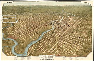
Neighborhoods in Spokane, Washington are officially grouped by the Spokane City Council into three main city council districts: 1, 2, and 3. Each city council district contains multiple, official neighborhoods that are recognized with a neighborhood council. Informally, neighborhoods are colloquially grouped by local geographical, geological, cultural, or historical features The list of neighborhoods below is organized based on the official designations by the City of Spokane. Unofficial neighborhoods and districts are listed within the official neighborhood in which they are located.

University City (UC) is a community in San Diego, California, located in the northwestern portion of the city next to the University of California, San Diego. The area was originally intended to serve as housing for the faculty of the university, hence the name.

Bryn Mawr, formerly Nahant, Redlands Junction and West Redlands, is a formerly unincorporated community in San Bernardino County, California, United States, annexed by the city of Loma Linda. As of 2000, its population numbered 213. Bryn Mawr is bordered on the east by Redlands.

Olinda is a neighborhood in Brea, California, located on Carbon Canyon Road east of the rest of the city. The original village was founded in the 1890s and grew when petroleum was discovered at the adjacent Brea-Olinda Oil Field. In February 1917, Olinda Village and the nearby town of Randolph were incorporated as the city of Brea. The site is now registered as California Historical Landmark #918 registered on January 1. 1978.

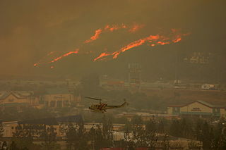
The Freeway Complex Fire was a 2008 wildfire in the Santa Ana Canyon area of Orange County, California. The fire started as two separate fires on November 15, 2008. The Freeway Fire started first shortly after 9 am with the Landfill Fire igniting approximately 2 hours later. These two separate fires merged a day later and ultimately destroyed 314 residences in Anaheim Hills and Yorba Linda.

The Waldo Canyon fire was a forest fire that started approximately 4 miles (6.4 km) northwest of Colorado Springs, Colorado on June 23, 2012, and was declared 100 percent contained on July 10, 2012, after no smoke plumes were visible on a small portion of the containment line on Blodgett Peak. The fire was active in the Pike National Forest and adjoining areas, covering a total of 18,247 acres. The fire had caused the evacuation of over 32,000 residents of Colorado Springs, Manitou Springs and Woodland Park, several small mountain communities along the southwestern side of U.S. Highway 24, and partial evacuation of the United States Air Force Academy. There were 346 homes destroyed by the fire. U.S. Highway 24, a major east–west road, was closed in both directions. The Waldo Canyon Fire resulted in insurance claims totaling more than US $453.7 million. It was the most destructive fire in Colorado state history, as measured by the number of homes destroyed, until the Black Forest Fire surpassed it almost a year later when it consumed 486 homes and damaged 28 others.

The Pocantico River is a nine-mile-long (14 km) tributary of the Hudson River in western central Westchester County, New York, United States. It rises from Echo Lake, in the town of New Castle south of the hamlet of Millwood, and flows generally southwest past Briarcliff Manor to its outlet at Sleepy Hollow. Portions of the towns of Mount Pleasant and Ossining are within its 16-square-mile (41 km2) watershed.

The Creek Fire was a large wildfire that burned in Kagel Canyon and the Angeles National Forest north of Sylmar, a neighborhood in Los Angeles, California, United States, and one of multiple wildfires that broke out across Southern California in December 2017. The Creek Fire burned 15,619 acres (63 km2) and destroyed 123 structures, including 60 homes, before being contained on January 9, 2018, following heavy rainfall from a winter storm. The fire threatened the communities of Santa Clarita, Glendale, Olive View, Lake View Terrace, Sunland-Tujunga, Shadow Hills, Sylmar, Pacoima, Lopez Canyon, and Kagel Canyon, as well as the Olive View–UCLA Medical Center. During the wildfire, 115,000 residents were forced to evacuate their homes.

The Holy Fire was a wildfire that burned in the Cleveland National Forest in Orange and Riverside Counties, California. The wildfire started on August 6, 2018, at around 1:15 PM PDT, in the vicinity of Trabuco Canyon. A suspected arsonist was booked into the Orange County jail in Santa Ana, California but found not guilty in 2023. The blaze burned 23,136 acres (94 km2) and destroyed 18 buildings, before it was fully contained on September 13, 2018. While the fire was actively spreading in early and mid-August, residents of the nearby cities of Corona, Temescal Valley, and Lake Elsinore were placed under evacuation orders.


