| CDP [3] | County | Location
of County | Population
(2020) | Population
(2010) [4] | Population
(2000) [5] | Population
(1990) [6] | Population
(1980) [7] | Notes [8] [9] [10] [11] [12] [13] [14] [15] [16] [17] [18] |
|---|
| Acalanes Ridge | Contra Costa |  | 1,285 | 1,137 | x | x | x | |
| Acampo | San Joaquin |  | 334 | 341 | x | x | x | First appeared as a census designated place in the 2010 U.S. census, one of ten CDPS (Acampo, Collierville, Dogtown, Mountain House, Peters, Terminous, Thornton, Victor, Waterloo, and Woodbridge) formed out of the deleted North Woodbridge CDP and South Woodbridge CDP. [4] |
| Acton | Los Angeles |  | 7,431 | 7,596 | 2,390 | 1,471 | x | |
| Adin | Modoc | 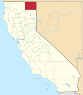 | 205 | 272 | x | x | x | |
| Agua Dulce | Los Angeles |  | 3,451 | 3,342 | x | x | x | |
| Aguanga | Riverside | 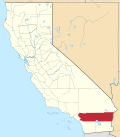 | 989 | 1,128 | x | x | x | |
| Ahwahnee | Madera |  | 2,296 | 2,246 | x | x | x | |
| Airport | Stanislaus |  | 1,389 | 1,964 | x | x | x | The community first was listed as an unincorporated place under the name La-Loma Airport in the 1950 U.S. census (pop. 7,866) [10] and then under Airport in the 1960 U.S. census (pop. 3,689). [9] It was not listed thereafter until the 2010 U.S. Census. [4] |
| Alamo | Contra Costa |  | 15,314 | 14,570 | 15,626 | 12,277 | 8,505 | First appeared as an unincorporated place in the 1960 U.S. census (1,791); [9] and then in the 1970 U.S. census under the name Alamo-Danville after being joined with the community of Danville (pop. 14,059) [8] (Danville had a population of 3,585 in the 1960 Census). [8] The two communities were again separated in the 1980 United States census and redesignated as census designated places. [7] |
| Albion | Mendocino | 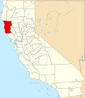 | 153 | 168 | x | x | x | |
| Alderpoint | Humboldt |  | 137 | 186 | x | x | x | |
| Alhambra Valley | Contra Costa |  | 805 | 924 | x | x | x | |
| Alleghany | Sierra |  | 30 | 58 | x | x | x | |
| Allendale | Solano |  | 1,651 | 1,506 | x | x | x | |
| Allensworth | Tulare |  | 531 | 471 | x | x | x | |
| Almanor | Plumas | 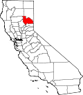 | 3 | 0 | 0 | x | x | |
| Alondra Park | Los Angeles |  | 8,569 | 8,592 | 8,622 | 12,215 | 12,096 | Listed as an unincorporated place in the 1970 U.S. Census (pop. 12,193) [8] |
| Alpaugh | Tulare |  | 871 | 1,026 | 761 | x | x | |
| Alpine | San Diego |  | 14,696 | 14,236 | 13,143 | 9,695 | 5,368 | First appeared as an unincorporated community in the 1960 U.S. census (pop. 1,044); [9] and the 1970 U.S. census (pop. 1,570). [8] |
| Alpine Village | Alpine |  | 224 | 114 | 136 | x | x | |
| Alta | Placer |  | 615 | 610 | x | x | x | |
| Alta Sierra | Nevada |  | 7,204 | 6,911 | 6,522 | 5,709 | 2,168 | |
| Alta Sierra | Kern |  | 103 | x | x | x | x | |
| Altadena | Los Angeles |  | 42,846 | 42,777 | 42,610 | 42,658 | 40,983 | Listed as an unincorporated place in the 1960 U.S. Census (pop. 40,568) [9] and in the 1970 U.S. census (pop. 42,415) [8] |
| Alto | Marin |  | 732 | 711 | x | x | x | |
| Alum Rock | Santa Clara |  | 12,042 | 15,536 | 13,479 | x | x | |
| Amador Pines | Amador |  | 1,118 | x | x | x | x | |
| Amesti | Santa Cruz |  | 2,637 | 3,478 | 2,436 | x | x | |
| Anchor Bay | Mendocino |  | 473 | 340 | x | x | x | |
| Angwin | Napa |  | 2,633 | 3,051 | 3,148 | 3,503 | 3,256 | Listed as an unincorporated place in the 1970 U.S. census (pop. 2,690) [8] |
| Antelope | Sacramento |  | 48,733 | 45,770 | x | x | x | |
| Anza | Riverside |  | 3,075 | 3,014 | x | x | x | |
| Aptos | Santa Cruz |  | 6,664 | 6,220 | 9,396 | 9,061 | 7,039 | Listed as an unincorporated place in the 1970 U.S. census (pop. 8,704) [8] |
| Aptos Hills-Larkin Valley | Santa Cruz |  | 2,383 | 2,381 | 2,361 | 2,205 | x | |
| Arbuckle | Colusa |  | 3,484 | 3,028 | 2,332 | 1,912 | 1,306 | Listed as an unincorporated place in the 1970 U.S. census (pop. 1,037) [8] |
| Arden-Arcade | Sacramento |  | 94,569 | 92,186 | 96,025 | 92,040 | 87,570 | Listed as an unincorporated place in the 1960 U.S. census (pop. 73,352) [9] and the 1970 U.S. census (pop. 82,492) [8] |
| Armona | Kings |  | 4,274 | 4,156 | 3,239 | 4,156 | 4,274 | Listed as an unincorporated place in the 1950 U.S. census (pop. 1,274), [10] 1960 U.S. census (pop. 1,302) [9] and the 1970 U.S. census (pop. 1,392) [8] |
| Arnold | Calaveras |  | 3,288 | 3,843 | 4,218 | 3,788 | 2,385 | |
| Aromas | Monterey,
San Benito | 
 | | | | | | |
| Artois | Glenn |  | 295 | 295 | x | x | x | |
| Ashland | Alameda | 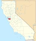 | 23,823 | 21,925 | 20,793 | 16,590 | 13,893 | Listed as an unincorporated place in the 1970 U.S. census (pop. 14,810) [8] |
| Aspen Springs | Mono | 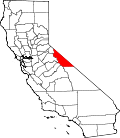 | 70 | 65 | x | x | x | |
| Auberry | Fresno | 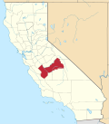 | 3,238 | 2,369 | 2,053 | 1,866 | x | |
| Auburn Lake Trails | El Dorado |  | 3,388 | 3,426 | x | x | x | |
| August | San Joaquin |  | | | | | | |
| Avery | Calaveras |  | 636 | 646 | 672 | x | x | |
| Avila Beach | San Luis Obispo | 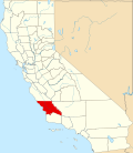 | | | | | | |
| Avocado Heights | Los Angeles |  | 13,317 | 15,411 | 15,148 | 14,232 | 11,721 | Listed as an unincorporated place in the 1970 U.S. census (pop. 9,810) [8] |
| Baker | San Bernardino |  | 442 | 735 | x | x | x | |
| Bakersfield Country Club | Kern |  | 1,715 | x | x | x | x | |
| Ballard | Santa Barbara |  | 768 | 467 | x | x | x | |
| Ballico | Merced | 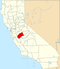 | 347 | 406 | x | x | x | |
| Bangor | Butte |  | 695 | 646 | x | x | x | |
| Bass Lake | Madera |  | 527 | 575 | x | x | x | |
| Bay Point | Contra Costa |  | 23,896 | 21,349 | 21,534 | x | x | |
| Bayview | Contra Costa |  | 1,782 | 1,754 | x | x | x | |
| Bayview | Humboldt |  | 2,619 | 2,510 | 2,359 | 1,318 | x | |
| Baywood Park | San Mateo | 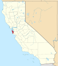 | 1,693 | x | x | x | x | |
| Beale AFB | Yuba |  | 1,303 | 1,319 | 5,115 | 6,912 | 6,329 | Listed as an unincorporated community (pop 7,029) under the name the Beale East in the 1970 U.S. census. [8] |
| Bear Creek | Merced |  | 273 | 290 | x | x | x | |
| Bear Valley | Alpine |  | 128 | 121 | 133 | x | x | |
| Bear Valley | Mariposa |  | 156 | 125 | x | x | x | |
| Bear Valley Springs | Kern |  | 5,592 | 5,172 | x | x | x | |
| Beckwourth | Plumas |  | 478 | 432 | 342 | x | x | |
| Belden | Plumas |  | 15 | 22 | 26 | x | x | |
| Bell Canyon | Ventura |  | 1,946 | 2,049 | x | x | x | |
| Bella Vista | Shasta |  | 3,641 | 2,781 | x | x | x | |
| Ben Lomond | Santa Cruz |  | | | | | | |
| Benbow | Humboldt |  | 422 | 321 | x | x | x | |
| Bend | Tehama |  | 603 | 619 | x | x | x | |
| Benton | Mono |  | 279 | 280 | x | x | x | |
| Benton Park | Kern |  | 5,333 | x | x | x | x | |
| Bermuda Dunes | Riverside |  | | | | | | |
| Berry Creek | Butte |  | 1,637 | 1,424 | x | x | x | |
| Bertsch-Oceanview | Del Norte | 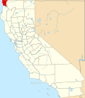 | 2,520 | 2,436 | 2,238 | x | x | |
| Bethel Island | Contra Costa |  | 2,131 | 2,137 | 2,312 | 2,115 | 1,774 | First appeared as an unincorporated place in the 1970 U.S. census (pop. 1,398). [8] |
| Bieber | Lassen |  | 266 | 312 | x | x | x | |
| Big Bear City | San Bernardino |  | 12,738 | 12,304 | 5,779 | 4,920 | 11,151 | Listed as an unincorporated place in the 1950 U.S. census (pop. 1,434), 1960 U.S. census (pop. 1,562), [9] and the 1970 U.S. census (pop. 5,268) [8] |
| Big Bend | Shasta |  | 79 | 102 | 149 | x | x | |
| Big Creek | Fresno |  | 151 | 175 | x | x | x | |
| Big Lagoon | Humboldt |  | 161 | 93 | x | x | x | |
| Big Pine | Inyo |  | | | | | | |
| Big River | San Bernardino |  | 1,084 | 1,327 | 1,266 | 705 | x | |
| Biola | Fresno |  | 1,427 | 1,623 | 1,037 | x | x | |
| Black Point-Green Point | Marin |  | 1,431 | 1,306 | 1,143 | x | x | |
| Blackhawk | Contra Costa |  | 9,637 | 9,354 | 10,048 | 6,199 | x | The CDP was renamed Blackhawk-Camino Tassajara in the 2000 U.S. census. [5] The name was changed back to Blackhawk in the 2010 U.S. census. [4] |
| Blacklake | San Luis Obispo |  | | | | | | |
| Blairsden | Plumas |  | 38 | 39 | 50 | x | x | |
| Bloomfield | Sonoma |  | | | | | | |
| Bloomington | San Bernardino |  | 24,339 | 23,851 | 19,318 | 15,116 | 12,781 | Listed as an unincorporated community in the 1970 U.S. census (pop. 11,957) [8] |
| Bluewater | San Bernardino |  | 116 | 172 | 265 | 261 | x | |
| Bodega Bay | Sonoma |  | | | | | | |
| Bodega | Sonoma |  | | | | | | |
| Bodfish | Kern |  | 2,008 | 1,956 | 1,823 | 1,283 | 1,379 | |
| Bolinas | Marin |  | | | | | | |
| Bombay Beach | Imperial | 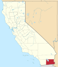 | 231 | 295 | 366 | x | x | |
| Bonadelle Ranchos | Madera |  | 5,497 | x | x | x | x | |
| Bonita | San Diego |  | 12,917 | 12,538 | 12,401 | 12,542 | 6,257 | |
| Bonny Doon | Santa Cruz |  | | | | | | |
| Bonsall | San Diego |  | 4,546 | 3,982 | 3,401 | 1,881 | x | |
| Boonville | Mendocino |  | 1,018 | 1,035 | x | x | x | |
| Bootjack | Mariposa |  | | | | | | |
| Boron | Kern |  | 2,086 | 2,253 | 2,025 | 2,101 | 2,040 | Listed as an unincorporated community in the 1970 U.S. census (pop. 1,999) [8] |
| Boronda | Monterey |  | 1,760 | 1,710 | 1,325 | x | x | |
| Borrego Springs | San Diego |  | 1,405 | 2,244 | 2,535 | 2,244 | 1,405 | |
| Bostonia | San Diego |  | 16,882 | 15,379 | 15,169 | 13,670 | x | |
| Boulder Creek | Santa Cruz |  | | | | | | |
| Boulevard | San Diego |  | 359 | 315 | x | x | x | |
| Bowles | Fresno |  | 158 | 166 | 182 | x | x | |
| Boyes Hot Springs | Sonoma |  | | | | | | |
| Bradley | Monterey |  | 69 | 93 | 120 | x | x | |
| Bret Harte | Stanislaus |  | 5,135 | 1,152 | 5,161 | x | x | |
| Bridgeport | Mono |  | 553 | 575 | x | x | x | |
| Broadmoor | San Mateo |  | | | | | | |
| Brookdale | Santa Cruz |  | | | | | | |
| Brooks | Yolo |  | 31 | x | x | x | x | |
| Brooktrails | Mendocino |  | 3,632 | 3,235 | x | x | x | |
| Buck Meadows | Mariposa |  | 21 | 31 | x | x | x | |
| Buckhorn | Amador |  | 2,597 | 2,429 | x | x | x | |
| Bucks Lake | Plumas |  | 22 | 10 | 17 | x | x | |
| Buena Vista | Amador |  | 542 | 429 | x | x | x | |
| Burbank | Santa Clara |  | | | | | | |
| Burney | Shasta |  | | | | | | |
| Burnt Ranch | Trinity |  | | | | | | |
| Butte Creek Canyon | Butte |  | 780 | 1,086 | x | x | x | |
| Butte Meadows | Butte |  | 74 | 40 | x | x | x | |
| Butte Valley | Butte |  | 945 | 899 | x | x | x | |
| Buttonwillow | Kern |  | 1,337 | 1,508 | 1,266 | 1,301 | 1,350 | Listed as an unincorporated community in the 1970 U.S. census (pop. 1,193) [8] |
| Byron | Contra Costa |  | 1,140 | 1,277 | 916 | x | x | |
| Bystrom | Stanislaus |  | 4,518 | 4,008 | 4,148 | x | x | |
| C-Road | Plumas |  | 140 | 150 | 152 | x | x | |
| Cabazon | Riverside |  | | | | | | |
| California Hot Springs | Tulare |  | 50 | 37 | x | x | x | |
| California Pines | Modoc |  | 473 | 520 | x | x | x | |
| California Polytechnic State University | San Luis Obispo |  | 8,583 | x | x | x | x | |
| Callender | San Luis Obispo |  | | | | | | |
| Calpella | Mendocino |  | 799 | 679 | x | x | x | |
| Calpine | Sierra |  | | | | | | |
| Calwa | Fresno |  | 1,776 | 2,052 | x | x | x | |
| Camanche North Shore | Amador |  | 1,070 | 979 | x | x | x | |
| Camanche Village | Amador |  | 964 | 847 | x | x | x | |
| Cambria | San Luis Obispo |  | | | | | | |
| Cambrian Park | Santa Clara |  | | | | | | |
| Cameron Park | El Dorado |  | 18,881 | 18,228 | 14,549 | 11,897 | 5,607 | |
| Camino | El Dorado |  | 1,871 | 1,750 | x | x | x | |
| Camino Tassajara | Contra Costa |  | 4,951 | 2,197 | x | x | x | |
| Camp Nelson | Tulare |  | 106 | 97 | x | x | x | |
| Camp Pendleton Mainside | San Diego |  | 9,683 | 5,200 | 8,197 | 10,373 | 2,065 | The name of the CDP was Camp Pendleton North prior to 2020. Listed as an unincorporated community in the 1970 U.S. census (pop. 11,803) [8] |
| Camp Pendleton South | San Diego |  | 12,468 | 10,616 | 8,854 | 11,299 | 7,952 | Listed as an unincorporated community in the 1970 U.S. census (pop. 13,692) [8] |
| Campo | San Diego |  | 2,955 | 2,684 | x | x | x | |
| Campo Seco | Calaveras |  | x | x | x | x | x | New CDP in 2023 |
| Camptonville | Yuba |  | 158 | 158 | x | x | x | |
| Canby | Modoc |  | 183 | 315 | x | x | x | |
| Cantua Creek | Fresno |  | 500 | 466 | 655 | x | x | |
| Canyondam | Plumas |  | 30 | 31 | 37 | x | x | |
| Caribou | Plumas |  | 1 | 0 | 0 | x | x | |
| Carmel Valley Village | Monterey |  | | | | | | |
| Carmet | Sonoma |  | | | | | | |
| Carmichael | Sacramento |  | | | | | | |
| Carnelian Bay | Placer |  | 518 | 524 | x | x | x | |
| Carrick | Siskiyou |  | 143 | 131 | 156 | x | x | |
| Cartago | Inyo |  | 62 | 92 | 109 | x | x | |
| Caruthers | Fresno |  | 2,613 | 2,497 | 2,103 | 1,603 | 1,514 | |
| Casa Conejo | Ventura |  | 3,286 | 3,249 | 3,180 | 3,286 | x | |
| Casa Loma | Kern |  | 1,804 | x | x | x | x | |
| Casa de Oro-Mount Helix | San Diego |  | 19,576 | 18,762 | 18,874 | 30,727 | 19,651 | Listed as an unincorporated place under the name Grossmont-Mt. Helix in the 1970 U.S. census (pop. 7,623). [8] |
| Casmalia | Santa Barbara |  | | | | | | |
| Caspar | Mendocino |  | 500 | 509 | x | x | x | |
| Cassel | Shasta |  | | | | | | |
| Castaic | Los Angeles |  | 18,937 | 19,015 | x | x | x | |
| Castella | Shasta |  | 214 | x | x | x | x | |
| Castle Hill | Contra Costa |  | 1,271 | 1,299 | x | x | x | Formed from part of Alamo CDP |
| Castro Valley | Alameda |  | 66,441 | 61,388 | 57,292 | 48,619 | 44,011 | Listed as an unincorporated place in the 1960 U.S. census (pop. 37,120) [9]
and the 1970 U.S. census (pop. 44,760) [8] |
| Castroville | Monterey |  | | | | | | |
| Catheys Valley | Mariposa |  | 829 | 825 | x | x | x | |
| Cayucos | San Luis Obispo |  | | | | | | |
| Cazadero | Sonoma |  | | | | | | |
| Cedar Flat | Placer |  | 797 | x | x | x | x | |
| Cedar Ridge | Tuolumne |  | 1,235 | 1,132 | x | x | x | Formed from part of deleted Phoenix Lake-Cedar Ridge CDP and additional area. [4] |
| Cedar Slope | Tulare |  | 10 | 0 | x | x | x | |
| Cedarville | Modoc |  | 437 | 514 | x | x | x | |
| Centerville | Fresno |  | 378 | 392 | x | x | x | |
| Centerville | Shasta |  | 2,095 | x | x | x | x | |
| Chalfant | Mono |  | 660 | 651 | x | x | x | |
| Challenge-Brownsville | Yuba |  | 1,161 | 1,148 | 1,069 | 1,096 | x | |
| Channel Islands Beach | Ventura |  | 2,870 | 3,103 | 3,142 | 3,317 | x | |
| Charleston View | Inyo |  | 45 | x | x | x | x | |
| Charter Oak | Los Angeles |  | 9,739 | 9,310 | 9,027 | 8,858 | 6,840 | |
| Cherokee | Butte |  | 88 | 69 | x | x | x | |
| Cherokee Strip | Kern |  | 206 | 227 | x | x | x | |
| Cherry Valley | Riverside |  | | | | | | |
| Cherryland | Alameda |  | 15,808 | 14,728 | 13,837 | 11,088 | 9,425 | Listd as an unincorporated community in the 1970 U.S. census (pop. 9,969) [8] |
| Chester | Plumas |  | 2,187 | 2,144 | 2,316 | 2,082 | 1,756 | Listed as an unincorporated community in the 1960 U.S. census (pop. 1,553) and the 1970 U.S. census (pop. 1,531) [8] |
| Chilcoot-Vinton | Plumas |  | 446 | 454 | 387 | x | x | |
| China Lake Acres | Kern |  | 1,757 | 1,876 | 1,761 | x | x | |
| Chinese Camp | Tuolumne |  | 90 | 126 | 146 | x | x | |
| Choctaw Valley | Kern |  | 237 | x | x | x | x | |
| Chualar | Monterey |  | 1,185 | 1,190 | 1,444 | x | x | |
| Citrus | Los Angeles |  | 10,243 | 10,866 | 10,581 | 9,481 | 12,450 | |
| Clarksburg | Yolo |  | 402 | 418 | x | x | x | |
| Clay | Sacramento |  | 1,252 | 1,195 | x | x | x | |
| Clear Creek | Lassen |  | 175 | 169 | x | x | x | |
| Clearlake Oaks | Lake |  | | | | | | |
| Clearlake Riviera | Lake |  | 3,410 | 3,090 | x | x | x | The community changed its name to Kelseyville Rivera in 2021; the census continues to use Clearlake Rivera |
| Cleone | Mendocino |  | 622 | 618 | x | x | x | |
| Clio | Plumas |  | 77 | 66 | 90 | x | x | |
| Clipper Mills | Butte |  | 160 | 142 | x | x | x | |
| Clyde | Contra Costa |  | 729 | 678 | 694 | x | x | |
| Coarsegold | Madera |  | 4,144 | 1,840 | x | x | x | |
| Cobb | Lake |  | | | | | | |
| Coffee Creek | Trinity |  | | | | | | |
| Cohasset | Butte |  | 830 | 847 | x | x | x | |
| Cold Springs | El Dorado |  | 556 | 446 | x | x | x | |
| Cold Springs | Tuolumne |  | 123 | 181 | x | x | x | |
| Coleville | Mono |  | 419 | 495 | x | x | x | |
| College City | Colusa |  | 292 | 290 | x | x | x | |
| Collierville | San Joaquin |  | 2,094 | 1,934 | x | x | x | First appeared as a census designated place in the 2010 U.S. census, one of ten CDPS (Acampo, Collierville, Dogtown, Mountain House, Peters, Terminous, Thornton, Victor, Waterloo, and Woodbridge) formed out of the deleted North Woodbridge CDP and South Woodbridge CDP. [4] |
| Coloma | El Dorado |  | 521 | 529 | x | x | x | |
| Columbia | Tuolumne |  | | | | | | |
| Comptche | Mendocino |  | 167 | 159 | x | x | x | |
| Concow | Butte |  | 402 | 710 | 1,095 | 1,392 | x | |
| Contra Costa Centre | Contra Costa |  | 5,364 | 6,808 | 5,133 | x | x | Formed as the Waldon CDP in the 2000 U.S. census. |
| Copperopolis | Calaveras |  | 3,400 | 3,671 | 2,363 | x | x | |
| Coronita | Riverside |  | 2,639 | 2,608 | x | x | x | |
| Corralitos | Santa Cruz |  | | | | | | |
| Coto de Caza | Orange |  | 14,710 | 14,866 | 13,057 | x | x | |
| Cottonwood | Kern |  | 3,971 | x | x | x | x | |
| Cottonwood | Shasta |  | 6,268 | 3,316 | 2,960 | 1,747 | 1,553 | Listed as an unincorporated community in the 1970 U.S. census (pop 1,288) [8] |
| Coulterville | Mariposa |  | 115 | 201 | x | x | x | |
| Country Club | San Joaquin |  | | | | | | |
| Courtland | Sacramento |  | 326 | 355 | x | x | x | |
| Covelo | Mendocino |  | | | | | | |
| Cowan | Stanislaus |  | | | | | | |
| Crescent Mills | Plumas |  | 206 | 196 | 258 | x | x | |
| Cressey | Merced |  | 366 | 394 | x | x | x | |
| Crest | San Diego |  | 2,828 | 2,593 | 2,716 | x | x | |
| Crestline | San Bernardino |  | 11,650 | 10,770 | 10,218 | 8,594 | 6,715 | Listed as an unincorporated place under the name Crest Forest in the 1970 U.S. census (3,509). [8] |
| Creston | San Luis Obispo |  | | | | | | |
| Crockett | Contra Costa |  | 3,242 | 3,094 | 3,194 | 3,228 | x | |
| Cromberg | Plumas |  | 272 | 261 | 290 | x | x | |
| Crowley Lake | Mono |  | 980 | 875 | x | x | x | |
| Crows Landing | Stanislaus |  | | | | | | |
| Cutler | Tulare |  | 4,480 | 5,000 | 4,491 | 4,450 | 3,149 | Listed as an unincorporated place in the 1950 U.S. census (pop. 1,768), 1960 U.S. census (pop. 2,191), [9] and the 1970 U.S. census (pop. 2,503) [8] |
| Cutten | Humboldt |  | 3,223 | 3,108 | 2,933 | 1,516 | 2,375 | Listed as an unincorporated community in the 1960 U.S. census (pop. 1,572); [9]
and the 1970 U.S. census (pop. 2,228) [8] |
| Cuyama | Santa Barbara |  | | | | | | |
| Dales | Tehama |  | 28 | x | x | x | x | |
| Daphnedale Park | Modoc |  | 129 | 184 | x | x | x | |
| Darwin | Inyo |  | 36 | 43 | 54 | x | x | |
| Davenport | Santa Cruz |  | | | | | | |
| Day Valley | Santa Cruz |  | | | | | | |
| Deer Park | Napa |  | | | | | | |
| Del Aire | Los Angeles |  | 10,338 | 10,001 | 9,012 | 8,040 | 8,487 | Listed as an unincorporated place in the 1970 U.S. census (pop 11,930) [8] |
| Del Dios | San Diego |  | 396 | x | x | x | x | |
| Del Monte Forest | Monterey |  | | | | | | |
| Del Rey | Fresno |  | 1,358 | 1,639 | 950 | 1,150 | 1,126 | |
| Del Rio | Stanislaus |  | 1,399 | 1,270 | 1,168 | x | x | |
| Delft Colony | Tulare |  | 412 | 454 | x | x | x | |
| Delhi | Merced |  | | | | | | |
| Delleker | Plumas |  | 802 | 705 | 674 | x | x | |
| Denair | Stanislaus |  | | | | | | |
| Derby Acres | Kern |  | 301 | 322 | 376 | x | x | |
| Descanso | San Diego |  | 1,499 | 1,423 | x | x | x | |
| Desert Center | Riverside |  | 256 | 204 | x | x | x | |
| Desert Edge | Riverside |  | 4,180 | 3,822 | x | x | x | |
| Desert Palms | Riverside |  | 6,686 | 6,957 | x | x | x | |
| Desert Shores | Imperial |  | 1,128 | 1,104 | 792 | x | x | |
| Desert View Highlands | Los Angeles |  | 2,175 | 2,154 | 2,337 | 2,360 | 2,676 | Listed as an unincorporated place in the 1970 U.S. census (pop 2,172) [8] |
| Di Giorgio | Kern |  | 400 | x | x | x | x | |
| Diablo | Contra Costa |  | 1,255 | 1,158 | 988 | x | x | |
| Diablo Grande | Stanislaus |  | | | | | | |
| Diamond Springs | El Dorado |  | 11,345 | 11,037 | 4,888 | 2,872 | 2,287 | |
| Dillon Beach | Marin |  | 246 | 283 | 319 | x | x | |
| Discovery Bay | Contra Costa |  | 15,358 | 13,352 | 8,981 | 5,351 | 1,326 | |
| Dixon Lane-Meadow Creek | Inyo |  | | | | | | |
| Dobbins | Yuba |  | 1,161 | 1,148 | x | x | x | |
| Dogtown | San Joaquin |  | 2,516 | 2,506 | x | x | x | First appeared as a census designated place in the 2010 U.S. census, one of ten CDPS (Acampo, Collierville, Dogtown, Mountain House, Peters, Terminous, Thornton, Victor, Waterloo, and Woodbridge) formed out of the deleted North Woodbridge CDP and South Woodbridge CDP. [4] |
| Dollar Point | Placer |  | | | | | | |
| Dorrington | Calaveras |  | 519 | 609 | 727 | x | x | |
| Dos Palos Y | Merced |  | 310 | 323 | x | x | x | |
| Douglas City | Trinity |  | | | | | | |
| Douglas Flat | Calaveras |  | x | x | x | x | x | New CDP in 2023 |
| Downieville | Sierra |  | | | | | | |
| Doyle | Lassen |  | 536 | 678 | x | x | x | |
| Drytown | Amador |  | 186 | 167 | x | x | x | |
| Ducor | Tulare |  | 616 | 612 | 504 | x | x | |
| Dunnigan | Yolo |  | 1,382 | 1,416 | x | x | x | |
| Durham | Butte |  | 5,834 | 5,518 | 5,220 | 4,784 | x | |
| Dustin Acres | Kern |  | 677 | 652 | 585 | x | x | |
| Dutch Flat | Placer |  | 183 | 160 | x | x | x | |
| Eagleville | Modoc |  | 45 | 59 | x | x | x | |
| Earlimart | Tulare |  | 7,679 | 8,537 | 6,583 | 5,881 | 4,578 | Listed as an unincorporated place in the 1950 U.S. census (pop. 2,162), 1960 U.S. census (pop. 2,897), [9] and the 1970 U.S. census (pop. 3,080) [8] |
| East Bakersfield | Kern |  | 9,749 | x | x | x | x | |
| East Foothills | Santa Clara |  | | | | | | |
| East Hemet | Riverside |  | | | | | | |
| East Los Angeles | Los Angeles |  | 118,786 | 126,496 | 124,283 | 126,379 | 110,017 | Listed as an unincorporated place in the 1960 U.S. census (pop 104,270) [9] and the 1970 U.S. census (pop. 104,881) [8] |
| East Nicolaus | Sutter |  | | | | | | |
| East Niles | Kern |  | 28,390 | x | x | x | x | |
| East Oakdale | Stanislaus |  | 3,201 | 2,762 | 2,742 | x | x | |
| East Orosi | Tulare |  | 423 | 495 | 426 | x | x | |
| East Pasadena | Los Angeles |  | 6,021 | 6,144 | 6,045 | 5,910 | x | |
| East Porterville | Tulare |  | 5,549 | 7,331 | 6,730 | 5,790 | 5,218 | Listed as an unincorporated place in the 1960 U.S. census (pop. 3,538) [9] and the 1970 U.S. census (pop. 4,042) [8] |
| East Quincy | Plumas |  | 2,463 | 2,489 | 2,398 | x | x | |
| East Rancho Dominguez | Los Angeles |  | 15,114 | 15,135 | 9,286 | 7,967 | 6,435 | Listed as an unincorporated place in the 1970 U.S. census (pop 5,853) [8] |
| East Richmond Heights | Contra Costa |  | 3,460 | 3,280 | 3,357 | 3,266 | x | |
| East San Gabriel | Los Angeles |  | 22,769 | 14,874 | 14,512 | 12,736 | x | |
| East Shore | Plumas |  | 181 | 156 | 177 | x | x | |
| East Sonora | Tuolumne |  | | | | | | |
| East Tulare Villa | Tulare |  | 773 | 778 | x | x | x | |
| East Whittier | Los Angeles |  | 10,394 | 9,757 | 9,538 | 9,367 | 9,688 | Listed as an unincorporated place in the 1970 U.S. census (pop 11,930) [8] |
| Eastern Goleta Valley | Santa Barbara |  | 28,656 | x | x | x | x | |
| Easton | Fresno |  | 1,972 | 2,083 | 1,966 | 1,877 | 1,710 | Listed as an unincorporated community in the 1970 U.S. census (pop. 1,065) [8] |
| Edgewood | Siskiyou |  | 72 | 43 | 67 | x | x | |
| Edison | Kern |  | 255 | x | x | x | x | |
| Edmundson Acres | Kern |  | 296 | 279 | x | x | x | |
| Edna | San Luis Obispo |  | | | | | | |
| Edwards AFB | Kern |  | 2,135 | 2,063 | 5,909 | 7,423 | 8,554 | Listed as an unincorporated community in the 1970 U.S. census (pop. 10,331) [8] |
| El Adobe | Kern |  | 391 | x | x | x | x | |
| El Centro Naval Air Facility | Imperial |  | 280 | x | x | x | x | |
| El Cerrito | Riverside |  | | | | | | |
| El Dorado Hills | El Dorado |  | 50,547 | 42,108 | 18,016 | 6,395 | 3,453 | |
| El Granada | San Mateo |  | | | | | | |
| El Macero | Yolo |  | 1,074 | x | x | x | x | |
| El Modena | Orange |  | x | x | x | x | x | New CDP in 2024 |
| El Monte Mobile Village | Tulare |  | 156 | x | x | x | x | |
| El Nido | Merced |  | 331 | 330 | x | x | x | |
| El Portal | Mariposa |  | 372 | 474 | x | x | x | |
| El Rancho | Tulare |  | 96 | 124 | x | x | x | |
| El Rio | Ventura |  | 7,037 | 7,198 | 6,193 | 6,419 | 5,674 | Listed as an unincorporated place in the 1950 U.S. census (pop. 1,376), 1960 U.S. census (pop. 6,966), [9] and the 1970 U.S. census (pop. 6,173) [8] |
| El Sobrante | Riverside |  | 14,039 | 12,723 | x | x | x | |
| El Sobrante | Contra Costa |  | 15,524 | 12,669 | 12,260 | 9,852 | 10,535 | |
| El Verano | Sonoma |  | | | | | | |
| Eldridge | Sonoma |  | | | | | | |
| Elfin Forest | San Diego |  | 600 | x | x | x | x | |
| Elizabeth Lake | Los Angeles |  | 1,651 | 1,756 | x | x | x | |
| Elk Creek | Glenn |  | 138 | 163 | x | x | x | |
| Elkhorn | Monterey |  | | | | | | |
| Elmira | Solano |  | 193 | 188 | 205 | x | x | |
| Elverta | Sacramento |  | 5,435 | 5,492 | x | x | x | |
| Emerald Lake Hills | San Mateo |  | | | | | | |
| Empire | Stanislaus |  | 4,202 | 4,189 | 3,903 | x | x | |
| Esparto | Yolo |  | 3,572 | 3,108 | 1,858 | 1,487 | 1,303 | Listed as an unincorporated place in the 1970 U.S. census (pop. 1,088) [8] |
| Eucalyptus Hills | San Diego |  | 5,517 | 5,313 | x | x | x | |
| Fair Oaks | Sacramento |  | | | | | | |
| Fairbanks Ranch | San Diego |  | 2,244 | 3,148 | 3,002 | x | x | |
| Fairfax | Kern |  | 1,879 | x | x | x | x | |
| Fairhaven | Humboldt |  | 165 | x | x | x | x | |
| Fairmead | Madera |  | 1,235 | 1,447 | x | x | x | |
| Fairview | Alameda |  | 11,341 | 10,003 | 9,470 | 9,045 | x | |
| Fall River Mills | Shasta |  | 616 | 573 | 648 | x | x | |
| Fallbrook | San Diego |  | 32,267 | 29,100 | 27,988 | 26,987 | 25,988 | Listed as an unincorporated place in the 1950 U.S. census (pop. 15,889), 1960 U.S. census (pop. 20,987), [9] and the 1970 U.S. census (pop. 25,678) [8] |
| Farmington | San Joaquin |  | 220 | 207 | 262 | x | x | |
| Fellows | Kern |  | 52 | 106 | 153 | x | x | |
| Felton | Santa Cruz |  | | | | | | |
| Fetters Hot Springs-Agua Caliente | Sonoma |  | | | | | | |
| Fiddletown | Amador |  | 279 | 235 | x | x | x | |
| Fieldbrook | Humboldt |  | 827 | 859 | x | x | x | |
| Fields Landing | Humboldt |  | 287 | 276 | x | x | x | |
| Fish Camp | Mariposa |  | 49 | 59 | x | x | x | |
| Florence-Graham | Los Angeles |  | 61,983 | 63,387 | 60,197 | 57,147 | 48,662 | Listed as an unincorporated place in the 1960 U.S. census (pop. 38,164) [9] and the 1970 U.S. census (pop. 42,895) [8] |
| Florin | Sacramento |  | | | | | | |
| Floriston | Nevada |  | 80 | 74 | x | x | x | |
| Flournoy | Tehama |  | 117 | 101 | x | x | x | |
| Foothill Farms | Sacramento |  | | | | | | |
| Forbestown | Butte |  | 396 | 320 | x | x | x | |
| Ford City | Kern |  | 4,348 | 4,278 | 3,512 | 3,781 | 3,392 | Listed as an unincorporated place in the 1950 U.S. census (pop. 4,347), 1960 U.S. census (pop. 3,926), [9] and the 1970 U.S. census (pop. 3,503) [8] |
| Forest Meadows | Calaveras |  | 1,276 | 1,249 | 1,197 | x | x | |
| Forest Ranch | Butte |  | 1,304 | 1,184 | x | x | x | |
| Foresta | Mariposa |  | 29 | x | x | x | x | First listed as a CDP in the 2020 U.S. census under the name Crane Creek; the name was changed to the Foresta CDP in 2022. [19] |
| Foresthill | Placer |  | | | | | | |
| Forestville | Sonoma |  | | | | | | |
| Fort Bidwell | Modoc |  | 129 | 184 | x | x | x | |
| Fort Dick | Del Norte |  | 912 | x | x | x | x | |
| Fort Hunter Liggett | Monterey |  | 250 | x | x | x | x | |
| Fort Irwin | San Bernardino |  | 8,096 | 8,845 | x | x | x | |
| Fort Washington | Fresno |  | 255 | 233 | x | x | x | |
| Franklin | Merced |  | 6,919 | 6,149 | x | x | x | |
| Franklin | Sacramento |  | 167 | 155 | x | x | x | |
| Frazier Park | Kern |  | 2,592 | 2,691 | 2,348 | 2,201 | 1,444 | First listed as an unincorporated place in the 1970 U.S. census (pop. 1,167) [8] |
| Freedom | Santa Cruz |  | | | | | | |
| Freeport | Sacramento |  | 58 | 38 | x | x | x | |
| French Camp | San Joaquin |  | | | | | | |
| French Gulch | Shasta |  | 373 | 346 | 254 | x | x | |
| French Valley | Riverside |  | 35,280 | 23,067 | x | x | x | |
| Friant | Fresno |  | 446 | 509 | 788 | x | x | |
| Fruitdale | Santa Clara |  | 989 | 935 | 895 | x | x | |
| Fruitridge Pocket | Sacramento |  | 6,102 | 5,800 | x | x | x | Formed from part of the deleted Parkway-South Sacramento CDP [4] |
| Fuller Acres | Kern |  | 917 | 991 | x | x | x | |
| Fulton | Sonoma |  | | | | | | |
| Furnace Creek | Inyo |  | 136 | 24 | 31 | x | x | |
| Garberville | Humboldt |  | 818 | 913 | x | x | x | |
| Garden Acres | San Joaquin |  | | | | | | |
| Garden Farms | San Luis Obispo |  | | | | | | |
| Garey | Santa Barbara |  | | | | | | |
| Garnet | Riverside |  | 7,118 | 7,543 | x | x | x | |
| Gasquet | Del Norte |  | 657 | 661 | x | x | x | |
| Gazelle | Siskiyou |  | 95 | 70 | 136 | x | x | |
| Georgetown | El Dorado |  | 2,255 | 2,367 | 962 | x | x | |
| Gerber | Tehama |  | 1,044 | 1,066 | x | x | x | |
| Geyserville | Sonoma |  | | | | | | |
| Glen Ellen | Sonoma |  | | | | | | |
| Glencoe | Calaveras |  | x | x | x | x | x | New CDP in 2023 |
| Glennville | Kern |  | 158 | x | x | x | x | |
| Gold Mountain | Plumas |  | 73 | 80 | x | x | x | |
| Gold River | Sacramento |  | 7,844 | 7,912 | 8,023 | x | x | |
| Golden Hills | Kern |  | 9,578 | 8,656 | 7,434 | 5,423 | x | |
| Good Hope | Riverside |  | 9,468 | 9,192 | x | x | x | |
| Goodmanville | Kern |  | 121 | x | x | x | x | |
| Goodyears Bar | Sierra |  | | | | | | |
| Goshen | Tulare |  | 4,968 | 3,006 | 2,394 | x | x | |
| Graeagle | Plumas |  | 724 | 737 | 831 | x | x | |
| Grangeville | Kings |  | 508 | 469 | x | x | x | |
| Granite Bay | Placer |  | | | | | | |
| Granite Hills | San Diego |  | 3,267 | 3,035 | 3,246 | 3,197 | x | |
| Graniteville | Nevada |  | 1 | 11 | x | x | x | |
| Graton | Sonoma |  | | | | | | |
| Grayson | Stanislaus |  | 1,041 | 952 | 1,077 | x | x | |
| Greeley Hill | Mariposa |  | 927 | 915 | x | x | x | |
| Green Acres | Riverside |  | 2,918 | 1,805 | x | x | x | |
| Green Valley | Los Angeles |  | 1,654 | 1,625 | 1,859 | x | x | |
| Green Valley | Solano |  | 1,654 | 1,625 | 1,859 | x | x | |
| Greenacres | Kern |  | 5,496 | 5,566 | x | 7,379 | 5,381 | First appeared as an unincorporated place in the 1970 U.S. census (pop. 2,116); [4] and as a census designated place in the 1980 U.S. census. [7] The CDP was deleted prior to the 2000 U.S. census after being partly annexed to the city of Bakersfield. [5] The remaining area was again designated as census designated place in the 2010 U.S. census. [4] |
| Greenfield | Kern |  | 3,477 | 3,991 | x | x | x | |
| Greenhorn | Plumas |  | 247 | 236 | 146 | x | x | |
| Greenview | Siskiyou |  | 208 | 201 | 200 | x | x | |
| Greenville | Plumas |  | 1,160 | 1,129 | 1,026 | | | |
| Grenada | Siskiyou |  | 314 | 367 | 361 | x | x | |
| Grimes | Colusa |  | 296 | 391 | x | x | x | |
| Grizzly Flats | El Dorado |  | 1,093 | 1,066 | x | x | x | |
| Groveland | Tuolumne |  | 540 | 601 | x | x | x | Formed from part of deleted Groveland-Big Oak Flat CDP and additional area. [4] |
| Guerneville | Sonoma |  | | | | | | |
| Guinda | Yolo |  | 245 | 254 | x | x | x | |
| Hacienda Heights | Los Angeles |  | 54,191 | 54,038 | 53,122 | 52,354 | 49,422 | First listed as an unincorporated place in the 1970 U.S. census (pop. 35,969) [8] |
| Hamilton Branch | Plumas |  | 505 | 537 | 587 | x | x | |
| Hamilton City | Glenn |  | 2,263 | 1,759 | 1,903 | 1,811 | 1,337 | |
| Happy Camp | Siskiyou |  | | | | | | |
| Happy Valley | Shasta |  | 4,949 | x | x | x | x | |
| Harbison Canyon | San Diego |  | 4,048 | 3,841 | 3,645 | 2,122 | x | |
| Hardwick | Kings |  | 151 | 138 | x | x | x | |
| Hathaway Pines | Calaveras |  | x | x | x | x | x | New CDP in 2023 |
| Harmony Grove | San Diego |  | 2,079 | x | x | x | x | |
| Hartland | Tulare |  | 69 | 30 | x | x | x | |
| Hartley | Solano |  | | | | | | |
| Hasley Canyon | Los Angeles |  | 1,195 | 1,137 | x | x | x | |
| Hat Creek | Shasta |  | | | | | | |
| Hayfork | Trinity |  | | | | | | |
| Heber | Imperial |  | | | | | | |
| Herald | Sacramento |  | 1,160 | 1,184 | x | x | x | |
| Herlong | Lassen |  | 237 | 298 | x | x | x | |
| Hickman | Stanislaus |  | 604 | 641 | 457 | x | x | |
| Hidden Meadows | San Diego |  | 4,484 | 3,485 | 3,463 | 2,371 | x | |
| Hidden Valley Lake | Lake |  | | | | | | |
| Highgrove | Riverside |  | | | | | | |
| Highlands | San Mateo |  | 2,359 | x | x | x | x | |
| Hillcrest | Kern |  | 10,528 | x | x | x | x | |
| Hilmar-Irwin | Merced |  | | | | | | |
| Hiouchi | Del Norte |  | 314 | 301 | x | x | x | |
| Home Garden | Kings |  | 1,653 | 1,761 | 1,702 | 1,549 | 1,495 | Listed as an unincorporated place in the 1970 U.S. census (pop. 2,494). [8] |
| Home Gardens | Riverside |  | 11,203 | 11,570 | 9,461 | 7,780 | 5,783 | Listed as an unincorporated place in the 1960 U.S. census (pop. 5,116). [9] and the 1970 U.S. census (pop. 1,541). [8] |
| Homeland | Riverside |  | | | | | | |
| Homestead Valley | San Bernardino |  | 2,789 | 3,032 | x | x | x | |
| Homewood Canyon | Inyo |  | 40 | 44 | x | x | x | Split from the Homewood Canyon-Valley Wells CDP prior to the 2010 U.S. census |
| Honcut | Butte |  | 306 | 370 | x | x | x | |
| Hood | Sacramento |  | 244 | 271 | x | x | x | |
| Hoopa | Humboldt |  | 3,167 | x | x | x | x | |
| Hopland | Mendocino |  | 661 | 756 | x | x | x | |
| Hornbrook | Siskiyou |  | 266 | 248 | 286 | x | x | |
| Hornitos | Mariposa |  | 38 | 75 | x | x | x | |
| Humboldt Hill | Humboldt |  | 3,498 | 3,414 | 3,246 | 2,865 | x | |
| Hyampom | Trinity |  | | | | | | |
| Hydesville | Humboldt |  | 1,244 | 1,237 | 1,209 | 1,131 | x | |
| Hypericum | Tulare |  | 125 | x | x | x | x | |
| Idlewild | Tulare |  | 32 | 43 | x | x | x | |
| Idyllwild-Pine Cove | Riverside |  | | | | | | |
| Igo | Shasta |  | 103 | x | x | x | x | |
| Independence | Inyo |  | 593 | 669 | 574 | x | x | |
| Indian Falls | Plumas |  | 37 | 54 | 79 | x | x | |
| Indianola | Humboldt |  | 791 | 823 | | | | |
| Indio Hills | Riverside |  | 1,048 | 972 | x | x | x | |
| Interlaken | Santa Cruz |  | | | | | | |
| Inverness | Marin |  | | | | | | |
| Inyokern | Kern |  | 988 | 1,099 | 984 | x | x | |
| Iron Horse | Plumas |  | 269 | 297 | 321 | x | x | |
| Isla Vista | Santa Barbara |  | | | | | | |
| Ivanhoe | Tulare |  | 4,468 | 4,495 | 4,474 | 3,293 | 2,684 | First appeared as an unincorporated place in the 1950 U.S. census (pop. 1,172); [10] the 1960 U.S. census (pop. 1,616); [9] and the 1970 U.S. census (pop. 1,595). [8] |
| Jacumba | San Diego |  | 540 | 561 | x | x | x | |
| Jamestown | Tuolumne |  | | | | | | |
| Jamul | San Diego |  | 6,179 | 6,163 | 5,920 | 2,258 | 1,826 | |
| Janesville | Lassen |  | 2,461 | 1,408 | x | x | x | |
| Jenner | Sonoma |  | | | | | | |
| Johannesburg | Kern |  | 113 | 172 | 176 | x | x | |
| Johnson Park | Shasta |  | 686 | x | x | x | x | |
| Johnstonville | Lassen |  | 973 | 1,024 | x | x | x | |
| Johnsville | Plumas |  | 22 | 20 | 21 | x | x | |
| Jones Valley | Shasta |  | 1,160 | x | x | x | x | |
| Joshua Tree | San Bernardino |  | 6,489 | 7,414 | 4,207 | 3,898 | 2,083 | Listed as an unincorporated place in the 1970 U.S. Census (pop. 1,211) [8] |
| Jovista | Tulare |  | 41 | x | x | x | x | |
| Julian | San Diego |  | 1,318 | 1,502 | 1,621 | 1,284 | 1,320 | |
| Junction City | Trinity |  | | | | | | |
| June Lake | Mono |  | 611 | 629 | x | x | x | |
| Keedie | Plumas |  | 51 | 66 | 96 | x | x | |
| Keeler | Inyo |  | 71 | 66 | 66 | x | x | |
| Keene | Kern |  | 469 | 431 | 339 | x | x | |
| Kelly Ridge | Butte |  | 3,006 | 2,544 | x | x | x | Formed from part of Oroville East CDP |
| Kelseyville | Lake |  | 1,567 | 2,861 | 2,928 | 3,353 | 3,382 | |
| Kennedy | San Joaquin |  | 3,223 | 3,254 | 3,275 | x | x | |
| Kennedy Meadows | Tulare |  | 58 | 28 | x | x | x | |
| Kensington | Contra Costa |  | 5,428 | 5,077 | 4,936 | 4,974 | 5,342 | First listed as an unincorporated place in the 1970 U.S. census (pop. 5,823) [8] |
| Kentfield | Marin |  | | | | | | |
| Kenwood | Sonoma |  | | | | | | |
| Kep'el | Humboldt |  | 76 | x | x | x | x | |
| Kernville | Kern |  | 1,549 | 1,395 | 1,736 | 1,656 | 1,660 | |
| Keswick | Shasta |  | | | | | | |
| Kettleman City | Kings |  | 1,242 | 1,439 | 1,499 | 1,411 | 1,051 | |
| Keyes | Stanislaus |  | | | | | | |
| Kings Beach | Placer |  | | | | | | |
| Kingvale | Nevada,
Placer | 
 | 128 | 143 | x | x | x | |
| Kirkwood | Alpine,
Amador | 
 | 96 | 158 | 190 | x | x | |
| Klamath | Del Norte |  | 1,088 | 779 | 651 | 827 | x | |
| Knights Ferry | Stanislaus |  | 112 | x | x | x | x | |
| Knights Landing | Yolo |  | 1,117 | 995 | x | x | x | |
| Knightsen | Contra Costa |  | 1,596 | 1,568 | 861 | x | x | |
| La Crescenta-Montrose | Los Angeles |  | 19,997 | 19,653 | 18,532 | 16,968 | 16,531 | First listed as an unincorporated place in the 1970 U.S. census (pop. 19,594) [8] |
| La Cresta | Kern |  | 8,787 | x | x | x | x | |
| La Grange | Stanislaus |  | 166 | x | x | x | x | |
| La Honda | San Mateo |  | | | | | | |
| La Porte | Plumas |  | 65 | 26 | 73 | x | x | |
| La Presa | San Diego |  | 35,033 | 34,169 | 32,721 | x | x | |
| La Riviera | Sacramento |  | | | | | | |
| La Selva Beach | Santa Cruz |  | | | | | | |
| La Vina | Madera |  | 637 | 279 | x | x | x | |
| Ladera | San Mateo |  | | | | | | |
| Ladera Heights | Los Angeles |  | 6,654 | 6,498 | 6,568 | 6,316 | 6,647 | First listed as an unincorporated place in the 1970 U.S. Census (pop. 6,079) [8] |
| Ladera Ranch | Orange |  | 26,170 | 22,980 | x | x | x | |
| Lagunitas-Forest Knolls | Marin |  | | | | | | |
| Lake Almanor Country Club | Plumas |  | 847 | 419 | 451 | x | x | |
| Lake Almanor Peninsula | Plumas |  | 366 | 356 | 336 | x | x | |
| Lake Almanor West | Plumas |  | 211 | 270 | 329 | x | x | |
| Lake Arrowhead | San Bernardino |  | 12,401 | 12,424 | 8,934 | 6,539 | 6,272 | Listed as an unincorporated place in the 1970 U.S. Census (pop. 2,682) [8] |
| Lake California | Tehama |  | 3,377 | 3,054 | x | x | x | |
| Lake City | Modoc |  | 71 | 61 | x | x | x | |
| Lake Davis | Plumas |  | 23 | 45 | 72 | x | x | |
| Lake Don Pedro | Mariposa |  | 1,765 | 1,077 | x | x | x | |
| Lake Hughes | Los Angeles |  | 544 | 649 | x | x | x | |
| Lake Isabella | Kern |  | 3,573 | 3,466 | 3,315 | 3,323 | 3,428 | |
| Lake Los Angeles | Los Angeles |  | 13,187 | 12,328 | 11,523 | 7,977 | x | |
| Lake Mathews | Riverside |  | 5,972 | 5,980 | x | x | x | |
| Lake Nacimiento | San Luis Obispo |  | | | | | | |
| Lake Riverside | Riverside |  | 1,375 | 1,173 | x | x | x | |
| Lake San Marcos | San Diego |  | 5,328 | 4,437 | 4,138 | 3,802 | x | |
| Lake Shastina | Siskiyou |  | 2,401 | x | x | x | x | |
| Lake Sherwood | Ventura |  | 1759 | 1,527 | x | x | x | |
| Lake Wildwood | Nevada |  | 5,158 | 4,991 | 4,868 | x | x | |
| Lake of the Pines | Nevada |  | | | | | | |
| Lake of the Woods | Kern |  | 790 | 917 | 833 | x | x | |
| Lakehead | Shasta |  | 469 | 461 | 549 | x | x | Listed under the name Lakehead-Lakeshore in the 2000 U.S. census [4] |
| Lakeland Village | Riverside |  | | | | | | |
| Lakeside | Kern |  | 843 | x | x | x | x | |
| Lakeside | San Diego |  | 21,152 | 20,648 | 19,560 | 19,412 | 23,921 | Listed as an unincorporated place in the 1970 U.S. Census (pop. 11,991) [8] |
| Lakeview | Riverside |  | | | | | | |
| Lamont | Kern |  | 14,049 | 15,120 | 13,296 | 11,517 | 9,616 | Listed as an unincorporated place in the 1950 U.S. census (pop. 3,571), 1960 U.S. census (pop. 6,177), [9] and the 1970 U.S. census (pop. 7,007) [8] |
| Lanare | Fresno |  | 540 | 589 | 540 | x | x | |
| Larkfield-Wikiup | Sonoma |  | | | | | | |
| Las Flores | Orange |  | 5,995 | 5,971 | 5,625 | x | x | |
| Las Flores | Tehama |  | 1,044 | 1,066 | x | x | x | |
| Las Lomas | Monterey |  | | | | | | |
| Laton | Fresno |  | 1,622 | 1,824 | 1,236 | 1,415 | 1,100 | Listed as an unincorporated community in the 1960 U.S. census (pop. 1,052); [9]
and the 1970 U.S. census (pop. 1,071) [8] |
| Laytonville | Mendocino |  | | | | | | |
| Le Grand | Merced |  | | | | | | |
| Lebec | Kern |  | 1,239 | 1,468 | 1,224 | x | x | |
| Lee Vining | Mono |  | 217 | 222 | x | x | x | |
| Leggett | Mendocino |  | 77 | 122 | x | x | x | |
| Lemon Cove | Tulare |  | 298 | 308 | 298 | x | x | |
| Lemon Hill | Sacramento |  | 14,496 | 13,729 | x | x | x | Formed from part of the deleted Parkway-South Sacramento CDP. [4] |
| Lemoore Station | Kings |  | 6,568 | 7,438 | 5,749 | x | 5,888 | Listed as an unincorporated place in the 1970 U.S. census (pop. 8,512) [8] No census was conducted in 1990 although it remained a CDP. [7] |
| Lennox | Los Angeles |  | 20,323 | 22,753 | 22,950 | 22,757 | 18,445 | Listed as an unincorporated place in the 1960 U.S. census (pop. 31,224) [9] and the 1970 U.S. census (pop. 16,121) [8] |
| Lenwood | San Bernardino |  | 3,623 | 3,543 | 3,222 | 3,190 | 2,974 | Listed as an unincorporated place in the 1960 U.S. census (pop. 3,834) [9] and the 1970 U.S. census (pop. 2,407) [8] |
| Leona Valley | Los Angeles |  | 1,555 | 1,607 | x | x | x | |
| Lewiston | Trinity |  | | | | | | |
| Lexington Hills | Santa Clara |  | | | | | | |
| Likely | Modoc |  | 58 | 63 | x | x | x | |
| Lincoln Village | San Joaquin |  | | | | | | |
| Linda | Yuba |  | 21,654 | 17,773 | 13,474 | 13,033 | 10,225 | First appeared as an unincorporated place in the 1960 U.S. census (6,129); [9] and then in the 1970 U.S. census (pop. 7,731) [8] |
| Lindcove | Tulare |  | 189 | 406 | x | x | x | |
| Linden | San Joaquin |  | | | | | | |
| Linnell Camp | Tulare |  | 696 | 949 | x | x | x | |
| Litchfield | Lassen |  | 160 | 195 | x | x | x | |
| Little Grass Valley | Plumas |  | 25 | 2 | 0 | x | x | |
| Little River | Mendocino |  | 94 | 117 | x | x | x | |
| Little Valley | Lassen |  | | | | | | |
| Littlerock | Los Angeles |  | 1,535 | 1,377 | 1,402 | 1,320 | x | |
| Live Oak | Santa Cruz |  | | | | | | |
| Lockeford | San Joaquin |  | | | | | | |
| Lockwood | Amador |  | 495 | x | x | x | x | |
| Lockwood | Monterey |  | 368 | 379 | x | x | x | |
| Lodoga | Colusa |  | 184 | 197 | x | x | x | |
| Loleta | Humboldt |  | 828 | 783 | x | x | x | |
| Loma Mar | San Mateo |  | | | | | | |
| Loma Rica | Yuba |  | 2,409 | 2,368 | 2,075 | 1,852 | x | |
| Lompico | Santa Cruz |  | | | | | | |
| London | Tulare |  | 1,518 | 1,869 | 1,848 | 1,638 | 1,257 | |
| Lone Pine | Inyo |  | | | | | | |
| Long Barn | Tuolumne |  | 162 | 155 | x | x | x | |
| Lookout | Modoc |  | 68 | 84 | x | x | x | |
| Los Alamos | Santa Barbara |  | 1,839 | 1,890 | 1,372 | x | x | |
| Los Berros | San Luis Obispo |  | | | | | | |
| Los Molinos | Tehama |  | 2,098 | 2,037 | 1,952 | 1,709 | 1,241 | |
| Los Olivos | Santa Barbara |  | | | | | | |
| Los Osos | San Luis Obispo |  | | | | | | |
| Los Ranchos | San Luis Obispo |  | | | | | | |
| Lost Hills | Kern |  | 2,370 | 2,412 | 1,938 | 1,212 | x | |
| Lower Lake | Lake |  | | | | | | |
| Loyola | Santa Clara |  | | | | | | |
| Lucas Valley-Marinwood | Marin |  | | | | | | |
| Lucerne | Lake |  | | | | | | |
| Lucerne Valley | San Bernardino |  | 5,331 | 5,811 | x | x | x | |
| Lytle Creek | San Bernardino |  | 725 | 701 | x | x | x | |
| Mabie | Plumas |  | 181 | 161 | x | x | x | |
| Macdoel | Siskiyou |  | 86 | 133 | 140 | x | x | |
| Mad River | Trinity |  | | | | | | |
| Madeline | Lassen |  | 21 | x | x | x | x | |
| Madera Acres | Madera |  | | | | | | |
| Madera Ranchos | Madera |  | 3,623 | x | x | x | x | |
| Madison | Yolo |  | 581 | 503 | x | x | x | |
| Magalia | Butte |  | 7,795 | 11,310 | 10,569 | 8,987 | x | |
| Malaga | Fresno |  | 884 | 947 | 762 | x | x | Incorrectly named Calwa CDP when formed in the 2000 U.S. census; renamed Malaga for the 2010 U.S. Census |
| Manchester | Mendocino |  | 159 | 195 | x | x | x | |
| Manila | Humboldt |  | 828 | 783 | x | x | x | |
| Manton | Tehama |  | 276 | 347 | 372 | x | x | |
| March ARB | Riverside |  | | | | | | |
| Marin City | Marin |  | 2,993 | 2,666 | x | x | x | |
| Marina del Rey | Los Angeles |  | 11,373 | 8,866 | 8,176 | 7,431 | 8,065 | |
| Mariposa | Mariposa |  | | | | | | |
| Markleeville | Alpine |  | 191 | 210 | 197 | x | x | |
| Martell | Amador |  | 282 | 207 | x | x | x | |
| Matheny | Tulare |  | 1,125 | 1,212 | x | x | x | |
| Mather | Sacramento |  | 4,698 | 4,451 | x | x | x | Formed from part of deleted Rancho Cordova CDP and additional area |
| Maxwell | Colusa |  | 1,067 | 1,103 | x | x | x | |
| Mayfair | Fresno |  | 4,831 | 4,589 | x | x | x | |
| Mayflower Village | Los Angeles |  | 5,402 | 5,515 | 5,081 | 4,978 | 5,017 | |
| McArthur | Shasta |  | 334 | 338 | 365 | x | x | |
| McClellan Park | Sacramento |  | 926 | 743 | x | x | x | Formed from part of the North Highlands CDP and additional area [4] |
| McClenney Tract | Tulare |  | 15 | 10 | x | x | x | |
| McCloud | Siskiyou |  | | | | | | |
| McGee Creek | Mono |  | 45 | 41 | x | x | x | |
| McKinleyville | Humboldt |  | 16,262 | 15,177 | 13,599 | 10,749 | 7,772 | |
| McKittrick | Kern |  | 102 | 115 | 160 | x | x | |
| McSwain | Merced |  | 4,480 | 3,704 | x | x | x | |
| Mead Valley | Riverside |  | 19,819 | 18,510 | x | x | x | |
| Meadow Valley | Plumas |  | 453 | 464 | 575 | x | x | |
| Meadow Vista | Placer |  | | | | | | |
| Meadowbrook | Riverside |  | 3,142 | 3,185 | x | x | x | |
| Mecca | Riverside |  | | | | | | |
| Meiners Oaks | Ventura |  | 3,911 | 3,571 | 3,750 | 3,329 | 9,512 | Listed as an unincorporated place in the 1950 U.S. census (pop. 2,446), [10] 1960 U.S. census (pop. 3,513); [9] and under the name Meiners Oaks-Mira Monte in the 1970 U.S. census (pop. 7,025) [8] The name was changed back to Meiners Oaks for the 1980 U.S. census. [7] |
| Mendocino | Mendocino |  | 932 | 894 | 824 | x | x | |
| Mentone | San Bernardino |  | 9,557 | 8,720 | 7,803 | 5,675 | x | |
| Meridian | Sutter |  | | | | | | |
| Mesa | Inyo |  | 275 | 251 | 214 | x | x | |
| Mesa Verde | Riverside |  | 766 | 1,023 | x | x | x | |
| Mesa Vista | Alpine |  | 217 | 200 | 182 | x | x | |
| Mettler | Kern |  | 90 | 136 | 157 | x | x | |
| Mexican Colony | Kern |  | 283 | 281 | x | x | x | |
| Meyers | El Dorado |  | 2,163 | x | x | x | x | |
| Mi-Wuk Village | Tuolumne |  | | | | | | |
| Middletown | Lake |  | 1,114 | 1,323 | 1,020 | x | x | |
| Midpines | Mariposa |  | 379 | 1,204 | x | x | x | |
| Midway City | Orange |  | 8,825 | 8,485 | x | x | x | |
| Milford | Lassen |  | 147 | 167 | x | x | x | |
| Millerton | Fresno |  | 686 | x | x | x | x | |
| Millville | Shasta |  | 724 | 727 | 610 | x | x | |
| Mineral | Tehama |  | 136 | 123 | 143 | x | x | |
| Minkler | Fresno |  | 867 | 1,003 | x | x | x | |
| Mira Monte | Ventura |  | 6,618 | 6,854 | 7,177 | 7,744 | x | First appeared as a census designated place prior to the 1990 U.S. census after being separated from the Meiners Oaks CDP. [7] |
| Miranda | Humboldt |  | 441 | 520 | x | x | x | |
| Mission Canyon | Santa Barbara |  | 2,540 | 2,381 | 2,610 | x | x | |
| Mission Hills | Santa Barbara |  | | | | | | |
| Modjeska | Orange |  | 632 | x | x | x | x | |
| Mohawk Vista | Plumas |  | 107 | 159 | 121 | x | x | |
| Mojave | Kern |  | 2,086 | 2,253 | 2,025 | 2,101 | 2,040 | Listed as an unincorporated place in the 1950 U.S. census (pop. 2,055), 1960 U.S. census (pop. 1,845), [9] and the 1970 U.S. census (pop. 1,999) [8] |
| Mokelumne Hill | Calaveras |  | 691 | 646 | 774 | x | x | |
| Monmouth | Fresno |  | 120 | 152 | x | x | x | |
| Mono City | Mono |  | 184 | 172 | x | x | x | |
| Mono Vista | Tuolumne |  | | | | | | |
| Monson | Tulare |  | 152 | 188 | x | x | x | |
| Montalvin Manor | Contra Costa |  | 3,099 | 2,876 | x | x | x | Formed in 2010 from part of split Bayview-Montalvin CDP and part of Tara Hills CDP |
| Montara | San Mateo |  | | | | | | |
| Monte Rio | Sonoma |  | | | | | | |
| Montecito | Santa Barbara |  | 8,638 | 8,965 | 10,000 | x | x | |
| Monterey Park Tract | Stanislaus |  | | | | | | |
| Montgomery Creek | Shasta |  | 176 | 163 | 96 | x | x | |
| Monument Hills | Yolo |  | 1,702 | 1,542 | x | x | x | |
| Morada | San Joaquin |  | | | | | | |
| Morongo Valley | San Bernardino |  | 3,514 | 3,552 | 1,929 | 1,544 | 1,137 | |
| Moskowite Corner | Napa |  | 237 | 210 | x | x | x | |
| Moss Beach | San Mateo |  | | | | | | |
| Moss Landing | Monterey |  | 237 | 204 | 300 | x | x | |
| Mount Hebron | Siskiyou |  | 103 | 95 | 92 | x | x | |
| Mount Hermon | Santa Cruz |  | | | | | | |
| Mount Laguna | San Diego |  | 74 | 57 | x | x | x | |
| Mountain Center | Riverside |  | 66 | 63 | x | x | x | |
| Mountain Gate | Shasta |  | | | | | | |
| Mountain House | San Joaquin |  | 24,499 | 9,675 | x | x | x | First appeared as a census designated place in the 2010 U.S. census, one of ten CDPS (Acampo, Collierville, Dogtown, Mountain House, Peters, Terminous, Thornton, Victor, Waterloo, and Woodbridge) formed out of the deleted North Woodbridge CDP and South Woodbridge CDP. [4] Incorporated as a city in 2024. |
| Mountain Meadows | Kern |  | 303 | x | x | x | x | |
| Mountain Mesa | Kern |  | 823 | 777 | 716 | 1,153 | x | |
| Mountain Ranch | Calaveras |  | 223 | 1,628 | 1,557 | x | x | |
| Mountain View Acres | San Bernardino |  | 3,337 | 3,130 | 2,521 | 2,469 | 1,686 | |
| Mountain View | Contra Costa |  | 2,622 | 2,372 | 2,468 | x | x | |
| Mt. Bullion | Mariposa |  | 154 | x | x | x | x | |
| Muir Beach | Marin |  | 304 | 310 | 295 | x | x | |
| Murphys | Calaveras |  | 1,995 | 2,213 | 2,061 | x | x | |
| Muscoy | San Bernardino |  | 10,719 | 10,644 | 8,919 | 7,541 | 6,188 | Listed as an unincorporated place in the 1970 U.S. Census (pop. 7,091) [8] |
| Myers Flat | Humboldt |  | 90 | 146 | x | x | x | |
| Myrtletown | Humboldt |  | 4,882 | 4,675 | 4,459 | 4,413 | 3,959 | Listed as an unincorporated community in the 1950 U.S. census (pop. 1,727); [10]
the 1960 U.S. census (pop. 3,634); [9]
and the 1970 U.S. census (pop. 3,922) [8] |
| New Cuyama | Santa Barbara |  | | | | | | |
| New Pine Creek | Modoc |  | 87 | 98 | x | x | x | |
| Newcastle | Placer |  | 1,321 | 1,224 | x | x | x | |
| Newell | Modoc |  | 301 | 449 | x | x | x | |
| Nicasio | Marin |  | 81 | 96 | x | x | x | |
| Nice | Lake |  | | | | | | |
| Nicolaus | Sutter |  | | | | | | |
| Niland | Imperial |  | | | | | | |
| Nipinnawasee | Madera |  | 615 | 475 | x | x | x | |
| Nipomo | San Luis Obispo |  | | | | | | |
| Nord | Butte |  | 286 | 320 | x | x | x | |
| Norris Canyon | Contra Costa |  | 1,313 | 957 | x | x | x | |
| North Auburn | Placer |  | | | | | | |
| North Edwards | Kern |  | 1,054 | 1,058 | 1,227 | 1,259 | 1,107 | |
| North El Monte | Los Angeles |  | 3,730 | 3,723 | 3,703 | 3,384 | x | |
| North Fair Oaks | San Mateo |  | | | | | | |
| North Fork | Madera |  | 3,250 | x | x | x | x | |
| North Gate | Contra Costa |  | 667 | 679 | x | x | x | Formed from part of Alamo CDP and additional area |
| North Highlands | Sacramento |  | 49,327 | 42,694 | 44,187 | 42,105 | 37,825 | Listed as an unincorporated place in the 1960 U.S. Census (pop. 21,271) [9] and in the 1970 U.S. census (pop. 31,854) [8] |
| North Lakeport | Lake |  | 3,547 | 3,314 | 2,879 | x | x | |
| North Richmond | Contra Costa |  | 4,175 | 3,717 | x | x | x | |
| North San Juan | Nevada |  | | | | | | |
| North Shore | Riverside |  | 3,585 | 3,477 | x | x | x | |
| North Tustin | Orange |  | 25,718 | 24,917 | 24,044 | 24,358 | 26,174 | First listed as an unincorporated place in the 1970 U.S. census (pop 26,598) [8] |
| Nubieber | Lassen |  | 50 | 19 | x | x | x | |
| Nuevo | Riverside |  | | | | | | |
| Oak Glen | San Bernardino |  | 602 | 638 | x | x | x | |
| Oak Hills | San Bernardino |  | 9,450 | 8,879 | x | x | x | |
| Oak Park | Ventura |  | 13,898 | 14,266 | 2,320 | 2,412 | x | |
| Oak Run | Shasta |  | 158 | x | x | x | x | |
| Oak Shores | San Luis Obispo |  | | | | | | |
| Oak View | Ventura |  | 6,215 | 4,066 | 4,199 | 3,606 | 4,671 | First appeared as an unincoporated place under the name Oakview in the 1950 U.S. census (1,648); [10] and then as Oak View the 1960 U.S. census (2,448) [9] and the 1970 U.S. census (pop. 4,872) [8] |
| Oakhurst | Madera |  | | | | | | |
| Oakville | Napa |  | 49 | 71 | x | x | x | |
| Oasis | Riverside |  | 4,468 | 6,890 | x | x | x | |
| Occidental | Sonoma |  | | | | | | |
| Oceano | San Luis Obispo |  | | | | | | |
| Ocotillo | Imperial |  | 215 | 266 | 296 | x | x | |
| Oildale | Kern |  | 36,135 | 32,684 | 27,885 | 26,553 | 23,382 | Listed as an unincorporated place in the 1970 U.S. census (pop. 20,879) [8] |
| Olancha | Inyo |  | 131 | 192 | 134 | x | x | |
| Old Fig Garden | Fresno |  | 5,477 | 5,365 | x | x | x | |
| Old River | Kern |  | 123 | x | x | x | x | |
| Old Station | Shasta |  | | | | | | |
| Old Stine | Kern |  | 3,841 | x | x | x | x | |
| Olde Stockdale | Kern |  | 568 | x | x | x | x | |
| Olivehurst | Yuba |  | 16,595 | 13,656 | 11,061 | 9,738 | 8,929 | Listed as an unincorporated place in the 1950 U.S. census (pop. 3,588), 1960 U.S. census (pop. 4,835), [9] and the 1970 U.S. census (pop. 8,100) [8] |
| Ono | Shasta |  | 93 | x | x | x | x | |
| Onyx | Kern |  | 457 | 475 | 476 | x | x | |
| Orange Blossom | Stanislaus |  | 1,068 | x | x | x | x | |
| Orange Park Acres | Orange |  | x | x | x | x | x | New CDP in 2024 |
| Orangevale | Sacramento |  | | | | | | |
| Orcutt | Santa Barbara |  | 32,034 | 28,905 | 28,830 | x | x | |
| Orick | Humboldt |  | 328 | 357 | x | x | x | |
| Orosi | Tulare |  | 13,898 | 14,266 | 2,320 | 2,412 | 4,076 | First appeared as an unincorporated place in the 1960 U.S. census (pop. 1,048) [9] and the 1970 U.S. census (pop. 2,757). [8] |
| Oroville East | Butte |  | 8,038 | 8,280 | 8,680 | 8,462 | x | |
| Pacheco | Contra Costa |  | 4,183 | 3,685 | 3,562 | 3,325 | x | |
| Pajaro | Monterey |  | | | | | | |
| Pajaro Dunes | Santa Cruz |  | | | | | | |
| Pala | San Diego |  | 1,490 | x | x | x | x | |
| Palermo | Butte |  | 5,555 | 5,382 | 5,720 | 5,260 | 2,572 | First appeared as an unincorporated place in the 1970 U.S. census (pop. 1,966). [8] |
| Palo Cedro | Shasta |  | 2,931 | 1,269 | 1,247 | x | x | |
| Palo Verde | Imperial |  | 152 | 171 | 236 | x | x | |
| Paloma | Calaveras |  | x | x | x | x | x | New CDP in 2023 |
| Panorama Heights | Tulare |  | 44 | 41 | x | x | x | |
| Paradise | Mono |  | 174 | 153 | x | x | x | |
| Paradise Park | Santa Cruz |  | | | | | | |
| Parklawn | Stanislaus |  | | | | | | |
| Parksdale | Madera |  | | | | | | |
| Parkway | Sacramento |  | 15,962 | 14,670 | x | x | x | Formed from part of the deleted Parkway-South Sacramento CDP and from area detached from Sacramento city. [4] |
| Parkwood | Madera |  | | | | | | |
| Pasatiempo | Santa Cruz |  | | | | | | |
| Paskenta | Tehama |  | 110 | 114 | x | x | x | |
| Patterson Tract | Tulare |  | 1,888 | 1,752 | x | x | x | |
| Patton Village | Lassen |  | 632 | 702 | x | x | x | |
| Paxton | Plumas |  | 0 | 14 | 21 | x | x | |
| Paynes Creek | Tehama |  | 54 | 57 | x | x | x | |
| Pearsonville | Inyo |  | 8 | 17 | 27 | x | x | |
| Penn Valley | Nevada |  | | | | | | |
| Penngrove | Sonoma |  | | | | | | |
| Penryn | Placer |  | 1,150 | 831 | x | x | x | |
| Pepperdine University | Los Angeles |  | 2,747 | x | x | x | x | |
| Pescadero | San Mateo |  | | | | | | |
| Petaluma Center | Sonoma |  | 709 | x | x | x | x | |
| Peters | San Joaquin |  | 706 | 672 | x | x | x | First appeared as a census designated place in the 2010 U.S. census, one of ten CDPS (Acampo, Collierville, Dogtown, Mountain House, Peters, Terminous, Thornton, Victor, Waterloo, and Woodbridge) formed out of the deleted North Woodbridge CDP and South Woodbridge CDP. [4] |
| Phelan | San Bernardino |  | 14,304 | 13,859 | x | x | x | |
| Phillipsville | Humboldt |  | 124 | 140 | x | x | x | |
| Philo | Mendocino |  | 319 | 349 | x | x | x | |
| Phoenix Lake | Tuolumne |  | 4,264 | 4,269 | x | x | x | Formed from part of the deleted Phoenix Lake-Cedar Ridge CDP and part of Mono Vista CDP. [4] |
| Pierpoint | Tulare |  | 59 | 52 | x | x | x | |
| Pike | Sierra |  | | | | | | |
| Pine Canyon | Monterey |  | 1,871 | 1,822 | x | x | x | |
| Pine Flat | Tulare |  | 206 | 166 | x | x | x | |
| Pine Grove | Amador |  | 2,891 | 2,219 | x | x | x | |
| Pine Hills | Humboldt |  | 3,186 | 3,131 | 3,108 | 2,947 | 2,686 | |
| Pine Mountain Club | Kern |  | 2,422 | 2,315 | 1,600 | x | x | |
| Pine Mountain Lake | Tuolumne |  | 2,636 | 2,796 | x | x | x | Formed from part of the deleted Groveland-Big Oak Flat CDP and additional area. [4] |
| Pine Valley | San Diego |  | 1,645 | 1,510 | 1,501 | 1,297 | x | |
| Pioneer | Amador |  | 1,066 | 1,094 | x | x | x | |
| Piru | Ventura |  | 2,587 | 2,063 | 1,196 | 1,157 | 1,284 | |
| Pixley | Tulare |  | 3,828 | 3,310 | 2,586 | 2,457 | 2,488 | First appeared as an unincorporated place in the 1960 U.S. census (pop. 1,327); [9] and the 1970 U.S. census (pop. 1,584). [8] |
| Piñon Hills | San Bernardino |  | 7,258 | 7,272 | x | x | x | |
| Plainview | Tulare |  | 945 | 846 | x | x | x | |
| Planada | Merced |  | | | | | | |
| Platina | Shasta |  | 13 | x | x | x | x | |
| Pleasure Point | Santa Cruz |  | | | | | | |
| Plumas Eureka | Plumas |  | 334 | 339 | 320 | x | x | |
| Plumas Lake | Yuba |  | 8,126 | 5,853 | x | x | x | |
| Point Reyes Station | Marin |  | 895 | 848 | 818 | x | x | |
| Pollock Pines | El Dorado |  | 7,112 | 6,871 | 4,728 | 4,291 | 1,941 | |
| Ponderosa | Tulare |  | 51 | 16 | x | x | x | |
| Poplar-Cotton Center | Tulare |  | 2,370 | 2,470 | 1,496 | 1,901 | 1,295 | First appeared as an unincorporated place under the name Poplar in the 1960 U.S. census (pop. 1,478); [9] and the 1970 U.S. census (pop. 1,239). [8] The name was changed to Poplar-Cotton Center for the 1980 U.S. census. |
| Port Costa | Contra Costa |  | 190 | 190 | 232 | x | x | |
| Posey | Tulare |  | 23 | 10 | x | x | x | |
| Poso Park | Tulare |  | 9 | 9 | x | x | x | |
| Post Mountain | Trinity |  | 3,032 | x | x | x | x | |
| Potomac Park | Kern |  | 9,164 | x | x | x | x | |
| Potrero | San Diego |  | 648 | 656 | x | x | x | |
| Potter Valley | Mendocino |  | 665 | 646 | x | x | x | |
| Prattville | Plumas |  | 24 | 33 | 28 | x | x | |
| Princeton | Colusa |  | 309 | 303 | x | x | x | |
| Proberta | Tehama |  | 267 | 237 | x | x | x | |
| Prunedale | Monterey |  | | | | | | |
| Pumpkin Center | Kern |  | 421 | x | x | x | x | |
| Quartz Hill | Los Angeles |  | 11,447 | 10,912 | 9,890 | 9,626 | 7,421 | Listed as an unincorporated place in the 1960 U.S. census (pop. 3,325) [9] and the 1970 U.S. Census (pop. 4,935) [8] |
| Quincy | Plumas |  | 1,630 | 1,728 | 1,879 | x | x | |
| Rackerby | Butte,
Yuba | 
 | 210 | 204 | x | x | |
| Rail Road Flat | Calaveras |  | 316 | 475 | 549 | x | x | |
| Rainbow | San Diego |  | | | | | | |
| Raisin City | Fresno |  | 303 | 380 | 165 | x | x | |
| Ramona | San Diego |  | | | | | | |
| Rancho Calaveras | Calaveras |  | 5,590 | 5,325 | 4,182 | x | x | |
| Rancho Mission Viejo | Orange |  | 10,378 | x | x | x | x | |
| Rancho Murieta | Sacramento |  | | | | | | |
| Rancho San Diego | San Diego |  | | | | | | |
| Rancho Santa Fe | San Diego |  | 3,156 | 3,117 | 3,252 | x | x | |
| Rancho Tehama Reserve | Tehama |  | 1,572 | 1,485 | 1,406 | x | x | |
| Randsburg | Kern |  | 45 | 69 | 77 | x | x | |
| Red Corral | Amador |  | 1,687 | 1,413 | x | x | x | |
| Redcrest | Humboldt |  | 61 | 89 | x | x | x | |
| Redway | Humboldt |  | 1,247 | 1,225 | 1,188 | 1,212 | 1,094 | |
| Redwood Valley | Mendocino |  | 1,843 | 1,729 | x | x | x | |
| Reliez Valley | Contra Costa |  | 3,354 | 3,101 | x | x | x | |
| Rexland Acres | Kern |  | 3,563 | x | x | x | x | |
| Richfield | Tehama |  | 309 | 306 | x | x | x | |
| Richgrove | Tulare |  | 2,358 | 2,882 | 2,723 | 1,899 | 1,398 | First appeared as an unincorporated place the 1970 U.S. census (pop. 1,023). [8] |
| Richvale | Butte |  | 234 | 244 | x | x | x | |
| Ridgecrest Heights | Kern | | 380 | x | x | x | x | |
| Ridgemark | San Benito |  | 3,212 | 3,016 | 2,741 | x | x | |
| Rio Linda | Sacramento |  | | | | | | |
| Rio Oso | Sutter |  | | | | | | |
| Rio del Mar | Santa Cruz |  | | | | | | |
| Ripley | Riverside |  | 538 | 692 | x | x | x | |
| River Pines | Amador |  | 390 | 379 | x | x | x | |
| Riverdale | Fresno |  | 3,477 | 3,153 | 2,416 | 1,980 | 1,866 | Listed as an unincorporated community in the 1960 U.S. census (pop. 1,012); [9]
and the 1970 U.S. census (pop. 1,722) [8] |
| Riverdale Park | Stanislaus |  | 1,053 | 1,128 | 1,094 | x | x | |
| Rivergrove | Kern |  | 195 | x | x | x | x | |
| Robbins | Sutter |  | | | | | | |
| Robinson Mill | Butte |  | 89 | 80 | x | x | x | |
| Rodeo | Contra Costa |  | 9,653 | 8,679 | 8,717 | 7,589 | 8,286 | First listed as an unincorporated place in the 1970 U.S. census (pop. 5,356) [8] |
| Rodriguez Camp | Tulare |  | 133 | 156 | x | x | x | |
| Rolling Hills | Madera |  | 793 | 742 | x | x | x | |
| Rollingwood | Contra Costa |  | 3,015 | 2,969 | 2,900 | x | x | |
| Romoland | Riverside |  | 2,005 | 1,684 | x | x | x | A CDP of the same name was deleted in 2008 after being incorporated into the city of Meifee; and a new CDP was formed in the 2010 U.S. Census from area adjacent to the original CDP. [4] |
| Rosamond | Kern |  | 20,961 | 18,150 | 14,349 | 7,430 | 2,869 | Listed as an unincorporated place in the 1970 U.S. census (pop. 2,281) [8] |
| Rose Hills | Los Angeles |  | 2,927 | 2,803 | x | x | x | |
| Rosedale | Kern |  | 18,639 | 14,058 | 8,445 | 4,673 | x | |
| Rosemont | Sacramento |  | | | | | | |
| Rossmoor | Orange |  | 10,625 | 10,244 | 10,298 | x | x | |
| Rough and Ready | Nevada |  | | | | | | |
| Round Mountain | Shasta |  | 160 | 155 | 122 | x | x | |
| Round Valley | Inyo |  | 482 | 435 | 278 | x | x | |
| Rouse | Stanislaus |  | | | | | | |
| Rowland Heights | Los Angeles |  | 48,231 | 48,993 | 48,553 | 42,647 | 28,252 | Lsted as an unincorporated place in the 1970 U.S. census (pop. 16,881) [8] |
| Rumsey | Yolo |  | 91 | x | x | x | x | |
| Running Springs | San Bernardino |  | 5,268 | 4,862 | 5,125 | 4,195 | x | |
| Ruth | Trinity |  | | | | | | |
| Rutherford | Napa |  | 115 | 164 | x | x | x | |
| Sage | Riverside |  | 3,370 | x | x | x | x | |
| Salida | Stanislaus |  | | | | | | |
| Salmon Creek | Sonoma |  | | | | | | |
| Salton City | Imperial |  | 5,155 | 3,763 | 978 | x | x | |
| Salton Sea Beach | Imperial |  | 508 | 422 | 392 | x | x | |
| Salyer | Trinity |  | 389 | x | x | x | x | |
| Samoa | Humboldt |  | 229 | 258 | x | x | x | |
| San Andreas | Calaveras |  | 2,994 | 2,783 | 2,615 | x | x | |
| San Antonio Heights | San Bernardino |  | 3,441 | 3,371 | 3,122 | 2,935 | x | |
| San Ardo | Monterey |  | 392 | 517 | 501 | x | x | |
| San Diego Country Estates | San Diego |  | | | | | | |
| San Geronimo | Marin |  | 510 | 446 | 436 | x | x | |
| San Lorenzo | Alameda |  | 29,581 | 23,452 | 21,898 | 19,987 | 20,545 | Listed as an unicorporated community in the 1960 U.S. census (pop. 23,773) [9]
and the 1970 U.S. census (pop. 24,633) [8] |
| San Lucas | Monterey |  | 324 | 269 | 419 | x | x | |
| San Martin | Santa Clara |  | | | | | | |
| San Miguel | Contra Costa |  | 3,591 | 3,392 | x | x | x | |
| San Miguel | San Luis Obispo |  | | | | | | |
| San Pasqual | Los Angeles |  | 2,101 | 2,041 | x | x | x | |
| San Simeon | San Luis Obispo |  | | | | | | |
| Santa Margarita | San Luis Obispo |  | | | | | | |
| Santa Nella | Merced |  | 2,211 | 1,380 | x | x | x | |
| Santa Rosa Valley | Ventura |  | 3,312 | 3,334 | x | x | x | |
| Santa Susana | Ventura |  | 1,160 | 1,037 | x | x | x | |
| Santa Venetia | Marin |  | | | | | | |
| Santa Ynez | Santa Barbara |  | | | | | | |
| Saranap | Contra Costa |  | 5,830 | 5,202 | x | x | x | |
| Saticoy | Ventura |  | 1,133 | 1,029 | x | x | x | |
| Sattley | Sierra |  | | | | | | |
| Scotia | Humboldt |  | 681 | 850 | x | x | x | |
| Sea Ranch | Sonoma |  | | | | | | |
| Seacliff | Santa Cruz |  | | | | | | |
| Searles Valley | San Bernardino |  | 1,565 | 1,739 | 1,885 | 2,740 | 3,439 | Listed as an unincorporated place in the 1970 U.S. Census (pop. 3,828) [8] |
| Seeley | Imperial |  | | | | | | |
| Sequoia Crest | Tulare |  | 24 | 10 | x | x | x | |
| Sereno del Mar | Sonoma |  | | | | | | |
| Seville | Tulare |  | 446 | 480 | x | x | x | |
| Shandon | San Luis Obispo |  | 1,168 | 1,295 | 986 | x | x | |
| Shasta | Shasta |  | | | | | | |
| Shaver Lake | Fresno |  | 580 | 634 | 705 | x | x | |
| Sheep Ranch | Calaveras |  | x | x | x | x | x | New CDP in 2023 |
| Shell Ridge | Contra Costa |  | 1,014 | 959 | x | x | x | |
| Shelter Cove | Humboldt |  | 803 | 693 | x | x | x | |
| Sheridan | Placer |  | 1,385 | 1,238 | x | x | x | |
| Shingle Springs | El Dorado |  | 4,660 | 4,432 | 2,643 | 2,049 | 1,268 | |
| Shingletown | Shasta |  | | | | x | x | |
| Shoshone | Inyo |  | 22 | 31 | 52 | x | x | |
| Sierra Brooks | Sierra |  | | | | | | |
| Sierra City | Sierra |  | | | | | | |
| Sierra Village | Tuolumne |  | 411 | 456 | x | x | x | Formed from part of the Mi-Wuk Village CDP and additional area. [4] |
| Sierraville | Sierra |  | | | | | | |
| Silver City | Tulare |  | 0 | 0 | x | x | x | |
| Silver Lakes | San Bernardino |  | 6,317 | 5,623 | x | x | x | Also listed as Helendale |
| Silverado | Orange |  | 932 | x | x | x | x | |
| Silverado Resort | Napa |  | 948 | 1,095 | x | x | x | |
| Sisquoc | Santa Barbara |  | | | | | | |
| Sky Valley | Riverside |  | 2,411 | 2,406 | x | x | x | |
| Sleepy Hollow | Marin |  | 2,401 | 2,384 | x | x | x | |
| Smartsville | Yuba |  | 185 | 177 | x | x | x | |
| Smith Corner | Kern |  | 594 | 524 | x | x | x | |
| Smith River | Del Norte |  | 906 | 866 | x | x | x | |
| Snelling | Merced |  | 238 | 231 | x | x | x | |
| Soda Bay | Lake |  | | | | | | |
| Soda Springs | Nevada |  | | | | | | |
| Somis | Ventura |  | 1,429 | x | x | x | x | |
| Sonoma State University | Sonoma |  | 2,679 | x | x | x | x | |
| Soquel | Santa Cruz |  | | | | | | |
| Soulsbyville | Tuolumne |  | | | | | | |
| South Dos Palos | Merced |  | | | | | | |
| South Monrovia Island | Los Angeles |  | 6,515 | 6,777 | x | x | x | |
| South Oroville | Butte |  | 3,235 | 5,742 | 7,695 | 7,463 | 7,246 | First appeared as an unincorporated place in the 1960 U.S. census (pop. 3,704) [9] and the 1970 U.S. census (pop. 4,111). [8] |
| South San Gabriel | Los Angeles |  | 7,920 | 8,070 | 7,595 | 7,700 | 5,421 | Listed as an unincorporated community in the 1970 U.S. census (pop. 5051) [8] |
| South San Jose Hills | Los Angeles |  | 19,855 | 20,551 | 20,218 | 17,814 | 16,049 | Listed as an unincorporated community in the 1970 U.S. census (pop. 12,386) [8] |
| South Taft | Kern |  | 2,100 | 2,169 | 1,898 | 2,170 | 2,073 | Listed as an unincorporated place in the 1960 U.S. census (1,910) [9] and the 1970 U.S. census (pop. 2,214) [8] |
| South Whittier | Los Angeles |  | 56,415 | 57,156 | 55,193 | 49,514 | 43,815 | Listed as an unincorporated community in the 1970 U.S. census (pop. 46,461) [8] |
| Spaulding | Lassen |  | 206 | 178 | x | x | x | |
| Spreckels | Monterey |  | 692 | 673 | 485 | x | x | |
| Spring Garden | Plumas |  | 19 | 16 | 55 | x | x | |
| Spring Valley | San Diego |  | | | | | | |
| Spring Valley | Lake |  | | | | | | |
| Spring Valley Lake | San Bernardino |  | 9,598 | 8,220 | x | x | x | |
| Springville | Tulare |  | 967 | 934 | 1,109 | x | x | |
| Yokuts Valley | Fresno |  | 3,564 | 3,162 | 2,691 | 2,161 | x | Formerly named Squaw Valley; renamed Yokuts Valley after the 2020 U.S. census |
| Squirrel Mountain Valley | Kern |  | 760 | 547 | 498 | x | x | |
| Stallion Springs | Kern |  | 3,139 | 2,488 | 1,522 | x | x | |
| Stanford | Santa Clara |  | | | | | | |
| Stebbins | Kern |  | 1,423 | x | x | x | x | |
| Stevenson Ranch | Los Angeles |  | 20,178 | 17,557 | x | x | x | |
| Stevinson | Merced |  | 273 | 313 | x | x | x | |
| Stinson Beach | Marin |  | 541 | 632 | 751 | x | x | |
| Stirling City | Butte |  | 284 | 295 | x | x | x | |
| Stones Landing | Lassen |  | 86 | x | x | x | x | |
| Stonyford | Colusa |  | 133 | 149 | x | x | x | |
| Stratford | Kings |  | 1,121 | 1,277 | 1,264 | x | x | |
| Strathmore | Tulare |  | 2,830 | 2,819 | 2,584 | 2,353 | 1,955 | First appeared as an unincorporated place in the 1960 U.S. census (pop. 1,095) [9] and the 1970 U.S. census (pop. 1,221). [8] |
| Strawberry | Marin |  | | | | | | |
| Strawberry | Tuolumne |  | 87 | 86 | x | x | x | |
| Sugarloaf Saw Mill | Tulare |  | 14 | 18 | x | x | x | |
| Sugarloaf Village | Tulare |  | 7 | 10 | x | x | x | |
| Sultana | Tulare |  | 183 | 775 | x | x | x | |
| Summerland | Santa Barbara |  | 1,222 | 1,448 | 1,545 | x | x | |
| Sun Village | Los Angeles |  | 12,345 | 11,565 | x | x | x | |
| Sunny Slopes | Mono |  | 139 | 182 | x | x | x | |
| Sunnyside | Fresno |  | 4,627 | 4,235 | x | x | x | |
| Sunnyside-Tahoe City | Placer |  | | | | | | |
| Sunol | Alameda |  | 922 | 913 | 1,332 | x | x | |
| Sutter | Sutter |  | | | | | | |
| Swall Meadows | Mono |  | 178 | 220 | x | x | x | |
| Taft Heights | Kern |  | 1,999 | 1,949 | 1,865 | 2,050 | 2,211 | Listed as an unincorporated place in the 1950 U.S. census (pop. 2,176), 1960 U.S. census (pop. 2,661), [9] and the 1970 U.S. census (pop. 2,108) [8] |
| Taft Mosswood | San Joaquin |  | 1,626 | 1,530 | 1,388 | x | x | |
| Tahoe Vista | Placer |  | | | | | | |
| Tahoma | El Dorado,
Placer | 
 | 1,034 | 1,191 | x | x | x | |
| Talmage | Mendocino |  | 986 | 1,130 | 1,141 | x | x | |
| Tamalpais-Homestead Valley | Marin |  | | | | | | |
| Tancred | Yolo |  | 89 | x | x | x | x | |
| Tara Hills | Contra Costa |  | 5,364 | 5,126 | 5,332 | 4,998 | x | |
| Tarina | Kern |  | 18 | x | x | x | x | |
| Tarpey Village | Fresno |  | 3,997 | 3,888 | x | x | x | |
| Taylorsville | Plumas |  | 123 | 140 | 154 | x | x | |
| Tecopa | Inyo |  | 120 | 150 | 99 | x | x | |
| Temelec | Sonoma |  | | | | | | |
| Temescal Valley | Riverside |  | 26,232 | 22,535 | x | x | x | |
| Templeton | San Luis Obispo |  | | | | | | |
| Tennant | Siskiyou |  | 63 | 41 | 63 | x | x | |
| Terminous | San Joaquin |  | 429 | 381 | x | x | x | First appeared as a census designated place in the 2010 U.S. census, one of ten CDPS (Acampo, Collierville, Dogtown, Mountain House, Peters, Terminous, Thornton, Victor, Waterloo, and Woodbridge) formed out of the deleted North Woodbridge CDP and South Woodbridge CDP. [4] |
| Terra Bella | Tulare |  | 2,910 | 3,310 | 3,466 | 2,740 | 1,807 | First appeared as an unincorporated place in the 1970 U.S. census (pop. 1,037). [8] |
| Teviston | Tulare |  | 1,185 | 1,215 | x | x | x | |
| Thermal | Riverside |  | 2,676 | 2,865 | x | x | x | |
| Thermalito | Butte |  | 7,198 | 6,646 | 6,045 | 5,646 | 4,961 | First appeared as an unincorporated place in the 1970 U.S. census (pop. 4,217). [8] |
| Thornton | San Joaquin |  | 1,004 | 1,131 | x | x | x | First appeared as a census designated place in the 2010 U.S. census, one of ten CDPS (Acampo, Collierville, Dogtown, Mountain House, Peters, Terminous, Thornton, Victor, Waterloo, and Woodbridge) formed out of the deleted North Woodbridge CDP and South Woodbridge CDP. [4] |
| Thousand Palms | Riverside |  | | | | | | |
| Three Rivers | Tulare |  | 2,053 | 2,182 | 2,248 | x | x | |
| Three Rocks | Fresno |  | 248 | 246 | x | x | x | |
| Timber Cove | Sonoma |  | | | | | | |
| Tipton | Tulare |  | 2,519 | 2,543 | 1,790 | 1,383 | 1,185 | |
| Tobin | Plumas |  | 19 | 12 | 11 | x | x | |
| Tomales | Marin |  | 187 | 204 | 210 | x | x | |
| Tonyville | Tulare |  | 329 | 316 | x | x | x | |
| Tooleville | Tulare |  | 286 | 339 | x | x | x | |
| Topanga | Los Angeles |  | 8,560 | 8,289 | x | x | x | |
| Topaz | Mono |  | 150 | 50 | x | x | x | |
| Toro Canyon | Santa Barbara |  | 1,835 | 1,508 | 1,697 | x | x | |
| Trabuco Canyon | Orange |  | 1,020 | x | x | x | x | |
| Tranquillity | Fresno |  | 805 | 799 | 813 | x | x | |
| Traver | Tulare |  | 731 | 713 | 732 | x | x | |
| Tres Pinos | San Benito |  | | | | | | |
| Trinity Center | Trinity |  | | | | | | |
| Trinity Village | Trinity |  | | | | | | |
| Trona | Inyo |  | 11 | 10 | x | x | x | Split from the Homewood Canyon-Valley Wells CDP prior to the 2010 U.S. census |
| Trowbridge | Sutter |  | | | | | | |
| Tuolumne City | Tuolumne |  | | | | | | |
| Tupman | Kern |  | 177 | 161 | 227 | x | x | |
| Tuttle | Merced |  | 102 | 103 | x | x | x | |
| Tuttletown | Tuolumne |  | 787 | 668 | x | x | x | |
| Twain | Plumas |  | 75 | 82 | 87 | x | x | |
| Twain Harte | Tuolumne |  | | | | | | |
| Twin Lakes | Mono |  | 45 | x | x | x | x | |
| Twin Lakes | Santa Cruz |  | | | | | | |
| University of California-Davis | Yolo |  | 8,525 | 5,786 | x | x | x | |
| University of California-Merced | Merced |  | 0 | 0 | x | x | x | First listed in 2010 but has zero population in both 2010 and 2020. |
| University of California-Santa Barbara | Santa Barbara |  | 9,710 | x | x | x | x | |
| Upper Lake | Lake |  | 1,095 | 1,052 | 989 | x | x | |
| Val Verde | Los Angeles |  | 2,399 | 2,468 | 1,472 | 1,689 | x | |
| Valinda | Los Angeles |  | 22,437 | 22,822 | 21,776 | 18,735 | 18,700 | Listed as an unincorporated community in the 1970 U.S. census (pop. 18,837) [8] |
| Valle Vista | Riverside |  | | | | | | |
| Vallecito | Calaveras |  | 442 | 442 | 427 | x | x | |
| Valley Acres | Kern |  | 504 | 527 | 512 | x | x | |
| Valley Center | San Diego |  | | | | | | |
| Valley Ford | Sonoma |  | | | | | | |
| Valley Home | Stanislaus |  | | | | | | |
| Valley Ranch | Plumas |  | 128 | 109 | 92 | x | x | |
| Valley Springs | Calaveras |  | 3,779 | 3,553 | 2,560 | x | x | |
| Valley Wells | Inyo |  | | 0 | x | x | x | Split from the Homewood Canyon-Valley Wells CDP prior to the 2010 U.S. census |
| Vandenberg AFB | Santa Barbara |  | | | | | | |
| Vandenberg Village | Santa Barbara |  | | | | | | |
| Verdi | Sierra |  | | | | | | |
| Victor | San Joaquin |  | 313 | 293 | x | x | x | First appeared as a census designated place in the 2010 U.S. census, one of ten CDPS (Acampo, Collierville, Dogtown, Mountain House, Peters, Terminous, Thornton, Victor, Waterloo, and Woodbridge) formed out of the deleted North Woodbridge CDP and South Woodbridge CDP. [4] |
| View Park-Windsor Hills | Los Angeles |  | 11,419 | 11,075 | 10,958 | 11,769 | 12,101 | Listed as an unincorporated community in the 1970 U.S. census (pop. 12,268) [8] |
| Vina | Tehama |  | 198 | 237 | x | x | x | |
| Vincent | Los Angeles |  | 15,714 | 15,922 | 15,097 | 13,713 | x | |
| Vine Hill | Contra Costa |  | 4,323 | 3,761 | 3,260 | 3,214 | 6,129 | Listed as Vine-Hill-Pacheco in the 1980 U.S. census |
| Vineyard | Sacramento |  | 43,935 | 24,836 | 10,109 | x | x | |
| Virginia Lakes | Mono |  | 7 | x | x | x | x | |
| Vista Santa Rosa | Riverside |  | 2,607 | 2,926 | x | x | x | |
| Volcano | Amador |  | 104 | 115 | x | x | x | |
| Volta | Merced |  | 366 | 246 | x | x | x | |
| Walker | Mono |  | 704 | 721 | x | x | x | |
| Wallace | Calaveras |  | 479 | 403 | 220 | x | x | |
| Walnut Grove | Sacramento |  | 669 | 1,542 | 1,452 | x | x | |
| Walnut Park | Los Angeles |  | 15,214 | 15,966 | 16,180 | 14,722 | 11,811 | Listed as an unincorporated community in the 1970 U.S. census (pop. 8,925) [8] |
| Warm Springs | Riverside |  | 1,586 | 2,676 | x | x | x | |
| Warner Valley | Plumas |  | 8 | 2 | x | x | x | |
| Washington | Nevada |  | | | | | | |
| Waterloo | San Joaquin |  | 534 | 572 | x | x | x | First appeared as a census designated place in the 2010 U.S. census, one of ten CDPS (Acampo, Collierville, Dogtown, Mountain House, Peters, Terminous, Thornton, Victor, Waterloo, and Woodbridge) formed out of the deleted North Woodbridge CDP and South Woodbridge CDP. [4] |
| Waukena | Tulare |  | 80 | 108 | x | x | x | |
| Wautec | Humboldt |  | 48 | x | x | x | x | |
| Wawona | Mariposa |  | 111 | 169 | x | x | x | |
| Weaverville | Trinity |  | | | | | | |
| Weedpatch | Kern |  | 2,206 | 2,658 | 2,726 | 1,892 | 1,553 | |
| Weitchpec | Humboldt |  | 112 | x | x | x | x | |
| Weldon | Kern |  | 2,303 | 2,642 | 2,387 | x | x | |
| Weott | Humboldt |  | 219 | 288 | x | x | x | |
| West Athens | Los Angeles |  | 9,393 | 8,729 | 9,101 | 8,729 | 8,531 | Listed as an unincorporated community in the 1970 U.S. census (pop. 13, 286) [8] |
| West Bishop | Inyo |  | | | | | | |
| West Carson | Los Angeles |  | 22,870 | 21,699 | 21,138 | 20,143 | 17,997 | Listed as an unincorporated community in the 1970 U.S. census (pop. 15,918) [8] |
| West Goshen | Tulare |  | 536 | 511 | x | x | x | |
| West Menlo Park | San Mateo |  | | | | | | |
| West Modesto | Stanislaus |  | 5,965 | 5,682 | 6,096 | x | x | |
| West Park | Fresno |  | 1,053 | 1,157 | x | x | x | |
| West Point | Calaveras |  | 688 | 674 | 746 | x | x | |
| West Puente Valley | Los Angeles |  | 22,959 | 22,636 | 22,589 | 20,254 | 20,445 | Listed as an unincorporated community in the 1970 U.S. census (pop. 20,733) [8] |
| West Rancho Dominguez | Los Angeles |  | 24,347 | 5,669 | 5,435 | 5,451 | 5,907 | Listed as an unincorporated community (pop. 5,748) in the 1970 U.S. census [8] |
| West Whittier-Los Nietos | Los Angeles |  | 25,325 | 25,540 | 25,129 | 24,164 | 21,001 | Listed as an unincorporated community in the 1970 U.S. census (pop. 20,845) [8] |
| Westhaven-Moonstone | Humboldt |  | 1,187 | 1,205 | 1,044 | 1,109 | x | |
| Westley | Stanislaus |  | 575 | 603 | 747 | x | x | |
| Westmont | Los Angeles |  | 33,913 | 31,853 | 31,623 | 31,044 | 27,916 | Listed as an unincorporated community in the 1970 U.S. census (pop. 29,310) [8] |
| Westside | Fresno |  | 143 | x | x | x | x | |
| Westwood | Lassen |  | | | | | | |
| Whitehawk | Plumas |  | 144 | 113 | 96 | x | x | |
| Whitewater | Riverside |  | 984 | 859 | x | x | x | |
| Whitley Gardens | San Luis Obispo |  | | | | | | |
| Whitmore | Shasta |  | 311 | x | x | x | x | |
| Wilkerson | Inyo |  | 543 | 563 | 562 | x | x | |
| Wilseyville | Calaveras |  | x | x | x | x | x | New CDP in 2023 |
| Williams Canyon | Orange |  | 93 | x | x | x | x | |
| Willow Creek | Humboldt |  | 1,720 | 1,710 | 1,743 | 1,576 | x | |
| Willowbrook | Los Angeles |  | 24,295 | 35,983 | 34,138 | 32,772 | 30,845 | Listed as an unincorporated community in the 1970 U.S. census (pop. 28,705) [8] |
| Wilsonia | Tulare |  | 14 | 5 | x | x | x | |
| Wilton | Sacramento |  | | | | | | |
| Winchester | Riverside |  | | | | | | |
| Winter Gardens | San Diego |  | 22,380 | 20,631 | 19,771 | x | x | |
| Winterhaven | Imperial |  | 390 | 394 | 529 | x | x | |
| Winton | Merced |  | | | | | | |
| Wofford Heights | Kern |  | 2,213 | 2,200 | 2,276 | 2,270 | 2,112 | |
| Woodacre | Marin |  | | | | | | |
| Woodbridge | San Joaquin |  | 4,031 | 3,984 | x | 3,456 | 1,682 | First appeared as an unincorporated place in the 1970 U.S. census (pop. 1,397) [8] and as a census designated place in the 1980 U.S. census. [7] It was deleted after being split into the North Woodbridge CDP and South Woodbridge CDP prior to the 2000 U.S. census. [5] It reappeared prior to the 2010 U.S. census, one of ten CDPS (Acampo, Collierville, Dogtown, Mountain House, Peters, Terminous, Thornton, Victor, Waterloo, and Woodbridge) formed out of the deleted North Woodbridge CDP and South Woodbridge CDP. [4] |
| Woodcrest | Riverside |  | | | | | | |
| Woodlands | San Luis Obispo |  | | | | | | |
| Woodville | Tulare |  | 1,680 | 1,740 | 1,678 | 1,557 | 1,507 | First appeared as an unincorporated place in the 1960 U.S. census (pop. 1,045) [9] and the 1970 U.S. census (pop. 1,031). [8] |
| Woodville Farm Labor Camp | Tulare |  | 729 | x | x | x | x | |
| Woody | Kern |  | 108 | x | x | x | x | |
| Wrightwood | San Bernardino |  | 4,720 | 4,525 | 3,837 | 3,308 | 2,511 | |
| Yankee Hill | Butte |  | 260 | 333 | x | x | x | Formed from part of Concow CDP and additional area) |
| Yermo | San Bernardino |  | 623 | x | x | x | x | |
| Yettem | Tulare |  | 201 | 211 | x | x | x | |
| Yolo | Yolo |  | 425 | 450 | x | x | x | |
| Yosemite Lakes | Madera |  | | | | | | |
| Yosemite Valley | Mariposa |  | 337 | 1,035 | 200 | x | x | |
| Yosemite West | Mariposa |  | 47 | x | x | x | x | |
| Zayante | Santa Cruz |  | | | | | | |
|


