California Pines, California

Last updated

California Pines, California
Modoc County California Incorporated and Unincorporated areas California Pines Highlighted 0609834.svg
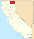
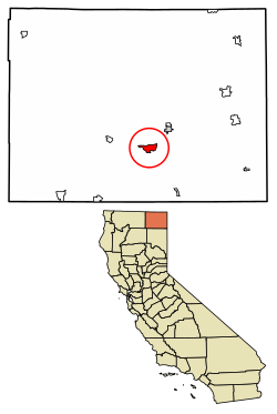
Location of California Pines in Modoc County, California.
USA California location map.svg
Red pog.svg
California Pines, California
Location in California
Coordinates: 41°24′36″N120°40′45″W / 41.41000°N 120.67917°W / 41.41000; -120.67917
Country Flag of the United States.svg  United States
State Flag of California.svg  California
County Modoc
Area
[1]
  Total7.57 sq mi (19.60 km2)
  Land7.43 sq mi (19.24 km2)
  Water0.14 sq mi (0.37 km2)  1.87%
Elevation
[2]
4,406 ft (1,343 m)
Population
 (2020)
  Total473
  Density63.69/sq mi (24.59/km2)
Time zone UTC-8 (Pacific (PST))
  Summer (DST) UTC-7 (PDT)
ZIP code
96101 [3]
Area code 530
GNIS feature ID1947700; 2582955
U.S. Geological Survey Geographic Names Information System: California Pines, California; U.S. Geological Survey Geographic Names Information System: California Pines, California

California Pines is a census-designated place [4] in Modoc County, California. [2] It lies at an elevation of 4406 feet (1343 m). [2] Its population is 473 as of the 2020 census, down from 520 from the 2010 census.

Contents

Geography

According to the United States Census Bureau, the CDP covers an area of 7.6 square miles (19.6 km2), 98.13% of it land, and 1.87% of it water.

Demographics

Historical population
CensusPop.Note
2020 473
U.S. Decennial Census [5]

At the 2010 census California Pines had a population of 520. The population density was 68.7 inhabitants per square mile (26.5/km2). The racial makeup of California Pines was 416 (80.0%) White, 11 (2.1%) African American, 16 (3.1%) Native American, 6 (1.2%) Asian, 2 (0.4%) Pacific Islander, 33 (6.3%) from other races, and 36 (6.9%) from two or more races. Hispanic or Latino of any race were 83 people (16.0%). [6]

The whole population lived in households, no one lived in non-institutionalized group quarters and no one was institutionalized.

There were 216 households, 63 (29.2%) had children under the age of 18 living in them, 96 (44.4%) were opposite-sex married couples living together, 25 (11.6%) had a female householder with no husband present, 14 (6.5%) had a male householder with no wife present. There were 10 (4.6%) unmarried opposite-sex partnerships, and 4 (1.9%) same-sex married couples or partnerships. 66 households (30.6%) were one person and 33 (15.3%) had someone living alone who was 65 or older. The average household size was 2.41. There were 135 families (62.5% of households); the average family size was 2.98.

The age distribution was 129 people (24.8%) under the age of 18, 35 people (6.7%) aged 18 to 24, 79 people (15.2%) aged 25 to 44, 172 people (33.1%) aged 45 to 64, and 105 people (20.2%) who were 65 or older. The median age was 47.2 years. For every 100 females, there were 108.8 males. For every 100 females age 18 and over, there were 99.5 males.

There were 276 housing units at an average density of 36.5 per square mile, of the occupied units 183 (84.7%) were owner-occupied and 33 (15.3%) were rented. The homeowner vacancy rate was 3.7%; the rental vacancy rate was 10.8%. 436 people (83.8% of the population) lived in owner-occupied housing units and 84 people (16.2%) lived in rental housing units.

Politics

In the state legislature, California Pines is in the 1st Senate District , represented by Republican Brian Dahle, [7] and the 1st Assembly District , represented by Republican Megan Dahle. [8]

Federally, California Pines is in California's 1st congressional district , represented by Republican Doug LaMalfa. [9]

Related Research Articles

<span class="mw-page-title-main">Lake of the Pines, California</span> Census-designated place in California, United States

Lake of the Pines is a census-designated place (CDP) and a gated residential community in Nevada County, California, United States. The population was 3,917 at the 2010 census.

<span class="mw-page-title-main">Blairsden, California</span> Census-designated place in California, United States

Blairsden is a census-designated place (CDP) in Plumas County, California, United States. Blairsden is located 20 miles (32.2 km) east-southeast of Quincy. It is located on the Feather River Route. The population was 39 at the 2010 census, down from 50 at the 2000 census.

<span class="mw-page-title-main">East Shore, California</span> Census-designated place in California, United States

East Shore is a census-designated place (CDP) in Plumas County, California, United States. The population was 156 at the 2010 census, down from 177 at the 2000 census.

<span class="mw-page-title-main">Indian Falls, California</span> Census-designated place in California, United States

Indian Falls is a census-designated place (CDP) in Plumas County, California, United States. The population was 54 at the 2010 census, up from 37 at the 2000 census.

<span class="mw-page-title-main">Iron Horse, California</span> Census-designated place in California, United States

Iron Horse is a census-designated place (CDP) in Plumas County, California, United States. The population was 297 at the 2010 census, down from 321 at the 2000 census.

<span class="mw-page-title-main">Lake Davis, California</span> Census-designated place in California, United States

Lake Davis is a census-designated place (CDP) in Plumas County, California, United States, located on Lake Davis. The population was 45 at the 2010 census.

<span class="mw-page-title-main">Prattville, California</span> Census-designated place in California, United States

Prattville is a census-designated place (CDP) in Plumas County, California, United States. The population was 33 at the 2010 census, up from 28 at the 2000 census.

<span class="mw-page-title-main">Spring Garden, California</span> Census-designated place in California, United States

Spring Garden is a census-designated place (CDP) in Plumas County, California, United States. The population was 16 at the 2010 census, down from 55 at the 2000 census.

<span class="mw-page-title-main">Storrie, California</span> Census-designated place in California, United States

Storrie is a census-designated place (CDP) in Plumas County, California and about 20 miles northeast of Lake Oroville. As of the 2010 Census, the CDP had a population of four.

<span class="mw-page-title-main">Taylorsville, California</span> Census-designated place in California, United States

Taylorsville is a census-designated place (CDP) in Plumas County, California, United States. The population was 150 at the 2010 census, down from 154 at the 2000 census. The annual Stone Ranch Reunion is held in Taylorsville.

<span class="mw-page-title-main">Valley Ranch, California</span> Census-designated place in California, United States

Valley Ranch is a census-designated place in Plumas County, California, United States. The population was 109 at the 2010 census, up from 92 at the 2000 census.

<span class="mw-page-title-main">Millville, California</span> Census-designated place in California, United States

Millville is a census-designated place (CDP) in Shasta County, California, United States. Its population is 724 as of the 2020 census, down from 727 from the 2010 census.

<span class="mw-page-title-main">Bieber, California</span> Place in California, United States

Bieber is a unincorporated community in Lassen County, California. It is located on the Pit River, 55 miles (89 km) north-northwest of Susanville, at an elevation of 4,124 feet (1,257 m) Its population is 266 as of the 2020 census, down from 312 from the 2010 census. For statistical purposes, the United States Census Bureau has defined Bieber as a census-designated place (CDP). The ZIP Code is 96009. The community is inside area code 530.

<span class="mw-page-title-main">Hat Creek, California</span> Census designated place in California, United States

Hat Creek is a census designated place (CDP) in Shasta County, California. Hat Creek is situated at an elevation of 3,422 feet (1,043 m). Its population is 266 as of the 2020 census, down from 309 from the 2010 census.

New Pine Creek is a census-designated place in Modoc County, California. It is located on the Oregon border 7 miles (11 km) north-northeast of Willow Ranch, at an elevation of 4842 feet. Its population is 87 as of the 2020 census, down from 98 from the 2010 census. A 1913 book described Pine Creek as being on Goose Lake and having a population of 300.

Patton Village is a census-designated place in Lassen County, California. It lies at an elevation of 4111 feet. Its population is 632 as of the 2020 census, down from 702 from the 2010 census.

<span class="mw-page-title-main">Gold Mountain, California</span> Place in California, United States

Gold Mountain is an unincorporated community in Plumas County, California. Gold Mountain sits at an elevation of 5,341 feet (1,628 m). The 2010 United States census reported Gold Mountain's population was 80. For statistical purposes, the United States Census Bureau has defined Gold Mountain as a census-designated place (CDP).

Mountain Gate is a census-designated place (CDP) in Shasta County, California, United States. Mountain Gate sits at an elevation of 915 feet (279 m). Its population is 815 as of the 2020 census, down from 943 from the 2010 census.

<span class="mw-page-title-main">Keswick, California</span> Census-designated place in California, United States

Keswick is a census-designated place (CDP) in Shasta County, California. Keswick sits at an elevation of 732 feet (223 m). Its population is 188 as of the 2020 census, down from 451 from the 2010 census.

Sierra Brooks is a census-designated place (CDP) in Sierra County, California. Sierra Brooks sits at an elevation of 5,180 feet (1,580 m). The 2010 United States census reported Sierra Brooks's population was 478.

References

  1. "2020 U.S. Gazetteer Files". United States Census Bureau. Retrieved October 30, 2021.
  2. 1 2 3 U.S. Geological Survey Geographic Names Information System: California Pines, California
  3. "California Pines CA ZIP Code". zipdatamaps.com. 2023. Retrieved February 17, 2023.
  4. U.S. Geological Survey Geographic Names Information System: California Pines, California
  5. "Census of Population and Housing". Census.gov. Retrieved June 4, 2016.
  6. "2010 Census Interactive Population Search: CA - California Pines CDP". U.S. Census Bureau. Archived from the original on July 15, 2014. Retrieved July 12, 2014.
  7. "Senators". State of California. Retrieved March 10, 2013.
  8. "Members Assembly". State of California. Retrieved March 2, 2013.
  9. "California's 1st Congressional District - Representatives & District Map". Civic Impulse, LLC. Retrieved March 2, 2013.