Willow Creek, California

Last updated

Willow Creek, California
Bigfoot Museum Willow Creek.jpg
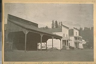
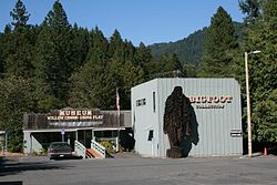
The "Bigfoot Museum" in Willow Creek
Humboldt County California Incorporated and Unincorporated areas Willow Creek Highlighted.svg
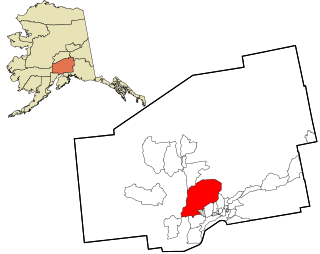
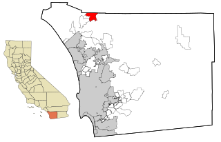
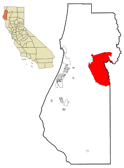
Location in Humboldt County and the state of California
Coordinates: 40°56′22″N123°37′53″W / 40.93944°N 123.63139°W / 40.93944; -123.63139
CountryFlag of the United States.svg United States
State Flag of California.svg  California
County Humboldt
Area
[1]
  Total30.610 sq mi (79.281 km2)
  Land30.310 sq mi (78.504 km2)
  Water0.300 sq mi (0.777 km2)  0.98%
Elevation
[2]
610 ft (186 m)
Population
 (2020) [3]
  Total1,720
  Density56/sq mi (22/km2)
Time zone UTC−8 (Pacific (PST))
  Summer (DST) UTC−7 (PDT)
ZIP code
95573
Area code 530
FIPS code 06-85642
GNIS feature ID1660182
U.S. Geological Survey Geographic Names Information System: Willow Creek, California

Willow Creek (formerly China Flat) [4] is a census-designated place (CDP) in Humboldt County, California, United States. The population was 1,710 at the 2010 census, down from 1,743 at the 2000 census. Residents of this small mountain town are commonly referred to as "Willow Creekers." The town is located around 30 miles (48 km) from county seat and harbor city Eureka, with the two places vastly differing in climate.

Contents

Willow Creek sits along the Trinity River. Willow Creek is described as a "rugged mountain community nestled in the heart of the Six Rivers National Forest." This area of California is located in the Trinity/Shasta/Cascade Region, near the Oregon border, and is easily reached via State Routes 299 and 96 (the "Bigfoot Scenic Byway").

The town is approximately 50 miles south of where the Patterson-Gimlin film was made. Willow Creek calls itself the Bigfoot capital of the world, has a Bigfoot Museum and holds an annual "Bigfoot Daze" festival in September in honor of the creature, followed by various festivities in a local park. [5] The roadhead of the Bluff Creek / Fish Lake Road, near which many alleged Bigfoot sightings and footprint finds occurred, is about 30 miles north, along Route 96.

An Amazon reviewer [6] of the 2013 found-footage horror film, Willow Creek, says, "The endearing quirkiness of the town is captured very well in the iconography, the interviews (particularly with Steven S., the bookstore owner), and the food." The Wikipedia review says, "The two stop off first in Willow Creek ... where various locals talk to Jim's camera, warning them to keep out of the woods, singing ballads about Bigfoot, and generally enjoying their 15 minutes in the spotlight while Jim and Kelly have a blast ...."

Willow Creek was served for many decades by the weekly Klamity Kourier newspaper, which closed in 2006 and was quickly replaced by the Bigfoot Valley News. The Bigfoot Valley News has since closed, but the regional newspaper, Two Rivers Tribune (www.tworiverstribune.com), opened in 1994 and is still going strong. Its news coverage area is from Burnt Ranch to Happy Camp, 97.5 miles [7] (by Routes 299 and 96) to the north.

Geography

According to the United States Census Bureau, the CDP has a total area of 30.6 square miles (79 km2), which include 30.3 square miles (78 km2) of land and 0.3 square miles (0.78 km2) of water.

The CDP in 2000, according to the United States Census Bureau, was larger with a total area of 204.5 square miles (530 km2), which included 204.4 square miles (529 km2) of land and 0.2 square miles (0.52 km2) of water.

Climate

This region experiences much warmer summers than locations near the coast, such as county seat Eureka, but retains high winter rainfall associated with coastal locations. Daytime highs in summer represent areas with hot-summer-Mediterranean climates but are moderated by cool nights, causing high diurnal temperature variation. On climate maps, Willow Creek has a hot-summer Mediterranean climate (Csa). [8] Summer highs are extremely hot compared to areas of the county affected by coastal fog. At the same time, winters are considerably colder, with light snowfall not unusual a few times per season.

Climate data for Willow Creek, 1981–2010 normals, extremes 1968–present
MonthJanFebMarAprMayJunJulAugSepOctNovDecYear
Record high °F (°C)70
(21)
76
(24)
85
(29)
96
(36)
105
(41)
112
(44)
119
(48)
115
(46)
108
(42)
99
(37)
80
(27)
65
(18)
119
(48)
Mean maximum °F (°C)59.6
(15.3)
67.1
(19.5)
76.6
(24.8)
86.1
(30.1)
93.7
(34.3)
100.1
(37.8)
105.6
(40.9)
105.0
(40.6)
99.9
(37.7)
86.2
(30.1)
69.3
(20.7)
58.8
(14.9)
107.8
(42.1)
Mean daily maximum °F (°C)53.5
(11.9)
57.0
(13.9)
63.0
(17.2)
69.9
(21.1)
77.6
(25.3)
86.2
(30.1)
95.2
(35.1)
94.5
(34.7)
87.9
(31.1)
74.6
(23.7)
58.8
(14.9)
50.4
(10.2)
72.4
(22.4)
Daily mean °F (°C)44.3
(6.8)
46.3
(7.9)
50.4
(10.2)
55.1
(12.8)
60.9
(16.1)
67.6
(19.8)
74.0
(23.3)
73.3
(22.9)
67.7
(19.8)
58.5
(14.7)
49.1
(9.5)
43.3
(6.3)
57.5
(14.2)
Mean daily minimum °F (°C)35.0
(1.7)
35.5
(1.9)
37.8
(3.2)
40.3
(4.6)
44.1
(6.7)
49.0
(9.4)
52.7
(11.5)
52.0
(11.1)
47.4
(8.6)
42.4
(5.8)
39.3
(4.1)
36.1
(2.3)
42.6
(5.9)
Mean minimum °F (°C)29.0
(−1.7)
28.9
(−1.7)
31.1
(−0.5)
33.2
(0.7)
37.2
(2.9)
41.5
(5.3)
46.6
(8.1)
46.3
(7.9)
42.2
(5.7)
34.1
(1.2)
31.0
(−0.6)
28.3
(−2.1)
24.6
(−4.1)
Record low °F (°C)17
(−8)
13
(−11)
22
(−6)
24
(−4)
27
(−3)
29
(−2)
34
(1)
39
(4)
32
(0)
22
(−6)
19
(−7)
5
(−15)
5
(−15)
Average precipitation inches (mm)10.16
(258)
7.75
(197)
7.02
(178)
3.81
(97)
2.50
(64)
0.94
(24)
0.22
(5.6)
0.31
(7.9)
0.69
(18)
2.86
(73)
7.46
(189)
11.76
(299)
55.48
(1,410.5)
Average snowfall inches (cm)0.9
(2.3)
0.4
(1.0)
0.1
(0.25)
0.0
(0.0)
0.0
(0.0)
0.0
(0.0)
0.0
(0.0)
0.0
(0.0)
0.0
(0.0)
0.0
(0.0)
0.1
(0.25)
1.0
(2.5)
2.5
(6.3)
Source 1: NOAA [9]
Source 2: National Weather Service (mean maxima/minima 19912020) [10]

History

The indigenous people from here are part of the Tsnungwe or South Fork Hupa and are speakers of the Hupa Language. [11] Willow Creek's first non-indigenous settlers were Chinese laborers from the mining and lumber camps, which earned the town the name China Flat. [4] The China Flat post office opened in 1878, and changed its name to Willow Creek in 1915. [4]

Demographics

Downtown Willow Creek in 2022. 2022 08 09-09.22.18.255-CDT.jpg
Downtown Willow Creek in 2022.

2010

The 2010 United States Census [12] reported that Willow Creek had a population of 1,710. The population density was 55.9 inhabitants per square mile (21.6/km2). The racial makeup of Willow Creek was 1,375 (80.4%) White, 6 (0.4%) African American, 167 (9.8%) Native American, 14 (0.8%) Asian, 6 (0.4%) Pacific Islander, 29 (1.7%) from other races, and 113 (6.6%) from two or more races. Hispanic or Latino of any race were 108 persons (6.3%).

The Census reported that 1,699 people (99.4% of the population) lived in households, 11 (0.6%) lived in non-institutionalized group quarters, and 0 (0%) were institutionalized.

There were 812 households, out of which 161 (19.8%) had children under the age of 18 living in them, 353 (43.5%) were opposite-sex married couples living together, 63 (7.8%) had a female householder with no husband present, 32 (3.9%) had a male householder with no wife present. There were 75 (9.2%) unmarried opposite-sex partnerships, and 7 (0.9%) same-sex married couples or partnerships. 283 households (34.9%) were made up of individuals, and 94 (11.6%) had someone living alone who was 65 years of age or older. The average household size was 2.09. There were 448 families (55.2% of all households); the average family size was 2.65.

The population was spread out, with 287 people (16.8%) under the age of 18, 100 people (5.8%) aged 18 to 24, 366 people (21.4%) aged 25 to 44, 642 people (37.5%) aged 45 to 64, and 315 people (18.4%) who were 65 years of age or older. The median age was 49.5 years. For every 100 females, there were 101.4 males. For every 100 females age 18 and over, there were 102.1 males.

There were 1,108 housing units at an average density of 36.2 per square mile (14.0/km2), of which 812 were occupied, of which 525 (64.7%) were owner-occupied, and 287 (35.3%) were occupied by renters. The homeowner vacancy rate was 1.7%; the rental vacancy rate was 5.2%. 1,087 people (63.6% of the population) lived in owner-occupied housing units and 612 people (35.8%) lived in rental housing units.

2000

As of the census [13] of 2000, there were 1,743 people, 772 households, and 481 families residing in the CDP. The population density was 8.5 people per square mile (3.3/km2). There were 1,099 housing units at an average density of 5.4 per square mile (2.1/km2). The racial makeup of the CDP was 81.81% White, 0.52% Black or African American, 9.52% Native American, 0.57% Asian, 0.34% Pacific Islander, 1.43% from other races, and 5.79% from two or more races. 5.57% of the population were Hispanic or Latino of any race.

There were 772 households, out of which 24.0% had children under the age of 18 living with them, 49.9% were married couples living together, 8.2% had a female householder with no husband present, and 37.6% were non-families. 31.6% of all households were made up of individuals, and 11.8% had someone living alone who was 65 years of age or older. The average household size was 2.26 and the average family size was 2.81.

In the CDP, the population was spread out, with 22.5% under the age of 18, 5.8% from 18 to 24, 21.8% from 25 to 44, 30.1% from 45 to 64, and 19.9% who were 65 years of age or older. The median age was 45 years. For every 100 females, there were 101.5 males. For every 100 females age 18 and over, there were 104.4 males.

The median income for a household in the CDP was $27,276, and the median income for a family was $35,720. Males had a median income of $33,375 versus $27,955 for females. The per capita income for the CDP was $18,664. About 10.3% of families and 14.4% of the population were below the poverty line, including 19.8% of those under age 18 and 2.3% of those age 65 or over.

Politics

In the state legislature, Willow Creek is in the 2nd Senate District , represented by Democrat Mike McGuire, [14] and the 2nd Assembly District , represented by Democrat Jim Wood. [15]

Federally, Willow Creek is in California's 2nd congressional district , represented by Democrat Jared Huffman. [16]

See also

Related Research Articles

<span class="mw-page-title-main">Willow, Alaska</span> CDP in Alaska, United States

Willow is a census-designated place (CDP) in the Matanuska-Susitna Borough in the U.S. state of Alaska. Located 26 miles northwest from Wasilla along the George Parks Highway, it is part of the Anchorage, Alaska Metropolitan Statistical Area. At the 2020 census the population was 2,196, up from 2,102 in 2010.

<span class="mw-page-title-main">Durham, California</span> Census-designated place in California, United States

Durham is a census-designated place (CDP) in Butte County, California, United States. The population was 5,518 at the 2010 census.

<span class="mw-page-title-main">West Point, California</span> Census-designated place in California, United States

West Point is a census-designated place (CDP) in Calaveras County, California, in the United States. As of the 2010 United States Census, West Point's population was 674, down from 746 as of the 2000 census. The town is registered as California Historical Landmark #268. There is an annual West Point Lumberjack Days festival in the community.

<span class="mw-page-title-main">Auberry, California</span> Census-designated place in California, United States

Auberry is a census-designated place (CDP) in Fresno County, California, United States. The population was 2,369 at the 2010 census, up from 2,053 at the 2000 census. Auberry is located on Little Sandy Creek 9.5 miles (15 km) west of Shaver Lake Heights, at an elevation of 2,018 feet (615 m).

<span class="mw-page-title-main">Cantua Creek, California</span> Census-designated place in California, United States

Cantua Creek is a census-designated place (CDP) in Fresno County, California, United States. As of the 2010 census, the population was 466, down from the 655 reported at the 2000 census. Cantua Creek is located 11 miles (18 km) south-southwest of Tranquillity, at an elevation of 295 feet.

<span class="mw-page-title-main">Shaver Lake, California</span> Census-designated place in California, United States

Shaver Lake is a census-designated place (CDP) in Fresno County, California, United States. The population was 634 at the 2010 census, down from 705 at the 2000 census. Shaver Lake is on the southwest end of the lake of the same name, 10 miles (16 km) east of New Auberry, at an elevation of 5,627 ft (1,715 m). The name honors C.B. Shaver, founder of the Fresno Flume and Irrigation Company that built the dam, creating the lake. The lake served as a mill pond for the Shaver Sawmill and the source for a flume that ran 65 miles (105 km) to Clovis. The original town of Shaver was buried under the lake when the Thomas A. Edison Company purchased and enlarged the lake in 1919.

<span class="mw-page-title-main">Winterhaven, California</span> Census-designated place in California, United States

Winterhaven is a census-designated place (CDP) in Imperial County, California. Winterhaven is 6.5 miles (10 km) east of Pilot Knob, The population was 394 at the 2010 census, down from 529 at the 2000 census. It is part of the El Centro, CA Metropolitan Area. North of Interstate 8 and bordering Yuma, Arizona, the town is partly in the Fort Yuma Indian Reservation. The Colorado River marks the town's southern border.

<span class="mw-page-title-main">Quartz Hill, California</span> Census-designated place in California, United States

Quartz Hill is a census-designated place (CDP) in Los Angeles County, California, United States. The population was 10,912 at the 2010 census, up from 9,890 at the 2000 census. The name is also shared with the neighboring district areas of its border cities, Palmdale, and Lancaster. Quartz Hill was once home to the Quartz Hill Airport. According to the Greater Antelope Valley Economic Alliance report of 2009, the Palmdale / Lancaster urban area of which Quartz Hill is a part, has a population of 483,998.

<span class="mw-page-title-main">Le Grand, California</span> Census-designated place in California, United States

Le Grand is an unincorporated community and census-designated place (CDP) in Merced County, California, United States. Le Grand is 14 miles (23 km) east-southeast of Merced, the county seat at an elevation of 253 feet (77 m). The population was 1,592 at the 2020 census, down from 1,659 at the 2010 census.

<span class="mw-page-title-main">Meadow Valley, California</span> Census-designated place in California, United States

Meadow Valley is a census-designated place (CDP) in Plumas County, California, United States. The population was 453 at the 2020 census, down from 464 at the 2010 census.

<span class="mw-page-title-main">Bluewater, California</span> Census-designated place in California, United States

Bluewater is a census-designated place (CDP) in San Bernardino County, California, United States. The population was 172 at the 2010 census, down from 265 at the 2000 census.

<span class="mw-page-title-main">Rainbow, California</span> Census designated place in California, United States

Rainbow is a census designated place (CDP) in northern San Diego County in the U.S. state of California. The population was 1,832 at the 2010 census, down from 2,026 at the 2000 census.

<span class="mw-page-title-main">Lincoln Village, California</span> Census-designated place in California, United States

Lincoln Village is a census-designated place (CDP) in San Joaquin County, California, United States. The population was 4,381 at the 2010 census, up from 4,216 at the 2000 census.

<span class="mw-page-title-main">Lake Nacimiento, California</span> Census-designated place in California, United States

Lake Nacimiento is a census-designated place (CDP) in northern San Luis Obispo County, California, United States.

<span class="mw-page-title-main">Graton, California</span> Census-designated place in California, United States

Graton is an unincorporated town and census-designated place (CDP) in west Sonoma County, California, United States. The population was 1,707 at the 2010 census. Graton's ZIP code is 95444. The town also has a culinary reputation attributed to two restaurants in the area.

<span class="mw-page-title-main">Lemon Cove, California</span> Census designated place in California, United States

Lemon Cove is a census-designated place (CDP) in the San Joaquin Valley in Tulare County, California, United States. The population was 308 at the 2010 census, up from 298 at the 2000 census.

<span class="mw-page-title-main">Strathmore, California</span> Census-designated place in California, United States

Strathmore is a census-designated place (CDP) in Tulare County, California, United States. The population was 2,819 at the 2010 census, up from 2,584 at the 2000 census.

<span class="mw-page-title-main">Willow Creek, Montana</span> Census-designated place in Gallatin County, Montana, United States.

Willow Creek is a census-designated place (CDP) in Gallatin County, Montana, United States. The population was 210 at the 2010 census. It is part of the Bozeman, MT Micropolitan Statistical Area.

<span class="mw-page-title-main">Neilton, Washington</span> Census-designated place in Washington, United States

Neilton is an unincorporated community and census-designated place (CDP) in Grays Harbor County, Washington, United States. The population was 315 at the 2010 census.

<span class="mw-page-title-main">Burnt Ranch, California</span> Census-designated place in California, United States

Burnt Ranch is a census-designated place (CDP) in Trinity County, California. It has a school and a post office. Its ZIP Code is 95527, and it is in area code 530. Its elevation is 1,502 feet (458 m). Its population is 250 as of the 2020 census, down from 281 from the 2010 census.

References

  1. "2010 Census U.S. Gazetteer Files – Places – California". United States Census Bureau.
  2. U.S. Geological Survey Geographic Names Information System: Willow Creek, California
  3. "Explore Census Data". data.census.gov. Retrieved May 6, 2023.
  4. 1 2 3 Durham, David L. (1998). California's Geographic Names: A Gazetteer of Historic and Modern Names of the State. Clovis, Calif.: Word Dancer Press. p. 168. ISBN   1-884995-14-4.
  5. "Big Foot Days Willow Creek California". www.seecalifornia.com.
  6. Samuel Lamerson
  7. per Google Maps
  8. "Willow Creek, California Koppen Climate Classification (Weatherbase)". Weatherbase.
  9. "U.S. Climate Normals Quick Access – Station: Willow Creek 1NW, CA". National Oceanic and Atmospheric Administration. Retrieved November 27, 2022.
  10. "NOAA Online Weather Data – NWS Eureka". National Weather Service. Retrieved November 27, 2022.
  11. Tsnungwe Place Names, by Tsnungwe Tribal Elders, 1994
  12. "2010 Census Interactive Population Search: CA - Willow Creek CDP". U.S. Census Bureau. Archived from the original on July 15, 2014. Retrieved July 12, 2014.
  13. "U.S. Census website". United States Census Bureau . Retrieved January 31, 2008.
  14. "Senators". State of California. Retrieved March 10, 2013.
  15. "Members Assembly". State of California. Retrieved March 2, 2013.
  16. "California's 2nd Congressional District - Representatives & District Map". Civic Impulse, LLC. Retrieved March 1, 2013.