Cutten, California

Last updated
Cutten
Humboldt County California Incorporated and Unincorporated areas Cutten Highlighted.svg
Location in Humboldt County and the state of California
Coordinates: 40°46′11″N124°08′34″W / 40.76972°N 124.14278°W / 40.76972; -124.14278 Coordinates: 40°46′11″N124°08′34″W / 40.76972°N 124.14278°W / 40.76972; -124.14278
Country Flag of the United States.svg  United States
State Flag of California.svg  California
County Humboldt
Area
[1]
  Total1.28 sq mi (3.32 km2)
  Land1.28 sq mi (3.32 km2)
  Water0.00 sq mi (0.00 km2)  0%
Elevation
200 ft (61 m)
Population
 (2020)
  Total3,223
  Density2,516.00/sq mi (971.26/km2)
Time zone UTC-8 (Pacific (PST))
  Summer (DST) UTC-7 (PDT)
ZIP code
95503, 95534
Area code(s) 707
FIPS code 06-17722
GNIS feature ID1655945
U.S. Geological Survey Geographic Names Information System: Cutten, California

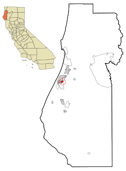
Cutten, a census-designated place (CDP) in Humboldt County, California, United States, is an unincorporated community, which is part of Greater Eureka. The city was named for David Page Cutten and his family, who were prominent figures in the history of Humboldt County during the early 1850s. [2] Cutten is located 2.5 miles (4 km) south-southeast of downtown Eureka, [3] at an elevation of 200 feet (61 m). [4] Its population is 3,223 as of the 2020 census, up from 3,108 from the 2010 census.

Contents

Geography

According to the United States Census Bureau, the CDP has a total area of 1.3 square miles (3.4 km2), all of it land.

History

The first post office at Cutten opened in 1929. [3] An early name for the area was the Cutten-McDonald Tract. [5] The ZIP Code is 95534. [6] However, the 95534 zip code is specific to the post office only and all physical addresses within the CDP have the Eureka, California 95503 zip code.

Demographics

Historical population
CensusPop.
2020 3,223
U.S. Decennial Census [7]

2010

The 2010 United States Census [8] reported that Cutten had a population of 3,108. The population density was 2,401.8 inhabitants per square mile (927.3/km2). The racial makeup of Cutten was 2,628 (84.6%) White, 27 (0.9%) African American, 119 (3.8%) Native American, 80 (2.6%) Asian, 11 (0.4%) Pacific Islander, 78 (2.5%) from other races, and 165 (5.3%) from two or more races. Hispanic or Latino of any race were 254 persons (8.2%).

The Census reported that 3,092 people (99.5% of the population) lived in households, 11 (0.4%) lived in non-institutionalized group quarters, and 5 (0.2%) were institutionalized.

There were 1,304 households, out of which 407 (31.2%) had children under the age of 18 living in them, 574 (44.0%) were opposite-sex married couples living together, 141 (10.8%) had a female householder with no husband present, 80 (6.1%) had a male householder with no wife present. There were 94 (7.2%) unmarried opposite-sex partnerships, and 14 (1.1%) same-sex married couples or partnerships. 390 households (29.9%) were made up of individuals, and 153 (11.7%) had someone living alone who was 65 years of age or older. The average household size was 2.37. There were 795 families (61.0% of all households); the average family size was 2.95.

The population was spread out, with 718 people (23.1%) under the age of 18, 287 people (9.2%) aged 18 to 24, 798 people (25.7%) aged 25 to 44, 823 people (26.5%) aged 45 to 64, and 482 people (15.5%) who were 65 years of age or older. The median age was 37.9 years. For every 100 females, there were 96.2 males. For every 100 females age 18 and over, there were 92.3 males.

There were 1,372 housing units at an average density of 1,060.3 per square mile (409.4/km2), of which 1,304 were occupied, of which 713 (54.7%) were owner-occupied, and 591 (45.3%) were occupied by renters. The homeowner vacancy rate was 2.3%; the rental vacancy rate was 3.4%. 1,762 people (56.7% of the population) lived in owner-occupied housing units and 1,330 people (42.8%) lived in rental housing units.

2000

As of the census [9] of 2000, there were 2,933 people, 1,197 households, and 799 families residing in the CDP. The population density was 2,248.8 inhabitants per square mile (868.3/km2). There were 1,249 housing units at an average density of 957.6 per square mile (369.7/km2). The racial makeup of the CDP was 87.93% White, 0.75% Black or African American, 3.07% Native American, 1.50% Asian, 0.38% Pacific Islander, 2.11% from other races, and 4.26% from two or more races. 6.00% of the population were Hispanic or Latino of any race.

There were 1,197 households, out of which 30.6% had children under the age of 18 living with them, 49.0% were married couples living together, 12.4% had a female householder with no husband present, and 33.2% were non-families. 24.5% of all households were made up of individuals, and 8.9% had someone living alone who was 65 years of age or older. The average household size was 2.40 and the average family size was 2.85.

In the CDP, the population was spread out, with 23.4% under the age of 18, 10.0% from 18 to 24, 25.8% from 25 to 44, 27.4% from 45 to 64, and 13.4% who were 65 years of age or older. The median age was 39 years. For every 100 females, there were 89.6 males. For every 100 females age 18 and over, there were 88.4 males.

The median income for a household in the CDP was $35,786, and the median income for a family was $42,283. Males had a median income of $39,545 versus $21,574 for females. The per capita income for the CDP was $19,317. About 8.3% of families and 13.5% of the population were below the poverty line, including 13.7% of those under age 18 and 10.0% of those age 65 or over.

Politics

In the state legislature, Cutten is in the 2nd Senate District , represented by Democrat Mike McGuire, [10] and the 2nd Assembly District , represented by Democrat Jim Wood. [11]

Federally, Cutten is in California's 2nd congressional district , represented by Democrat Jared Huffman. [12]

See also

Related Research Articles

Diablo, California Census-designated place in California, United States

Diablo is a census-designated place (CDP) in Contra Costa County, California, United States. The population was 1,158 at the 2010 census. It is located 2.5 miles (4.0 km) east-northeast of Danville.

Bayview, Humboldt County, California Census-designated place in California, United States

Bayview is a census-designated place (CDP) located adjacent to the City of Eureka in Humboldt County, California, United States. Its population is 2,619 as of the 2020 census, up from 2,510 from the 2010 census. Many locals consider this area as part of "Pine Hill."

Blue Lake, California City in California, United States

Blue Lake is a city in Humboldt County, California, United States. Blue Lake is located on the Mad River in a deep valley, 16 miles (26 km) northeast of Eureka, at an elevation of 131 feet. Its population is 1,208 as of the 2020 census, down from 1,253 from the 2010 census.

Humboldt Hill, California Census-designated place in Humboldt County, California, U.S.

Humboldt Hill is a census-designated place (CDP) in Humboldt County, California, United States. Humboldt Hill rises to an elevation of 636 feet (194 m). The population was 3,414 at the 2010 census, up from 3,246 at the 2000 census. The area is in the 95503 zip code and part of unincorporated Eureka.

Hydesville, California Census-designated place in California, United States

Hydesville is a census-designated place (CDP) in Humboldt County, California, United States. Hydesville is located 4.5 miles (7.2 km) southeast of Fortuna, at an elevation of 364 feet (111 m). The population was 1,237 at the 2010 census, up from 1,209 at the 2000 census.

McKinleyville, California Census-designated place in California, United States

McKinleyville is a census-designated place (CDP) in Humboldt County, California McKinleyville is located 5.25 miles (8.4 km) north of Arcata, at an elevation of 141 feet (43 m). The population was 15,177 at the 2010 census, up from 13,599 at the time of the 2000 census.

Myrtletown, California Census designated place in California, United States

Myrtletown is a census-designated place (CDP) in Humboldt County, California, United States. Myrtletown lies at an elevation of 112 feet. Myrtletown is a part of the Eureka, California metropolitan area. The population was 4,675 at the 2010 census, up from 4,459 at the 2000 census.

Pine Hills, California Census-designated place in California, United States

Pine Hills is a census-designated place (CDP) in Humboldt County, California, United States, adjacent to Eureka. The population was 3,131 at the 2010 census, up from 3,108 at the 2000 census. Pine Hills includes areas like Ridgewood and areas as far south as the small neighborhood of Elk River. An area near this artificial census construct is called Pine Hill by Local government agencies and officials. Pine Hill is a much smaller area than "Pine Hills" and as defined by local agencies is actually within an adjacent CDP named Bayview.

Lost Hills, California Census-designated place in California, United States

Lost Hills is a census-designated place (CDP) in Kern County, California, United States. Lost Hills is located 42 miles (68 km) west-northwest of Bakersfield, at an elevation of 305 feet (93 m). The population was 2,412 at the 2010 census, up from 1,938 at the 2000 census. About 75% of the population is engaged in agricultural positions.

Granite Bay, California Census-designated place in California, United States

Granite Bay is a census-designated place (CDP) in Placer County, California, United States. It is part of the Sacramento–Arden-Arcade–Roseville Metropolitan Statistical Area. The population was 20,402 at the 2010 census, up from 19,388 at the 2000 census. The ZIP codes are 95746 and 95661. Granite Bay is a primarily residential suburb of Sacramento and is located just east of Roseville and west of Folsom Lake.

Plumas Eureka, California Census-designated place in California, United States

Plumas Eureka is a census-designated place (CDP) in Plumas County, California, United States. The population was 320 at the 2000 census.

Miranda is a census-designated place in Humboldt County, California. It is located 2.5 miles (4 km) northwest of Phillipsville, in the heart of redwood country, at an elevation of 351 feet. The ZIP Code is 95553. The population was 520 at the 2010 census.

Alderpoint is a census-designated place in Humboldt County, California at an elevation of 472 feet (144 m), 11 miles (18 km) east-northeast of Garberville. Its population is 137 as of the 2020 census, down from 186 from the 2010 census. The ZIP Code is 95511 and its area code is 707.

Fieldbrook, California Census-designated place in California, United States

Fieldbrook is a census-designated place in Humboldt County, California. It is located 7 miles (11 km) north-northeast of Arcata, at an elevation of 203 feet (62 m). The population was at 860 at the 2010 census.

Mad River is a census-designated place (CDP) in Trinity County, California. Mad River is located in the southern part of the county. Mad River sits at an elevation of 2,484 feet (757 m). The ZIP Code is 95552. Its population is 361 as of the 2020 census, down from 420 from the 2010 census.

Phillipsville is a census-designated place in Humboldt County, California. It is located on the South Fork of the Eel River 7.5 miles (12.1 km) north of Garberville, at an elevation of 289 feet. It is the southernmost town on the Avenue of the Giants. Near the town is the Chimney Tree. This is a redwood tree that resembles a chimney. The ZIP Code is 95559. The community is inside area code 707. The population was 140 at the 2010 census.

Benbow, California Census designated place in California, United States

Benbow is a census-designated place in Humboldt County, California, located beside the South Fork Eel River. It is located 2 miles (3.2 km) south-southeast of Garberville, at an elevation of 440 feet. Its population is 422 as of the 2020 census, up from 321 from the 2010 census.

Fields Landing, California Census-designated place in California, United States

Fields Landing is a census-designated place in Humboldt County, California. It is located on Humboldt Bay 6 miles (9.7 km) south-southwest of downtown Eureka, at an elevation of 13 feet. The ZIP Code is 95537. The population was 276 at the 2010 census.

Indianola, California Census-designated place in California, United States

Indianola is a census-designated place in Humboldt County, California. It is located 4 miles (6.4 km) south of Arcata, at an elevation of 46 feet. The place appears on the USGS Arcata South map. Addresses in this neighborhood are part of unincorporated Eureka, California, located entirely within the 95503 ZIP code. The population was 823 at the 2010 census.

Manila, California Census-designated place in California, United States

Manila is a census-designated place located adjacent to Humboldt Bay in Humboldt County, California. It is located 3.25 miles (5.2 km) north of downtown Eureka, at an elevation of 13 feet. The ZIP Code is 95521. The population was 784 at the 2010 census.

References

  1. "2020 U.S. Gazetteer Files". United States Census Bureau. Retrieved October 30, 2021.
  2. Turner, Dennis W.; Turner, Gloria H. (2010). Place Names of Humboldt County, California (2nd ed.). Orangevale, CA: Dennis W. & Gloria H. Turner. p. 67. ISBN   978-0-9629617-2-4.
  3. 1 2 Durham, David L. (1998). California's Geographic Names: A Gazetteer of Historic and Modern Names of the State. Clovis, Calif.: Word Dancer Press. p. 45-46. ISBN   1-884995-14-4.
  4. U.S. Geological Survey Geographic Names Information System: Cutten, California
  5. Turner, Dennis W. (1993). Place Names of Humboldt County, California: A Compendium 1542-1992. Eureka, CA: Eureka Printing Company, Inc. p. 57. ISBN   978-0-9629617-1-7.
  6. USPS ZIP Code lookup tool Archived 2010-11-22 at the Wayback Machine
  7. "Census of Population and Housing". Census.gov. Retrieved June 4, 2016.
  8. "2010 Census Interactive Population Search: CA - Cutten CDP". U.S. Census Bureau. Archived from the original on July 15, 2014. Retrieved July 12, 2014.
  9. "U.S. Census website". United States Census Bureau . Retrieved 2008-01-31.
  10. "Senators". State of California. Retrieved March 10, 2013.
  11. "Members Assembly". State of California. Retrieved March 2, 2013.
  12. "California's 2nd Congressional District - Representatives & District Map". Civic Impulse, LLC. Retrieved March 1, 2013.