Tsurau, California

Last updated

Coordinates: 41°03′34″N124°08′35″W / 41.05944°N 124.14306°W / 41.05944; -124.14306

Geographic coordinate system Coordinate system

A geographic coordinate system is a coordinate system that enables every location on Earth to be specified by a set of numbers, letters or symbols. The coordinates are often chosen such that one of the numbers represents a vertical position and two or three of the numbers represent a horizontal position; alternatively, a geographic position may be expressed in a combined three-dimensional Cartesian vector. A common choice of coordinates is latitude, longitude and elevation. To specify a location on a plane requires a map projection.

Tsurai
Former settlement

Tsurai Plaque.JPG

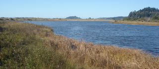
This stone marker and plaque mark the former location of the indigenous Yurok settlement of Tsurai/Tsuaru.
USA California location map.svg
Red pog.svg
Tsurai
Location in California
Coordinates: 41°03′34″N124°08′35″W / 41.05944°N 124.14306°W / 41.05944; -124.14306
Country United States
State California
County Humboldt County
Elevation [1] 174 ft (53 m)
Official name Old Indian Village of Tsurai [2]
Reference no. 838

Tsurai (also, Tschura, Tschura-Allequas, Tsurau, and Zoreisch) is a former Yurok settlement in Humboldt County, California. [1] It was located at Trinidad, at an elevation of 174 feet (53 m) [1] and is California State Historic Landmark #838. [2]

Humboldt County, California County in California, United States

Humboldt County is a county in the U.S. state of California. As of the 2010 census, the population was 132,646. The county seat is Eureka.

California State of the United States of America

California is a state in the Pacific Region of the United States. With 39.6 million residents, California is the most populous U.S. state and the third-largest by area. The state capital is Sacramento. The Greater Los Angeles Area and the San Francisco Bay Area are the nation's second and fifth most populous urban regions, with 18.7 million and 9.7 million residents respectively. Los Angeles is California's most populous city, and the country's second most populous, after New York City. California also has the nation's most populous county, Los Angeles County, and its largest county by area, San Bernardino County. The City and County of San Francisco is both the country's second-most densely populated major city after New York City and the fifth-most densely populated county, behind only four of the five New York City boroughs.

Trinidad, California City in California, United States

Trinidad Yurok: Chuerey is a seaside city in Humboldt County, located on the Pacific Ocean 8 miles (13 km) north of the Arcata-Eureka Airport and 15 miles (24 km) north of the college town of Arcata. Situated at an elevation of 174 feet (53 m) above its own North Coast harbor, Trinidad is one of California's smallest incorporated cities by population. Trinidad is noted for its spectacular coastline with ten public beaches and offshore rocks, part of the California Coastal National Monument, of which Trinidad is a Gateway City. Fishing operations related to Trinidad Harbor are vital to both local tourism and commercial fishery interests in the region.

Related Research Articles

Pine Hill, California Unincorporated community in California, United States

Pine Hill is an unincorporated community in Humboldt County, California. It is located 2.5 miles (4 km) south of downtown Eureka, at an elevation of 135 feet. The area is now part of unincorporated Eureka.

Camp Klamath, California Unincorporated community in California, United States

Camp Klamath is an unincorporated community in Del Norte County, California. It is located on the east bank of the Klamath River 1.5 miles (2.4 km) from its mouth, at an elevation of 23 feet.

Douglas Park, California Unincorporated community in California, United States

Douglas Park is an unincorporated community in Del Norte County, California. It is located on the south bank of the Smith River 7.5 miles (12 km) east-northeast of Crescent City, at an elevation of 138 feet.

Hoppaw, California Unincorporated community in California, United States

Hoppaw is an unincorporated community in Del Norte County, California. It is located on Hoppaw Creek 3 miles (4.8 km) east-southeast of the mouth of the Klamath River, at an elevation of 36 feet. It appears in the Requa U.S. Geological Survey Map.

Tryon Corner, California Unincorporated community in California, United States

Tryon Corner is an unincorporated community in Del Norte County, California. Located 3.5 miles (5.6 km) west of Smith River, at an elevation of 33 feet.

Waukell Flat, California Former settlement in California, United States

Waukell Flat is a former settlement in Del Norte County, California. It was located on the south bank of the Klamath River 4.25 miles (6.8 km) from its mouth, at an elevation of 23 feet. It still appeared on maps as of 1952.

Berry Glenn is a locality in Humboldt County, California. It lies at an elevation of 52 feet (16 m).

Brainard, California Unincorporated community in California, United States

Brainard is an unincorporated community in Humboldt County, California. It is located on the Northwestern Pacific Railroad 4 miles (6.4 km) south-southwest of Arcata, at an elevation of 7 feet.

Crannell, California Unincorporated community in California, United States

Crannell is a former settlement in Humboldt County, California. It is located 4.5 miles (7.2 km) southeast of Trinidad, at an elevation of 203 feet (62 m).

Elk Grove, Humboldt County, California Former settlement in California, United States

Elk Grove is a former settlement in Humboldt County, California. It was located 6 miles (9.7 km) north-northeast of Orick, at an elevation of 151 feet. It still appeared on maps as of 1947.

Moonstone, California Unincorporated community in California, United States

Moonstone is an unincorporated community in Humboldt County, California. It is located 2.5 miles (4.0 km) southeast of Trinidad, at an elevation of 121 feet. For census purposes, it is aggregated in Westhaven-Moonstone, California. The area is sited adjacent to Pacific Ocean beach and the mouth of the Little River with views of the rugged coastline.

Patricks Point, California Unincorporated community in California, United States

Patricks Point is an unincorporated community in Humboldt County, California. It is located 4.5 miles (7.2 km) north of Trinidad, at an elevation of 239 feet.

Westhaven, Humboldt County, California Unincorporated community in California, United States

Westhaven is an unincorporated community in Humboldt County, California. It is located 2.5 miles (4 km) southeast of Trinidad, at an elevation of 328 feet. For census purposes it is amalgamated into Westhaven-Moonstone. The ZIP Code is 95570.

Blaine is a former settlement in Humboldt County, California. It was located 8 miles (13 km) south of Orick.

Myrtle Grove is a former settlement in Humboldt County, California. It was located at a site within the current city limits of Eureka.

Little River State Beach

Little River State Beach is a protected beach of California, United States, in Humboldt County. It is located at the mouth of the Little River, 13 miles (21 km) north of Eureka right off U.S. Route 101. The 152-acre (62 ha) park was established in 1931.

Pelican State Beach is a designated California State Beach located in Del Norte County, California. Located 21 miles (30 km) north of Crescent City on US Route 101 near the town of Smith River, this undeveloped site is immediately south of the Oregon state line, making this site the northernmost California state beach. It is the northern terminus of the California Coastal Trail.

The Cher-Ae Heights Indian Community of the Trinidad Rancheria is a federally recognized tribe of Chetco, Hupa, Karuk, Tolowa, Wiyot, and Yurok people in Humboldt County, California. As of the 2010 Census the population was 132.

Bay City is an unincorporated community in Grays Harbor County, in the U.S. state of Washington.

References

  1. 1 2 3 U.S. Geological Survey Geographic Names Information System: Tsurau, California
  2. 1 2 "Tsurai". Office of Historic Preservation, California State Parks. Retrieved 2012-10-07.