Big Bend, California

Last updated

Big Bend
Madesi Valley
Shasta County California Incorporated and Unincorporated areas Big Bend Highlighted.svg
Location in Shasta County and the state of California
Coordinates: 41°1′11″N121°54′28″W / 41.01972°N 121.90778°W / 41.01972; -121.90778
Country Flag of the United States (23px).png  United States
State Flag of California.svg  California
Area
[1]
  Total5.82 sq mi (15.08 km2)
  Land5.74 sq mi (14.85 km2)
  Water0.09 sq mi (0.23 km2)  1.53%
Elevation
1,701 ft (514 m)
Population
 (2020)
  Total79
  Density13.78/sq mi (5.32/km2)
Time zone UTC-8 (Pacific (PST))
  Summer (DST) UTC-7 (PDT)
ZIP code
96011
Area code 530
FIPS code 06-06475
GNIS feature ID0256886

Big Bend of the Madesi Valley is the indigenous homeland of the Madesi tribe, located in Shasta County, northeastern California. It is named for a major change in course of the Pit River.

Contents

Its population is 79 as of the 2020 census, down from 102 from the 2010 census. For statistical purposes, the United States Census Bureau has defined Big Bend as a census-designated place (CDP).

History

Native Americans

For several thousand years prior to the 19th century, Big Bend was the heart of the territory of the Madesi tribe (pronounced Mah-day-see) tribe (or "band") of Pit River Native Americans. The Madesi is one of nine bands (also called "tribelets") that spoke the Achomawi language. (Early anthropologists mistakenly called all nine bands in the language group "Achomawi," although only one of the bands was actually called Achomawi.) [2]

The Madesi band's territorial region included Big Bend and the surrounding area of the Lower Pit River (Ah-choo'-mah in the Madesi dialect, which has few or no speakers still living), and several of its tributaries, such as Kosk Creek (An-noo-che'che) and Nelson Creek (Ah-lis'choo'-chah). The main village of the Madesi was on the north bank of the Pit River, east of Kosk Creek, and was called Mah-dess', or Mah-dess' Atjwam (Madesi Valley), and was directly across the river from the smaller villages that surrounded the hot springs on the river's south bank, which were called Oo-le'-moo-me, Lah'-lah-pis'-mah, and Al-loo-satch-ha. [3]

The Madesi people enjoyed great abundance of food sources, which mainly consisted of acorns, deer, salmon, and other fish from the river.

Euro-American settlers

The Big Bend area is so remote and isolated that the Madesi was one of the last indigenous peoples of California to be invaded and pushed out of their ancestral homeland.

As white settlers began to come to Big Bend in the 1860s, few Madesi were left in the area, and the newcomers began to claim the conquered land as their own. By the 1890s, Big Bend was becoming a small quiet town of white settlers, centered around the hot springs. It was originally called Elena (1890) by the Euro-Americans settlers, and then changed to Henderson, (1906) before they began calling it "Big Bend" (1922).

Early white settlers built a log hotel with a post office and a saloon just above the main hot springs. Many visitors around the turn of the 20th-century came to Big Bend to soak in the hot springs, seeking the reputed healing qualities of the hot mineral water baths.

Big Bend grew slowly until the late 1930s, when Pacific Gas and Electric Company began construction on the Pit Five Hydroelectric Dam and Pit Five Power House. [4] The dam construction brought thousands of jobs and people to Big Bend. This included engineers, builders, tunnel diggers (around 2000 hard-rock miners), and service workers to the area. Big Bend saw a "boom and bust" cycle, and the population was declining by the late 1940s, after the dam work was completed. Although the maintenance of the hydroelectric facilities and a large commercial logging industry still require numerous employees, almost all of the people working in such jobs live outside of Big Bend, contributing further to the population decline.

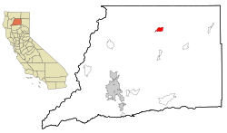
The population of Big Bend was only 102 people in the 2010 census, apparently the lowest number of residents since the 1860s. [5]

Geography

Big Bend is located at 41°1′11″N121°54′28″W / 41.01972°N 121.90778°W / 41.01972; -121.90778 (41.019803, -121.907881). [6]

The community is situated on a long bend in the Pit River which is the longest tributary to the Sacramento River. The Pit River (traditionally called Achoma) is one of only three rivers that crosses the Cascades mountain range and drains into the Pacific Ocean. Before the dams were built, the Pit River hosted the third largest Salmon run on the west coast of the US. From Big Bend is a striking view of Chalk Mountain (called Too-le-pah-ah-te Ah-ko by the Madesi tribe) which has a natural exposed slide feature of diatomaceous earth. The slide is locally called the "White Buffalo," since it resembles a white bison. Another prominent mountain hovering over the town of Big Bend is called Bald Peak (called Ma-how-mah-day Ah-ko by the Madesi tribe), which has dozens of cold water springs, creating numerous creeks that feed into the Pit River, a spring-fed, or a "free stone" river.

According to the United States Census Bureau, the CDP has a total area of 5.8 square miles (15 km2), 98.47% of it land and 1.53% of it water.

Climate

Climate data for Big Bend, California
MonthJanFebMarAprMayJunJulAugSepOctNovDecYear
Mean daily maximum °F (°C)49.7
(9.8)
52.9
(11.6)
56.9
(13.8)
64.5
(18.1)
74.9
(23.8)
84.3
(29.1)
93.5
(34.2)
93.2
(34.0)
86.0
(30.0)
72.0
(22.2)
57.0
(13.9)
48.3
(9.1)
69.4
(20.8)
Mean daily minimum °F (°C)31.9
(−0.1)
32.7
(0.4)
35.2
(1.8)
38.4
(3.6)
45.0
(7.2)
51.3
(10.7)
55.5
(13.1)
53.9
(12.2)
49.7
(9.8)
42.0
(5.6)
35.8
(2.1)
31.6
(−0.2)
41.9
(5.5)
Average precipitation inches (mm)13.36
(339)
11.90
(302)
10.72
(272)
5.40
(137)
3.21
(82)
1.24
(31)
0.22
(5.6)
0.39
(9.9)
1.56
(40)
4.70
(119)
9.35
(237)
13.36
(339)
75.41
(1,913.5)
Average snowfall inches (cm)7.7
(20)
4.9
(12)
2.6
(6.6)
0.7
(1.8)
0.0
(0.0)
0.0
(0.0)
0.0
(0.0)
0.0
(0.0)
0.0
(0.0)
0.0
(0.0)
1.3
(3.3)
7.1
(18)
24.3
(61.7)
Source: XMACIS [7]

Demographics

Historical population
CensusPop.Note
2020 79
U.S. Decennial Census [8]
1850–1870 [9] [10] 1880-1890 [11]
1900 [12] 1910 [13] 1920 [14]
1930 [15] 1940 [16] 1950 [17]
1960 [18] 1970 [19] 1980 [20]
1990 [21] 2000 [22] 2010 [23]

2010

The 2010 United States Census [24] reported that Big Bend had a population of 102. The population density was 17.5 inhabitants per square mile (6.8/km2). The racial makeup of Big Bend was 85 (83.3%) White, 0 (0.0%) African American, 10 (9.8%) Native American, 0 (0.0%) Asian, 0 (0.0%) Pacific Islander, 1 (1.0%) from other races, and 6 (5.9%) from two or more races. Hispanic or Latino of any race were 2 persons (2.0%).

The Census reported that 102 people (100% of the population) lived in households, 0 (0%) lived in non-institutionalized group quarters, and 0 (0%) were institutionalized.

There were 58 households, out of which 8 (13.8%) had children under the age of 18 living in them, 15 (25.9%) were opposite-sex married couples living together, 4 (6.9%) had a female householder with no husband present, 4 (6.9%) had a male householder with no wife present. There were 4 (6.9%) unmarried opposite-sex partnerships, and 0 (0%) same-sex married couples or partnerships. 34 households (58.6%) were made up of individuals, and 11 (19.0%) had someone living alone who was 65 years of age or older. The average household size was 1.76. There were 23 families (39.7% of all households); the average family size was 2.65.

The population was spread out, with 11 people (10.8%) under the age of 18, 13 people (12.7%) aged 18 to 24, 19 people (18.6%) aged 25 to 44, 42 people (41.2%) aged 45 to 64, and 17 people (16.7%) who were 65 years of age or older. The median age was 50.3 years. For every 100 females, there were 131.8 males. For every 100 females age 18 and over, there were 139.5 males.

There were 90 housing units at an average density of 15.5 per square mile (6.0/km2), of which 33 (56.9%) were owner-occupied, and 25 (43.1%) were occupied by renters. The homeowner vacancy rate was 0%; the rental vacancy rate was 0%. 51 people (50.0% of the population) lived in owner-occupied housing units and 51 people (50.0%) lived in rental housing units.

2000

As of the census [25] of 2000, there were 149 people, 70 households, and 38 families residing in the CDP. The population density was 26.1 inhabitants per square mile (10.1/km2). There were 106 housing units at an average density of 18.5 per square mile (7.1/km2). The racial makeup of the CDP was 83.22% White, 8.72% Native American, 1.34% Asian, 3.36% from other races, and 3.36% from two or more races. Hispanic or Latino of any race were 3.36% of the population.

There were 70 households, out of which 21.4% had children under the age of 18 living with them, 42.9% were married couples living together, 4.3% had a female householder with no husband present, and 45.7% were non-families. 41.4% of all households were made up of individuals, and 12.9% had someone living alone who was 65 years of age or older. The average household size was 2.13 and the average family size was 2.97.

In the CDP, the population was spread out, with 23.5% under the age of 18, 4.7% from 18 to 24, 21.5% from 25 to 44, 36.2% from 45 to 64, and 14.1% who were 65 years of age or older. The median age was 45 years. For every 100 females, there were 119.1 males. For every 100 females age 18 and over, there were 128.0 males.

The median income for a household in the CDP was $23,750, and the median income for a family was $23,000. Males had a median income of $33,750 versus $40,625 for females. The per capita income for the CDP was $16,183. There were 50.0% of families and 45.2% of the population living below the poverty line, including 60.0% of under eighteens and 25.0% of those over 64.

Politics

In the state legislature Big Bend is located in the 1st Senate District , represented by Republican Brian Dahle, [26] and the 1st Assembly District , represented by Republican Megan Dahle. [27]

Federally, Big Bend is in California's 1st congressional district , represented by Republican Doug LaMalfa. [28]

Natural attractions

Hot springs

Big Bend is known in the Northern California region for its geothermal hot springs. There are several hot spring sources on the Big Bend Hot Springs property along the Pit River. Privately owned land containing hot springs is expected to open for public tourism.

Pit River

The Pit River is a "free stone river" and provides excellent fishing for McCloud River redband trout.

The Pit River has had occasional white water level releases from the dams to provide white water rafting with Class 4 and Class 5 rapids.

A highly scenic gravel road follows the Pit River upstream from Big Bend to Highway 89 near McArthur-Burney Falls Memorial State Park.

Iron Canyon Reservoir

Iron Canyon Reservoir, located near Big Bend, impounds water diverted from the McCloud River and contains Rainbow Trout and Brown Trout. This reservoir provides an opportunity for canoeing and float tubing. [29] The reservoir is in the Shasta-Trinity National Forest and has two campgrounds, one administered by the US Forest Service and one by Pacific Gas and Electric Company.

Related Research Articles

<span class="mw-page-title-main">Byron, California</span> Census designated place in California, United States

Byron is a census designated place (CDP) in Contra Costa County, California, United States.

<span class="mw-page-title-main">Auberry, California</span> Census-designated place in California, United States

Auberry is a census-designated place (CDP) in Fresno County, California, United States. The population was 2,369 at the 2010 census, up from 2,053 at the 2000 census. Auberry is located on Little Sandy Creek 9.5 miles (15 km) west of Shaver Lake Heights, at an elevation of 2,018 feet (615 m).

<span class="mw-page-title-main">Cartago, California</span> Census-designated place in California, United States

Cartago is a census-designated place in Inyo County, California, United States. Cartago is located on the west side of Owens Lake 3 miles (4.8 km) north-northwest of Olancha. The population was 92 at the 2010 census, down from 109 at the 2000 census.

<span class="mw-page-title-main">Bodfish, California</span> Census-designated place in California, United States

Bodfish is a census-designated place (CDP) in the southern Kern River Valley of the Southern Sierra Nevada, in Kern County, California.

<span class="mw-page-title-main">Cobb, California</span> Census designated place in California, United States

Cobb is a census designated place (CDP) in Lake County, California, United States. Cobb is located 1 mile (1.6 km) northwest of Whispering Pines, at an elevation of 2,631 feet (802 m). The population was 1,778 at the 2010 census, up from 1,638 at the 2000 census.

<span class="mw-page-title-main">Avocado Heights, California</span> Census-designated place in California, United States

Avocado Heights is an unincorporated census-designated place (CDP) in the San Gabriel Valley of Los Angeles County, California, United States. It is almost entirely surrounded by the City of Industry with only a small strip of unincorporated Los Angeles County separating it from South El Monte. It is in close proximity to both the Pomona (SR-60) and San Gabriel (I-605) freeways. To the west is the San Gabriel River and the California Country Club. Avocado Heights is approximately 15 miles (24 km) from the downtown Los Angeles Civic Center. The population was 15,411 at the 2010 census, up from 15,148 at the 2000 census.

<span class="mw-page-title-main">Black Point-Green Point, California</span> Census-designated place in California, United States

Black Point-Green Point is a census-designated place (CDP) in Marin County, California, United States. It is unincorporated, sitting between the city of Novato to the southwest and the Petaluma River and San Pablo Bay to the northeast. The population was 1,431 at the 2020 census.

<span class="mw-page-title-main">Covelo, California</span> Census-designated place in California, United States

Covelo is a census-designated place (CDP) in Mendocino County, California, United States. Covelo is located 14 miles (23 km) east-northeast of Laytonville, at an elevation of 1,398 feet (426 m). The population was 1,394 at the 2020 census, up from 1,255 at the 2010 census. 405 acres (1.64 km2) of Covelo is part of the Round Valley Indian Reservation.

<span class="mw-page-title-main">Big Bear City, California</span> Unincorporated community in California, United States

Big Bear City is an unincorporated community in San Bernardino County, California, United States along the east shore of Big Bear Lake and surrounded by the San Bernardino National Forest. It is 27 miles (43 km) northeast of the city of San Bernardino, and immediately east of the incorporated city of Big Bear Lake. For statistical purposes, the United States Census Bureau has defined Big Bear City as a census-designated place (CDP). Its population was 12,304 at the 2010 census, up from 5,779 at the 2000 census. Big Bear City is mostly residential, with smaller houses and cabins laid out in typical square block fashion. Big Bear is on the Pacific Crest Trail.

<span class="mw-page-title-main">Big River, California</span> Census-designated place in California, United States

Big River is a census-designated place (CDP) in San Bernardino County, California, United States. The population was 1,084 at the 2020 census, down from 1,327 at the 2010 census.

<span class="mw-page-title-main">Round Mountain, California</span> Census-designated place in California, United States

Round Mountain is a census-designated place in Shasta County, California, United States. Its population is 160 as of the 2020 census, up from 155 from the 2010 census.

<span class="mw-page-title-main">Boyes Hot Springs, California</span> Census designated place in California, United States

Boyes Hot Springs is a census-designated place (CDP) in Sonoma Valley, Sonoma County, California, United States. The population was 6,656 people at the 2010 census. Resorts in Boyes Hot Springs, El Verano, Fetters Hot Springs, and Agua Caliente were popular health retreats for tourists from San Francisco and points beyond until the middle of the 20th century because of the geothermic hot springs that still well up from deep within the Earth.

<span class="mw-page-title-main">El Verano, California</span> Census-designated place in California, United States

El Verano is a census-designated place (CDP) in Sonoma Valley, Sonoma County, California, United States. The population was 4,123 at the 2010 census, falling to 3,867 at the 2020 census.

<span class="mw-page-title-main">Deweyville, Texas</span> CDP in Texas, United States

Deweyville is a census-designated place (CDP) in Newton County, on the central eastern border of Texas, United States. The population was 571 at the 2020 census, down from 1,023 at the 2010 census.

<span class="mw-page-title-main">Achomawi</span> Native American tribe in Northern California

Achomawi are the northerly nine bands of the Pit River tribe of Palaihnihan Native Americans who live in what is now northeastern California in the United States. These 5 autonomous bands of the Pit River Indians historically spoke slightly different dialects of one common language, and the other two bands spoke dialects of a related language, called Atsugewi. The name "Achomawi" means river people and properly applies to the band which historically inhabited the Fall River Valley and the Pit River from the south end of Big Valley Mountains, westerly to Pit River Falls. The nine bands of Achumawi lived on both sides of the Pit River from its origin at Goose Lake to Montgomery Creek, and the two bands of Atsugewi lived south of the Pit River on creeks tributary to it in the Hat Creek valley and Dixie Valley.

<span class="mw-page-title-main">Bieber, California</span> Place in California, United States

Bieber is an unincorporated community in Lassen County, California. It is located on the Pit River, 55 miles (89 km) north-northwest of Susanville, at an elevation of 4,124 feet (1,257 m) Its population is 266 as of the 2020 census, down from 312 from the 2010 census. For statistical purposes, the United States Census Bureau has defined Bieber as a census-designated place (CDP). The ZIP Code is 96009. The community is inside area code 530.

<span class="mw-page-title-main">Burnt Ranch, California</span> Census-designated place in California, United States

Burnt Ranch is a census-designated place (CDP) in Trinity County, California. It has a school and a post office. Its ZIP Code is 95527, and it is in area code 530. Its elevation is 1,502 feet (458 m). Its population is 250 as of the 2020 census, down from 281 from the 2010 census.

<span class="mw-page-title-main">Benton, California</span> Census-designated place in California, United States

Benton is a census-designated place (CDP) in Mono County, California, United States. It includes the unincorporated communities of Benton and Benton Hot Springs and is 32 miles (51 km) north of the community of Bishop, at an elevation of 5,387 feet (1,642 m). The population of the CDP was 279 at the 2020 census.

<span class="mw-page-title-main">Courtland, California</span> Census-designated place in California, United States

Courtland is a census-designated place in Sacramento County, California, United States. Courtland is located along the Sacramento River 17 miles (27 km) south-southwest of Sacramento. Courtland has a post office with ZIP code 95615, which was established in 1872. Courtland was named after Courtland Sims, son of James V. Sims, a landowner who opened a steamer landing in the community in 1870.

<span class="mw-page-title-main">Bend, California</span> Census-designated place in California, United States

Bend is a census-designated place in Tehama County, California, United States. Bend is located on the Sacramento River 6 miles (9.7 km) north-northeast of Red Bluff. Bend had a post office from 1897 to 1935. The community was originally known as Horsethief Bend; the name was changed to Sander's Bend and later shortened to Bend. The community was named after a nearby meander in the Sacramento River. The population was 619 at the 2010 census.

References

  1. "2020 U.S. Gazetteer Files". United States Census Bureau. Retrieved October 30, 2021.
  2. Achomawi Geography, (University of California Publications in American Archaeology and Ethnology), Volume 23, Number 5, 1928 By Fred Bowerman Kniffen
  3. THE CLASSIFICATION AND DISTRIBUTION OF THE PIT RIVER INDIAN TRIBES OF CALIFORNIA. Smithsonian Miscellaneous Collections, Volume 78, Number 3. E. H. Harriman Fund. Publication 2874. By G. Hart. Merriam
  4. 120 FERC ¶ 62,001 UNITED STATES OF AMERICA FEDERAL ENERGY REGULATORY COMMISSION Pacific Gas and Electric Company Project No. 233-081 Shasta County, California ORDER ISSUING NEW LICENSE (July 2, 2007) Issued by FERC OSEC 07/02/2007 in Docket#: P-233-081
  5. Big Bend, California
  6. "US Gazetteer files: 2010, 2000, and 1990". United States Census Bureau. February 12, 2011. Retrieved April 23, 2011.
  7. "xmACIS2". NOAA. Retrieved May 21, 2023.
  8. "Decennial Census by Decade". United States Census Bureau .
  9. "1870 Census of Population - Population of Civil Divisions less than Counties - California - Almeda County to Sutter County" (PDF). United States Census Bureau .
  10. "1870 Census of Population - Population of Civil Divisions less than Counties - California - Tehama County to Yuba County" (PDF). United States Census Bureau .
  11. "1890 Census of Population - Population of California by Minor Civil Divisions" (PDF). United States Census Bureau .
  12. "1900 Census of Population - Population of California by Counties and Minor Civil Divisions" (PDF). United States Census Bureau .
  13. "1910 Census of Population - Supplement for California" (PDF). United States Census Bureau .
  14. "1920 Census of Population - Number of Inhabitants - California" (PDF). United States Census Bureau .
  15. "1930 Census of Population - Number and Distribution of Inhabitants - California" (PDF). United States Census Bureau .
  16. "1940 Census of Population - Number of Inhabitants - California" (PDF). United States Census Bureau .
  17. "1950 Census of Population - Number of Inhabitants - California" (PDF). United States Census Bureau .
  18. "1960 Census of Population - General population Characteristics - California" (PDF). United States Census Bureau .
  19. "1970 Census of Population - Number of Inhabitants - California" (PDF). United States Census Bureau .
  20. "1980 Census of Population - Number of Inhabitants - California" (PDF). United States Census Bureau .
  21. "1990 Census of Population - Population and Housing Unit Counts - California" (PDF). United States Census Bureau .
  22. "2000 Census of Population - Population and Housing Unit Counts - California" (PDF). United States Census Bureau .
  23. "2010 Census of Population - Population and Housing Unit Counts - California" (PDF). United States Census Bureau .
  24. "2010 Census Interactive Population Search: CA - Big Bend CDP". U.S. Census Bureau. Archived from the original on July 15, 2014. Retrieved July 12, 2014.
  25. "U.S. Census website". United States Census Bureau . Retrieved January 31, 2008.
  26. "Senators". State of California. Retrieved March 10, 2013.
  27. "Members Assembly". State of California. Retrieved March 2, 2013.
  28. "California's 1st Congressional District - Representatives & District Map". Civic Impulse, LLC. Retrieved March 1, 2013.
  29. "Ironcanyon.org website". Archived from the original on August 14, 2007. Retrieved September 13, 2007.