Beegum, California

Last updated

Beegum
Former town
USA California location map.svg
Red pog.svg
Beegum
Usa edcp location map.svg
Red pog.svg
Beegum
Coordinates: 40°20′42″N122°51′29″W / 40.34500°N 122.85806°W / 40.34500; -122.85806
Country Flag of the United States.svg  United States
State California
County Tehama County
Elevation
397 m (1,303 ft)

Beegum, also known as Bee Gum, [1] is a defunct town which was located in an unincorporated area of Tehama and Shasta counties, in the U.S. state of California. [2] [3] In the early 1900s, it was a mining town in the Harrison Gulch mining district. [4] [5]

Contents

Starting in 1913, proposals to make the road between Beegum and Peanut in Trinity County part of the state highway system were discussed repeatedly in the California state legislature. [6] [7] In 1933, the segment between Beegum and Peanut became part of the state highway connecting Eureka, California, to Reno, Nevada via Red Bluff. [8]

By 1972, California State Route 36 was moved, bypassing Beegum and leading to the eventual abandonment of the hamlet, as well as the hunting and fishing resort which operated there. [2]

History

The community took its name from nearby Beegum Peak, which was said to resemble a bee gum hive and was also inhabited by bees. [9] The town was situated next to Beegum Creek, which forms the county line between Tehama and Shasta counties. [4] [3] [10]

During the California Gold Rush, prospectors flocked to Beegum Creek to look for placer gold, [11] but there were no major discoveries in the Harrison Gulch district until the 1890s when the Midas Mine vein was found in 1894. [12]

Beegum served as the first stagecoach stop between Red Bluff and the coast. [2] From Beegum, stagecoaches proceeded to Peanut, Hayfork, and Eureka. [13]

A post office was in operation at Beegum from 1895, [14] and was ordered to close in January 1918. [15] In 1902, miner Fred Smith was shot and killed by his partner George Wheeler near the Beegum post office, after Wheeler discovered that Smith was having an affair with his wife. [16]

Selvester Ranch and businesses

The town was located on land that had been part of the Selvester Ranch, where the Selvester family lived for three generations. [13] The Beegum area including the family ranch was popular with hunters. [17]

Patriarch Isaac Selvester (1847–1930) purchased properties in Beegum after first settling in Maxwell, Colusa County, in 1887. [18] In 1904, he and his sons Smith, George and Joseph formed the livestock company Selvester & Sons, raising cattle, horses and mules near Beegum. [19] He put his ranch at Beegum up for sale in 1920. [20]

Isaac Selvester also conducted a freight depot and roadhouse in Beegum, until freight teams were no longer used to haul payload from mines. [18] The family business then shifted to cater to the automobile trade. [18] In the late 1920s, his grandsons Jesse I. Selvester and Smith I. Selvester each operated businesses called "Beegum Garage", causing Smith to file a restraining order against his brother and W. D. Linton. [5]

For a time, George W. Selvester operated a grocery store in Beegum. [21] In 1955, Jesse I. Selvester was serving as foreman for the Beegum Mining Company, which had built a $200,000 chrome ore concentration plant in Beegum Gorge the year before. [22]

School

The Beegum school operated for over half a century, until it was suspended in 1943 due to lack of pupils as well as a shortage of teachers. [23] In the early years of the school, as many as 30 to 40 children lived in the community. [23] One of the teachers was Maybelle B. Belote, who went on to marry Joseph Selvester in 1902. [24]

In 1929, 12 pupils were enrolled at the Beegum school. [25] In 1930, one of the three residents living closest to the schoolhouse agreed to give free rent to parents who built small dwellings near the school, so they could live there five days a week while their children attended school. [26] For a period of 15 years or more before it closed, the school taught both elementary and high school students. [23]

Highway

In 1913, a bill was introduced in the lower house of the California state legislature, requesting an appropriation of $50,000 to build a 20-mile state highway connecting Beegum and Peanut in Trinity County. [7] The Redding chamber of commerce opposed the measure, arguing that the route would be a disadvantage to the people of Shasta County. [27] The bill was the first of many to be introduced repeatedly in the California legislature over the next twenty years. [6]

After years of debate, in 1925, the California assembly passed bill No. 151 to place the road between Peanut and Beegum in the state highway system. [28] By closing the gap between Peanut and Beegum, it was argued, motorists would have a nearly straight highway across the state connecting Eureka, California, to Reno, Nevada, via Red Bluff. [28] Governor Friend Richardson subsequently vetoed the bill, [29] leading The Sacramento Union to comment: "This veto is proper. If the people of Beegum and Peanut have not enough imagination to find new names for their hamlets, at least for legislative purposes, they are not entitled to new roads." [30]

In 1930, the California State Automobile Association reported that between Red Bluff and Beegum, there was "good graveled and dirt road", but that after leaving Beegum toward Peanut, there was "a somewhat rough and rocky stretch". [31] A 1931 report by the Eureka district office of the National Automobile Club was more critical, stating: "Between Peanut and Beegum, the road is in very poor condition. There are numerous streams to be forded on this stretch, there being no bridges, and during or immediately following storms this part of the road is impassable." [32]

In March 1933, the California Department of Public Works announced that it would recommend to the California legislature inclusion of the Red Bluff–Eureka road into the state highway system. [8] By August, the state highway department kicked off road repairs, with one crew to be headquartered in Beegum, housed in five cabins constructed by George Selvester for their use. [33] In June 1934, the Red Bluff Daily News reported that the Red Bluff–Eureka highway was in "excellent shape", including the segment from "Beegum and over Beegum mountain to Noble's Station and on to Wildwood and Peanut". [34]

In 1966, the state allocated $250,000 for improvements of Forest Highway 6, the Peanut–Beegum Highway, and paving a segment of Highway 36. [35]

In 1972, the Oakland Tribune noted that California State Route 36 had bypassed the hamlets of Beegum and Peanut over the course of making highway improvements. [36] The decision to move the highway was devastating to the hunting and fishing resort then operating in Beegum. [2]

Related Research Articles

<span class="mw-page-title-main">Shasta County, California</span> County in the United States

Shasta County, officially the County of Shasta, is a county located in the northern portion of the U.S. state of California. Its population is 182,155 as of the 2020 census, up from 177,223 from the 2010 census. The county seat is Redding.

<span class="mw-page-title-main">Tehama County, California</span> County in California, United States

Tehama County is a county located in the northern part of the U.S. state of California. As of the 2020 census, the population was 65,829. The county seat and largest city is Red Bluff.

<span class="mw-page-title-main">Red Bluff, California</span> City in California, United States

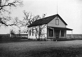
Red Bluff is a city in and the county seat of Tehama County, California, United States. The population was 14,710 at the 2020 census, up from 14,076 at the 2010 census.

<span class="mw-page-title-main">Sacramento Valley</span> Area of the Central Valley in California

The Sacramento Valley is the area of the Central Valley of the U.S. state of California that lies north of the Sacramento–San Joaquin River Delta and is drained by the Sacramento River. It encompasses all or parts of ten Northern California counties. Although many areas of the Sacramento Valley are rural, it contains several urban areas, including the state capital, Sacramento. Since 2010, statewide droughts in California have further strained both the Sacramento Valley's and the Sacramento metropolitan region's water security.

<span class="mw-page-title-main">California State Route 99</span> State highway in California, United States

State Route 99 (SR 99) is a north–south state highway in the U.S. state of California, stretching almost the entire length of the Central Valley. From its southern end at Interstate 5 (I-5) near Wheeler Ridge to its northern end at SR 36 near Red Bluff, SR 99 goes through the densely populated eastern parts of the valley. Cities served include Bakersfield, Delano, Tulare, Visalia, Fresno, Madera, Merced, Turlock, Modesto, Manteca, Stockton, Sacramento, Yuba City, and Chico.

<span class="mw-page-title-main">California State Route 36</span> Highway in California

State Route 36 is an east–west state highway in the U.S. state of California that is routed from U.S. Route 101 in Humboldt County to U.S. Route 395 just east of Susanville in Lassen County. The highway passes through Red Bluff, the county seat of Tehama County, on the northern edge of the Sacramento Valley. The portion of SR 36 travelling past Lassen Volcanic National Park and Lake Almanor is part of the Volcanic Legacy Scenic Byway, a National Scenic Byway. Also, Route 36 between Alton and Susanville is a designated Blue Star Memorial Highway.

<span class="mw-page-title-main">Area code 530</span> Area code in northern California

Area code 530 is a telephone area code in the North American Numbering Plan (NANP) in northeastern and Northern California. It was created in 1997 in an area code split of 916.

KVIP and KVIP-FM are Christian radio stations in Redding, California, United States, broadcasting at 540 kHz on the AM band and 98.1 MHz on the FM band. The FM station's programming is also carried on a regional network of transmitters and translators in far northern California and southern Oregon, including three high-power stations: KNDZ (89.3 MHz) in McKinleyville, California, covering Eureka; KMWR (90.7 MHz) in Brookings, Oregon; and KGRV (700 kHz), an AM station serving Roseburg, Oregon, that generates its own funding.

Peanut is an unincorporated area in Trinity County, California, previously called Salt Creek. It is located on Highway 3, south of Hayfork and north of Highway 36 at an elevation of 2,499 feet (762 m).

There are 28 routes assigned to the "A" zone of the California Route Marker Program, which designates county routes in California. The "A" zone includes county highways in Lassen, Plumas, Shasta, Siskiyou, and Tehama counties.

Beegum Creek is a stream located in Shasta and Tehama counties, southwest of Redding in the U.S. state of California. The stream cuts through Beegum Gorge and runs 16 miles (26 km) before it empties into Cottonwood Creek.

<span class="mw-page-title-main">Cottonwood Creek (Sacramento River tributary)</span> River in Shasta County, United States

Cottonwood Creek is a major stream and tributary of the Sacramento River in Northern California. About 68 miles (109 km) long measured to its uppermost tributaries, the creek drains a large rural area bounded by the crest of the Coast Ranges, traversing the northwestern Sacramento Valley before emptying into the Sacramento River near the town of Cottonwood. It defines the boundary of Shasta and Tehama counties for its entire length. Because Cottonwood Creek is the largest undammed tributary of the Sacramento River, it is known for its Chinook salmon and steelhead runs.

<span class="mw-page-title-main">Red Bank Creek</span> River in California, United States

Red Bank Creek is a major stream in Tehama County, California, and a tributary of the Sacramento River. About 39 miles (63 km) long, it originates in the foothills of the Coast Ranges, near the boundary of the Mendocino National Forest, and flows east across the Sacramento Valley to join the Sacramento River near Red Bluff. Red Bank Creek, like the other streams draining this part of the western Sacramento Valley, is a highly seasonal stream that flows only during the winter and spring.

The 1968 Chico State Wildcats football team represented Chico State College—now known as California State University, Chico—as a member of the Far Western Conference (FWC) during the 1968 NCAA College Division football season. Led by second-year head coach Pete Riehlman, Chico State compiled an overall record of 5–5 with a mark of 2–4 in conference play, placing fifth in the FWC. The team was outscored by its opponents 206 to 149 for the season. The Wildcats played home games at College Field in Chico, California.

<span class="mw-page-title-main">El Camino, California</span> Special district in California, United States

El Camino is a rural community and irrigation district near Gerber in Tehama County, in the U.S. state of California. As a special district, the El Camino Irrigation District is owned by local residents who govern it through locally elected board members.

<span class="mw-page-title-main">Red Bank, California</span> Rural area in Tehama Co., California, United States

Red Bank is an agricultural district in Tehama County, in the U.S. state of California. The district and nearby Red Bank Creek both take their names from Rancho Barranca Colorado. The red soil in question was said to be on the north bank of the creek. Red Bank was later the name of a post office in the district, previously named Eby, and of a school in the district.

Loybas Hill is an unincorporated community in Tehama County, in the U.S. state of California. According to the Geographic Names Information System, the community is on the west side of the Sacramento River and 4.6 miles southeast of the city of Corning.

The Red Bank Fire was one of a series of wildfires in Tehama County, California, 25 miles west of Red Bluff. The Red Bank area fire was ignited from a series lightning strikes and erupted out of control on Thursday, September 5, 2019. The blaze, along with the South and Henthrone fires, is burning in a remote location, 30 miles south of Redding, California. The fire was contained on September 13 at 8,838 acres (36 km2). Two structures were destroyed.

The Superior Court of California, County of Tehama, also known as the Tehama County Superior Court or Tehama Superior Court, is the branch of the California superior court with jurisdiction over Tehama County.

<span class="mw-page-title-main">Fountain Fire</span> 1992 wildfire in Shasta County, California

The 1992 Fountain Fire was a large and destructive wildfire in Shasta County, California. After igniting on August 20 in an act of probable but unattributed arson, the fire was driven by strong winds, outpacing firefighters for two days while exhibiting extreme fire behavior such as long-range spotting, crown fire runs, and pyrocumulonimbus clouds that generated dry lightning. The fire consumed 63,960 acres (25,880 ha) and destroyed hundreds of homes, primarily in the communities of Round Mountain and Montgomery Creek along the State Route 299 corridor. In 1992 the Fountain Fire was the third most destructive wildfire in recorded California history, though it no longer ranks among even the top 20 most destructive California wildfires. At a suppression cost more than $22 million it was then also the most expensive fire to contain in recorded California history, but it has since been surpassed in that respect also.

References

  1. "Build Road From Peanut to Bee Gum – Project endorsed by Tehama and Shasta Counties in joint meeting". Record Searchlight. Redding. August 6, 1912. Retrieved November 10, 2023 via Newspapers.com.
  2. 1 2 3 4 Aho, Jill (August 25, 2009). "The bygone town of Beegum". Herald and News. Klamath Falls. Archived from the original on November 10, 2023. Retrieved November 10, 2023.
  3. 1 2 U.S. Geological Survey Geographic Names Information System: Beegum, California
  4. 1 2 "Beegum Creek". United States Geological Survey, Mineral Resource Data System. Retrieved November 10, 2023.
  5. 1 2 "'By Gum' Tehaman Says Brother Can't Use 'Beegum' Name". The Sacramento Bee. April 3, 1929. Retrieved November 10, 2023 via Newspapers.com.
  6. 1 2 "Future of California Highways". The Los Angeles Times . September 29, 1949. Retrieved November 11, 2023 via Newspapers.com. Until the early 30s, California highways to a very large extent, were routed by acts of the Legislature and some fantastic results came out of the ensuing political scramble. At each session there was, as an example, a bill calling for a highway between Peanut and Beegum.
  7. 1 2 "Beegum-Peanut Road". Daily People's Cause. January 23, 1913. Retrieved November 10, 2023 via Newspapers.com.
  8. 1 2 "Red Bluff–Eureka Road to Be Brought Into State System". Red Bluff Daily News. March 13, 1933. Retrieved November 11, 2023 via Newspapers.com.
  9. Gudde, Erwin Gustav (1998). Bright, William (ed.). California Place Names (4th edition, revised and enlarged ed.). University of California Press. p. 31. ISBN   0-520-21316-5.
  10. Logan, Clarence August (1919). Platinum and Allied Metals in California. Vol. 85. Sacramento: California State Mining Bureau. pp. 48–49.
  11. Smith, Josie (2016). Tehama County. Arcadia Publishing. ISBN   9781439658666.
  12. Klein, James (2000). Where to Find Gold in Northern California. Baldwin Park, California: Gem Guides Book Co. p. 60. ISBN   1889786055.
  13. 1 2 "Sylvester Ranch Once Stage Stop". Red Bluff Daily News. April 3, 1956. Retrieved November 10, 2023 via Newspapers.com.
  14. Hislop, Donald L.; Hughes, Benjamin M. (2007). "Tehama County Place Names" (PDF). Archived from the original (PDF) on May 8, 2017. Retrieved November 12, 2023 via Tehama County Department of Education.
  15. "Tehama and Sierra Post Offices No More". The Sacramento Bee. January 21, 1918. Retrieved November 10, 2023 via Newspapers.com.
  16. "Public Feeling Justifies Killing on Bee Gum Creek". Free Press Saturday Weekly. June 28, 1902. Retrieved November 10, 2023 via Newspapers.com.
  17. "Beegum Is Mecca of Many Hunters". The Shasta Courier. July 27, 1914. Retrieved November 10, 2023 via Newspapers.com.
  18. 1 2 3 "Death Takes I. Selvester, Aged Pioneer". Colusa Sun-Herald. April 10, 1930. Retrieved November 10, 2023 via Newspapers.com.
  19. "New Stock Firm". Daily Evening Sentinel. Red Bluff. April 4, 1904. Retrieved November 10, 2023 via Newspapers.com.
  20. "Isaac Selvester's Ranch at Bee Gum for Sale". Sacramento Bee . May 10, 1920. Retrieved November 11, 2023 via Newspapers.com.
  21. "Funeral Rites Set for G. W. Selvester". The Corning Daily Observer. January 17, 1950. Retrieved November 13, 2023 via Newspapers.com.
  22. "Chrome Mill in Beegum Gorge". Record Searchlight. Redding. February 7, 1955. Retrieved November 13, 2023 via Newspapers.com.
  23. 1 2 3 "For First Time in Half Century Beegum School Fails to Open". Red Bluff Daily News. September 15, 1943. Retrieved November 10, 2023 via Newspapers.com.
  24. "One Hundred Years Ago: Wedded at Christian Church". Red Bluff Daily News . November 18, 2006. Retrieved November 11, 2023.
  25. "Schools Make Loss and Gain". The Morning Times / Red Bluff Sentinel. September 21, 1929. Retrieved November 10, 2023 via Newspapers.com.
  26. "School Problem Solved By Tehama Residents". Woodland Daily Democrat. Valley News Alliance. June 9, 1930. Retrieved November 10, 2023 via Newspapers.com.
  27. "Chamber of Commerce Prepares for Congress – Will oppose state aid for highway from Peanut to Beegum". The Semi-Weekly Searchlight. Redding. January 31, 1913. Retrieved November 11, 2023 via Newspapers.com.
  28. 1 2 "Assembly for Peanut–Beegum State Highway". Record Searchlight. April 10, 1925. Retrieved November 11, 2023 via Newspapers.com.
  29. "Peanut–Beegum Bill Is Vetoed". The Searchlight. April 28, 1925. Retrieved November 11, 2023 via Newspapers.com.
  30. "Horse Still Has His Place". The Sacramento Union . April 30, 1925. Retrieved November 11, 2023 via Newspapers.com.
  31. "Trinity Highway in Good Order". The San Francisco Examiner . September 28, 1930. Retrieved November 11, 2023 via Newspapers.com.
  32. "Conditions Vary On Eureka–Valley Road". The Sacramento Union . January 4, 1931. Retrieved November 11, 2023 via Newspapers.com.
  33. "State Crews on Beegum Road Now Busy on Repairs". The Corning Daily Observer. August 26, 1933. Retrieved November 11, 2023 via Newspapers.com.
  34. "Red Bluff–Eureka Highway Found in Excellent Shape". Red Bluff Daily News. June 12, 1934. Retrieved November 11, 2023 via Newspapers.com.
  35. "$750,000 marked for forest roads". Record Searchlight. Redding. November 25, 1966. Retrieved November 11, 2023 via Newspapers.com.
  36. "HIghway 36: Scenic but Dangerous". Oakland Tribune . October 19, 1972. Retrieved November 10, 2023 via Newspapers.com.