
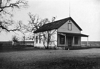
Hooker is an unincorporated area in northwest Tehama County, California, near Hooker Creek. [1] [2] It is an agricultural community. [3]
Hooker is an unincorporated area in northwest Tehama County, California, near Hooker Creek. [1] [2] It is an agricultural community. [3]
The community takes its name from J. M. Hooker, who settled near the mouth of Hooker Creek in 1852. [1] Hooker railroad station took its name from the creek. [1]
A post office was in operation at Hooker from November 20, 1885. [1] It was reestablished on May 31, 1889, and was closed on October 31, 1928. [1] The community once had a schoolhouse, Hooker School, now defunct. [4]
Based on 1990 census data, a United States Department of Agriculture report found that the population of the Hooker block group aggregation was 3,011. [2]

Colusa County is a county located in the U.S. state of California. As of the 2020 census, the population was 21,839. The county seat is Colusa. It is in the northern Sacramento Valley, northwest of the state capital, Sacramento.

Tehama County is a county located in the northern part of the U.S. state of California. As of the 2020 census, the population was 65,829. The county seat and largest city is Red Bluff.

Red Bluff is a city in and the county seat of Tehama County, California, United States. The population was 14,710 at the 2020 census, up from 14,076 at the 2010 census.

Rancho Tehama, also known as the Rancho Tehama Reserve, is an unincorporated community in Tehama County, California, United States. As of the 2020 census, the population of the community and nearby areas was 1,572. The lightly populated rural, remote community has large lots where some residents farm olives, walnuts and almonds.

The Feather River is the principal tributary of the Sacramento River, in the Sacramento Valley of Northern California. The river's main stem is about 73 miles (117 km) long. Its length to its most distant headwater tributary is just over 210 miles (340 km). The main stem Feather River begins in Lake Oroville, where its four long tributary forks join—the South Fork, Middle Fork, North Fork, and West Branch Feather Rivers. These and other tributaries drain part of the northern Sierra Nevada, and the extreme southern Cascades, as well as a small portion of the Sacramento Valley. The total drainage basin is about 6,200 square miles (16,000 km2), with approximately 3,604 square miles (9,330 km2) above Lake Oroville.
Rosewood is an unincorporated community in Tehama County, in the U.S. state of California. Rosewood is situated along State Route 36 at the junction with County Route A5 to Cottonwood.
Rancho Las Flores was a 13,316-acre (53.89 km2) Mexican land grant in present-day Tehama County, California given in 1844 by Governor Manuel Micheltorena to William Chard. The name means "ranch of the flowers". The grant was on the west side of the Sacramento River and was bounded by Rancho Barranca Colorado and Coyote Creek on the north and by Rancho Saucos and Elder Creek on the south, and encompassed present-day Gerber and Proberta.

Rancho Saucos was a 22,212-acre (89.89 km2) Mexican land grant in present-day Tehama County, California given in 1844 by Governor Manuel Micheltorena to Robert H. Thomes. The name means "Ranch of the Elder trees". The grant extended along the west side of the Sacramento River from Elder Creek and Rancho Las Flores on the north to Thomes Creek on the south, and encompassed present-day Tehama.
Rancho Primer Cañon o Rio de Los Berrendos was a 26,637-acre (107.80 km2) Mexican land grant in present day Tehama County, California given in 1844 by Governor Manuel Micheltorena to Job Francis Dye. Rio de Los Berrendos means River of the Antelopes. The grant was on the east side of the Sacramento River and was bounded by Antelope Creek on the north and Rancho Rio de los Molinos and Dye Creek on the south.
Beegum Creek is a stream located in Shasta and Tehama counties, in the U.S. state of California. The stream runs 16 miles (26 km) before it empties into Cottonwood Creek.

Thomes Creek is a major watercourse on the west side of the Sacramento Valley in Northern California. The creek originates in the Coast Ranges and flows east for about 62 miles (100 km) to join the Sacramento River, at a point about 7 miles (11 km) northeast of Corning in Tehama County.
Beegum is an unincorporated community in Shasta and Tehama counties, in the U.S. state of California.

Cold Fork, California is a historical crossroads and small settlement along Cold Fork Creek, a river tributary of the Cottonwood Creek in Tehama County, in the U.S. state of California, recorded on some historical maps as a district. The tributary, which is a fork of the South Fork of Cottonwood Creek, rises on the east slope of North Yolla Bolly Mountain, and flows generally east from there for about 22 miles (35 km) falling from an altitude of 6,000 feet (1,800 m) above sea level to 5,200 feet (1,600 m).

El Camino is a small rural community and irrigation district in Tehama County, in the U.S. state of California. It is a subdivision, in California law, of what used to be the Finnell Ranch.
Henleyville is an unincorporated community in Tehama County, in the U.S. state of California.
Lowrey is an unincorporated community in Tehama County, in the U.S. state of California.
Red Bank is an agricultural district in Tehama County, in the U.S. state of California. The district and nearby Red Bank Creek both take their names from Rancho Barranca Colorado. The red soil in question was said to be on the north bank of the creek. Red Bank was later the name of a post office in the district, previously named Eby, and of a school in the district.
Loybas Hill is an unincorporated community in Tehama County, in the U.S. state of California. According to the Geographic Names Information System, the community is on the west side of the Sacramento River and 4.6 miles southeast of the city of Corning.
Municipalities and communities of Tehama County, California, United States | ||
|---|---|---|
| Cities |  | |
| CDPs | ||
| Unincorporated communities | ||
| Footnotes | ‡This populated place also has portions in an adjacent county or counties | |
40°18′03″N122°19′37″W / 40.30083°N 122.32694°W
| | This Tehama County, California-related article is a stub. You can help Wikipedia by expanding it. |