
Butte County is a county located in the northern central part of the U.S. state of California. In the 2020 census, its population was 211,632. The county seat is Oroville.

Sonoma County is a county located in the U.S. state of California. As of the 2020 United States Census, its population was 488,863. Its seat of government and largest city is Santa Rosa.

Amador City is a city in Amador County, California, United States. The population was 200 as of the 2020 Census, up from 185 in 2010, making it the least populous incorporated city in California. Amador City is also noted for being the smallest city in California by area.

Mariposa is an unincorporated community and census-designated place (CDP) in and the county seat of Mariposa County, California, United States. The population was 1,526 at the 2020 census. The community is named after the flocks of monarch butterflies seen overwintering there by early explorers.
Fort Bragg is a city along the Pacific Coast of California along Shoreline Highway in Mendocino County. The city is 24 miles (39 km) west of Willits, at an elevation of 85 feet (26 m). Its population was 6,983 at the 2020 census.

Cupertino is a city in Santa Clara County, California, United States, directly west of San Jose on the western edge of the Santa Clara Valley with portions extending into the foothills of the Santa Cruz Mountains. The population was 60,381 as of the 2020 census. The city is widely known for being the home of Apple Inc., headquartered within the city at Apple Park.

Boulder Creek is a small rural mountain community in the coastal Santa Cruz Mountains. It is a census-designated place (CDP) in Santa Cruz County, California, with a population of 5,429 as of the 2020 census. Throughout its history, Boulder Creek has been home to a logging town and a resort community, as well as a counter-culture haven. Today, it is identified as the gateway to Big Basin Redwoods State Park.
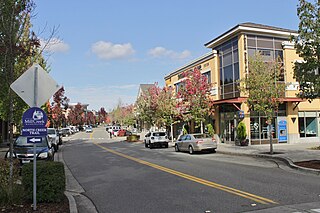
Mill Creek is a city in Snohomish County, Washington, United States. It is located between the cities of Everett and Lynnwood, approximately 20 miles (32 km) northeast of Seattle. The city has a population of 20,926 as of the 2020 census. The city lies along State Route 527 and North Creek, a tributary of the Sammamish River, on the east side of Interstate 5.
North Fork is an unincorporated community in Madera County, California, United States. As of the 2020 United States census it had a population of 3,250. For statistical purposes, the United States Census Bureau has defined North Fork as a census-designated place (CDP). North Fork is part of the Madera Metropolitan Statistical Area and is home to the tribal headquarters of the Northfork Rancheria of Mono Indians of California.

Gualala is an unincorporated community in Mendocino County in the U.S. state of California. It is located north of The Sea Ranch and south of Point Arena, California. Gualala shares its southern border with the southern border of Mendocino County. It is located on the Pacific coast at the mouth of the Gualala River, on State Route 1. It serves as a commercial center for the surrounding area. Gualala was once a logging town, but tourism is now its central economic activity.

The Yuba River is a tributary of the Feather River in the Sierra Nevada and eastern Sacramento Valley, in the U.S. state of California. The main stem of the river is about 40 miles (64 km) long, and its headwaters are split into three major forks. The Yuba River proper is formed at the North Yuba and Middle Yuba rivers' confluence, with the South Yuba joining a short distance downstream. Measured to the head of the North Yuba River, the Yuba River is just over 100 miles (160 km) long.

The Kaweah River is a river draining the southern Sierra Nevada in Tulare County, California in the United States. Fed primarily by high elevation snowmelt along the Great Western Divide, the Kaweah begins as four forks in Sequoia National Park, where the watershed is noted for its alpine scenery and its dense concentrations of giant sequoias, the largest trees on Earth. It then flows in a southwest direction to Lake Kaweah – the only major reservoir on the river – and into the San Joaquin Valley, where it diverges into multiple channels across an alluvial plain around Visalia. With its Middle Fork headwaters starting at almost 13,000 feet (4,000 m) above sea level, the river has a vertical drop of nearly two and a half miles (4.0 km) on its short run to the San Joaquin Valley, making it one of the steepest river drainages in the United States. Although the main stem of the Kaweah is only 33.6 miles (54.1 km) long, its total length including headwaters and lower branches is nearly 100 miles (160 km).

Mill Creek is a 17.8-mile-long (28.6 km) stream, originating in the San Bernardino Mountains, in San Bernardino County, California. It is a major tributary of the Santa Ana River. Their confluence occurs just downstream of the upper Santa Ana Canyon mouth. Part of the upper creek flows through San Bernardino National Forest, with the headwaters, being in the San Gorgonio Wilderness.
Mill Creek is a large stream in northern California. It is an eastside tributary of the Sacramento River, draining an area of 134 square miles (350 km2) and flowing for 56.5 miles (90.9 km). The creek begins in Shasta County, California, but almost immediately flows into Tehama County, California. The creek's source is a thermal spring at an elevation of 8,200 feet (2,500 m) in Lassen Volcanic National Park. At first, the creek flows roughly south while meandering to the east and west, but the lower two-thirds of the creek flow roughly southwest until it reaches the Sacramento River at an elevation of only 200 feet (61 m), just north of Los Molinos, California.

Glenbrook is a census-designated place (CDP) on the east shore of Lake Tahoe in Douglas County, Nevada, United States. The population was 215 at the 2010 census. Beach and Bay are for residents and renters living in Glenbrook's gated community. There is no public access to the beach or bay.

Chiques Creek is a 31.6-mile-long (50.9 km) tributary of the Susquehanna River in Lebanon and Lancaster counties, Pennsylvania in the United States.

Arroyo Corte Madera del Presidio is a 4.1-mile-long (6.6 km) year-round stream in southern Marin County, California, United States. This watercourse is also known as Corte Madera Creek, although the actual stream of that name flows into San Francisco Bay further north at Point San Quentin. This watercourse has a catchment basin of about 8 square miles (21 km2) and drains the south-eastern slopes of Mount Tamalpais and much of the area in and around the town of Mill Valley; this stream discharges to Richardson Bay.

San Vicente Creek is a 9.3-mile-long (15.0 km) northern California coastal stream which flows entirely within Santa Cruz County. It flows from the Santa Cruz Mountains to the Pacific Ocean.

Little Butte Creek is a 17-mile-long (27 km) tributary of the Rogue River in the U.S. state of Oregon. Its drainage basin consists of approximately 354 square miles (917 km2) of Jackson County and another 19 square miles (49 km2) of Klamath County. Its two forks, the North Fork and the South Fork, both begin high in the Cascade Range near Mount McLoughlin and Brown Mountain. They both flow generally west until they meet near Lake Creek. The main stem continues west, flowing through the communities of Brownsboro, Eagle Point, and White City, before finally emptying into the Rogue River about 3 miles (5 km) southwest of Eagle Point.
Manchester was a mining town in the Los Burros Mining District in the southern Big Sur region of Monterey County, California from about 1875 to 1895. The town was reached by a 20 miles (32 km) road from King City to Jolon. From Jolon travelers could ride or take a stage or wagon to the Wagon Caves, followed by a difficult 14 miles (23 km) trail over the steep Santa Lucia Mountains to the site, about 4 miles (6.4 km) inland of Cape San Martin. Prospecting began in the area in the 1850s.


